- Cooper Landing, Alaska
-
Cooper Landing — CDP —  Location in Alaska
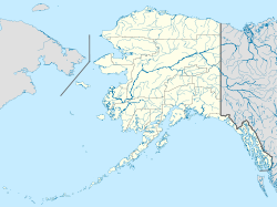
 Cooper Landing
Coordinates: 60°29′26″N 149°47′40″W / 60.49056°N 149.79444°W Country United States State Alaska Borough Kenai Peninsula Area – Total 69.9 sq mi (181.1 km2) – Land 66.0 sq mi (170.9 km2) – Water 3.9 sq mi (10.2 km2) Elevation 410 ft (123 m) Population (2000) – Total 369 – Density 5.7/sq mi (2.2/km2) Time zone AKST (UTC-9) – Summer (DST) AKDT (UTC-8) ZIP code 99572 Area code(s) 907 FIPS code 02-17190 GNIS feature ID 1421192 Website www.cooperlandingchamber.com/ Cooper Landing, also commonly referred to as The Landing, is a census-designated place (CDP) in Kenai Peninsula Borough, Alaska, United States, about 160 kilometers south of Anchorage, at the confluence of Kenai Lake and Kenai River. The town was first settled in the 19th century by gold and mineral prospectors, and has become a summer tourist destination thanks to its scenic wilderness location and proximity to the salmon fishing of the Kenai River. As of the 2000 census, the population in Cooper Landing was 369.
Contents
History
Cooper Landing was named for Joseph Cooper, a miner who discovered gold there in 1884. However, Peter Doroshin, a Russian engineer, had identified gold prospects as far back as 1848 when the territory was still part of Russian America.
Cooper Creek was first recorded in 1898 by the U.S. Geological Survey. In 1900, the Census found 21 miners and 1 wife living at Cooper Creek. The Riddiford Post Office began operations in 1924, and the Riddiford School opened in 1928.
In 1938, a road was constructed to Seward. In 1948, a road to Kenai was opened, and by 1951, residents could drive to Anchorage. The Cooper Landing Community Club was first formed in 1949. The Cooper Lake Hydroelectric Facility was constructed in 1959-60.
Geography
Cooper Landing is located at 60°29′26″N 149°47′40″W / 60.49056°N 149.79444°W (60.490529, -149.794519)[1].
According to the United States Census Bureau, the CDP has a total area of 69.9 square miles (181 km2). 66.0 square miles (171 km2) of it is land and 3.9 square miles (10 km2) of it (5.61%) is water.
Demographics
As of the census[2] of 2000, there were 369 people, 162 households, and 96 families residing in the CDP. The population density was 5.6 people per square mile (2.2/km²). There were 379 housing units at an average density of 5.7 per square mile (2.2/km²). The racial makeup of the CDP was 91.60% White, 0.27% Black or African American, 2.98% Native American, 1.63% Asian, 0.27% from other races, and 3.25% from two or more races. 1.08% of the population were Hispanic or Latino of any race.
 The "Spirit of the Kenai" operates
as a charter out of Cooper Landing.There were 162 households out of which 21.6% had children under the age of 18 living with them, 50.6% were married couples living together, 4.3% had a female householder with no husband present, and 40.7% were non-families. 34.0% of all households were made up of individuals and 9.9% had someone living alone who was 65 years of age or older. The average household size was 2.14 and the average family size was 2.74.
In the CDP the population was spread out with 18.2% under the age of 18, 7.0% from 18 to 24, 23.8% from 25 to 44, 32.2% from 45 to 64, and 18.7% who were 65 years of age or older. The median age was 46 years. For every 100 females there were 117.1 males. For every 100 females age 18 and over, there were 120.4 males.
The median income for a household in the CDP was $34,844, and the median income for a family was $51,250. Males had a median income of $46,319 versus $34,276 for females. The per capita income for the CDP was $24,795. None of the families and 2.2% of the population were living below the poverty line, including no under eighteens and none of those over 64.
References
- ^ "US Gazetteer files: 2010, 2000, and 1990". United States Census Bureau. 2011-02-12. http://www.census.gov/geo/www/gazetteer/gazette.html. Retrieved 2011-04-23.
- ^ "American FactFinder". United States Census Bureau. http://factfinder.census.gov. Retrieved 2008-01-31.
External links
Coordinates: 60°29′26″N 149°47′40″W / 60.490529°N 149.794519°W
Municipalities and communities of Kenai Peninsula Borough, Alaska Cities 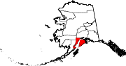
CDPs Anchor Point | Bear Creek | Beluga | Clam Gulch | Cohoe | Cooper Landing | Crown Point | Diamond Ridge | Fox River | Fritz Creek | Funny River | Halibut Cove | Happy Valley | Hope | Kalifornsky | Kasilof | Lowell Point | Miller Landing | Moose Pass | Nanwalek | Nikiski | Nikolaevsk | Ninilchik | Port Graham | Primrose | Ridgeway | Salamatof | Seldovia Village | Sterling | Sunrise | Tyonek
Unincorporated
communitiesKachemak Selo | Razdolna | Voznesenka
Bodies of water Snow River · Trail River · Trail Lakes · Kenai Lake · Kenai River · Skilak Lake · Russian River ·
Settlements Primrose · Crown Point · Moose Pass · Cooper Landing · Sterling · Soldotna · Kenai ·
Protected areas Categories:- Cities in Alaska
- Populated places in Kenai Peninsula Borough, Alaska
- Census-designated places in Alaska


Wikimedia Foundation. 2010.