- Fryšták
Geobox | Settlement
name = Fryšták
other_name =
category = Town

image_caption = Town Hall

symbol = Frystak CoA CZ.jpg
etymology =
official_name =
motto =
nickname =
country = Czech Republic
country_
state =
region = Zlín
region_type = Region
district = Zlín
district_type = District
commune = Zlín
municipality =
part =
river =
location =
elevation = 271
lat_d = 49
lat_m = 17
lat_s = 6
lat_NS = N
long_d = 17
long_m = 41
long_s = 3
long_EW = E
highest =
highest_elevation =
highest_lat_d =
highest_long_d =
lowest =
lowest_elevation =
lowest_lat_d =
lowest_long_d =
area = 24.16
area_round = 2
population = 3527
population_date = 2006-07-03
population_density = auto
established =January 15 ,1356
established_type = First mentioned
mayor = Lubomír Doležel
timezone =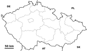
map_background = Czechia - background map.png
map_locator = Czechia
commons = Fryšták
statistics = [http://www.statnisprava.cz/ebe/ciselniky.nsf/i/585211 statnisprava.cz]
website = [http://www.frystak.cz/ www.frystak.cz]
footnotes =Fryšták is town in
Zlín Region ofCzech Republic . It lies between citiesZlín andHolešov , on the Fryštácký stream, under theHostýnsko-vsetínská hornatina , on the interface betweenMoravian Wallachia andHaná .History
First documented about Fryšták is from 14th century in written document from
January 15 ,1356 : "... Nicolaus Luce de Freystat clerius Olomoucensis diocesis, publicus auctoritate imperiali notarius ..."cite book
last = Boček
first = Antonín
authorlink = Antonín Boček
coauthors = Josef Chytil,Vincenc Brandl a Bertold Bretholz
title =Codex diplomaticus et epistolaris Moraviae
url = http://147.231.53.91/src/index.php?s=v&cat=3
format = HTML
series = 15/15
year = 1305, 1836 - 1845, 1850 - 1903
location = Olomouc, Brno
language = Czech, Latin, German
pages = 58
chapter = 71
chapterurl = http://147.231.53.91/src/index.php?s=v&action=jdi&cat=3&bookid=70&page=58&action_button=%21 ] .Demografy
Parts
Fryšták is divided into 4 parts:
* Fryšták
* Dolní Ves
* Horní Ves
* VítováReferences
External links
* [http://cs.wikipedia.org/wiki/Fry%C5%A1t%C3%A1k Translated from Czech Wikipedia]


Wikimedia Foundation. 2010.