- Maryland Route 19
-
Maryland Route 19

Route information Maintained by MDSHA Length: 8.60 mi[1] (13.84 km) Major junctions West end:  MD 213 in Church Hill
 MD 300 in Church Hill
 MD 405 in Church Hill
 US 301 near Ingleside
East end:  MD 313 in Ingleside
Location Counties: Queen Anne's Highway system Maryland highway system
Interstate • US • State • Minor • Former • Turnpikes←  MD 18
MD 18MD 20  →
→Maryland Route 19 (MD 19) is a state highway in the U.S. state of Maryland. Known for much of its length as Roberts Station Road, the state highway runs 8.60 mi (13.84 km) from MD 213 in Church Hill east to MD 313 in Ingleside. MD 19 runs through central Queen Anne's County, connecting both communities with U.S. Route 301 (US 301) near the road's namesake community. The state highway was one of the original state roads marked for improvement by the Maryland State Roads Commission in 1909. MD 19 was paved in the mid 1910s. The state highway has been extended on both ends following realignments of MD 313 and MD 213 in the late 1940s and early 1970s, respectively.
Contents
Route description
MD 19 begins at an intersection with MD 213 (Church Hill Road) in Church Hill. The state highway heads south as two-lane Main Street into the town limits of Church Hill, intersecting MD 300 (Sudlersville Road).[1][2] MD 19 continues toward the center of town, where the highway passes in front of historic St. Luke's Episcopal Church, the church that inspired the town's name.[3] MD 19 turns southeast onto Walnut Street, while Main Street continues south toward another junction with MD 213 as unsigned MD 19A. The state highway passes through a residential area then leaves the town limits heading south. MD 19 curves to the east at the intersection with MD 405 (Price Station Road).[1][2]
MD 19 continues through farmland as Roberts Station Road. The state highway intersects US 301 (Blue Star Memorial Highway) before crossing the Centreville Branch of the Northern Line of the Maryland and Delaware Railroad at the hamlet of Roberts Station. MD 19 veers southeast toward Ingleside, where the highway intersects Roe Ingleside Road and crosses Beaverdam Ditch. Shortly after intersecting the old alignment of MD 313, St. Paul Road, the state highway reaches its eastern terminus at current MD 313 (Goldsboro Road).[1][2]
History
The Church Hill–Ingleside road was designated one of the original state roads to be improved by the Maryland State Roads Commission in 1909, part of the longer highway between Chestertown and Denton.[4] Paving of the state road was completed in 1915.[5] MD 19 was among the original highways signed when Maryland highways were first signed numerically in 1927.[6] MD 19's eastern terminus was extended east to current MD 313 from St. Paul Road when MD 313 bypassed Ingleside in 1949.[7][8] MD 19's western terminus was extended north along Main Street in Church Hill, formerly part of MD 213, when MD 213 bypassed Church Hill in 1971.[9]
Junction list
The entire route is in Queen Anne's County.
Location Mile[1] Roads intersected Notes Church Hill 0.00 MD 213 (Church Hill Road) – Chestertown, CentrevilleWestern terminus 0.47 MD 300 (Sudlersville Road) – SudlersvilleOfficially MD 300A 1.05 Main Street south MD 19 turns southeast onto Walnut Street; Main Street is unsigned MD 19A 2.05 MD 405 south (Price Station Road) – Price, Bridgetown3.93 US 301 (Blue Star Memorial Highway) – Bay Bridge, WilmingtonIngleside 8.13 Roe Ingleside Road south – Roe Former MD 305 8.25 St. Paul Road north Old alignment of MD 313 8.60 MD 313 (Goldsboro Road) – Goldsboro, BarclayEastern terminus 1.000 mi = 1.609 km; 1.000 km = 0.621 mi Auxiliary route
MD 19A is the unsigned designation for the 0.49-mile (0.79 km) section of Main Street between MD 213 on the south side of Church Hill and MD 19 in the center of the town.[1][10] Like MD 19's portion of Main Street, MD 19A is a piece of the old alignment of MD 213 through Church Hill. MD 19A was designated in 1971 when MD 213's bypass of Church Hill was completed.[9]
References
- ^ a b c d e f "Highway Location Reference: Queen Anne's County" (PDF). Maryland State Highway Administration. 2009. http://www.marylandroads.com/Location/2009_QUEENANNES.pdf. Retrieved 2010-09-29.
- ^ a b c Google, Inc. Google Maps – Maryland Route 19 (Map). Cartography by Google, Inc. http://maps.google.com/maps?f=d&source=s_d&saddr=MD-19+W%2FMain+St&daddr=MD-19+E%2FRoberts+Station+Rd%2FRoe-Ingleside+Rd&geocode=FXdzVQIdnJ14-w%3BFdKBVAIdlFV6-w&hl=en&mra=ls&sll=39.084238,-75.888491&sspn=0.03058,0.077162&ie=UTF8&t=h&z=12. Retrieved 2010-09-29.
- ^ Pfingsten, Bill (2007-10-23). "St. Luke's Episcopal Parish Marker". The Historical Marker Database. Bel Air, MD: J.J. Prats. http://www.hmdb.org/marker.asp?marker=3099. Retrieved 2010-09-29.
- ^ Report of the State Roads Commission of Maryland. 1927-1930. Baltimore: Maryland State Roads Commission. 1930-10-01. pp. 20–21. http://www.archive.org/details/reportofstateroa1927mary. Retrieved 2010-09-29.
- ^ Report of the State Roads Commission of Maryland. 1912-1915. Baltimore: Maryland State Roads Commission. May 1915. p. 112. http://www.archive.org/details/annualreportsofs1912mary. Retrieved 2010-09-29.
- ^ Maryland Geological Survey. Map of Maryland: Showing State Road System and State Aid Roads (Map) (1927 ed.).
- ^ Report of the State Roads Commission of Maryland. 1949-1950. Baltimore: Maryland State Roads Commission. 1950-12-20. p. 110. http://www.archive.org/details/reportofstateroa1949mary. Retrieved 2010-09-29.
- ^ Maryland State Roads Commission. Maryland: Official Highway Map (Map) (1950 ed.).
- ^ a b Maryland State Roads Commission. Maryland: Official Highway Map (Map) (1971 ed.).
- ^ Google, Inc. Google Maps – Maryland Route 19A (Map). Cartography by Google, Inc. http://maps.google.com/maps?f=d&source=s_d&saddr=Main+St&daddr=Main+St&geocode=FQQ1VQIdVnN4-w%3BFdRCVQIdEo54-w&hl=en&mra=ls&sll=39.140771,-75.986284&sspn=0.003819,0.009645&ie=UTF8&ll=39.140271,-75.988805&spn=0.003819,0.009645&t=h&z=17. Retrieved 2010-09-29.
External links
Roads in Queen Anne's County, Maryland State highways 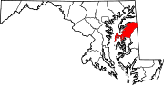
U.S. Highways Categories:- State highways in Maryland
- Roads in Queen Anne's County, Maryland


Wikimedia Foundation. 2010.