Dunasziget

Dunasziget
Dunasziget
Dunasziget is located in Hungary
Dunasziget
Location of Dunasziget
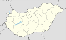
Coordinates: 47°56′20″N 17°21′05″E / 47.93893°N 17.35127°E / 47.93893; 17.35127Coordinates: 47°56′20″N 17°21′05″E / 47.93893°N 17.35127°E / 47.93893; 17.35127
Country  Hungary
County Győr-Moson-Sopron
Area
 – Total 35.89 km2 (13.9 sq mi)
Population (2004)
 – Total 1,477
 – Density 41.15/km2 (106.6/sq mi)
Time zone CET (UTC+1)
 – Summer (DST) CEST (UTC+2)
Postal code 9226
Area code(s) 96

Dunasziget is a village in Győr-Moson-Sopron county, Hungary.

External links


Wikimedia Foundation. 2010.

Игры ⚽ Поможем написать курсовую

Look at other dictionaries:

  • Dunasziget — Administration …   Wikipédia en Français

  • Zátonyi Csárda Panzió — (Dunasziget,Венгрия) Категория отеля: Адрес: 9226 Dunasziget, Zátonyi u. 3 …   Каталог отелей

  • Sopron — This article is about the city. For the historical county in the Kingdom of Hungary named Sopron / Ödenburg, see Sopron (county). Sopron Aerial photography of the City Hall and the Main square …   Wikipedia

  • Győr-Moson-Sopron County — Infobox Hungarian county name =Győr Moson Sopron region =Western Transdanubia seat = Győr area = 4089 population = 420,000 density = 103 cities = 174Győr Moson Sopron is the name of an administrative county (comitatus or megye) in north western… …   Wikipedia

  • Mosonmagyaróvár — Wieselburg Ungarisch Altenburg Castle …   Wikipedia

  • List of islands of Hungary — DanubeIn Esztergom*Körtvélyesi sziget *Nyáros sziget *Csitri sziget *Prímás sziget *Helemba sziget *Dédai sziget *Törpe szigetIn Budapest (from north to south)* Palotai sziget (in fact, it s a peninsula today) * Czuczor utca (1093 Budapest,… …   Wikipedia

  • Csorna — Aerial view …   Wikipedia

  • Forstinning — Infobox German Location Wappen = Wappen von Forstinning.png lat deg = 48 |lat min = 10 lon deg = 11 |lon min = 55 Lageplan = Bundesland = Bayern Regierungsbezirk = Oberbayern Landkreis = Ebersberg Höhe = 512 Fläche = 12.26 Einwohner = 3412 Stand …   Wikipedia

  • Forstinning — Wappen Deutschlandkarte …   Deutsch Wikipedia

  • Kleingebiet Mosonmagyarovar — Koordinaten fehlen! Hilf mit. Das Kleingebiet Mosonmagyaróvár (ungarisch Mosonmagyaróvári kistérség) ist eine ungarische Verwaltungseinheit (LAU 1) innerhalb des Komitats Győr Moson Sopron. Der Verwaltungssitz ist in Mosonmagyaróvár. Gemeinden… …   Deutsch Wikipedia

Share the article and excerpts

Direct link
Do a right-click on the link above
and select “Copy Link”