- Ballymacnab
Ballymacnab, lga|Baile Mhic An Aba, is a
Townland andvillage in the Parish of Cill Chluana,County Armagh , "(lga|'Ard Mhacha'), " in the province ofUlster , The North of Ireland.Infobox Irish Place
name = Ballymacnab
gaeilge = Baile Mhic an Aba
crest
motto =
map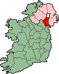
pin coords = left: 152px; top: 70px
north coord = 54.2984
west coord = 6.6399
irish grid = H886397
area =
elevation = 350 m
province =Ulster
county =County Armagh
population = Under 500 [ [http://www.nisra.gov.uk/ NISRA - Northern Ireland Statistics and Research Agency ] ] |Geography & History
Ballymacnab is a small rural village approximately 6 miles from
Armagh City , on the road towards the town ofNewtownhamilton . It is located within theKilleen ward of Armagh City and District Council [ [http://www.ninis.nisra.gov.uk/ NINIS | Neighbourhood Statistics for NI ] ] . Local buildings and amenities include Saint Patrick'sRoman Catholic Church lga|Naomh Pádraig, Baile Mhic an Aba [ [http://www.armagharchdiocese.org/parishes/83 Killcluney (Ballymacnab, Clady & Granemore) ] ] , O'Tooles pub, Ballymacnab Gaelic Football Club, Foley school lga|Fo-Bhaile PS and Ballymacnab Hall. Seagahan Lake Reservoir is located to the east of the village, and includes the nearbyDam and Seagahan Water Treatment Works.Angling is permitted at the reservoir, subject to certain restrictions [ [http://www.discovernorthernireland.com/product.aspx?ProductID=2569 Seagahan Lake Reservoir ] ] . In May 2008,Northern Ireland Water commenced a £6.6 Million project to upgrade water treatment technology and infrastructure at the plant [ [http://www.niwater.com/may2008.asp May 2008 ] ] .The closest settlements Granemore to the west, Clady to the south, Keady to the north west, Armagh to the north and Mullaghbrac to the east. The Townland was previously part of lands confiscated from Catholic landowners and thereafter ceded to the Earl of Charlemont during the
plantation of Ulster [Connolly, S.J. (Ed); (2004). "The Oxford Companion to Irish History"] , includingJames Caulfeild, 3rd Earl of Charlemont , and worked by Tenant farmers under theTithe system.The majority Catholic population of Ballymacnab was reduced by emigration in the late nineteenth and early twentieth century [http://en.wikipedia.org/wiki/Economic_history_of_Ireland] [Guinnane, T (1997). "The Vanishing Irish: Households, Migration, and the Rural Economy in Ireland". Princeton University Press. ISBN: 0-69-104307-8.] . Many of the emigrants settled in
Glasgow ,Scotland [Burrowes, J (2003). "Irish: The Remarkable Saga of a Nation and a City". Mainstream Publishing. ISBN: 1-84-018685-2 ] [Coogan, T.P. (2002). "Wherever Green Is Worn: The Story of the Irish Diaspora". Hutchinson Press. ISBN: 0-09-995850-3] [Sloan, W. Cummings & Devine (Eds) (1997). "Employment Opportunities and Migrant Group Assimilation: the Highlanders and Irish in Glasgow, 1840-1900" in "Proc. Industry, Business & Society".] .Culture
In common with much of County Armagh, the area is steeped in history and folklore. One famous story concerns the ‘Bull’s Track’. This is a landmark at the junction of the main Armagh/Newtownhamilton road and the Ballymacnab Road that leads to Seagahan Dam. A large stone marks the spot where it is claimed a large black bull landed after having been flung from neighbouring Armaghbreague Mountain by an angry
Saint Patrick after the same bull had knocked down the church he was building in the ‘Breague for the third consecutive night. A mark which resembles the imprint of a Bull’s Foot remains to this day and recent refurbishment work to the landmark has highlighted the Bull’s Track as a tourist attraction. [ [http://www.ruralinks.org/bcda.shtml The RuraLinks Project BALLYMACNAB C D A ] ]References
Bibliography
* Connolly, S.J. (Ed); (2004). "The Oxford Companion to Irish History". ISBN: 0-19-280501-0.
* Burrowes, J; (2003). "Irish: The Remarkable Saga of a Nation and a City". ISBN: 1-84-018685-2.
* Coogan, T.P; (2002). "Wherever Green Is Worn: The Story of the Irish Diaspora". ISBN: 0-09-995850-3
* Guinnane, T (1997). "The Vanishing Irish: Households, Migration, and the Rural Economy in Ireland". ISBN: 0-69-104307-8.
* Sloan, W. Cummings & Devine (Eds) (1997). "Employment Opportunities and Migrant Group Assimilation: the Highlanders and Irish in Glasgow, 1840-1900" in "Proc. Industry, Business & Society".External links
* [http://ballymacnab.armagh.gaa.ie/ Ballymacnab Gaelic Football Club] - Official Site of the local
GAA football side.
* [http://www.ballymacnabcamogie.com/ Ballymacnab Camogie Club] - Official Site of the localCamogie club.
* [http://www.ruralinks.org/bcda.shtml/ Ballymacnab Community Development Association] - Local social, economic and cultural association.
Wikimedia Foundation. 2010.