- 2005–06 South-West Indian Ocean cyclone season
-
2005–06 South-West Indian Ocean cyclone season 
Season summary mapFirst storm formed: November 18, 2005 Last storm dissipated: April 16, 2006 Strongest storm: Carina – 915 hPa (mbar), 205 km/h (125 mph) (10-minute sustained) Tropical depressions: 10 Total storms: 6 Tropical cyclones: 3 Total fatalities: At least 26 Total damage: Unknown South-West Indian Ocean cyclone seasons
2003–04, 2004–05, 2005–06, 2006–07, 2007–08Related articles: The 2005–06 South-West Indian Ocean cyclone season was an annual event of tropical cyclone formation. It started on November 15, 2005 and ended on April 30, 2006, with the exception for Mauritius and the Seychelles, for which it continued until May 15. These dates conventionally delimit the period of each year when most tropical cyclones form in the basin, which is west of 90°E and south of the Equator. Tropical cyclones in this basin are monitored by the Regional Specialised Meteorological Centre in Réunion.
Storms
Tropical Disturbance 01R
Tropical disturbance (MFR) 
Duration September 5 – September 6 Intensity 35 km/h (25 mph) (10-min), Unknown Formed on September 5 and dissipated on September 6, 2005.
- Tropical Cyclone Database's storm summary and track file for 01R
Tropical Depression 02R
Tropical depression (MFR) Tropical storm (SSHS) 

Duration October 12 – October 15 Intensity 55 km/h (35 mph) (10-min), 997 mbar (hPa) Tropical Disturbance 02R formed approximately 860 nautical miles (1,590 km) east of Diego Garcia on October 12. It became more organised and the JTWC upgraded it to a Tropical Cyclone with a peak intensity of 35kt between October 14 and October 15. The system never reached Tropical Storm strength based on Météo France's advisories. Due to growing wind shear, the system dissipated over water on October 15.
Tropical Depression 03R
Tropical disturbance (MFR) Duration November 6 – November 8 Intensity 35 km/h (25 mph) (10-min), Unknown Formed on November 6 and dissipated on November 8, 2005.
- Tropical Cyclone Database's storm summary and track file for 03R
Tropical Depression 04R
Tropical depression (MFR) Tropical storm (SSHS) 

Duration November 5 – November 8 Intensity 55 km/h (35 mph) (10-min), 995 mbar (hPa) TCWC Perth issued a gale warning on a Tropical Low near 8.3°S 97.1°E on November 5. According to JTWC, the low developed into a tropical cyclone and reached its peak intensity of 45kt on the same day. It moved southwestward into Météo France (Réunion)'s area of Responsibility on November 7 and gradually weakened afterwards. The last JTWC warning was released the next day. Météo France tracked its remnants until November 9.
Intense Tropical Cyclone Bertie-Alvin
Intense tropical cyclone (MFR) Category 4 tropical cyclone (SSHS) 

Duration November 19 – December 3 Intensity 185 km/h (115 mph) (10-min), 930 mbar (hPa) TCWC Perth issued a gale warning on a Tropical Low near 3.5°S 94.0°E, which later became Bertie on November 17. Bertie gradually strengthened and became a Severe Tropical Cyclone on November 21, before entering the Southwest Indian Ocean on November 23 and being renamed Alvin. According to the JTWC, the cyclone reached its peak intensity of 115 knots (210 km/h) - which equates to a marginal Category 4 on the Saffir-Simpson hurricane scale - on the same day. Alvin weakened significantly afterwards and the last JTWC warning was released on November 26. Météo France tracked its remnants until November 30.
- Météo France's archive on the system, in French.
- Archive for Bertie-Alvin from the Tropical Cyclone Center Database.
- Tropical Cyclone Database's storm summary and track file for 03S (05R)
Tropical Depression 06R
Tropical depression (MFR) Tropical storm (SSHS) 

Duration December 21 – December 29 Intensity 55 km/h (35 mph) (10-min), 998 mbar (hPa) TCWC Perth issued a gale warning on a Tropical Low near 9.5°S 91.9°E on December 22. Moving west-southwestward, the low entered Météo France (Réunion)'s area of responsibility on December 23. During its long journey to the west, it became more organised and JTWC upgraded it to a Tropical Cyclone with peak intensity of 35kt between December 24 and December 25. The system then skirted east of Réunion as a zone of disturbed weather. Météo France tracked its remnants until December 30.
Tropical Disturbance 07R
Tropical disturbance (MFR) 
Duration January 5 – January 8 Intensity 45 km/h (30 mph) (10-min), Unknown A zone of disturbed weather developed on December 29. Moving southwestwards, it became an overland depression with maximum sustained winds of 25kt in Mozambique on January 5. The system tracked along the southern coast of Mozambique and became extratropical on January 8. The depression caused torrential rains in Mozambique and swept away 26 people.[1]
- Archive for 07R from the Tropical Cyclone Center Database.
Tropical Cyclone Boloetse
Tropical cyclone (MFR) Category 3 tropical cyclone (SSHS) 

Duration January 20 – February 6 Intensity 155 km/h (100 mph) (10-min), 950 mbar (hPa) A zone of disturbed weather developed northeast of Madagascar on January 20. The system organized into a Tropical Depression on January 24 and further intensified into Moderate Tropical Storm Boloetse on 25 January. The name was contributed by Lesotho. On 26 January, Boloetse briefly became a severe tropical storm with maximum sustained winds 50kt (92 km/h) near center. On January 29, Tropical Storm Boloetse crossed the coast near the village of Mananjary. On January 30, its remnants emerged into Mozambique Channel and reorganized. The system strengthened into a Severe Tropical Storm again on February 2, and strengthened further into a tropical cyclone. Operationally 08R was carried as a 90kt intense tropical cyclone but was downgraded following further analysis. Boloetse passed just southwest of Madagascar on February 4 and became extratropical on February 5.
- Météo France's archive on the system, in French.
- Archive for Boloetse from the Tropical Cyclone Center Database.
- More info here
Severe Tropical Storm 09R
Severe tropical storm (MFR) Tropical storm (SSHS) 

Duration February 18 – February 23 Intensity 95 km/h (60 mph) (10-min), 992 mbar (hPa) A tropical disturbance formed just west of Madagascar on February 15. It moved south-east, towards Mauritius and became more organized. On February 19, it was designated as Tropical Disturbance 09. The midget system quickly strengthened but its status was under dispute. Météo France upgraded it to a moderate tropical storm while JTWC classified it as a Tropical Storm equivalent. In contrast, Mauritius did not upgrade and name the system. In post-analysis, Météo France upgraded it further to a severe tropical storm. Since the satellite era, it is rare to have an unnamed severe tropical storm in any part of the world other than north Indian Ocean. The storm was short-lived, it rapidly weakened on February 20 and dissipated over water on February 23.
- Météo France's archive on the system, in French.
- Archive for 12S from the Tropical Cyclone Center Database.
Intense Tropical Cyclone Carina
Intense tropical cyclone (MFR) Category 4 tropical cyclone (SSHS) 

Duration February 22 – March 11 Intensity 205 km/h (125 mph) (10-min), 915 mbar (hPa) Tropical depression 10R (14S) formed far southeast of Diego Garcia on February 23. It became more organized and was upgraded to Moderate Tropical Storm Carina by Réunion at 1800 UTC February 23. The name was contributed by Mauritius. Carina moved southwards, and became a tropical cyclone on February 26. Carina remained over open waters and quickly intensified, becoming an intense tropical cyclone on February 27. At 0000Z Feb 28, Carina was moving west-southwest and nearing Category 5 strength on the Saffir-Simpson hurricane scale. Carina moved into an area with high wind shear on February 28, started to weaken on March 3. The remnants made an anti-clockwise loop and resumed a westerly track on before finally dissipated on March 10.
- Météo France's archive on the system, in French.
- Archive for Carina from the Tropical Cyclone Center Database.
Severe Tropical Storm Diwa
Severe tropical storm (MFR) Tropical storm (SSHS) 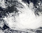

Duration March 2 – March 11 Intensity 110 km/h (70 mph) (10-min), 980 mbar (hPa) On March 2, Météo France identified a broad area of low pressure between 45°E and 55°E and from 8°S to 15°S. Within this area, two lows were detected. The main one (11R) was north of Mascarnes Islands while the other one was north of Madagascar.
11R became a tropical depression on March 3 and was later named Diwa. The name was contributed by Malawi. At first Diwa was classified as a moderate tropical storm by Mauritius, but as a tropical depression by Météo France, but a few hours later, Météo France also classified it as a tropical storm. This made the fourth documented case of a tropical cyclone being named before reaching tropical storm strength.[citation needed]
On the other hand, the other low briefly developed into a tropical disturbance (12R) on March 4. The two systems were less than 700 km away and Météo France said that Diwa might be partially influenced by a slight Fujiwhara effect with 12R. 12R was short-lived and Diwa remained the dominant system. Diwa came very near to Réunion but never made landfall. The outer edges of Diwa did caused some substantial rainfall on the island. The strongest gust reported was 194 km/h at the top of the Sainte-Rose Large-Piton. The highest rainfall in three days was 2720 mm in Commerson. After this, Diwa moved southwards and strengthened into a severe tropical storm on March 7. Eventually, Diwa became extratropical and reached its peak intensity on March 9.
- Météo France's archive on the system, in French.
- Archive for Diwa from the Tropical Cyclone Center Database.
Tropical Disturbance 12R
Tropical disturbance (MFR) Duration March 4 – March 4 Intensity 35 km/h (25 mph) (10-min), Unknown Formed and dissipated on March 4, 2006.
- Tropical Cyclone Database's storm summary and track file for 12R
Moderate Tropical Storm Elia
Moderate tropical storm (MFR) Tropical storm (SSHS) 

Duration April 10 – April 17 Intensity 75 km/h (45 mph) (10-min), 990 mbar (hPa) The unusually tenacious disturbance that would develop into Elia was first identified by NRL on April 2. It lingered around and organized very slowly. After waiting for nine days, it gathered gales in southern quadrants and Australian Bureau of Meteorology issued a shipping warning on April 11. It entered Météo France's area of responsibility as a Moderate Tropical Storm and was named Elia on April 13. The name was contributed by Madagascar. Elia encountered unfavourable shear conditions on April 15 causing the low level circulation to decouple from the convection. It degenerated into a remnant low the following day and finally dissipated on April 17.
Storm names
A tropical disturbance is named when it reaches moderate tropical storm strength. If a tropical disturbance reaches moderate tropical storm status west of 55°E, then the Sub-regional Tropical Cyclone Advisory Centre in Madagascar assigns the appropriate name to the storm. If a tropical disturbance reaches moderate tropical storm status between 55°E and 90°E, then the Sub-regional Tropical Cyclone Advisory Centre in Mauritius assigns the appropriate name to the storm. A new annual list is used every year so no names are retired.[1]
- Alvin
- Boloetse
- Carina
- Diwa
- Elia
- Farda (unused)
- Guduza (unused)
- Helio (unused)
- Isabella (unused)
- Jaone (unused)
- Kundai (unused)
- Lindsay (unused)
- Marinda (unused)
- Nadety (unused)
- Otile (unused)
- Pindile (unused)
- Quincy (unused)
- Rugare (unused)
- Sebina (unused)
- Timba (unused)
- Usta (unused)
- Velo (unused)
- Wilby (unused)
- Xanda (unused)
- Yuri (unused)
- Zoelle (unused)
See also
- Tropical cyclone scales
- List of Southern Hemisphere tropical cyclone seasons
- Atlantic hurricane seasons: 2005, 2006
- Pacific hurricane seasons: 2005, 2006
- Pacific typhoon seasons: 2005, 2006
- North Indian Ocean cyclone seasons: 2005, 2006
References
- ^ "Tropical Cyclone Operational Plan for the South Pacific and South-East Indian Ocean". World Meteorological Organization. 2003. http://ftp.wmo.int/pages/prog/www/TCP_vO/OperationPlans/TCP12-English2003.pdf. Retrieved 2008-08-15.
External links
- Joint Typhoon Warning Center (JTWC).
- Météo France (RSMC La Réunion).
- World Meteorological Organization
2000–09 South-West Indian Ocean cyclone seasons Categories:- Hurricane articles needing a track map
- 2005–06 South-West Indian Ocean cyclone season


Wikimedia Foundation. 2010.