- Murrurundi, New South Wales
-
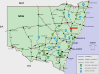
Murrurundi is a rural town in Upper Hunter Shire, located in the Upper Hunter Valley of New South Wales. Murrurundi, which is 193 km by road from Newcastle and 309 km from Sydney, has a population of 2,162 people (ABS 2006). The town is almost completely surrounded by mountains of the Liverpool Range, and is located on the Pages River, a tributary of the Hunter River.
Contents
Overview
Prior to European settlement, the Murrurundi district was home to the Wanaruah - and possibly the Kamilaroi - Aboriginal people. European settlement of the area began in the 1820s, and the town itself was established by the New South Wales government in 1840. In the same year, a local landholder - Thomas Haydon - established an adjacent private township called Haydonton. In 1913, the two neighbouring settlements were merged to create the modern-day town of Murrurundi.
The name "Murrurundi" is often erroneously thought to come from an Aboriginal word meaning "nestling in the valley". It does in fact mean "five fingers", a representation of the rock formation visible at the northern end of the township.
Benjamin Hall, father of bushranger Ben Hall had a small farm in a valley near Murrurundi in 1839. He opened a butcher's shop at Haydonton in 1842.[1] Ben Hall lived at Murrurundi until the age of 13.
Kerosene shale was mined at Mount Temi, some 11.25 km to the north of Murrurundi from 1886, but lay dormant for many years. The mine was revived in 1910 and a railway was constructed from Temple Court, 1.2 km west of Murrurundi, to the terminal of an airial ropeway bringing shale from the mine. Operations ceased during the First World War.[2]
Annual events include the annual rodeo and the King of the Ranges stockman challenge.
There are only a few sporting facilities due to the low population. These sports are senior rugby league, touch football, swimming club and cricket.
The New England Highway runs through the town, and it is served by a rail service.
Railway station
Murrurundi railway station is located on the Main North railway line, 352 km from Sydney. The station opened in 1872 and consists of a substantial brick station-house with a passing loop and goods yard.[3] There was also a locomotive depot for bank engines which lasted until the end of steam.
It continues to be served by a daily rail service operated by a Countrylink Xplorer train to and from Sydney and Armidale/Moree. The train to Armidale/Moree stops at 2:40pm and the train to Sydney stops at 12:26pm. Trains will only stop at this station on request.
Accident
Murrurundi is the nearest major town to the site of the Murulla rail accident.
Railway station
 Murrurundi
CountryLink North Western Station code MRN Suburb Murrurundi Street(s) Polding Street Distance from Central Station 354km km Station Altitude (above sea level) {{{altitude}}} m Types of stopping trains CountryLink Number of platforms 1 Number of tracks 1 Platform arrangement {{{platform_arr}}} Type of station Ground Transfers available Disabled access {{{disabled}}} Preceding station NSW Main lines Following station Temple Courttowards WallangarraMain North Line Blandfordtowards SydneyPreceding station CountryLink Following station CountryLink North Western towards SydneyReferences
- ^ "Guide to Murrindi in NSW". The Age Traveller. http://www.theage.com.au/travel/travel-factsheet/murrurundi--places-to-see-20081125-6gnd.html. Retrieved 2008-11-26.
- ^ The British-Australian Oil Company's Railway Eardley, Gifford Australian Railway Historical Society Bulletin, August, 1967
- ^ Murrurundi railway Station Accessed 1 April 2008.
Coordinates: 31°45′S 150°50′E / 31.75°S 150.833°E
Towns, suburbs and localities of Upper Hunter Shire | Hunter Region | New South Wales Towns, suburbs
& localitiesAberdeen • Belltrees • Blairmore • Blandford • Bow • Brawboy • Brushy Hill • Bunnan • Cassilis • Cliftlands • Crawney • Cuan • Dangarfield • Dartbrook • Dartbrook Upper • Davis Creek • Dry Creek • Ellerston • Glenbawn • Glenbawn Dam • Glenrock • Green Creek • Gundibri • Gundy • Gungal • Hunter Springs • Kars Springs • Kiernans Creek • Kingdom Ponds • Lake Glenbawn • Merriwa • Middle Brook • Moobi • Moonan Brook • Moonan Flat • Murrurundi • Murulla • Murulla North • Niangala • Omadale • Omadale Brook • Owens Gap • Pages Creek • Pages River • Parkville • Red Bank • Ridgelands • Rossgole • Rouchel • Rouchel Brook • Sandy Creek • Satur • Scone • Scotts Creek • Segenhoe • Sparks Creek • St Aubins • Stewarts Brook • Stirling Vale • Thompsons Creek • Thornthwaite • Timor • Tinagroo • Togar • Tomalla • Tooloogan • Turanville • Turill • Upper Rouchel • Waverley • Waverly • Wingen • Woolooma • Yarramoor
Other places &
points of interestCategories:- Suburbs of the Hunter Region, New South Wales
- Towns in the Hunter Region, New South Wales
- Transport in Hunter Region, New South Wales
Wikimedia Foundation. 2010.


