- San Jose, Occidental Mindoro
-
San Jose — Municipality — Aroma Beach in San Jose Map of Occidental Mindoro showing the location of San Jose.
 Location in the Philippines
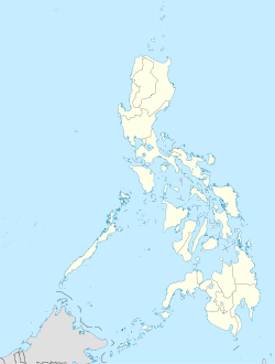
 San Jose
Coordinates: 12°21′13″N 121°4′0″E / 12.35361°N 121.066667°ECoordinates: 12°21′13″N 121°4′0″E / 12.35361°N 121.066667°E Country  Philippines
Region MIMAROPA (Region IV-B) Province Occidental Mindoro District Lone District of Occidental Mindoro Founded Barangays 38 Government – Mayor Hon. Jose Tapales Villarosa Area – Total 551.93 km2 (213.1 sq mi) Population (2007) – Total 111,009 – Density 201.1/km2 (520.9/sq mi) Time zone PST (UTC+8) ZIP code Income class 1st class municipality Website http://web.me.com/sanjosemindoro/phi/Welcome.html San Jose is a 1st class municipality in the province of Occidental Mindoro, Philippines. According to the 2000 census, it has a population of 111,009 people in 22,464 households. According to the 2007 census, the population increased to 118,807 people.
San Jose is considered the main commercial port in the province. It is named after its patron saint, St. Joseph, the husband of Mary. Most of the people are Visayans, Batangueños and Ilocanos.
San Jose is the center of entertainment and business in the province. Major banks such as Philippine National Bank (PNB), United Coconut Planters Bank (UCPB), Development Bank of the Philippines (DBP), Allied Bank, Metrobank, Landbank, Philippine Veterans Bank, have local branches and even fast food chain Jollibee has started operations in San Jose. Mr. Donut has started to operate too. Telecommunication services are provided by Digital Telecommunications (Digitel), Smart Communications, Globe, RCPI, and Piltel. Numerous internet cafes are also available mainly in the poblacion area. Major schools in the province include Divine Word College, Montessori de San Jose, Philippine Central Islands College (PCIC), I-NET Asia Technological School, Inc. and the Occidental Mindoro State College.
The population growth currently experienced by San Jose is attributed to a growing number of migrants.
Contents
Geography
It is located at the southern part of the province with a total land area of 551.9294 km². Climatic condition is classified under Type A category and slope is generally flat. Soil composition developed from recent alluvial deposits which are silty-loam to clay loam and landforms consist of limestone and sedimentary rocks. All types of erosion are present: slight, moderate and severe erosion. Eleven (11) rivers and creeks serve as natural drainage. Mineral deposits includes copper and limestone.
San Jose is politically subdivided into 38 barangays
- Ambulong
- Ansiray
- Bagong Sikat
- Bangkal
- Barangay 1 (Pob.)
- Barangay 2 (Pob.)
- Barangay 3 (Pob.)
- Barangay 4 (Pob.)
- Barangay 5 (Pob.)
- Barangay 6 (Pob.)
- Barangay 7 (Pob.)
- Barangay 8 (Pob.)
- Batasan
- Bayotbot
- Bubog
- Buri
- Camburay
- Caminawit
- Catayungan
- Central
- Ilin Proper
- Inasakan
- Ipil
- La Curva
- Labangan Iling
- Labangan Poblacion
- Mabini
- Magbay
- Mangarin
- Mapaya
- Murtha
- Monte Claro
- Natandol
- Pag-Asa
- Pawican
- San Agustin
- San Isidro
- San Roque 1 and 2
History
Historical records show that in 14th century, Chinese traders anchored to trade at the shores of Mangarin, the oldest settlement in the southern portion of Occidental Mindoro. Its name was derived from the word “Mandarin”, an official Chinese Palace, the remains of which can still be found in the old barrio of Mangarin. When the Spanish took possession of the Island in the 18th century, the first site of the Presidencia was built in sitio of Sinaoga[citation needed], on the western side of Barrio Sta. Teresa, now part of the municipality of Magsaysay. A year later, it was again transferred to Caminawit. On May 1, 1910,[1] Pandurucan, which was renamed San Jose, became the seat of the Civil Government with Don German Ramirez as its first appointed leader up to 1915. When the Japanese Imperial Forces occupied the town, Bonifacio Gomez was appointed as Mayor from 1941-1942 followed by Pedro Cuden, 1942–1943 and finally Isabelo Abeleda in 1944 until 1946. During the American reoccupation Bibiano Gaudiel replaced Isabelo Abeleda who regained his position in 1955.
San Jose figures prominently in Philippine history for its role during World War II. American forces led by General Douglas MacArthur with the Filipino soldiers staged a so-called "Second Landing" in the beaches of San Jose (the "First" being the famous Leyte Landing) on December 15, 1944, to retake the Philippine islands from the Japanese (the Battle of Mindoro). Securing San Jose and the whole Mindoro island proved decisive in the goal to recapture Manila and Luzon, and the eventual defeat of the Japanese Imperial forces by Filipino and American troops.
The Philippine government split Mindoro into two provinces, Occidental Mindoro and Oriental Mindoro in 1950. San Jose became the temporary capitol but was transferred to Mamburao on January 1950. Migration to Mindoro in the years after the war boosted population growth and spurred development. The Philippine Sugar Mill plantation in the northern Barangay Central helped San Jose become the center of commerce in those years. The economic base has since widened to include rice, corn, tobacco, salt, and aquaculture production.
Demographics
It is the most thickly populated area in the province which continuously grow at 2.38% annually. Out of the total population of 110,812 around 41.97% resides in urban area and 58.03% are situated in rural barangays. After experiencing negative migration during the 1990s, population is on a rebound and projected to increase further.
Average household size is recorded at 5 with built-up density of 6500 persons per km². About 69.42% are dependents resulting to a dependency ratio of 1:2. On the other hand, male-female ratio is computed at 108:100.
Tagalog is the most outspoken dialect and 83.97% are practicing Catholicism.
The municipality has largely diverse economic activities. However, majority of working force which is estimated at 76%, are still engage in agriculture.
Major crops produced includes corn, rice, garlic, onions and among others. It is also known for inland fishing producing lapu-lapu, milkfish, and export quality prawn. Substantial quantity of marine products are also available.
Commercial livestock and poultry farms producing layers, broilers and meat products also exist. It has the largest number of agricultural support facilities such as ricemills, warehouses, solar dryers, and the likes.
Registered commercial establishments number around 1,030 and the public market, the center of commercial activities, is the largest in the province.
Industries includes hollow blocks making, handicrafts and furniture, and other small scale processing and manufacturing plants.
Tourism
Known tourism facilities are beach resorts, hotels and restaurants.
The major attractions of the industrial town of San Jose are its three offshore islands - Ambulong, Ilin, and White Island. San Jose is also a favorite jump-off point to the world-class diving site - Apo Reef Marine Park.
- Ambulong Island
- Ambulong Island is a 30 km² island with fine beaches, cliffs and abundant coral formations. It is characterized by white sand beaches, cliffs along pillars jutting out of the water, and underwater caves. Coral gardens and tropical fish are abundant in several coves. A fisherman's village is located at the sheltered side of the island. Ambulong Island is also a jump-off point to some of the dive spots in the area, such as the Iling Point, Baniaga Reef, Ambulong Bank, Dungan Reef, Sardines Reef, Apo Reef, and Manadi Island. These dive sites are about an hour away by pumpboat from the Caminawit Port.
- Ilin Island
- Ilin Island has a village of shell divers, being abundant in shells and coral reefs. There are ancient burial caves of early Chinese traders, ethnic fishing villages, and numerous dive sites from which to view many tropical fishes. Lush foliage encircle the clear blue waters of the South China Sea. There are scuba diving facilities, a 6.8 CTM compressor, seaport facilities, diveboats, and PADI and NAUI-certified instructors.
- White Island (Manadi, Barrio Ilin, San Jose; 15 minutes by pumpboat from Caminawit Port)
- White Island has a long powdery beach where buried turtle eggs are occasionally found. It has an almost mile-long beach with smooth and powdery white sand. The tranquil and peaceful island is an ideal place for swimming, scuba diving and fishing. Turtle eggs are occasionally found buried in the sand, and visitors are cautioned to keep them undisturbed.
- Apo Reef
- Apo Reef is located in the territorial waters of the municipality of Sablayan, but San Jose is one of the points of entry of those who wish to get there. The Apo Reef Marine Park includes the fascinating bird-populated islands of Binangaan and Cajos del Bajo, which are surrounded by waters with over 500 species of marine life and luxuriant coral growth represented by approximately 400 to 500 kaleidoscopic coral species.
- Mt. Iglit National Park
- It is located in an area shared by the municipalities of Sablayan and Calintaan, but San Jose is also the main gateway there. It is a sanctuary for the 'tamaraw' (Anoa Mindorensis), an endemic species of buffalo found only in Mindoro. It provides a nice eco-tourism, trekking, or mountaineering alternative to beach/dive resorts.
Transportation
Local airlines such as Cebu Pacific, Philippine Airlines, and Zest Air fly from Manila to San Jose on a regular basis. Flights take approximately one hour. Montenegro and Besta Shipping operates a roll-on/roll-off ferry service from Manila to San Jose weekly. An alternate, similar service from the port of Batangas City takes from 12 to 16 hours also.
The provincial highway of Occidental Mindoro links most of the towns from north to south. Local bus and jeepney operators ply the route from the northernmost town of Abra de Ilog all the way to San Jose. The mostly dusty, gravel road is being upgraded and paved to hasten travel.
Most roads in the poblacion area and nearby barangays are well-paved. Tricycles are the common mode of transportation around town. Banca (small boat) transfers to nearby island resorts and diving spots are available.
Notes
- ^ By virtue of Excutive Order 31, signed by Governor General Cameroon Forbes on April 18, 1910.
External links
Municipalities Categories:- Municipalities of Occidental Mindoro


Wikimedia Foundation. 2010.