- Cumbe Mayo
-
Cumbe Mayo
Kumpi Mayu
Humpi Mayo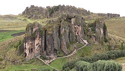
Panoramic from the museum in cumbe mayo. Location 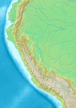
 Location of Cumbe Mayo in Peru
Coordinates 7°11′23″S 78°34′26″W / 7.18972°S 78.57389°WCoordinates: 7°11′23″S 78°34′26″W / 7.18972°S 78.57389°W Culture Cajamarca Period 1000 BC Country  Peru
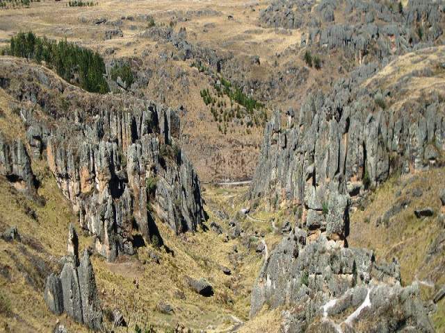
PeruRegion Cajamarca Elevation 3,300 m (10,800 ft) 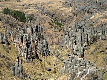 the view to the rock forest
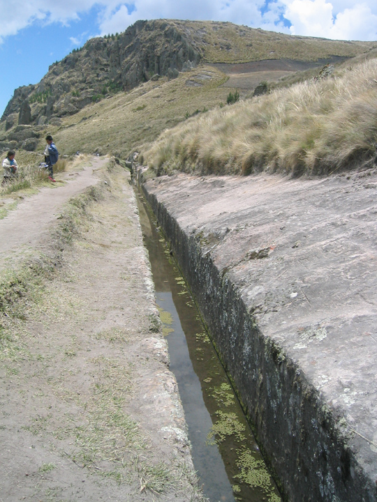
Cumbe Mayo is located about 12 miles (19 km) southwest of the Peruvian city of Cajamarca, at an elevation of approximately 11,000 feet (3,300 meters). The location is best known for the ruins of a Pre-Incan aqueduct stretching approximately five miles in length. The aqueduct collected water from the Atlantic watershed and redirected it on its way to the Pacific Ocean. It is thought to have been constructed around 1500 B.C. and was once thought to be the oldest existing man-made structure in South America. The name Cumbe Mayo may be derived from a Quechua phrase, kumpi mayu, meaning “well-made water channel,” or humpi mayo, meaning “thin river.”
 aqueduct
There are a number of petroglyphs on the aqueduct and surrounding caverns.
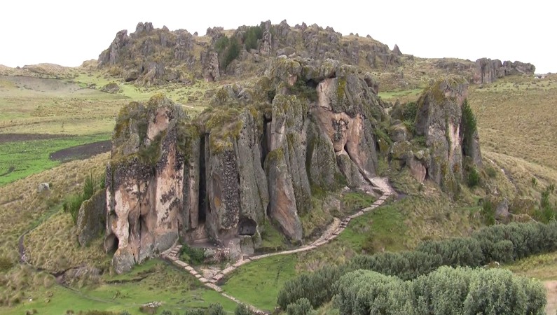
This remote mountainous region is also the location of a "stone forest" composed of natural volcanic rocks which have been shaped by erosion. These formations of volcanic rock are also known as Los Frailones, or the Stone Monks.
Archaeological sites in Peru  Acaray | Aspero | Bandurria | Buena Vista | Cahuachi | Cajamarquilla | Carajía | Caral | Cerro Pátapo | Chan Chan | Chankillo | Chavín de Huantar | Choquequirao | Coricancha | Cota Coca | Cumbe Mayo | Cusichaca valley | El Brujo | Garagay | Gran Pajáten | Gran Vilaya | Guitarrero Cave | Huaca de la Luna | Huaca del Sol | Huaca Pucllana | Huayna Picchu | Huilcahuain | Incahuasi, Ayacucho | Incahuasi, Cañete | Intihuatana | Jiskairumoko | Kenko | Kuelap | Kuntur Wasi | Llactapata | Machu Picchu | Miculla petroglyphs | Muyucmarca | Ollantaytambo | Pachacamac | Pikillacta | Pikimachay | Piruro | Písac | Puca Pucara | Pumacocha | Puyupatamarca | Qoriwayrachina | Raqchi | Rumicolca | Sacred Valley | Sacsayhuamán | Sayhuite | Sechin, Peru | Sillustani | Sipán | Tambo Colorado | Tambomachay | Tarahuasi | Tipón | Toquepala Caves | Toro Muerto | Túcume | Uchkus–Inkañan | Vilcabamba | Vitcos | Wari ruins | Wiñay Wayna | YanacaCategories:
- Archaeology stubs
- Archaeological sites in Peru
- Cajamarca Region
- History of Peru
- Petroglyphs
- Rock art in South America
- Pre-Columbian archaeological sites


Wikimedia Foundation. 2010.