- Moultrie County, Illinois
-
Moultrie County, Illinois 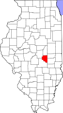
Location in the state of Illinois
Illinois's location in the U.S.Founded 1843 Seat Sullivan Largest city Sullivan Area
- Total
- Land
- Water
344.48 sq mi (892 km²)
335.94 sq mi (870 km²)
8.53 sq mi (22 km²), 2.48%Population
- (2010)
- Density
14,846
43/sq mi (16/km²)Time zone Central: UTC-6/-5 Website www.co.moultrie.il.us Moultrie County is a county located in the U.S. state of Illinois. According to the 2010 census, it has a population of 14,846, which is an increase of 3.9% from 14,287 in 2000.[1] Its county seat is Sullivan.[2] The name is pronounced as in "mole tree", unlike the pronunciation of its namesake.
Contents
Geography
According to the 2010 census, the county has a total area of 344.48 square miles (892.2 km2), of which 335.94 square miles (870.1 km2) (or 97.52%) is land and 8.53 square miles (22.1 km2) (or 2.48%) is water.[3]
Major highways
 U.S. Highway 36
 Illinois Route 16
 Illinois Route 32
 Illinois Route 121
 Illinois Route 133
Townships
Dora, East Nelson, Jonathan Creek, Lovington, Lowe, Marrowbone, Sullivan, Whitley
Adjacent counties
- Piatt County - north
- Douglas County - east
- Coles County - east
- Shelby County - south
- Macon County - northwest
History
Moultrie County was formed in 1843 out of Shelby and Coles Counties. It is named for South Carolina General, and later Governor, William Moultrie. General Moultrie defended Sullivan's Island, South Carolina from British attack in 1776. The site was later renamed Fort Moultrie. Nearby Jasper County was named for Sgt. William Jasper, another hero of the defense of Sullivan's Island.
-

Moultrie County at the time of its creation in 1843
Demographics
Historical populations Census Pop. %± 1900 15,224 — 1910 14,630 −3.9% 1920 14,839 1.4% 1930 13,247 −10.7% 1940 13,477 1.7% 1950 13,171 −2.3% 1960 13,635 3.5% 1970 13,263 −2.7% 1980 14,546 9.7% 1990 13,930 −4.2% 2000 14,287 2.6% IL Counties 1900-1990 As of the census[4] of 2000, there were 14,287 people, 5,405 households, and 3,978 families residing in the county. The population density was 43 people per square mile (16/km²). There were 5,743 housing units at an average density of 17 per square mile (7/km²). The racial makeup of the county was 98.91% White, 0.20% Black or African American, 0.17% Native American, 0.10% Asian, 0.05% Pacific Islander, 0.11% from other races, and 0.47% from two or more races. 0.48% of the population were Hispanic or Latino of any race. 28.8% were of German, 27.2% American, 11.4% English and 10.1% Irish ancestry according to Census 2000.
There were 5,405 households out of which 33.00% had children under the age of 18 living with them, 63.30% were married couples living together, 7.10% had a female householder with no husband present, and 26.40% were non-families. 23.60% of all households were made up of individuals and 12.00% had someone living alone who was 65 years of age or older. The average household size was 2.56 and the average family size was 3.03.
In the county the population was spread out with 25.70% under the age of 18, 7.90% from 18 to 24, 26.00% from 25 to 44, 22.80% from 45 to 64, and 17.70% who were 65 years of age or older. The median age was 39 years. For every 100 females there were 93.00 males. For every 100 females age 18 and over, there were 89.30 males.
The median income for a household in the county was $40,084, and the median income for a family was $46,655. Males had a median income of $35,470 versus $21,168 for females. The per capita income for the county was $18,562. About 5.30% of families and 7.80% of the population were below the poverty line, including 10.90% of those under age 18 and 7.70% of those age 65 or over.
Cities and towns
 Map of Moultrie County, Illinois.
Climate and weather
Sullivan, Illinois Climate chart (explanation) J F M A M J J A S O N D 234191.941243.352333.76543475534.18362487663.385633.180563.168453.9523533924Average max. and min. temperatures in °F Precipitation totals in inches Source: The Weather Channel[5] Metric conversion J F M A M J J A S O N D 511-7485-484111941861012412103281710231198329177727137820798112764-4Average max. and min. temperatures in °C Precipitation totals in mm In recent years, average temperatures in the county seat of Sullivan have ranged from a low of 19 °F (−7 °C) in January to a high of 87 °F (31 °C) in July, although a record low of −26 °F (−32 °C) was recorded in January 1915 and a record high of 111 °F (44 °C) was recorded in July 1936. Average monthly precipitation ranged from 1.89 inches (48 mm) in February to 4.05 inches (103 mm) in June.[5]
See also
References
- ^ "Moultrie County QuickFacts". United States Census Bureau. http://quickfacts.census.gov/qfd/states/17/17139.html. Retrieved 2011-11-05.
- ^ "Find a County". National Association of Counties. http://www.naco.org/Counties/Pages/FindACounty.aspx. Retrieved 2011-06-07.
- ^ "Census 2010 U.S. Gazetteer Files: Counties". United States Census. http://www.census.gov/geo/www/gazetteer/files/Gaz_counties_national.txt. Retrieved 2011-11-05.
- ^ "American FactFinder". United States Census Bureau. http://factfinder.census.gov. Retrieved 2008-01-31.
- ^ a b "Monthly Averages for Sullivan, Illinois". The Weather Channel. http://www.weather.com/weather/wxclimatology/monthly/graph/USIL1139. Retrieved 2011-01-27.

Macon County Piatt County 
Douglas County and Coles County  Moultrie County, Illinois

Shelby County Municipalities and communities of Moultrie County, Illinois Cities 
Villages Allenville | Arthur‡ | Bethany | Dalton City | Gays | Lovington
Townships Dora | East Nelson | Jonathan Creek | Lovington | Lowe | Marrowbone | Sullivan | Whitley
Unincorporated
communitiesBruce | Fuller‡ | Kirksville | Lake City
Footnotes ‡This populated place also has portions in an adjacent county or counties
Categories:- Illinois counties
- Moultrie County, Illinois
- 1843 establishments in the United States
- Populated places established in 1843


Wikimedia Foundation. 2010.