- Ogle County, Illinois
-
Ogle County, Illinois 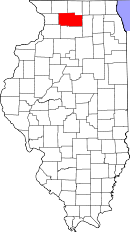
Location in the state of Illinois
Illinois's location in the U.S.Founded January 16, 1836 Seat Oregon Largest city Rochelle Area
- Total
- Land
- Water
762.98 sq mi (1,976 km²)
758.57 sq mi (1,965 km²)
4.41 sq mi (11 km²), 0.58%Population
- (2010)
- Density
53,497
67/sq mi (26/km²)Time zone Central: UTC-6/-5 Website www.oglecounty.org Ogle County is a county located in the U.S. state of Illinois. According to the 2010 census, it has a population of 53,497, which is an increase of 4.8% from 51,032 in 2000.[1] Its county seat is Oregon,[2] and its largest city is Rochelle. The whole of Ogle County lies within the Rochelle Micropolitan Statistical Area.
Contents
History & Politics
Ogle County was formed in 1836 out of Jo Daviess and LaSalle Counties, and named in honor of Captain Joseph Ogle, a veteran of the Revolutionary War who came to Illinois in 1785. Ogle did not have an organized government until 1837, so for a year it remained attached to Jo Daviess County.[citation needed] The county was divided three years later in 1839, when Lee County was formed.
-

Ogle County between 1836 and 1839
-

Ogle County in 1839, reduced to its present borders by the creation of Lee County
Ogle County is one of the most consistently Republican counties in the nation when it comes to Presidential elections. In the last 150 years Theodore Roosevelt's 1912 run as a Progressive was the only time a non-Republican carried the county. No Democratic candidate has ever won the county, which favored the Whig Party before the Republican Party was formed.[3] It is also represented by Republican Donald A. Manzullo as a county in Illinois's 16th congressional district.
 The Ogle County Judicial Center, across the street from the Old Ogle County Courthouse in Oregon, Illinois.
Geography
According to the 2010 census, the county has a total area of 762.98 square miles (1,976.1 km2), of which 758.57 square miles (1,964.7 km2) (or 99.42%) is land and 4.41 square miles (11.4 km2) (or 0.58%) is water.[4] Ogle County is bordered, on all sides, by other Illinois counties. To the north is Winnebago County, to the northeast Boone, and to the northwest Stephenson. DeKalb County lies east of Ogle County, and Carroll to the west. South of Ogle County is Lee, and Whiteside County, which is to the southwest.
Demographics
Historical populations Census Pop. %± 1900 29,129 — 1910 27,864 −4.3% 1920 26,830 −3.7% 1930 28,118 4.8% 1940 29,869 6.2% 1950 33,429 11.9% 1960 38,106 14.0% 1970 42,867 12.5% 1980 46,338 8.1% 1990 45,957 −0.8% 2000 51,032 11.0% 2010 53,497 4.8% IL Counties 1900-1990 As of the census[5] of 2000, there were 51,032 people, 19,278 households, and 14,169 families residing in the county. The population density was 67 people per square mile (26/km²). There were 20,420 housing units at an average density of 27 per square mile (10/km²). The racial makeup of the county was 95.35% White, 0.44% Black or African American, 0.24% Native American, 0.42% Asian, 0.04% Pacific Islander, 2.45% from other races, and 1.06% from two or more races. 6.01% of the population were Hispanic or Latino of any race. 34.1% were of German, 10.3% Irish, 9.7% American, 7.9% English and 5.1% Swedish ancestry according to Census 2000.
There were 19,278 households out of which 35.50% had children under the age of 18 living with them, 61.30% were married couples living together, 8.30% had a female householder with no husband present, and 26.50% were non-families. 22.50% of all households were made up of individuals and 9.80% had someone living alone who was 65 years of age or older. The average household size was 2.62 and the average family size was 3.07.
In the county the population was spread out with 27.50% under the age of 18, 7.20% from 18 to 24, 28.80% from 25 to 44, 23.10% from 45 to 64, and 13.40% who were 65 years of age or older. The median age was 37 years. For every 100 females there were 98.40 males. For every 100 females age 18 and over, there were 96.00 males.
The median income for a household in the county was $45,448, and the median income for a family was $53,028. Males had a median income of $39,862 versus $23,854 for females. The per capita income for the county was $20,515. About 5.30% of families and 7.10% of the population were below the poverty line, including 8.40% of those under age 18 and 5.30% of those age 65 or over.
Climate
Oregon, Illinois Climate chart (explanation) J F M A M J J A S O N D 1.626101.432152.644273.658374.370484.979583.582624.580603.373512.762392.845282.13117Average max. and min. temperatures in °F Precipitation totals in inches Source: The Weather Channel[6] Metric conversion J F M A M J J A S O N D 41-3-12360-9657-3921431102191242614882817114271684231169174727-254-1-8Average max. and min. temperatures in °C Precipitation totals in mm In recent years, average temperatures in Oregon have ranged from a low of 10 °F (−12 °C) in January to a high of 82 °F (28 °C) in July, although a record low of −27 °F (−33 °C) was recorded in January 1999 and a record high of 110 °F (43 °C) was recorded in July 1936. Average monthly precipitation ranged from 1.43 inches (36 mm) in February to 4.88 inches (124 mm) in June.[6]
Economy
Job base
By 2000, 65% of the county labor force was employed as white-collar workers with an increase of 20 points in comparison with 1990 statistics. Manufacturing remains the leading employment sector absorbing more than 21.7% of the labor force though there was a decrease from 30,4% in 1995. However it is expected that services would replace manufacturing starting 2015 as the leading activity.[7]
Agriculture remains an important sector of the county. The main products are corn and soybeans. In 2003, according to the Illinois Department of Agriculture, Ogle County was ranked 17th in the State for crop cash receipts, and 14th in the state for livestock cash receipts. As for livestock production, hogs and pigs are still leading even though productions decreased from 57,000 units in 1998 to 48,900 in 2002.[7]
The county also got some investment packages such as the building a $180 million truck-to-train cargo hub.[8] In August 2006, it was announced that a new ethanol production facility would receive a package of $5.5 million Opportunity Returns grant from the State.[9]
Transportation
Major highways
 Interstate 39
 Interstate 88
 U.S. Highway 52
 U.S. Highway 51
Airports
The following public-use airports are located in the county:[10]
- Ogle County Airport (C55) - Mount Morris, Illinois
- Rochelle Municipal Airport (RPJ) - Rochelle, Illinois
Recreation
Parks
- Castle Rock State Park
- Lowden State Park
- Lowden-Miller State Forest
- Sinnissippi Farms
- Weld Park
- White Pines State Park
Nature Preserves
- Beach Cemetery Prairie Nature Preserve
- Douglas E. Wade Prairie Nature Preserve
- Jarrett Prairie Nature Preserve
See also
- List of settlements in Ogle County, Illinois
- List of townships in Ogle County, Illinois
- List of cemeteries in Ogle County, Illinois
- National Register of Historic Places listings in Ogle County, Illinois
Bibliography
- Kauffman, Horace G.; Kauffman, Rebecca H., eds (1909). Historical Encyclopedia of Illinois and History of Ogle County. 2. Chicago: Munsell Publishing Company. http://www.archive.org/stream/historicalencyclop02bate#page/n7/mode/2up. Retrieved 2010-11-23.
- The History of Ogle County, Illinois. Chicago: H. F. Kett and Company. 1878. http://www.archive.org/stream/historyofoglecou00inkett#page/n7/mode/2up. Retrieved 2010-11-23.

Stephenson County Winnebago County Boone County Carroll County 
DeKalb County  Ogle County, Illinois

Whiteside County Lee County References and notes
- ^ "Ogle County QuickFacts". United States Census Bureau. http://quickfacts.census.gov/qfd/states/17/17141.html. Retrieved 2011-11-05.
- ^ "Find a County". National Association of Counties. http://www.naco.org/Counties/Pages/FindACounty.aspx. Retrieved 2011-06-07.
- ^ Geographie Electorale
- ^ "Census 2010 U.S. Gazetteer Files: Counties". United States Census. http://www.census.gov/geo/www/gazetteer/files/Gaz_counties_national.txt. Retrieved 2011-11-05.
- ^ "American FactFinder". United States Census Bureau. http://factfinder.census.gov. Retrieved 2008-01-31.
- ^ a b "Monthly Averages for Oregon, Illinois". The Weather Channel. http://www.weather.com/weather/wxclimatology/monthly/graph/USIL0900. Retrieved 2011-01-27.
- ^ a b "Amendatory Comprehensive Plan "2K4 update"" (pdf). oglecounty.org. http://www.oglecounty.org/zoning/Comprehensive%20Plan%202K4/Comp%20Plan%202004.pdf. Retrieved 2007-07-12.
- ^ "Special Report: Thinking Regional". rockcountyalliance.com. Archived from the original on 2007-06-13. http://web.archive.org/web/20070613124120/http://rockcountyalliance.com/news_details.asp?nid=16. Retrieved 2007-07-12.
- ^ "Gov. Blagojevich announces a new $25 million investment". rockcountyalliance.com. http://www.illinois.gov/PressReleases/ShowPressRelease.cfm?RecNum=5181&SubjectID=37. Retrieved 2007-07-12.
- ^ Public and Private Airports, Ogle County, Illinois
External links
Municipalities and communities of Ogle County, Illinois Cities 
Villages Adeline | Creston | Davis Junction | Forreston | Hillcrest | Leaf River | Monroe Center | Mount Morris | Stillman Valley
Townships Brookville | Buffalo | Byron | Dement | Eagle Point | Flagg | Forreston | Grand Detour | LaFayette | Leaf River | Lincoln | Lynnville | Marion | Maryland | Monroe | Mt. Morris | Oregon-Nashua | Pine Creek | Pine Rock | Rockvale | Scott | Taylor | White Rock | Woosung
Unincorporated
communitiesBaileyville | Brookville | Buffalo Grove | Chana | Daysville | Egan | Flagg | Flagg Center | Grand Detour | Haldane | Harper | Hazelhurst‡ | Holcomb | Kings | Lindenwood | Lost Nation | Paynes Point | Stratford | Woosung
Footnotes ‡This populated place also has portions in an adjacent county or counties
Categories:- Illinois counties
- 1836 establishments in the United States
- Populated places established in 1836
- Ogle County, Illinois
-


Wikimedia Foundation. 2010.