- Daniels County, Montana
-
Daniels County, Montana 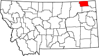
Location in the state of Montana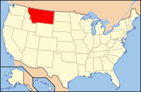
Montana's location in the U.S.Founded 1920 Seat Scobey Largest city Scobey Area
- Total
- Land
- Water
1,427 sq mi (3,696 km²)
1,426 sq mi (3,693 km²)
1 sq mi (3 km²), 0.03%Population
- (2010)
- Density
1,751
1/sq mi (0.55/km²)Daniels County is a county located in the U.S. state of Montana. As of 2010, the population was 1,751.[1] Its county seat is Scobey.[2]
As of 2000, Daniels County was considered the most rural county in the continental United States as measured by the Index of Relative Rurality.[3][4]
Contents
History
Daniels County was created in 1920 from portions of Sheridan and Valley Counties. The name comes from Mansfield Daniels, a local rancher.[5]
Geography
According to the U.S. Census Bureau, the county has a total area of 1,427 square miles (3,695.9 km2). 1,426 square miles (3,693.3 km2) is land and 1 square mile (2.6 km2) (0.03%) is water.
Daniels County is predominately rolling plains. The Poplar River flows through the county.
Major highways
 Montana Highway 5
 Montana Highway 13
Adjacent counties and rural municipalities
- Valley County, Montana - west
- Roosevelt County, Montana - south
- Sheridan County, Montana - east
- Old Post No. 43, Saskatchewan - northwest
- Poplar Valley No. 12, Saskatchewan - north
- Hart Butte No. 11, Saskatchewan - north
- Happy Valley No. 10, Saskatchewan - northeast

Old Post No. 43, Saskatchewan, Canada Poplar Valley No. 12, Saskatchewan, Canada and Hart Butte No. 11, Saskatchewan, Canada Happy Valley No. 10, Saskatchewan, Canada Valley County 
Sheridan County  Daniels County, Montana

Roosevelt County Economy
The main source of income for Daniels County has been cattle and dryland wheat.[6]
Demographics
Historical populations Census Pop. %± 1930 5,553 — 1940 4,563 −17.8% 1950 3,946 −13.5% 1960 3,755 −4.8% 1970 3,083 −17.9% 1980 2,835 −8.0% 1990 2,266 −20.1% 2000 2,017 −11.0% 2010 1,751 −13.2% U.S. Decennial Census As of the census[7] of 2000, there were 2,017 people, 892 households, and 561 families residing in the county. The population density was 1.4 people per square mile (0.55/km²). There were 1,154 housing units at an average density of 1 per square mile (0/km²). The racial makeup of the county was 96.03% White, 1.29% Native American, 0.25% Asian, 0.10% Pacific Islander, 0.59% from other races, and 1.74% from two or more races. 1.59% of the population were Hispanic or Latino of any race. 35.7% were of Norwegian, 20.0% German, 7.8% Irish and 5.5% French ancestry according to Census 2000.
There were 892 households out of which 23.70% had children under the age of 18 living with them, 54.90% were married couples living together, 5.50% had a female householder with no husband present, and 37.10% were non-families. 33.60% of all households were made up of individuals and 17.50% had someone living alone who was 65 years of age or older. The average household size was 2.22 and the average family size was 2.84.
In the county the population was spread out with 22.10% under the age of 18, 4.90% from 18 to 24, 20.00% from 25 to 44, 29.50% from 45 to 64, and 23.50% who were 65 years of age or older. The median age was 47 years. For every 100 females there were 96.00 males. For every 100 females age 18 and over, there were 97.90 males.
The median income for a household in the county was $27,306, and the median income for a family was $35,722. Males had a median income of $24,405 versus $18,421 for females. The per capita income for the county was $16,055. About 13.40% of families and 16.90% of the population were below the poverty line, including 19.20% of those under age 18 and 13.20% of those age 65 or over.
Communities
City
Town
Unincorporated communities
- Four Buttes
- Peerless
- Whitetail
Education
There is one K-12 school serving all of Daniels County.[8]
See also
- List of cemeteries in Daniels County, Montana
- List of lakes in Daniels County, Montana
- List of mountains in Daniels County, Montana
- National Register of Historic Places listings in Daniels County, Montana
References
- ^ "2010 Census Redistricting Data (Public Law 94-171) Summary File". American FactFinder. United States Census Bureau. http://factfinder2.census.gov/faces/tableservices/jsf/pages/productview.xhtml?pid=DEC_10_PL_GCTPL2.ST05&prodType=table. Retrieved 3 May 2011.
- ^ "Find a County". National Association of Counties. http://www.naco.org/Counties/Pages/FindACounty.aspx. Retrieved 2011-06-07.
- ^ "Measuring Rurality". In Context. Indiana Business Research Center at IU's Kelley School of Business. http://www.incontext.indiana.edu/2007/january/2.asp. Retrieved 26 May 2011.
- ^ "What's Rural". Daily Yonder Keep it Rural. Center for Rural Strategies. http://www.dailyyonder.com/whats-rural. Retrieved 26 May 2011.
- ^ "Montana Place Names Companion". Montana Place Names From Alzada to Zortman. Montana Historical Society Research Center. http://mtplacenames.org/. Retrieved 9 May 2011.
- ^ Merrill, Andrea; Judy Jacobson (1997). Montana almanac. Helena, Montana: Falcon Publishing. ISBN 1-56044-493-2.
- ^ "American FactFinder". United States Census Bureau. http://factfinder.census.gov. Retrieved 2008-01-31.
- ^ Scobey Chamber of Commerce and Agriculture. "Education". http://www.scobeymt.com/education.html. Retrieved 24 July 2011.
Municipalities and communities of Daniels County, Montana City 
Town Indian reservation Footnotes ‡This populated place also has portions in an adjacent county or counties
 State of Montana
Topics - Index
- History
- Governors
- People
- Geography
- State Government
- Delegations
- Visitor Attractions
Society - Crime
- Demographics
- Economy
- Education
- Politics
Regions - The Flathead
- Glacier National Park
- Regional designations of Montana
- Western Montana
- Yellowstone
Largest cities Counties - Beaverhead
- Big Horn
- Blaine
- Broadwater
- Carbon
- Carter
- Cascade
- Chouteau
- Custer
- Daniels
- Dawson
- Deer Lodge
- Fallon
- Fergus
- Flathead
- Gallatin
- Garfield
- Glacier
- Golden Valley
- Granite
- Hill
- Jefferson
- Judith Basin
- Lake
- Lewis and Clark
- Liberty
- Lincoln
- Madison
- McCone
- Meagher
- Mineral
- Missoula
- Musselshell
- Park
- Petroleum
- Phillips
- Pondera
- Powder River
- Powell
- Prairie
- Ravalli
- Richland
- Roosevelt
- Rosebud
- Sanders
- Sheridan
- Silver Bow
- Stillwater
- Sweet Grass
- Teton
- Toole
- Treasure
- Valley
- Wheatland
- Wibaux
- Yellowstone
Categories:- Montana counties
- Daniels County, Montana


Wikimedia Foundation. 2010.