Jhangi

Jhangi

Union Councils
name = Jhangi


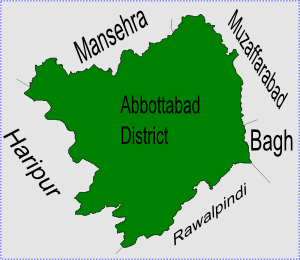
caption = Jhangi is located in Abbottabad District
province = NWFP
district = Abbottabad
tehsil = Abbottabad
nazim = Muhammad Saeed Khan
naib nazim = Sardar Muhammad Rafique [http://www.abbottabad.gov.pk/Union-council/UCDetailPage.asp?name=Jhangi Jhangi Union Council] ]
population = 26,226
coordinates = coord|34|12|0|N|73|14|0|E|region:PK_type:city|display=inline,title

Jhangi is one of the 51 Union Councils of Abbottabad District in the North West Frontier Province of Pakistan. [ [http://www.abbottabad.sdnpk.org/adminunit.htm Administrative Units of District Abbottabad] ] It is also known as Jhangi Syedan to the local population. It is located to the north of Abbottabad city (the district capital) and includes the north-western parts of the city and its suburbs and outlying villages.

ubdivisions

The Union Councils is administratively subdivided into the following areas:
*Banda Amlok
*Banda Batang
*Banda Falzullah
*Banda Khair Khan
*Banda Lamba
*Banda Noor Ahmed
*Banda Qazi
*Banda Sher Khan
*Bandi Gasan
*Dheri
*Dobather
*Jhangi
*Phagwarhan

Other villages are:

*Banda Buraj
*Banda Jalal Khan
*Banda Laman
*Boi Di Gali
*Laman Mera

Location

Jhangi is located at an average elevation of 1201 metres (3943 feet) [ [http://www.fallingrain.com/world/PK/3/Jhangi.html Location of Jhangi] To the south lies the municipality of Abbottabad

References


Wikimedia Foundation. 2010.

Игры ⚽ Нужно сделать НИР?

Look at other dictionaries:

  • Jhangi — est l une des 51 subdivisions du district d Abbottabad de la province de la Frontière du Nord Ouest, au Pakistan[1]. Références ↑ (en) …   Wikipédia en Français

  • Saraiki language — Saraiki Spoken in  Pakistan  India …   Wikipedia

  • Islamabad — Infobox Settlement name = Islamabad native name = Nastaliq|اسلام آباد nickname = settlement type = Capital City total type = motto = imagesize = 250px image caption = Top:Faisal Mosque, Centre Left: Islamabad in Winter, Centre Right:Rawal Lake,… …   Wikipedia

  • Abbottabad District — Abottabad District   District   Map of Hazara, Pakistan with Abbottabad District highlighted Country …   Wikipedia

  • Mughal (tribe) — Mughal Total population 2,666,000[1] Regions with significant populations •  India • …   Wikipedia

  • Demographics of Pakistan — This article is about the demographic features of the population of Pakistan, including population density, ethnicity, education level, health of the populace, economic status, religious affiliations and other aspects of the population.… …   Wikipedia

  • Nathia Gali —   Union council   Location of Nathia Gali union council (highlighted in red) within Abbottabad district …   Wikipedia

  • Namli Maira —   Union council   Location of Namli Maira (highlighted in red) within Abbottabad district, the names of the neighbouring districts to Abbottabad are also shown …   Wikipedia

  • Jhang District — Infobox Pakistan district district = Jhang District area = 8809 population = 536,000 pop year = density = 321.8 caption = Map of Jhang district, the green area shows the current area and boundaries of District Jhang, the adjacent districts of… …   Wikipedia

  • Dhamtour —   Union council   Dhamtore is located in Abbottabad District Coordinates …   Wikipedia

Share the article and excerpts

Direct link
Do a right-click on the link above
and select “Copy Link”