- Douglas County, Minnesota
-
Douglas County, Minnesota 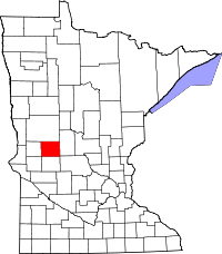
Location in the state of Minnesota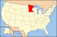
Minnesota's location in the U.S.Founded March 8, 1858 [1] Named for Stephen Douglas Seat Alexandria Largest city Alexandria Area
- Total
- Land
- Water
719.94 sq mi (1,865 km²)
634.32 sq mi (1,643 km²)
85.62 sq mi (222 km²), 11.89%Population
- (2010)
- Density
36,009
52/sq mi (20/km²)Time zone Central: UTC-6/-5 Website www.co.douglas.mn.us Douglas County is a county located in the U.S. state of Minnesota. As of 2010, the population was 36,009.[1] Its county seat is Alexandria[2].
Douglas County is the home of Minnesota's only wine-grape appellation, the 10,880 acres (44.0 km2) Alexandria Lakes AVA.[2]
Contents
Geography
According to the 2000 census, the county has a total area of 719.94 square miles (1,864.6 km2), of which 634.32 square miles (1,642.9 km2) (or 88.11%) is land and 85.62 square miles (221.8 km2) (or 11.89%) is water,[3] comprising over 250 lakes.
The county includes two of Minnesota's biomes: prairie grassland in the west and southeast, and temperate deciduous forest in the south-central, north, and east.[4]
Adjacent counties
- Otter Tail County (north)
- Todd County (east)
- Stearns County (southeast)
- Pope County (south)
- Stevens County (southwest)
- Grant County (west)
Transportation
Major highways
 Interstate 94
 U.S. Highway 52
 Minnesota State Highway 27
 Minnesota State Highway 29
Airports
Alexandria Municipal Airport, also known as Chandler Field, is a city-owned public-use airport located two nautical miles (3.7 km) southwest of the central business district of Alexandria, a city in Douglas County.
Demographics
Historical populations Census Pop. %± 1870 4,239 — 1880 9,130 115.4% 1890 14,606 60.0% 1900 17,964 23.0% 1910 17,669 −1.6% 1920 19,039 7.8% 1930 18,813 −1.2% 1940 20,369 8.3% 1950 21,304 4.6% 1960 21,313 0% 1970 22,892 7.4% 1980 27,839 21.6% 1990 28,839 3.6% 2000 32,821 13.8% 2010 36,009 9.7% U.S. Decennial Census As of the census[5] of 2000, there were 32,821 people, 13,276 households, and 9,027 families residing in the county. The population density was 52 people per square mile (20/km²). There were 16,694 housing units at an average density of 26 per square mile (10/km²). The racial makeup of the county was 98.49% White, 0.18% Black or African American, 0.24% Native American, 0.40% Asian, 0.03% Pacific Islander, 0.18% from other races, and 0.48% from two or more races. 0.59% of the population were Hispanic or Latino of any race. 38.5% were of German, 24.6% Norwegian and 8.1% Swedish ancestry according to Census 2000.
 Age pyramid of county residents based on 2000 U.S. census data.
There were 13,276 households out of which 29.90% had children under the age of 18 living with them, 59.00% were married couples living together, 6.40% had a female householder with no husband present, and 32.00% were non-families. 26.50% of all households were made up of individuals and 12.30% had someone living alone who was 65 years of age or older. The average household size was 2.42 and the average family size was 2.93.
In the county the population was spread out with 24.00% under the age of 18, 9.20% from 18 to 24, 25.00% from 25 to 44, 23.80% from 45 to 64, and 17.90% who were 65 years of age or older. The median age was 40 years. For every 100 females there were 99.00 males. For every 100 females age 18 and over, there were 96.90 males.
The median income for a household in the county was $37,703, and the median income for a family was $46,250. Males had a median income of $30,968 versus $21,240 for females. The per capita income for the county was $18,850. About 5.60% of families and 8.50% of the population were below the poverty line, including 9.30% of those under age 18 and 11.00% of those age 65 or over.
Cities and towns
Cities Townships † Most of Osakis is in Douglas County, but a part of the city extends into Todd County.
See also
References
- ^ "2010 Census Redistricting Data (Public Law 94-171) Summary File". American FactFinder. United States Census Bureau. http://factfinder2.census.gov/faces/tableservices/jsf/pages/productview.xhtml?pid=DEC_10_PL_GCTPL2.ST05&prodType=table. Retrieved 25 April 2011.
- ^ "Find a County". National Association of Counties. http://www.naco.org/Counties/Pages/FindACounty.aspx. Retrieved 2011-06-07.
- ^ "Census 2000 U.S. Gazetteer Files: Counties". United States Census. http://www.census.gov/tiger/tms/gazetteer/county2k.txt. Retrieved 2011-02-13.
- ^ "Minnesota's Biomes" (PDF). Minnesota Department of Natural Resources. 2008. http://files.dnr.state.mn.us/education_safety/education/forestry/biomes/biomes_posterback_sm.pdf. Retrieved 2010-02-27.
- ^ "American FactFinder". United States Census Bureau. http://factfinder.census.gov. Retrieved 2008-01-31.
External links

Otter Tail County Grant County 
Todd County  Douglas County, Minnesota

Stevens County Pope County Stearns County Municipalities and communities of Douglas County, Minnesota Cities Alexandria | Brandon | Carlos | Evansville | Forada | Garfield | Kensington | Millerville | Miltona | Nelson | Osakis‡

Townships Alexandria | Belle River | Brandon | Carlos | Evansville | Holmes City | Hudson | Ida | La Grand | Lake Mary | Leaf Valley | Lund | Millerville | Miltona | Moe | Orange | Osakis | Solem | Spruce Hill | Urness
Unincorporated
communityHolmes City
Footnotes ‡This populated place also has portions in an adjacent county or counties
Categories:- Minnesota counties
- Douglas County, Minnesota


Wikimedia Foundation. 2010.