- Coropuna
-
Nevado Coropuna 
View of Volcano CoropunaElevation 6,425 m (21,079 ft) Prominence 2,208 m (7,244 ft) Listing Ultra Location Southern Peru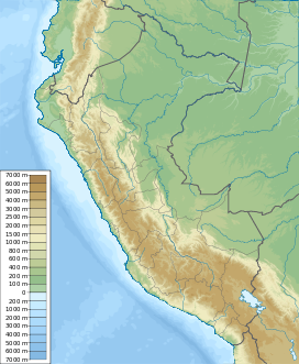
 Nevado Coropuna
Range Andes Coordinates 15°31′00″S 72°39′00″W / 15.5166667°S 72.65°WCoordinates: 15°31′00″S 72°39′00″W / 15.5166667°S 72.65°W Geology Type Stratovolcano complex Volcanic arc/belt Central Volcanic Zone Last eruption Unknown Climbing First ascent Inca, pre-Columbian Easiest route snow / glacier climb Nevado Coropuna is the largest and highest volcano in Peru, attaining an elevation of 6,425 metres (21,079 ft). It is located about 150 km (90 mi) northwest of Arequipa, the second largest city in Peru.
This massive ice-covered stratovolcano complex has a summit plateau which extends over 12 x 20 km (8 x 13 mi), with six separate summit cones rising above it. Three summits have over 300m of prominence [1], the true summit, 6425m, is at the northwest corner of the plateau. The southwest (Casulla) summit has an elevation of 6377m on the Peruvian IGM map[2] but may be equal or greater in height depending on the depth of seasonal snow. A further summit with over 300m prominence is Coropuna Este 6307m. A permanent ice cap of about 130 square kilometres (50 sq mi) in area covers the summit region, extending down to roughly 5,300 metres (17,400 ft) on the north side and 4,800 metres (15,700 ft) on the south. Vertical relief on the south flank exceeds 4,000 metres (13,000 ft) over a distance of less than 15 km (9 mi).
The name Coropuna means "shrine on the plateau" in Quechua. Coropuna was (and still is) one of the most sacred mountains in Peru, and in 1553 its temple was claimed to be the fifth most important shrine in the Inca Empire by the chronicler, Cieza de Leon. In 1982 Peruvian archaeologist José Antonio Chávez was able to briefly visit an Inca site called Achaymarca, which he felt was a likely candidate to be the temple of Coropuna. In 1989 Chávez and Johan Reinhard led an expedition to visit Achaymarca and surveyed the central ruins at 4,030 m (13,222 ft), which was part of a complex of over 200 structures, including an Inca ceremonial platform (ushnu). They also traced an Inca trail up to 5,500 m (18,044 ft) on the western slope of the mountain, where it disappeared beneath the glacier ice. Along this trail was an Inca site at 5,090 m (16,699 ft) that they named Ajocancha. In 1996 they organized another expedition which found wool and llama bones at 5,760 m (18,897 ft), llama bones and shards at 5,947 m (19,511 ft), and wood at 6,200 m (20,341 ft), providing evidence of pre-Columbian ascents.
Another large Inca site, Maucallacta, has been investigated by Peruvian and Polish archaeologists in recent years. It lies several km to the east of Achaymarca at the head of a separate drainage system and also contains an ushnu and numerous structures. Thus two "temples" of primary importance had been established by the Incas on Coropuna's slopes.
More information about Maucallacta, the sacred Inca oracle of Coropuna, can be found in the web site: www.maucallacta.com [1]
-

Coropuna, main summit on the left, Casulla on the right.
-

Coropuna from the ISS.
-

Aerial photo of Nevado Coropuna from the south, with the true summit at left.
See also
References
- Biggar, John (2005). The Andes: A Guide for Climbers (3rd ed.). Andes Publishing (Scotland). pp. 304 pp. ISBN 0-9536087-2-7. http://www.andes.org.uk/.
- González-Ferrán, Oscar (1995). Volcanes de Chile. Santiago, Chile: Instituto Geográfico Militar. pp. 640 pp. ISBN 956-202-054-1. (in Spanish; also includes volcanoes of Argentina, Bolivia, and Peru)
- De Silva, Shanaka L.; Francis, Peter (1991). Volcanoes of the Central Andes. Springer-Verlag. pp. 216 pp. ISBN 3540537066.
- "Coropuna". Global Volcanism Program, Smithsonian Institution. http://www.volcano.si.edu/world/volcano.cfm?vnum=1504-003.
- Reinhard, Johan (1999). "Coropuna: Lost Mountain Temple of the Incas." South American Explorers Journal 58: 5, 26-30.
- Reinhard, Johan (2005). The Ice Maiden: Inca Mummies, Mountain Gods, and Sacred Sites in the Andes. Washington, D.C.: National Geographic Society. ISBN 0-7922-6838-5.
- Ziólkowski, Mariusz (2008). "Coropuna y Solimana: Los Oráculos de Condersuyos." In Adivinación y oráculos en le Mundo Andino Antiguo, Curatola, Marco and Mariusz Ziólkowski (eds.), pp. 121–159. Fundo Editorial de la Pontificia Universidad Católica del Perú, Lima.
External links
Andean volcanoes Northern Volcanic Zone (6° N–3° S) Nevado del Ruiz · Nevado del Huila · Galeras · Cayambe · Reventador · Pichincha · Antisana · Illiniza · Cotopaxi · Quilotoa · Tungurahua · SangayCentral Volcanic Zone (15°–27° S) Ampato · Coropuna · Sabancaya · Chachani · El Misti · Ubinas · Huaynaputina · Parinacota · Irruputuncu · Azufre · Sairecabur · Pacana · Licancabur · Lascar · Llullaillaco · Galán · San Francisco · Ojos del SaladoSouthern Volcanic Zone (33°–46° S) Tupungato · Tupungatito · Maipo · Calabozos · Descabezado Grande · Cerro Azul · Nevado de Longaví · Nevados de Chillán · Antuco · Copahue · Callaqui · Lonquimay · Llaima · Sollipulli · Villarrica · Quetrupillán · Lanín · Mocho-Choshuenco · Carrán-Los Venados · Puyehue-Cordón Caulle · Osorno · Calbuco · Hornopirén · Michinmahuida · Chaitén · Corcovado · Cay · Macá · HudsonAustral Volcanic Zone (49°–55° S) Note: volcanoes are ordered by latitude from north to south Categories:- Stratovolcanoes
- Subduction volcanoes
- Volcanoes of Peru
- Mountains of Peru
- Arequipa Region
-


Wikimedia Foundation. 2010.