- Nettlestead, Kent
-
For Nettlestead in Suffolk, see Nettlestead, Suffolk.
Coordinates: 51°14′41″N 0°24′40″E / 51.244600°N 0.411210°E
Nettlestead 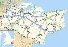
 Nettlestead
Nettlestead shown within KentDistrict Maidstone Shire county Kent Region South East Country England Sovereign state United Kingdom Police Kent Fire Kent Ambulance South East Coast EU Parliament South East England List of places: UK • England • Kent Nettlestead is a village and civil parish on the road south-west of, and part of the borough of Maidstone. More than 800 people live in the parish. The parish church of St Mary the Virgin has links with William the Conqueror's half brother, Odo.
According to the reference quoted below, 'it is said that Nettlestead church owes its enormous stained glass windows to a 15th century Agincourt veteran who came back from France very impressed with what had already been done with stained glass decoration for churches there.
The man was Reginald de Pympe, and his son, John, added more stained glass later in the same century. The de Pympes made quite an impression upon Nettlestead in their day. Reginald moved into Nettlestead Place, which he rebuilt at about the same time as he had the church rebuilt and embellished with the new glass.
Nettlestead Green is a separate village lying two miles further south. Both villages are close to the River Medway.
External links
External links
 Media related to Nettlestead, Kent at Wikimedia Commons
Mereworth Wateringbury Teston West Peckham 
West Farleigh  Nettlestead

Peckham Bush Nettlestead Green Yalding Towns and villages in the Maidstone borough of Kent, England 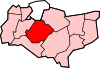 Allington · Barming · Bearsted · Bedmonton · Benover · Bexon · Bicknor · Boughton Green · Boughton Malherbe · Boughton Monchelsea · Boxley · Bredhurst · Broomfield · Caring · Chainhurst · Chart Sutton · Chegworth · Collier Street · Coxheath · Detling · Downswood · East Barming · East Farleigh · East Sutton · Fairbourne Heath · Frinsted · Grove Green · Harrietsham · Hawkenbury · Headcorn · Hollingbourne · Horden · Hucking · Hunton · Kingswood · Kit's Coty · Laddingford · Langley · Leeds · Lenham · Linton · Loose · Lordswood · Maidstone · Marden · Marley · Milebush · Nettlestead · Nettlestead Green · Otham · Otterden · Park Wood · Platt's Heath · Penenden Heath · Pollhill · Ringlestone (hamlet) · Ringlestone (suburb) · Sandling · Sandway · Shepway · Sutton Valence · Staplehurst · Stockbury · Teston · Thurnham · Tovil · Ulcombe · Walderslade · Weavering · West Farleigh · Wichling · Wormshill · Yalding
List of places in Kent Categories:- Maidstone (borough)
- Villages in Kent
- Civil parishes in Kent


Wikimedia Foundation. 2010.