- Sullivan County, New Hampshire
-
Sullivan County, New Hampshire 
Seal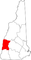
Location in the state of New Hampshire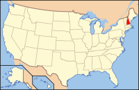
New Hampshire's location in the U.S.Founded 1827 Seat Newport Largest city Claremont Area
- Total
- Land
- Water
552.34 sq mi (1,431 km²)
537.38 sq mi (1,392 km²)
14.96 sq mi (39 km²), 2.63%Population
- (2010)
- Density
43,742
80/sq mi (31/km²)Website www.sullivancountynh.gov Sullivan County is a county located in the U.S. state of New Hampshire. As of 2010, the population was 43,472.[1] Its county seat is Newport.[2]
Contents
History
Sullivan County was organized at Newport in 1827, and is named for John Sullivan, revolutionary war hero and former governor. It was formed from the northern part of Cheshire County.
Politics
Presidential election results[3] Year Democrat Republican 2008 58.2% 13,249 40.3% 9,169 2004 52.4% 11,434 46.5% 10,142 2000 44.1% 8,224 49.8% 9,304 Geography
According to the U.S. Census Bureau, the county has a total area of 552 square miles (1,430 km2), of which 537 sq mi (1,390 km2) is land and 15 square miles (39 km2) (2.63%) is water.
Adjacent counties
- Grafton County (north)
- Merrimack County (east)
- Hillsborough County (southeast)
- Cheshire County (south)
- Windham County, Vermont (southwest)
- Windsor County, Vermont (west)

Grafton County Windsor County, Vermont 
Merrimack County  Sullivan County, New Hampshire

Windham County, Vermont Cheshire County Hillsborough County National protected area
Demographics
Historical populations Census Pop. %± 1830 19,669 — 1840 20,340 3.4% 1850 19,375 −4.7% 1860 19,041 −1.7% 1870 18,058 −5.2% 1880 18,161 0.6% 1890 17,304 −4.7% 1900 18,009 4.1% 1910 19,337 7.4% 1920 20,922 8.2% 1930 24,286 16.1% 1940 25,442 4.8% 1950 26,441 3.9% 1960 28,067 6.1% 1970 30,949 10.3% 1980 36,063 16.5% 1990 38,592 7.0% 2000 40,458 4.8% 2010 43,742 8.1% [4][5][6] As of the census[7] of 2000, there were 40,458 people, 16,530 households, and 11,174 families residing in the county. The population density was 29/; (75/sq mi). There were 20,158 housing units at an average density of 38 per square mile (14/km²). The racial makeup of the county was 97.99% White, 0.24% Black or African American, 0.29% Native American, 0.37% Asian, 0.02% Pacific Islander, 0.14% from other races, and 0.94% from two or more races. 0.55% of the population were Hispanic or Latino of any race. 16.9% were of English, 14.7% French, 11.7% French Canadian, 10.7% American, 10.0% Irish, 6.2% German and 5.1% Italian ancestry according to Census 2000. 96.1% spoke English and 1.6% French as their first language.
There were 16,530 households out of which 29.40% had children under the age of 18 living with them, 54.70% were married couples living together, 8.60% had a female householder with no husband present, and 32.40% were non-families. 25.70% of all households were made up of individuals and 10.90% had someone living alone who was 65 years of age or older. The average household size was 2.41 and the average family size was 2.88.
In the county the population was spread out with 23.90% under the age of 18, 6.40% from 18 to 24, 28.00% from 25 to 44, 25.90% from 45 to 64, and 15.80% who were 65 years of age or older. The median age was 40 years. For every 100 females there were 97.10 males. For every 100 females age 18 and over, there were 93.50 males.
The median income for a household in the county was $40,938, and the median income for a family was $48,516. Males had a median income of $32,185 versus $24,615 for females. The per capita income for the county was $21,319. About 5.20% of families and 8.50% of the population were below the poverty line, including 9.50% of those under age 18 and 8.80% of those age 65 or over.
Cities and towns
See also
References
- ^ United States Census Bureau, American FactFinder, 2010 Census figures. Retrieved March 23, 2011.
- ^ "Find a County". National Association of Counties. http://www.naco.org/Counties/Pages/FindACounty.aspx. Retrieved 2011-06-07.
- ^ "Dave Leip's Atlas of U.S. Presidential Elections". http://uselectionatlas.org/RESULTS/. Retrieved 2011-06-11.
- ^ http://www.census.gov/population/www/censusdata/cencounts/files/nh190090.txt
- ^ http://factfinder2.census.gov/faces/tableservices/jsf/pages/productview.xhtml?pid=DEC_10_PL_QTPL&prodType=table
- ^ http://mapserver.lib.virginia.edu/
- ^ "American FactFinder". United States Census Bureau. http://factfinder.census.gov. Retrieved 2008-01-31.
External links
Municipalities and communities of Sullivan County, New Hampshire City 
Towns Acworth | Charlestown | Cornish | Croydon | Goshen | Grantham | Langdon | Lempster | Newport | Plainfield | Springfield | Sunapee | Unity | Washington
Villages Balloch | Cornish Flat | East Lempster | Georges Mills | Guild | Meriden
Categories:- New Hampshire counties
- Sullivan County, New Hampshire


Wikimedia Foundation. 2010.