- Chebeague Island, Maine
-
Chebeague Island is an island town in Cumberland County, Maine, United States, located in Casco Bay, 10 miles from Portland. These islands are sometimes referred to as an older, now archaic term "The Calendar Islands" because there was once a belief that the approx. number of islands was about 365. See Casco Bay. The actual number is less than two hundred. Great Chebeague was a part of the town of Cumberland until July 1, 2007, when it became the town of Chebeague Island.[1]
Two ferry services provide transportation to the island. The Chebeague Transportation Company (CTC) makes the 15 minute run from Cousins Island, which in turn is connected by bridge to Yarmouth. Casco Bay Lines also provides service on all mail-boat and other "down-bay" trips that travel beyond Long Island.
Chebeague Island is part of the Portland–South Portland–Biddeford, Maine Metropolitan Statistical Area.
Contents
History
According to island lore, the name "Chebeague" comes from a Native American word meaning "Island of Many Springs" (pronounced "sha-Beeg"), as there are, indeed, many deep-running, underground fresh-water streams all over the island, in some places literally bubbling from the ground. Some Native Americans were still present after the European colonization of the area, as late as the 1870s.
The Native Americans did not dwell year-round on the island but paddled over by canoe during the summer months to fish. One can still notice areas of the island where clam shells are abundantly packed into the soil. This is mostly due to "shell piles" the Indians regularly made after their meals.
Original settlers in 1730 cleared much of the land for farming. Lobsters were so plentiful that they were not eaten, but rather used as fertilizer for fields. Great Chebeague was once home to the famous 'stone sloops' that carried quarried granite down the eastern seaboard, and marine contractors who built breakwaters, lighthouses, and set navigational markers.
By the late 19th century and throughout the early 20th century, tourists from Canada, Boston and points south began to visit Maine in a phenomenon sometimes known as the "rusticators" movement.[2] Cottages, Rooming houses, and Inns, such as the historical (but rebuilt) Chebeague Island Inn, were scattered around Casco Bay serviced by steamboats from Portland where crowds of tourists from the industrial cities of New England could get back to nature for a few days or weeks.[3] This tradition faded some, but continues to this day. Many of those who visit Chebeague in summer are middle class workers from towns and cities as far south as Baltimore, who have a family "cottage" on the island that has been passed down through generations.
In 2002 Chebeague Island explored secession from Cumberland, with whom they have been tied for 184 years. The initiative gained traction after school district 51 considered downsizing the island elementary school. The island won independence from Cumberland after votes in the Maine Senate (31-3) and House of Representatives (131-1) on April 5, 2006. [1] The separation took effect on 1 July 2007.[4]
Geographical features
Little Chebeague
Chebeague Island is known as "Great Chebeague," as it is not always a single landmass. The nearby island of "Little Chebeague" is accessible on foot, via a sandbar that appears at low tide. Being that there are many fresh-water underground springs and rivulets, low-tide exposed sandy areas such as the sandbar, or coves, often have "quicksand" zones that must be noted with caution. Little Chebeague, approximately 3/4 of a mile long, is uninhabited and mostly dense shrub and forest. Owned by the Maine Bureau of Parks and Lands, it is an undeveloped park where picnicking, camping and swimming are allowed, but no facilities are provided. Nearby Diamond Island also shares this low tide event of having a "great" and a "small" island classification.
Transportation
One main macadam paved road (with various different names, including North Road and South Road) loops around the island, with a few connecting paved roads in between, such as Schoolhouse Road and Littlefield Avenue.[4] There are many unpaved roads coming off the paved road that go to residential homes and various points and beaches. The beaches are considered state land and anyone can walk on them, like state park property, thus the reason many of the smaller roads simply end at coastal points. Some of smaller "roads" are merely single lane, rutted sand trails with heavy overgrowth to either side, and on the off-chance 2 cars meet coming at one another, one car must pull to the side or back up to a suitable area to allow the other to pass. Most residents have "island cars" that they leave there year-round; they take the abuse of rutted back roads with overgrowth that scratches the sides of vehicles, as well as the corrosive, briney Casco Bay air. Island cars are not required to have license plates, although they must be registered.
At approximately 5 miles long and 3 miles wide, Chebeague is the largest unconnected island in Casco Bay.
Despite being 10 miles from the city of Portland, it is still relatively unspoiled by development. However, this status has changed drastically since the early 1990s, breaking a many decades-long streak of little change in layout.
Notable events
In 1997, the people of Chebeague were a significant part of a movement that managed to overturn Nabisco's decision to discontinue the "Crown Pilot Crackers" from their product line. Due to it being such a tradition with the islanders as an accessory to their consumption of soup, an organized effort was created to bring the chowder cracker back. It was successful, so much so that not only was the Pilot Cracker made again, but it was turned into a media event, with Nabisco donating $1,000 to the Chebeague Historical Society. [2]
Wildlife and Nature
Deer, red fox, a variety of non-poisonous snakes, raccoons, frogs and toads, gray and black back gulls, loons and ducks are all creatures that can be seen on and about the island. Curiously, no grey squirrels or skunks are to be found on this, the second largest island in Casco Bay (Sebascodegan, or "Great Island" - part of the town of Harpswell and connected to the mainland by a bridge, is the largest). Mosquitoes can be a nuisance, and much of the island is soft, sandy, swampy soil (due largely in part to the many underground springs), which are perfect conditions for mosquito breeding.
Harbor seals can often be spotted from the shores of Chebeague, swimming or sunning themselves on the rocks of nearby uninhabited islands or on depth-marker buoys. Occasionally one might spot a porpoise breaking surface as well. Lobsters and lobstering are a big part of Casco Bay and the ocean surrounding Chebeague is dotted by thousands of lobster pot buoys, the livelihood of many year-round residents in the area. Lobstering is a big commodity of Casco Bay. Locals often fish from the docks and piers for mackerel, bluefish, or striped bass, just a few of many abundant fish in the area, and crab traps hang from the docks.
Blueberries
All over the island, as Maine is often known for, are blueberry patches that supply an abundant amount of blueberries, ardently picked by the locals. However, they are slowly decreasing in size as land development continues.
Clamming, red tide, and poaching
The many inlet coves around the island are home to abundant clam beds. During low tide, these fully exposed areas can be walked on and are often clammed by the locals, some of whom have made a living for decades harvesting steamers, hen clams, and razor clams from the muddy, clay rich soil. Clamming is often shut down when the red tide — a harmful microscopic ocean organism that affects shellfish — "blooms" in the area. People who eat clams that are affected by the red tide (even steamed ones) can become violently ill; the algae can be fatal. This paralytic poisoning often causes death to not only humans, but birds, larval and adult fish, and marine mammals.
For many years, mussels — which grow in clusters, attached by "beards" to rocks and seaweed, pier pilings, buoys, and just about any stable structure in the ocean — were largely ignored as edible. But during the 1980s and early 1990s, when clams were getting more difficult to acquire, mussels began to be considered good eating. Some consider these mollusks a bit more "gamey" in taste compared to clams but quite similar otherwise. Mussels can be reaped in much larger quantities, very quickly. Clams have to be dug out of the sand, by hand, with an angled pick; they very often withdrew deeper into their sand tunnel when they "hear" someone digging for them. This makes harvesting clams a backbreaking task. The clam shell may be broken during this procedure, ruining it. Mussels, on the other hand, are literally lying on the shore during low tide, and a bucketful can be collected in minutes. Marketing demands have reduced the mussel population greatly, and now they are often "grown" by farmers on floating barges where they can be easily "picked" when ready.
Ocean geography, tides, and weather
Typically Great Chebeague has 8–9 foot tides under normal conditions. Ocean floor geography in the general area can vary drastically, thus careful navigation must be taken when boating, even in small vessels. Many islands, including Great Chebeague, have extended rock outcroppings that are completely underwater during high tide but may be lurking just below the surface as the tide drops, and may appear 3–10 feet out of the water during low tide. The rip tide can be several knots, and rowing against it is physically impossible: Extra care must be taken when venturing out in small watercraft. Even on the clearest day, a thick fog can suddenly "roll in" out of nowhere, reducing visibility to zero.
Even during the warmest summer months, the ocean temperature is barely above 60 degrees. Falling out of a boat can be dangerous, if not fatal, depending on the time of year. Swimming is enjoyed only by the brave, usually in inlets and coves where the water temperature is slightly higher, and off the pier or docks. Like most islands in the area, Chebeague has as much rocky cliffs for a shoreline as beaches. Most beaches are rough and rocky, strewn with driftwood, barnacle-covered rocks, and slippery seaweed. The sand itself is as much, if not more, shards of crushed shells, and walking barefoot can be daunting if not impossible. The "Niblic" beach by the boatyard and Deer Point by Chandler's Cove are popular beaches for their soft stretch of sand. On a clear day at Deer Point, you can see Mount Washington. When the sun goes down, the temperatures can drop drastically and, even on the warmest summer days, nights are often very cool and can require long sleeves and pants and even a fire in the fireplace. Winters can be brutal, and usually by September most of the non-year-round residents are packed up and gone.
Stores and Services
There is cell phone service on the island, but it can be patchy if one is on the east side of the island, which faces the ocean. There is a post office and mail delivery, a boatyard, a church, a cemetery, a museum, a hotel (The Chebeague Island Inn) with restaurant, a "Clam Shack" take-out restaurant (with picnic tables on premises), a 9-hole golf course, the Library/Island Hall/Health Center (with wireless access), souvenir shops (The Niblic, Island Riches, and (previously) The Cobbler Shop), Doughty's Island Market, a taxi service, and a gas pump. There is a full time volunteer fire station and EMTs/ambulance. Police matters are handled by Cumberland County Sheriff officers. If there is a medical emergency, one must be taken to the mainland via the ambulance and ferry, which are always on call. Children of year-round residents take a boat back and forth to the mainland every day from the Stone Pier to go to middle and high school. Elementary school aged children usually stay on the island to attend the school house, which houses grades K-5. The Chebeague High School closed in 1956; the schoolhouse, built in 1871 still stands and serves as a museum for Great Chebeague's history.
Like nearby Cousins Island, connected to the mainland with a bridge, Great Chebeague has historically debated and entertained the idea of "hooking up" to the mainland or Cousins Island with a bridge of its own. A bridge would be beneficial to the islanders when they need to go shopping, and would eliminate the hassle and cost of taking a boat back and forth (and then needing transportation once you get there), but a bridge would also open up the possibility of island losing its charm and seclusion from the traffic of everyday mainland life. The idea of building a bridge was last considered seriously in 1970, but was soundly voted down by islanders.
Notable people
- Ellen Goodman, syndicated newspaper columnist.
- Warren Bogle, pitcher with the 1968 Oakland Athletics.[citation needed]
- Raymond Gilmartin, former CEO of Merck & Co..
- David Dodd, educator, financial analyst, author, economist.
See also
- List of islands of Maine
References
- ^ NPR "Maine Island Celebrates New Independence" 2007-07-04. Accessed 2011-02-11.
- ^ Woodard, Colin. The Lobster Coast. New York. Viking/Penguin, ISBN 0-670-03324-3, 2004
- ^ Frappier, William. Steamboat Yesterdays of Casco Bay. Stoddart, Canada, ISBN 978-1550460865, 2000
- ^ One town's Independence Day: Maine island seceding from Portland suburb to secure its future, The San Diego Union-Tribune, 2007-06-30. Accessed 2008-06-25.
External links
- Town of Chebeague Island
- Chebeague Island News
- Chebeague Transportation Company
- Casco bay Lines
- Red Tide Official Closures
Municipalities and communities of Cumberland County, Maine Cities 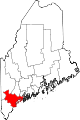
Towns Baldwin | Bridgton | Brunswick | Cape Elizabeth | Casco | Chebeague Island | Cumberland | Falmouth | Freeport | Frye Island | Gorham | Gray | Harpswell | Harrison | Long Island | Naples | New Gloucester | North Yarmouth | Pownal | Raymond | Scarborough | Sebago | Standish | Windham | Yarmouth
CDPs Other
villageCoordinates: 43°44′27″N 70°06′29″W / 43.74083°N 70.10806°W
Categories:- Islands of Cumberland County, Maine
- Towns in Cumberland County, Maine
- Populated places established in 2007
- Portland – South Portland – Biddeford metropolitan area

Wikimedia Foundation. 2010.