- Mahoning County, Ohio
-
Mahoning County, Ohio 
Seal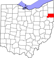
Location in the state of Ohio
Ohio's location in the U.S.Founded March 1, 1846[1] Named for a Native American word for salt lick Seat Youngstown Largest city Youngstown Area
- Total
- Land
- Water
423 sq mi (1,097 km²)
415 sq mi (1,075 km²)
8 sq mi (21 km²), 1.92%Population
- (2000)
- Density
257,555
620/sq mi (239/km²)Time zone Eastern: UTC-5/-4 Website www.mahoningcountyoh.gov Mahoning County is a county located in the state of Ohio. As of the 2010 census, the population was 238,823. [1] It is part of the Youngstown-Warren-Boardman, OH-PA Metropolitan Area.
Its county seat is Youngstown[2] and the county is named for an Indian word meaning "salt lick".[3]
Contents
Geography
According to the U.S. Census Bureau, the county has a total area of 423 square miles (1,100 km2).415 square miles (1,075 km²) of it is land and 8 square miles (21 km2) of it (1.92%) is water.
Adjacent counties
- Trumbull County (north)
- Mercer County, Pennsylvania (northeast)
- Lawrence County, Pennsylvania (east)
- Columbiana County (south)
- Stark County (southwest)
- Portage County (northwest)
Demographics
 A pyramid showing the age distribution of the County.
Historical populations Census Pop. %± 1850 23,735 — 1860 25,894 9.1% 1870 31,001 19.7% 1880 42,871 38.3% 1890 55,979 30.6% 1900 70,134 25.3% 1910 116,151 65.6% 1920 186,310 60.4% 1930 236,142 26.7% 1940 240,251 1.7% 1950 257,629 7.2% 1960 300,480 16.6% 1970 303,424 1.0% 1980 289,487 −4.6% 1990 264,806 −8.5% 2000 257,555 −2.7% Est. 2007 240,420 −6.7% Population 1850-2007.[1] As of the census[4] of 2000, there were 257,555 people, 102,587 households, and 68,835 families residing in the county. The population density was 620 people per square mile (239/km²). There were 111,762 housing units at an average density of 269 per square mile (104/km²). The racial makeup of the county was 81.04% White, 15.87% Black or African American, 0.17% Native American, 0.47% Asian, 0.02% Pacific Islander, 1.03% from other races, and 1.38% from two or more races. 2.97% of the population were Hispanic or Latino of any race.
There were 102,587 households out of which 28.40% had children under the age of 18 living with them, 49.00% were married couples living together, 14.10% had a female householder with no husband present, and 32.90% were non-families. 29.10% of all households were made up of individuals and 13.10% had someone living alone who was 65 years of age or older. The average household size was 2.44 and the average family size was 3.02.
In the county, the population was spread out with 23.70% under the age of 18, 8.40% from 18 to 24, 26.40% from 25 to 44, 23.70% from 45 to 64, and 17.80% who were 65 years of age or older. The median age was 40 years. For every 100 females there were 91.40 males. For every 100 females age 18 and over, there were 88.00 males.
The median income for a household in the county was $35,248, and the median income for a family was $44,185. Males had a median income of $36,313 versus $23,272 for females. The per capita income for the county was $18,818. About 9.60% of families and 12.50% of the population were below the poverty line, including 19.10% of those under age 18 and 8.70% of those age 65 or over.
Government
Main article: Ohio county governmentCommunities
 Map of Mahoning County, Ohio With Municipal and Township Labels
Cities
Villages
Townships
Census-designated places
Other communities
See also
References
- ^ a b "Ohio County Profiles: Mahoning County" (PDF). Ohio Department of Development. http://www.odod.state.oh.us/research/FILES/S0/Mahoning.pdf. Retrieved 2007-04-28.
- ^ "Find a County". National Association of Counties. http://www.naco.org/Counties/Pages/FindACounty.aspx. Retrieved 2011-06-07.
- ^ "Mahoning County data". Ohio State University Extension Data Center. Archived from the original on 2008-01-12. http://web.archive.org/web/20080112145136/http://www.osuedc.org/profiles/profile_entrance.php?fips=39099&sid=0. Retrieved 2007-04-28.
- ^ "American FactFinder". United States Census Bureau. http://factfinder.census.gov. Retrieved 2008-01-31.
External links

Portage County Trumbull County Mercer County, Pennsylvania 
Lawrence County, Pennsylvania  Mahoning County, Ohio

Stark County Columbiana County Municipalities and communities of Mahoning County, Ohio Cities Alliance‡ | Campbell | Canfield | Columbiana‡ | Salem‡ | Struthers | Youngstown‡

Villages Beloit | Craig Beach | Lowellville | New Middletown | Poland | Sebring | Washingtonville‡
Townships Austintown | Beaver | Berlin | Boardman | Canfield | Coitsville | Ellsworth | Goshen | Green | Jackson | Milton | Poland | Smith | Springfield
CDPs Unincorporated
communitiesDamascus‡ | Ellsworth | Greenford | Lake Milton | New Springfield | North Benton | North Jackson | North Lima | Petersburg
Footnotes ‡This populated place also has portions in an adjacent county or counties
Categories:- Ohio counties
- Mahoning County, Ohio
- 1846 establishments in the United States
- Youngstown metropolitan area


Wikimedia Foundation. 2010.