- McKinney Falls State Park
-
McKinney Falls State Park 
Lower McKinney Falls

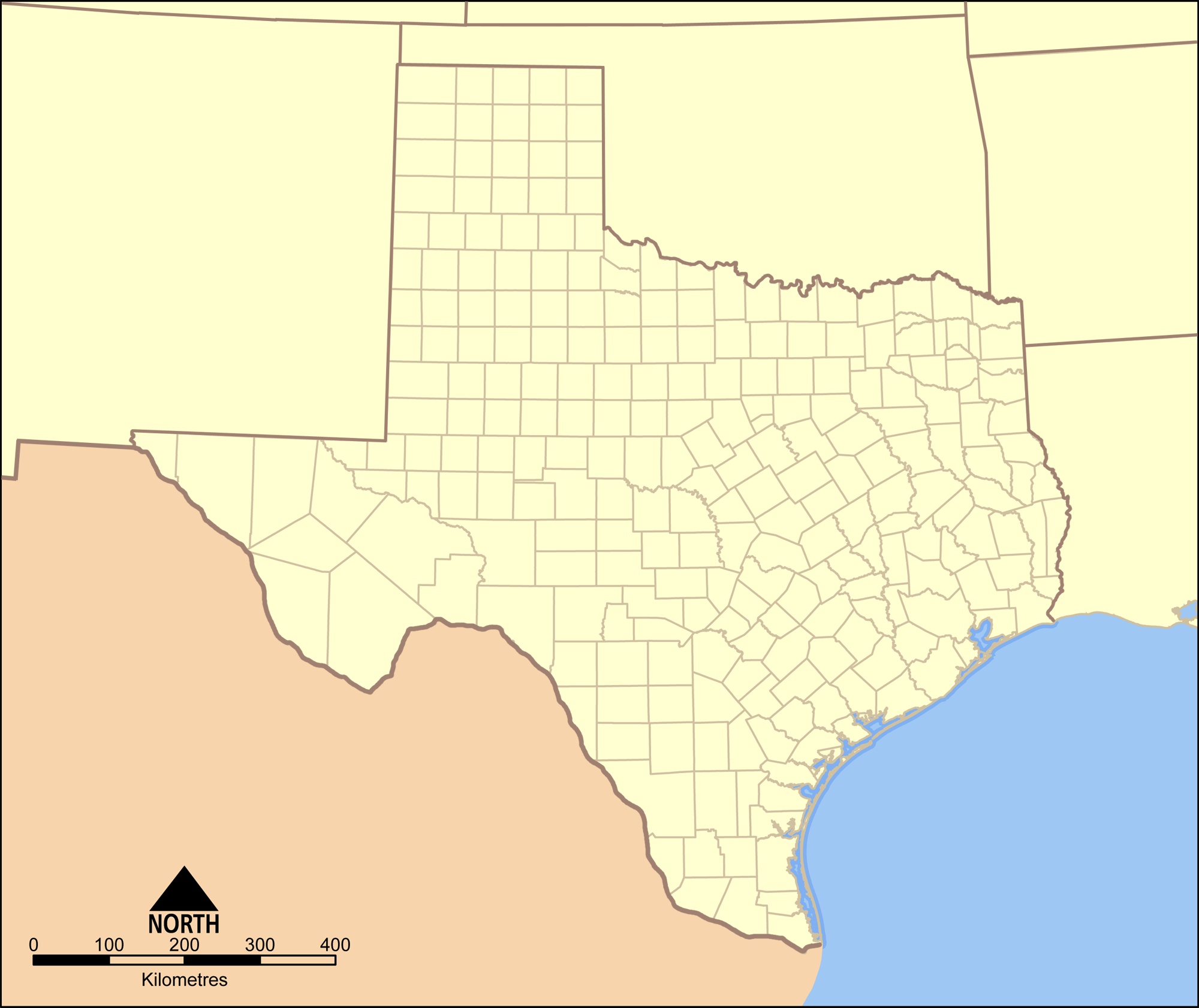
Location Travis County, Texas Nearest city Austin Coordinates 30°10′51″N 097°43′19″W / 30.18083°N 97.72194°WCoordinates: 30°10′51″N 097°43′19″W / 30.18083°N 97.72194°W Area 744.4 acres (301 ha) Established 1976 Governing body Texas Parks and Wildlife Department McKinney Falls State Park is a state park located at the southeastern edge of Austin, Texas, United States around the confluence of Onion and Williamson Creeks and is administered by the Texas Parks and Wildlife Department. The park opened on April 15, 1976 and is named after Thomas F. McKinney, a businessman and rancher, who owned and lived on the land in the mid-to-late 19th century.
Contents
Pre-history
During the Cretaceous Period, much of Texas was covered by a shallow sea. The sediments deposited during this period lithified in to the limestone rock underneath the park's soil and was exposed by erosion around the creek bed. Aquatic reptiles swam in the sea as evidenced by a complete skeleton of a mosasaur found in the rocks of Onion Creek not far from the park.[1]
A volcano, now long extinct and called "Pilot Knob," spewed debris into the surrounding sea. The streams of soft volcanic debris eroded faster than the hard limestone. The removal of the softer layers and undercutting of the limestone by the water led the falls to be formed over millions of years.
There is evidence that hunter-gatherers occupied the land that is now McKinney Falls State Park at least five thousand years ago, maybe more. The tribes found water in the creek and protection among the rock shelters created by the same undercutting action that created the falls.
History
 Thomas Freeman McKinney, the park's namesake.
The land that the park occupies was originally part of an eleven league (about 49,000 acres (20,000 ha)) grant that Mexican land speculator Santiago del Valle purchased from the government of Mexico. Samuel May Williams acquired ten leagues (about 44,000 acres (18,000 ha)) of the grant from del Valle and sold the land to Michael B. Menard who in turn sold nine leagues (about 40,000 acres (16,000 ha)) to Thomas F. McKinney in 1839[2]. McKinney did not move to his land until 1850 and took two years to build a stone house, barns and a gristmill. The mill was destroyed by a flood in 1869 and the house by a fire in the late 1940s. McKinney lived on the land ranching and raising thoroughbred horses until his death on October 5, 1873[3]. McKinney's wife, Anna, sold small parcels of land to relatives, and in 1885 she sold most of the land to James W. Smith.
In 1971, J.E. "Pete" Smith, the grandson of James Smith, donated 682 acres (276 ha) of the ranch to the State of Texas for a park. The land was appraised at $731,300 and the state received a matching federal grant to develop the park. After archaeological digs and surveys were completed, the park was developed. The park was dedicated on April 14, 1976 by Governor Dolph Briscoe and opened to the public on April 15.
The Texas Legislature also approved funds for the Texas Parks and Wildlife Department to construct new state offices on a bluff on the northern edge of the donated land. The offices are outside the park boundaries and only accessible by a separate road.
Features
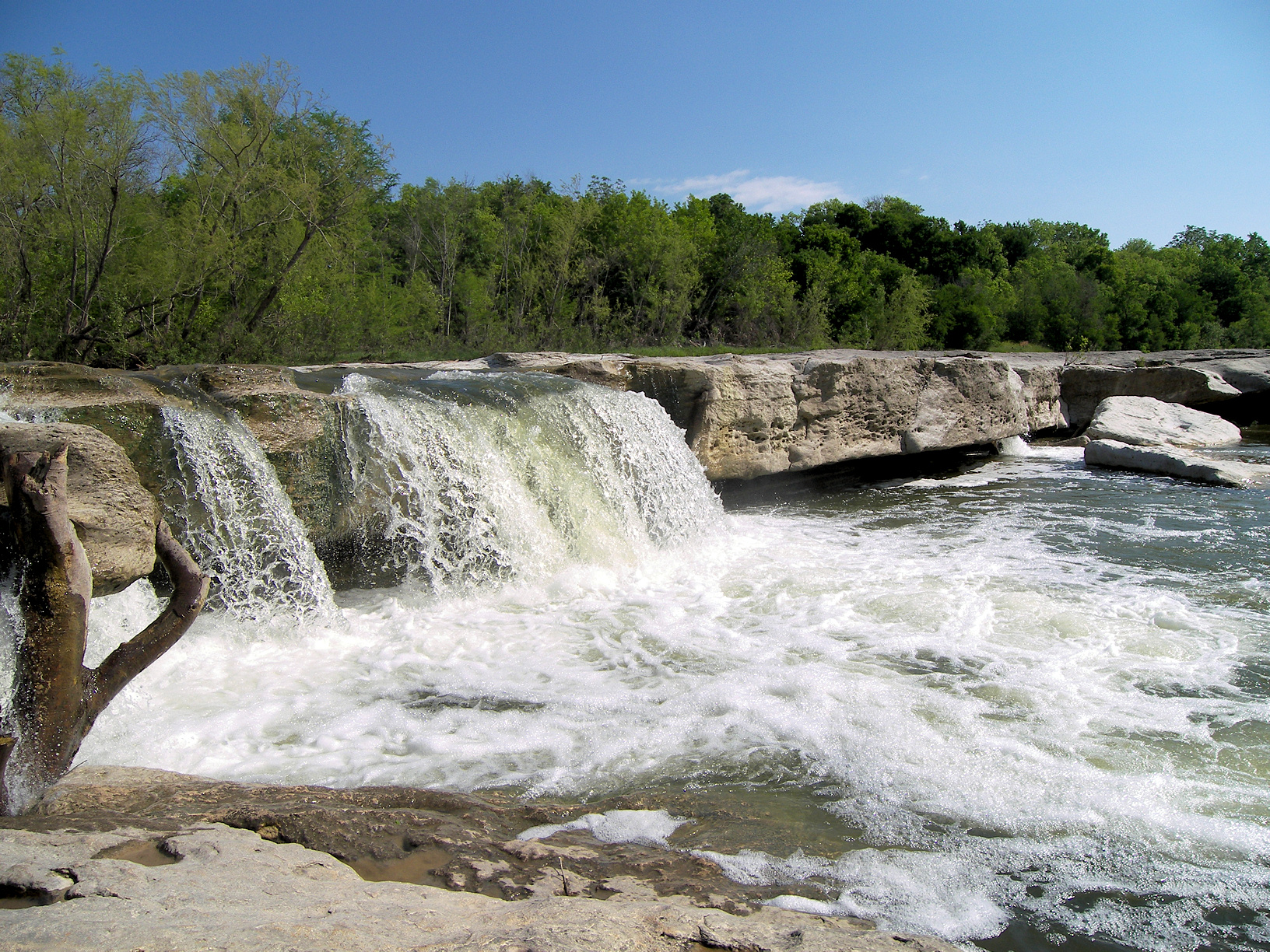
 The upper falls.
The park includes several designated hiking trails. The namesake features of the park are the scenic upper and lower falls along Onion Creek.
Flora
Bald Cypress, sycamores and pecan trees line the banks of Onion Creek and live oak, ashe juniper, and mesquite can be found on the drier uplands. Other trees found in the park include Wafer Ash, Red Oak, Texas Persimmon, chinaberry, Cedar Elm and Mexican Plum. In spring, the roads are lined with wildflowers, dominated by the Texas Bluebonnet. Cacti can also be found such as the Prickly Pear and Pencil Cactus.
Fauna
White-tailed deer are common throughout the park, as well as raccoons, armadillos, and fox squirrels. Many bird species are found in the park including buntings.
Historical Sites
The park also features the Smith Rock Shelter, a limestone overhang used for shelter by Native Americans for hundreds of years, along with the ruins of McKinney's stone house and his horse trainer's cabin. The Smith Rock Shelter and the McKinney homestead have each been added to the National Register of Historic Places.
Pollution
The park was a popular spot for swimming from the day it opened. In April, 1981, swimming in the park was banned when several elementary school children complained of cramps and nausea after swimming in Onion Creek. Testing indicated the fecal coliform count in the water was 2600 per 100 milliliters of water, well above the 200 count maximum deemed safe for swimming.[4]
The problem was blamed on rain water runoff from the mostly urban area located upstream on Onion and Williamson Creeks. The run off dumped animal waste, oils, dirt and debris into the creeks.[5] Another contributor was the Williamson Creek Wastewater Treatment Plant. The plant would occasionally dump effluent in various stages of treatment into Williamson Creek if there was equipment failure. By 1982, the plant was overloaded by the rapid growth of the city and regularly discharged effluent into the creek, not all of which met state standards for discharge.
Twelve years later in June, 1993, the park ban on swimming was finally lifted. This was due to the closure of the Williamson Creek Wastewater Treatment Plant in 1986, Austin's enactment of a comprehensive watershed ordinance and starting a city wide hazardous chemicals collection program.[6] Swimming is still often restricted because of high fecal coliform counts, usually after heavy rains.
See also
References
- ^ Raney, Jay A. Down to Earth at McKinney Falls State Park, Texas. Bureau of Economic Geology. 1997. p3.
- ^ Henson, Margaret Swett. McKinney Falls. The Texas State Historical Association, 1999. p 4.
- ^ ibid. p 36.
- ^ Mangan, Andy. "McKinney Falls thrives despite ban on swimming". Austin American-Statesman. Aug. 15, 1982. p B8.
- ^ McCann, Bill. "Creek Pollution Cuts Use of McKinney Falls State Park". Austin American-Statesman. Mar. 17, 1985. p B6.
- ^ "A Good Week for Parks". The Austin Chronicle. Jun. 24, 1993.
External links
- Texas Parks and Wildlife: McKinney Falls State Park
- Thomas F. McKinney from the Handbook of Texas Online
Protected Areas of Texas Federal El Orcoquisac Archeological District · Fort Davis National Historic Site · Lyndon B. Johnson National Historical Park · Palo Alto Battlefield National Historical Park · San Antonio Missions National Historical ParkAnahuac · Aransas · Attwater Prairie Chicken · Balcones Canyonlands · Big Boggy · Brazoria · Buffalo Lake · Grulla · Hagerman · Laguna Atascosa · Lower Rio Grande Valley · McFaddin · Muleshoe · San Bernard · Santa Ana · Texas Point · Trinity RiverState Abilene · Atlanta · Balmorhea · Barton Warnock Environmental Education Center · Bastrop · Bentsen-Rio Grande Valley · Big Bend Ranch · Big Spring · Blanco · Boca Chica · Bonham · Brazos Bend · Buescher · Caddo Lake · Caprock Canyons · Cedar Hill · Choke Canyon · Cleburne · Colorado Bend · Cooper Lake · Copper Breaks · Daingerfield · Davis Mountains · Devils River State Natural Area · Devil's Sinkhole State Natural Area · Dinosaur Valley · Eisenhower · Enchanted Rock State Natural Area · Estero Llano Grande · Fairfield Lake · Falcon · Fort Boggy · Fort Parker State Park · Fort Richardson State Park · Franklin Mountains · Galveston Island · Garner · Goliad · Goose Island · Government Canyon State Natural Area · Guadalupe River · Hill Country State Natural Area · Honey Creek State Natural Area · Huntsville · Indian Lodge · Inks Lake · Kickapoo Cavern · Lake Arrowhead · Lake Bob Sandlin · Lake Brownwood · Lake Casa Blanca International · Lake Colorado City · Lake Corpus Christi · Lake Livingston · Lake Mineral Wells · Lake Somerville · Lake Tawakoni · Lake Texana · Lake Whitney · Lockhart · Longhorn Cavern · Lost Creek Reservoir State Trailway · Lost Maples State Natural Area · Martin Creek Lake · Martin Dies, Jr. · Matagorda Island · McKinney Falls · Meridian · Mission Tejas · Monahans Sandhills · Mother Neff State Park · Mustang Island · Palmetto · Palo Duro Canyon · Pedernales Falls · Possum Kingdom · Purtis Creek · Ray Roberts Lake · Resaca de la Palma · San Angelo · Sea Rim · Sheldon Lake · South Llano River · Stephen F. Austin · Tyler · Village Creek · Walter Umphrey · Wyler Aerial TramwayActon · Admiral Nimitz · Barrington Living History Farm at Washington-on-the-Brazos · Battleship TEXAS · Caddoan Mounds · Casa Navarro · Confederate Reunion Grounds · Eisenhower Birthplace · Fanthorp Inn · Fannin Battleground · Fort Griffin · Fort Lancaster · Fort Leaton · Fort McKavett · Fort Richardson · Fulton Mansion · Goliad · Hueco Tanks · Kreische Brewery · Landmark Inn · Levi Jordan Plantation · Lipantitlan · Lyndon B. Johnson · Magoffin Homestead · Mission Espiritu Santo · Mission Rosario · Monument Hill · Penn Farm · Point Isabel Lighthouse · Sabine Pass Battleground · Sam Bell Maxey House · Samuel T. Rayburn House · San Felipe · San Jacinto Battleground · Sauer-Beckmann Farm · Sebastopol House · Seminole Canyon · Starr Family Home · Varner–Hogg Plantation · Washington-on-the-Brazos · Zaragosa BirthplaceState Wildlife TrailsGreat Texas Coastal · Heart of Texas · Panhandle Plains · Prairies and PineywoodsTexas Parks and Wildlife Department City of Austin History · Metro Area Counties Important
businessesHigher
educationMusic Antone's · Armadillo World Headquarters · Austin City Limits · Austin Lyric Opera · Austin Symphony Orchestra · Emo's · SXSW · Stevie Ray Vaughan · Willie NelsonLandmarks Austin-Bergstrom International Airport · Darrell K Royal-Texas Memorial Stadium · Dell Diamond · The Drag · Frank Erwin Center · Governor's Mansion · Lyndon Baines Johnson Library and Museum · Moonlight tower · Sixth Street · South Congress · State Capitol · Treaty Oak · UFCU Disch-Falk Field · University of Texas TowerParks and
preservesAuditorium Shores · Emma Long · Hippie Hollow · McKinney Falls · Mount Bonnell · Walnut Creek · Wild Basin · ZilkerBodies of
waterAustin–Round Rock–San Marcos Largest cities 
Other
communitiesBastrop · Buda · Burnet · Elgin · Hudson Bend · Hutto · Jollyville · Kyle · Lago Vista · Leander · Lakeway · Lockhart · Lost Creek · Luling · Marble Falls · Taylor · Smithville · Wells Branch · West Lake Hills · Wimberley · Windemere · WyldwoodCounties Parks and
preservesBalcones Canyonlands · Bastrop · Emma Long · Enchanted Rock · Hippie Hollow · Indiangrass · McKinney Falls · Mount Bonnell · Onion Creek · Pedernales Falls · John Stokes · Wild Basin · ZilkerGeography Bodies of
waterCategories:- Texas state parks
- Protected areas of Travis County, Texas
- Austin – Round Rock metropolitan area
- Parks in Austin, Texas


Wikimedia Foundation. 2010.