- Muskingum County, Ohio
-
Muskingum County, Ohio 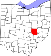
Location in the state of Ohio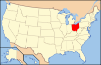
Ohio's location in the U.S.Founded March 1, 1804[1] Named for A Native American word meaning either "by the river-side" or "elk's eye" Seat Zanesville Largest city Zanesville Area
- Total
- Land
- Water
673 sq mi (1,742 km²)
665 sq mi (1,721 km²)
8 sq mi (21 km²), 1.18%Population
- (2000)
- Density
84,585
127/sq mi (49/km²)Time zone Eastern: UTC-5/-4 Website www.muskingumcounty.org Historical populations Census Pop. %± 1810 10,036 — 1820 17,824 77.6% 1830 29,334 64.6% 1840 38,749 32.1% 1850 45,049 16.3% 1860 44,416 −1.4% 1870 44,886 1.1% 1880 49,774 10.9% 1890 51,210 2.9% 1900 53,185 3.9% 1910 57,488 8.1% 1920 57,980 0.9% 1930 67,398 16.2% 1940 69,795 3.6% 1950 74,535 6.8% 1960 79,159 6.2% 1970 77,826 −1.7% 1980 83,340 7.1% 1990 82,068 −1.5% 2000 84,585 3.1% Muskingum County is a county located in the state of Ohio, United States. As of the 2010 census, the population was 86,074. [1] Its county seat is Zanesville[2]. Nearly bisected by the Muskingum River, it is based on a Delaware American Indian word translated as "town by the river"[3] or "elk's eye".[4]
The Zanesville Micropolitan Statistical Area includes all of Muskingum County.
Contents
Geography
According to the U.S. Census Bureau, the county has a total area of 673 square miles (1,740 km2).665 square miles (1,721 km²) of it is land and 8 square miles (21 km2) of it (1.18%) is water.
Adjacent counties
- Coshocton County (north)
- Guernsey County (east)
- Noble County (southeast)
- Morgan County (south)
- Perry County (southwest)
- Licking County (west)
Demographics
As of the census[5] of 2000, there were 84,585 people, 32,518 households, and 22,860 families residing in the county. The population density was 127 people per square mile (49/km²). There were 35,163 housing units at an average density of 53 per square mile (20/km²). The racial makeup of the county was 93.91% White, 4.01% Black or African American, 0.21% Native American, 0.27% Asian, 0.02% Pacific Islander, 0.20% from other races, and 1.37% from two or more races. 0.52% of the population were Hispanic or Latino of any race.
There were 32,518 households out of which 33.30% had children under the age of 18 living with them, 54.30% were married couples living together, 12.00% had a female householder with no husband present, and 29.70% were non-families. 24.90% of all households were made up of individuals and 10.90% had someone living alone who was 65 years of age or older. The average household size was 2.53 and the average family size was 3.01.
In the county, the population was spread out with 25.90% under the age of 18, 9.40% from 18 to 24, 27.70% from 25 to 44, 22.60% from 45 to 64, and 14.30% who were 65 years of age or older. The median age was 36 years. For every 100 females there were 92.00 males. For every 100 females age 18 and over, there were 88.40 males.
The median income for a household in the county was $35,185, and the median income for a family was $41,938. Males had a median income of $31,537 versus $22,151 for females. The per capita income for the county was $17,533. About 9.90% of families and 12.90% of the population were below the poverty line, including 17.90% of those under age 18 and 10.00% of those age 65 or over.
Culture
The Muskingum County Library System serves the communities of Muskingum County from its administrative offices in Zanesville, Ohio. This includes service to Dresden, Duncan Falls, New Concord, and Roseville. In 2005, the library loaned more than 918,000 items to its 73,000 cardholders. Total holding are over 328,000 volumes with over 190 periodical subscriptions.[6]
The Wilds is a 9,154 acres (37.04 km2) wildlife preserve open to visitation for a fee.
Government
 Muskingum County Courthouse
 Main article: Ohio county government
Communities
 Map of Muskingum County, Ohio With Municipal and Township Labels
City
Villages
Townships
Census-designated places
Other communities
Historical places
- Irville - Former populated place in Licking Township, removed for the creation of Dillon Lake.
- Mattingly Settlement - Named for the many members of the Mattingly family who settled in Muskingum Towship.
See also
References
- ^ "Ohio County Profiles: Muskingum County" (PDF). Ohio Department of Development. http://www.odod.state.oh.us/research/FILES/S0/Muskingum.pdf. Retrieved 2007-04-28.
- ^ "Find a County". National Association of Counties. http://www.naco.org/Counties/Pages/FindACounty.aspx. Retrieved 2011-06-07.
- ^ "History", Muskingum County Website, accessed 10 January 2010
- ^ "Muskingum County data". Ohio State University Extension Data Center. http://www.osuedc.org/profiles/profile_entrance.php?fips=39119&sid=0. Retrieved 2007-04-28.[dead link]
- ^ "American FactFinder". United States Census Bureau. http://factfinder.census.gov. Retrieved 2008-01-31.
- ^ "2005 Ohio Public Library Statistics:Statistics by County and Town". State Library of Ohio. http://winslo.state.oh.us/publib/2005_stats_by_county.xls. Retrieved october 30, 2006.
External links

Coshocton County Licking County 
Guernsey County  Muskingum County, Ohio

Perry County Morgan County Noble County Municipalities and communities of Muskingum County, Ohio City 
Villages Adamsville | Dresden | Frazeysburg | Fultonham | Gratiot‡ | New Concord | Norwich | Philo | Roseville‡ | South Zanesville
Townships CDPs Unincorporated
communitiesFootnotes ‡This populated place also has portions in an adjacent county or counties
Categories:- Ohio counties
- Muskingum County, Ohio
- 1804 establishments in the United States
- Populated places established in 1804


Wikimedia Foundation. 2010.