- Cherokee County, Oklahoma
-
Cherokee County, Oklahoma 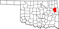
Location in the state of Oklahoma
Oklahoma's location in the U.S.Founded 1907 Seat Tahlequah Area
- Total
- Land
- Water
776 sq mi (2,010 km²)
751 sq mi (1,945 km²)
25 sq mi (65 km²), 3.27%Population
- (2000)
- Density
42,521
57/sq mi (22/km²)Cherokee County is a county located in the U.S. state of Oklahoma. As of 2000, the population was 42,521. Its county seat is Tahlequah[1].
Cherokee County was established in 1907.[2]
Contents
Geography
According to the U.S. Census Bureau, the county has a total area of 776 square miles (2,009.8 km2), of which 751 square miles (1,945.1 km2) is land and 25 square miles (64.7 km2) (3.27%) is water.
Major highways
 U.S. Highway 62
 State Highway 10
 State Highway 51
 State Highway 82
Adjacent counties
- Delaware County (north)
- Adair County (east)
- Sequoyah County (south)
- Muskogee County (southwest)
- Wagoner County (west)
- Mayes County (northwest)
Demographics
 Age pyramid for Cherokee County, Oklahoma, based on census 2000 data.
As of the census[3] of 2000, there were 42,521 people, 16,175 households, and 11,079 families residing in the county. The population density was 57 people per square mile (22/km²). There were 19,499 housing units at an average density of 26 per square mile (10/km²). The racial makeup of the county was 56.41% White, 1.20% Black or African American, 32.42% Native American, 0.27% Asian, 0.04% Pacific Islander, 2.10% from other races, and 7.56% from two or more races. 4.14% of the population were Hispanic or Latino of any race. 92.7% spoke English, 3.8% Spanish and 2.7% Cherokee as their first language.
There were 16,175 households out of which 32.70% had children under the age of 18 living with them, 52.50% were married couples living together, 11.90% had a female householder with no husband present, and 31.50% were non-families. 25.30% of all households were made up of individuals and 9.00% had someone living alone who was 65 years of age or older. The average household size was 2.52 and the average family size was 3.04.
In the county, the population was spread out with 26.30% under the age of 18, 14.60% from 18 to 24, 25.70% from 25 to 44, 21.50% from 45 to 64, and 12.00% who were 65 years of age or older. The median age was 32 years. For every 100 females there were 96.30 males. For every 100 females age 18 and over, there were 92.10 males.
The median income for a household in the county was $26,536, and the median income for a family was $32,369. Males had a median income of $25,993 versus $21,048 for females. The per capita income for the county was $13,436. About 17.00% of families and 22.90% of the population were below the poverty line, including 28.40% of those under age 18 and 13.80% of those age 65 or over.
Notable Citizens
- Bamboo Harvester, the horse who played television's Mr. Ed
- Sam Claphan, football player
- Robert Conley, author of numerous books about the Cherokee Indians
- Alice Brown Davis, Principal Chief of the Seminole Tribe of Oklahoma
- Jackson Narcomey, Muscogee Creek artist
- Ken Purdy, mayor of Tahlequah
- Wilson Rawls, author of Where the Red Fern Grows and Summer of the Monkeys
- Hastings Shade, Cherokee traditionalist and author
- Sonny Sixkiller, Cherokee football player
- Wes Studi, Cherokee actor
Communities
City
Towns
Census-designated places
Other community
NRHP sites
The following sites in Cherokee County are listed on the National Register of Historic Places:
- Cherokee Female Seminary, Tahlequah
- Cherokee National Capitol, Tahlequah
- Cherokee National Jail, Tahlequah
- Cherokee Supreme Court Building, Tahlequah
- First Cherokee Female Seminary Site, Tahlequah
- French-Parks House, Tahlequah
- Illinois Campground, Tahlequah
- Indian University of Tahlequah, Tahlequah
- Dr. Irwin D. Loeser Log Cabin, Tahlequah
- Murrell Home, Park Hill
- Ross Cemetery, Park Hill
- Tahlequah Armory, Tahlequah
- Tahlequah Carnegie Library, Tahlequah
- Joseph M. Thompson House, Tahlequah
References
- ^ "Find a County". National Association of Counties. http://www.naco.org/Counties/Pages/FindACounty.aspx. Retrieved 2011-06-07.
- ^ Columbia-Lippincott Gazeteer. p. 386
- ^ "American FactFinder". United States Census Bureau. http://factfinder.census.gov. Retrieved 2008-01-31.
External links
Municipalities and communities of Cherokee County, Oklahoma City 
Towns Fort Gibson‡ | Hulbert | Oaks‡
CDPs Unincorporated
communitiesBarber | Briggs | Caney Ridge | Carters Landing Cookson | Dry Creek | Eli | Ellerville | Etta | Gabriel | Gideon | Green County Estates | Indian Meadows | Liberty | Lowrey | Manard | Melvin | Metory | Moodys | Park Hill | Peggs | Pettit | Pettit Bay | Pumpkin Center | Qualls | Scraper | Tailholt | Teresita | Thompson Corner | Tsa La Gi Indian Village | Pike City | White Oak | Wildcat Point | Zeb
Ghost towns Cave Spring | Chronister | Eureka | Greenleaf | Luckey | New Spring Place | Ozark | Robbins
Footnotes ‡This populated place also has portions in an adjacent county or counties
National Register of Historic Places in Cherokee County, Oklahoma Park Hill First Cherokee Female Seminary Site · Murrell Home · Park Hill Mission Cemetery · Ross Cemetey

Tahlequah Alston-Bedwell House · American Legion Hut · Cherokee Female Seminary · Cherokee National Capitol · Cherokee National Jail · Cherokee Supreme Court Building · M. E. Franklin House · French-Parks House · Indian University of Tahlequah · Dr. Irwin D. Loeser Log Cabin · Leonard M. Logan House · Rosamund House · Tahlequah Armory · Tahlequah Carnegie Library · Joseph M. Thompson House · Illinois Campground
Categories:- Oklahoma counties
- 1907 establishments in the United States
- Populated places established in 1907
- Cherokee County, Oklahoma


Wikimedia Foundation. 2010.