- Columbia County, Oregon
-
Columbia County, Oregon 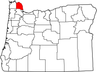
Location in the state of Oregon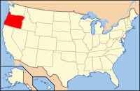
Oregon's location in the U.S.Founded 16 January 1854 Seat St. Helens Area
- Total
- Land
- Water
688 sq mi (1,782 km²)
657 sq mi (1,702 km²)
32 sq mi (83 km²), 4.59%Population
- (2010)
- Density
49,351
75/sq mi (28.9/km²)Website www.co.columbia.or.us Columbia County is a county located in the U.S. state of Oregon. It was named for the Columbia River, which forms its eastern and northern borders. As of 2010, its population was 49,351. The county seat is St. Helens.
Contents
Economy
The primary industries are wood products and paper manufacturing, trade, construction and horticulture.[1][2] The extensive stands of old growth timber, which had attracted many of the early settlers to the area, were completely logged over by the 1950s.[citation needed] Second-growth timber provides the raw material for local lumber and paper mills. About half the county's workforce commutes out of the county to work, most to the nearby Portland, Oregon metro area.[3] Columbia County's average nonfarm employment was 10,740 in 2007.[citation needed] The five largest private employers in Columbia County are Fred Meyer, Armstrong World Industries, Wal-Mart, Boise Paper, and USG.[4]
Government
The county is governed by an elected board of three commissioners. Each commissioner is elected to a term of four years. Other elected officials include the Sheriff, County Clerk, District Attorney, Treasurer, Surveyor, Assessor and Justice of the Peace. The current elected officials are: County Commissioners: Tony Hyde, Henry Heimuller, Earl Fisher; Assessor: Sue Martin; County Clerk: Betty Huser; County Sheriff: Jeff Dickerson; County Surveyor: Jerry Keenon; County Treasurer: Ruth Baker; District Attorney: Steve Atchison; and Justice of the Peace: Wally Thompson
Geography
According to the U.S. Census Bureau, the county has a total area of 688 square miles (1,781.9 km2), of which 657 square miles (1,701.6 km2) is land and 32 square miles (82.9 km2) (4.59%) is water.
Adjacent counties
- Clatsop County, Oregon - (west)
- Washington County, Oregon - (south)
- Multnomah County, Oregon - (southeast)
- Clark County, Washington - (east)
- Cowlitz County, Washington - (east, north)
- Wahkiakum County, Washington - (northwest)
National protected area
- Julia Butler Hansen National Wildlife Refuge (part)
Demographics
Historical populations Census Pop. %± 1860 532 — 1870 863 62.2% 1880 2,042 136.6% 1890 5,191 154.2% 1900 6,237 20.2% 1910 10,580 69.6% 1920 13,960 31.9% 1930 20,047 43.6% 1940 20,971 4.6% 1950 22,967 9.5% 1960 22,379 −2.6% 1970 28,790 28.6% 1980 35,646 23.8% 1990 37,557 5.4% 2000 43,560 16.0% 2010 49,351 13.3% [5][6][7]  The Columbia County Courthouse in St. Helens
As of the census[8] of 2000, there were 43,560 people, 16,375 households, and 12,035 families residing in the county. The population density was 66 people per square mile (26/km²). There were 17,572 housing units at an average density of 27 per square mile (10/km²). The racial makeup of the county was 94.42% White, 0.24% Black or African American, 1.33% Native American, 0.59% Asian, 0.10% Pacific Islander, 0.79% from other races, and 2.53% from two or more races. 2.51% of the population were Hispanic or Latino of any race. 21.2% were of German, 10.8% English, 9.4% American, 9.3% Irish and 5.4% Norwegian ancestry.
There were 16,375 households out of which 34.40% had children under the age of 18 living with them, 60.50% were married couples living together, 8.70% had a female householder with no husband present, and 26.50% were non-families. 21.10% of all households were made up of individuals and 8.10% had someone living alone who was 65 years of age or older. The average household size was 2.65 and the average family size was 3.06.
In the county, the population was spread out with 27.30% under the age of 18, 7.00% from 18 to 24, 28.10% from 25 to 44, 26.00% from 45 to 64, and 11.60% who were 65 years of age or older. The median age was 38 years. For every 100 females there were 100.00 males. For every 100 females age 18 and over, there were 98.10 males.
The median income for a household in the county was $45,797, and the median income for a family was $51,381. Males had a median income of $42,227 versus $27,216 for females. The per capita income for the county was $20,078. About 6.70% of families and 9.10% of the population were below the poverty line, including 11.60% of those under age 18 and 7.00% of those age 65 or over.
History
The Chinook and Clatskanie Native Americans inhabited this region for centuries prior to the arrival of Robert Gray, captain of the ship Columbia Rediviva, in 1792. The Lewis and Clark Expedition, traveled and camped along the Columbia River shore in the area later known as Columbia County in late 1805 and on their return journey in early 1806.
Columbia County was created in 1854 from the northern half of Washington County. Milton served as the county seat until 1857 when it was moved to St. Helens.
Politics
In Presidential elections the county is among the most consistently Democratic in the state. The Democratic Presidential candidate has won the county in every election following 1924.[9] That stated, the margin has been as little as three percent.[10]
It is part of Oregon's 1st congressional district, which is represented by David Wu and has a Cook Partisan Voting Index score of D+6.
Transportation
 The CC Rider transit service links the county to Portland and points in Washington County, including connecting with TriMet buses and the MAX light rail system in eastern Hillsboro.
Limited public transit service within Columbia County, and connecting the county with certain points in adjacent counties, is provided by the Columbia County Rider (or CC Rider), a service operated by the county's Transit Division.[11] The service carried 91,500 passengers in 2010.[12]
Communities
 Columbia County Sheriff's Office
Incorporated cities
Unincorporated communities
- Populated places
- Alston
- Apiary
- Bachelor Flat (historical)
- Beaver Homes
- Beaver Springs
- Birkenfeld
- Canaan
- Chapman
- Chapman Landing
- Clatskanie Heights
- Clear Creek
- Columbia Heights
- Corey Hill
- Deer Island
- Delena
- Fishhawk (historical)
- Spitzenberg
- Treharne
- Trenholm
- Warren
- West Saint Helens
- Woodson
- Yankton
- Locales
- Fern Hill
- Riverside
See also
References
- ^ Oregon Labor Market Information System
- ^ Bureau of Economic Analysis
- ^ U.S. Census Bureau
- ^ Columbia County Economic Team
- ^ http://www.census.gov/population/www/censusdata/cencounts/files/or190090.txt
- ^ http://factfinder2.census.gov
- ^ http://mapserver.lib.virginia.edu/
- ^ "American FactFinder". United States Census Bureau. http://factfinder.census.gov. Retrieved 2008-01-31.
- ^ David Leip's Presidential Atlas (Maps for Oregon by election)
- ^ The New York Times electoral map (Zoom in on Oregon)
- ^ "Welcome/Home page". Columbia County Rider. http://www.columbiacountyrider.com. Retrieved 2009-10-10.
- ^ Swan, Darryl (April 6, 2011). "Rail operation would create jobs, threaten CC Rider bus service". South County Spotlight (Pamplin Media Group). http://www.portlandtribune.com/metro_news/story.php?story_id=130211298608961300. Retrieved April 21, 2011.
Municipalities and communities of Columbia County, Oregon Cities Clatskanie | Columbia City | Prescott | Rainier | St. Helens | Scappoose | Vernonia

Unincorporated
communitiesCategories:- Oregon counties
- Columbia County, Oregon
- 1854 establishments in the United States
- Portland metropolitan area


Wikimedia Foundation. 2010.