- Huntingdon County, Pennsylvania
-
Huntingdon County, Pennsylvania 
Seal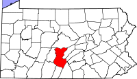
Location in the state of Pennsylvania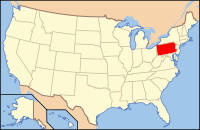
Pennsylvania's location in the U.S.Founded September 20, 1787 Seat Huntingdon Largest city Huntingdon Area
- Total
- Land
- Water
889 sq mi (2,302 km²)
874 sq mi (2,264 km²)
15 sq mi (39 km²), 1.68%Population
- (2010)
- Density
45,913
52/sq mi (20.2/km²)Website huntingdoncounty.net Huntingdon County is a county located in the U.S. state of Pennsylvania. In 2010, its population was 45,913. Huntingdon County was created on September 20, 1787, from part of Bedford County. Its county seat is Huntingdon.[1]
Contents
Geography
According to the U.S. Census Bureau, the county has a total area of 889 square miles (2,302.5 km2), of which 874 square miles (2,263.6 km2) is land and 15 square miles (38.8 km2) (1.68%) is water.
Adjacent counties
- Centre County (north)
- Mifflin County (east)
- Juniata County (east)
- Franklin County (southeast)
- Fulton County (south)
- Bedford County (southwest)
- Blair County (west)
Significant Topographic Features
Demographics
Historical populations Census Pop. %± 1790 7,558 — 1800 13,008 72.1% 1810 14,778 13.6% 1820 20,142 36.3% 1830 27,145 34.8% 1840 35,484 30.7% 1850 24,786 −30.1% 1860 28,100 13.4% 1870 31,251 11.2% 1880 33,954 8.6% 1890 35,751 5.3% 1900 34,650 −3.1% 1910 38,304 10.5% 1920 39,848 4.0% 1930 39,021 −2.1% 1940 41,836 7.2% 1950 40,872 −2.3% 1960 39,457 −3.5% 1970 39,108 −0.9% 1980 42,253 8.0% 1990 44,164 4.5% 2000 45,586 3.2% 2010 45,913 0.7% [2][3] As of the census[4] of 2000, there were 45,586 people, 16,759 households, and 11,798 families residing in the county. The population density was 52 people per square mile (20/km²). There were 21,058 housing units at an average density of 24 per square mile (9/km²). The racial makeup of the county was 93.33% White, 5.14% Black or African American, 0.11% Native American, 0.21% Asian, 0.01% Pacific Islander, 0.45% from other races, and 0.77% from two or more races. 1.15% of the population were Hispanic or Latino of any race. 33.9% were of German, 17.1% American, 11.1% Irish, 7.5% English and 5.7% Italian ancestry according to Census 2000.
There were 16,759 households out of which 30.10% had children under the age of 18 living with them, 58.10% were married couples living together, 8.30% had a female householder with no husband present, and 29.60% were non-families. 25.80% of all households were made up of individuals and 12.30% had someone living alone who was 65 years of age or older. The average household size was 2.44 and the average family size was 2.92.
In the county, the population was spread out with 21.70% under the age of 18, 10.10% from 18 to 24, 29.40% from 25 to 44, 24.00% from 45 to 64, and 14.80% who were 65 years of age or older. The median age was 38 years. For every 100 females there were 109.60 males. For every 100 females age 18 and over, there were 110.20 males.
Dialect, Accent, and Language
Almost everyone that lives in Huntingdon County speaks English as their first language. The dominant form of speech in Huntingdon County is the Central Pennsylvania accent, although some areas of the county, such as Kishacoquillas Valley, where many Amish and Mennonite people live, German is commonly spoken.
Notable natives
- Dylan Lane (born 1977)- game show host (currently hosts Chain Reaction) (born in Tyrone, Blair County, spent whole life in Huntingdon
- Robert Elliott Speer (1867-1947)- American religious leader
- Martin Grove Brumbaugh (1862-1930)- 26th Governor of Pennsylvania
- Horace Porter (1837-1921)- Civil War General and US Diplomat
- John Purdue (born October 31, 1802 in Huntingdon County) Primary original benefactor of Purdue University.
- Hugh Brady (born July 29, 1768 in Standingstone)
Media
Radio Stations
AM Radio Stations
Stations Within County
- WLLY 1150 AM- Huntingdon (Country)
Stations Outside of County
- WIEZ 670 AM- Lewistown (News/Talk)
- WMAJ 1450 AM- State College (Sports)
- WVAM 1430 AM- Altoona (Sports)
- WFBG 1290 AM- Altoona (News/Talk)
- WKMC 1370 AM- Roaring Spring (Nostalgia)
- WRTA 1240 AM- Altoona (News/Talk)
- WRSC 1390 AM- State College (News/Talk)
- WBLF 970 AM- Bellefonte (News/Talk)
- WPHB 1260 AM- Philipsburg (Country)
- WKVA 920 AM- Burnham (Oldies)
- WHP 580 AM- Harrisburg (News/Talk)
- KDKA 1020 AM- Pittsburgh- (heard much better at night) (News/Talk)
- WWVA 1170 AM- Wheeling, West Virginia- (heard much better at night) (News/Talk/Country)
FM Radio Stations
Stations Within County
- WHUN 106.3 FM- Huntingdon (Oldies)
- WLAK 103.5 FM- Huntingdon (Hot AC)
- WKVR 92.3 FM- Huntingdon (College)
- W273BE 102.5 FM- Huntingdon (Public Radio)
Stations Outside of County
- WFGY 98.1 FM- Altoona (Country)
- WFGE 101.1 FM- Tyrone (Country)
- WBUS 93.7 FM- State College (Classic Rock)
- WWOT 100.1 FM- Altoona (Top 40)
- WJOW 105.9 FM- Philipsburg (Country)
- WSKE 104.3 FM- Everett (Country)
- WJSM 92.7 FM- Martinsburg (Religious)
- WHPA 93.5 FM- Gallitzin (Oldies)
- WBRX 94.7 FM- Cresson (Adult Contemporary)
- WRXV 89.1 FM- State College (Christian Contemporary)
- WTLR 89.9 FM- State College (Religious)
- WRKY 104.9 FM- Hollidaysburg (Classic Rock)
- WRKW 99.1 FM- Ebensburg (Classic Rock)
- WFGI 95.5 FM- Johnstown (Country)
- WVNW 96.7 FM- Burnham (Country)
- WCHX 105.5 FM- Burnham (Classic Rock)
- WQWK 103.1 FM- State College (Classic Rock)
- WLTS 99.5 FM- Centre Hall (Classic Hits)
- WPSU 91.5 FM- State College (Public Radio)
Television
- {CBS}- WTAJ-TV, Altoona
- {ABC}- WATM-TV, Johnstown
- {Fox}- WWCP-TV, Johnstown
- {NBC}- WJAC-TV, Johnstown
- {PBS}- WPSU-TV, State College
- {CW}- WPCW, Jeannette
 Map of Huntingdon County, Pennsylvania with Municipal Labels showing Boroughs (red) and Townships (white).
Municipalities
Under Pennsylvania law, there are four types of incorporated municipalities: cities, boroughs, townships, and, in at most two cases, towns. The following boroughs and townships are located in Huntingdon County:
Boroughs
Townships
- Barree Township
- Brady Township
- Carbon Township
- Cass Township
- Clay Township
- Cromwell Township
- Dublin Township
- Franklin Township
- Henderson Township
- Hopewell Township
- Smithfield Township
- Springfield Township
- Spruce Creek Township
- Tell Township
- Todd Township
- Union Township
- Walker Township
- Warriors Mark Township
- West Township
- Wood Township
 Map of Huntingdon County, Pennsylvania School Districts
Education
Public School Districts
- Huntingdon Area School District
- Juniata Valley School District
- Mount Union Area School District
- Southern Huntingdon County School District
- Tussey Mountain School District
- Tyrone Area School District
Higher Education
Colleges and Universities
- Juniata College, a small, independent liberal arts college, is located in the county seat of Huntingdon.
- DuBois Business College, Huntingdon campus
- Pennsylvania Highlands Community College, Huntingdon campus (located in Walker Township)
See also
- List of municipal authorities in Juniata County, Pennsylvania
- National Register of Historic Places listings in Huntingdon County, Pennsylvania
References
- ^ "Find a County". National Association of Counties. http://www.naco.org/Counties/Pages/FindACounty.aspx. Retrieved 2011-06-07.
- ^ http://factfinder2.census.gov
- ^ http://mapserver.lib.virginia.edu/
- ^ "American FactFinder". United States Census Bureau. http://factfinder.census.gov. Retrieved 2008-01-31.
External links
- Huntingdon County official website
- Huntingdon County Chamber of Commerce official website
- Huntingdon County Business & Industry
- Huntingdon County Visitors Bureau official website
- Huntingdon County Community Website
- Huntingdon County, Pennsylvania detailed profile at City-Data.com
Municipalities and communities of Huntingdon County, Pennsylvania Boroughs Alexandria | Birmingham | Broad Top City | Cassville | Coalmont | Dudley | Huntingdon | Mapleton | Marklesburg | Mill Creek | Mount Union | Orbisonia | Petersburg | Rockhill | Saltillo | Shade Gap | Shirleysburg | Three Springs

Townships Unincorporated
communitiesAllenport | Ardenheim | Hesston | McConnellstown | Robertsdale | Spruce Creek
Categories:- Pennsylvania counties
- Huntingdon County, Pennsylvania
- 1787 establishments


Wikimedia Foundation. 2010.