- Juniata County, Pennsylvania
-
Juniata County, Pennsylvania 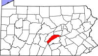
Location in the state of Pennsylvania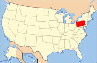
Pennsylvania's location in the U.S.Founded March 2, 1831 Seat Mifflintown Largest city Port Royal Area
- Total
- Land
- Water
394 sq mi (1,020 km²)
392 sq mi (1,015 km²)
2 sq mi (5 km²), 0.50%Population
- (2000)
- Density
24,636
63/sq mi (24.2/km²)Website www.co.juniata.pa.us Juniata County is a county located in the U.S. state of Pennsylvania. As of 2010, the population was 24,636. Juniata County was created on March 2, 1831, from part of Mifflin County and named for the Juniata River. Its county seat is Mifflintown[1].
Contents
Geography
According to the U.S. Census Bureau, the county has a total area of 394 square miles (1,020.5 km2), of which 392 square miles (1,015.3 km2) is land and 2 square miles (5.2 km2) (0.50%) is water.
Adjacent counties
- Snyder County (north)
- Northumberland County (east)
- Dauphin County (southeast)
- Perry County (south)
- Franklin County (southwest)
- Huntingdon County (west)
- Mifflin County (northwest)
Demographics
Historical populations Census Pop. %± 1840 11,080 — 1850 13,029 17.6% 1860 16,986 30.4% 1870 17,390 2.4% 1880 18,227 4.8% 1890 16,655 −8.6% 1900 16,054 −3.6% 1910 15,013 −6.5% 1920 14,464 −3.7% 1930 14,325 −1.0% 1940 15,373 7.3% 1950 15,243 −0.8% 1960 15,874 4.1% 1970 16,712 5.3% 1980 19,188 14.8% 1990 20,625 7.5% 2000 22,821 10.6% 2010 24,636 8.0% [2][3] As of the census[4] of 2000, there were 22,821 people, 8,584 households, and 6,463 families residing in the county. The population density was 58 people per square mile (22/km²). There were 10,031 housing units at an average density of 26 per square mile (10/km²). The racial makeup of the county was 98.05% White, 0.37% Black or African American, 0.14% Native American, 0.25% Asian, 0.17% Pacific Islander, 0.50% from other races, and 0.51% from two or more races. 1.62% of the population were Hispanic or Latino of any race. 45.4% were of German, 20.2% American, 5.7% Irish and 5.0% English ancestry according to Census 2000. 3.95% reported speaking Pennsylvania German, German, or Dutch at home; 1.63% speak Spanish.[5]
There were 8,584 households out of which 33.00% had children under the age of 18 living with them, 64.60% were married couples living together, 6.30% had a female householder with no husband present, and 24.70% were non-families. 21.10% of all households were made up of individuals and 10.50% had someone living alone who was 65 years of age or older. The average household size was 2.60 and the average family size was 3.01.
In the county, the population was spread out with 25.00% under the age of 18, 8.00% from 18 to 24, 28.10% from 25 to 44, 23.80% from 45 to 64, and 15.20% who were 65 years of age or older. The median age was 38 years. For every 100 females there were 99.00 males. For every 100 females age 18 and over, there were 96.40 males.
Accent and Dialect
The Central Pennsylvania accent is the dominant speech pattern in Juniata County.
There are many immigrant workers in Juniata County from Latin America and South-East Asia who moved to the area to work for Empire Kosher Poultry, the county's largest employer. Most of these immigrants speak Spanish or some other language of their first language. These immigrants speak English with varying degrees of fluency.
Municipalities
 Map of Juniata County, Pennsylvania with Municipal Labels showing Boroughs (red), Townships (white), and Census-designated places (blue).
Under Pennsylvania law, there are four types of incorporated municipalities: cities, boroughs, townships, and, in at most two cases, towns. The following boroughs and townships are located in Juniata County:
Boroughs
Townships
- Beale Township
- Delaware Township
- Fayette Township
- Fermanagh Township
- Greenwood Township
- Lack Township
- Milford Township
- Monroe Township
- Spruce Hill Township
- Susquehanna Township
- Turbett Township
- Tuscarora Township
- Walker Township
Census-designated places
Census-designated places are geographical areas designated by the U.S. Census Bureau for the purposes of compiling demographic data. They are not actual jurisdictions under Pennsylvania law. Other unincorporated communities, such as villages, may be listed here as well.
Villages
- Arch Rock
- Bunkertown
- Tuscarora
- East Salem
- Van Dyke
- Cross Keys
- Licking Creek
- Evendale
- Centre
- Walnut
- Oriental
- Seven Stars
- Pfoutz Valley
- Old Port
- Black Log(Dommers Efficiency)
- Honey Grove
- Van Wert
- Oakland Mills
- Reeds Gap(Partyville)
- Beale(Fred N Walters Home Village)
- Mt. Pleasant
- Spruce Hill
Education
 Map of Juniata County, Pennsylvania Public School Districts
Public School Districts
- Juniata County School District
- Greenwood School District
Academia Pomeroy Covered Bridge
Academia Pomeroy Covered Bridge at 278 feet portal to portal is the longest remaining covered bridge in Pennsylvania, crossing the Tuscarora Creek between Spruce Hill and Beale Townships. Owned by the Juniata County Historical Society, Mifflintown, since 1962, it is listed on the National Register of Historic Places.
See also
- List of municipal authorities in Juniata County, Pennsylvania
- National Register of Historic Places listings in Juniata County, Pennsylvania
- USS Juniata County (LST-850)
References
- ^ "Find a County". National Association of Counties. http://www.naco.org/Counties/Pages/FindACounty.aspx. Retrieved 2011-06-07.
- ^ http://factfinder2.census.gov
- ^ http://mapserver.lib.virginia.edu/
- ^ "American FactFinder". United States Census Bureau. http://factfinder.census.gov. Retrieved 2008-01-31.
- ^ [1]
External links
- Pennsylvania Department of Transportation, Bureau of Planning and Research, Geographic Information Division, "2005 General Highway Map of Juniata and Mifflin Counties" Note: shows boroughs, townships, roads, villages, some streams. URL accessed on April 5, 2006.
Municipalities and communities of Juniata County, Pennsylvania Boroughs 
Townships CDPs Categories:- Pennsylvania counties
- Juniata County, Pennsylvania
- 1831 establishments in the United States
- Populated places established in 1831


Wikimedia Foundation. 2010.