- Edmunds County, South Dakota
-
Edmunds County, South Dakota 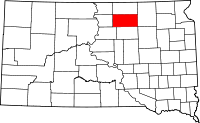
Location in the state of South Dakota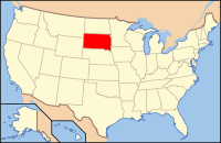
South Dakota's location in the U.S.Founded 1873 Seat Ipswich Area
- Total
- Land
- Water
1,151 sq mi (2,981 km²)
1,146 sq mi (2,967 km²)
6 sq mi (14 km²), .48%Population
- (2010)
- Density
4,071
4/sq mi (1/km²)Edmunds County is a county located in the U.S. state of South Dakota. As of the 2010 census, the population was 4,071.[1] It's county seat is Ipswich.[2]
Edmunds County is part of the Aberdeen, South Dakota, Micropolitan Statistical Area.
Contents
Geography
According to the U.S. Census Bureau, the county has a total area of 1,151 square miles (2,981.1 km2), of which 1,146 square miles (2,968.1 km2) is land and 6 square miles (15.5 km2) (0.48%) is water.
Townships
The county is divided into thirty-two townships: Adrian, Belle, Bowdle, Bryant, Clear Lake, Cleveland, Cloyd, Cordlandt, Cottonwood Lake, Fountain, Glen, Glover, Harmony, Hillside, Hosmer, Hudson, Huntley, Ipswich, Kent, Liberty, Madison, Modena, Montpelier, North Bryant, Odessa, Pembrook, Powell, Richland, Rosette, Sangamon, Union, and Vermont.
Major highways
 U.S. Highway 12
 South Dakota Highway 45
 South Dakota Highway 47
 South Dakota Highway 247
 South Dakota Highway 253
Adjacent counties
- McPherson County, South Dakota - north
- Brown County, South Dakota - east
- Faulk County, South Dakota - south
- Potter County, South Dakota - southwest
- Spink County, South Dakota - southeast
- Walworth County, South Dakota - west
Demographics
Historical populations Census Pop. %± 1890 4,399 — 1900 4,916 11.8% 1910 7,654 55.7% 1920 8,336 8.9% 1930 8,712 4.5% 1940 7,814 −10.3% 1950 7,275 −6.9% 1960 6,079 −16.4% 1970 5,548 −8.7% 1980 5,159 −7.0% 1990 4,356 −15.6% 2000 4,367 0.3% 2010 4,071 −6.8% U.S. Decennial Census As of the census[3] of 2000, there were 4,367 people, 1,681 households, and 1,210 families residing in the county. The population density was 4 people per square mile (1/km²). There were 2,022 housing units at an average density of 2 per square mile (1/km²). The racial makeup of the county was 99.20% White, 0.07% Black or African American, 0.25% Native American, 0.09% Asian, 0.02% Pacific Islander, 0.05% from other races, and 0.32% from two or more races. 0.48% of the population were Hispanic or Latino of any race. 69.4% were of German and 6.2% Norwegian ancestry according to Census 2000.
There were 1,681 households out of which 31.50% had children under the age of 18 living with them, 64.90% were married couples living together, 4.80% had a female householder with no husband present, and 28.00% were non-families. 25.60% of all households were made up of individuals and 15.00% had someone living alone who was 65 years of age or older. The average household size was 2.52 and the average family size was 3.04.
In the county, the population was spread out with 26.70% under the age of 18, 5.10% from 18 to 24, 23.30% from 25 to 44, 22.70% from 45 to 64, and 22.20% who were 65 years of age or older. The median age was 42 years. For every 100 females there were 97.20 males. For every 100 females age 18 and over, there were 94.30 males.
The median income for a household in the county was $32,205, and the median income for a family was $37,174. Males had a median income of $26,609 versus $18,080 for females. The per capita income for the county was $16,149. About 10.40% of families and 13.80% of the population were below the poverty line, including 16.80% of those under age 18 and 14.00% of those age 65 or over.
Notable events
Main article: 1999 South Dakota Learjet crashEdmunds County is the location where the Learjet of PGA Golfer Payne Stewart crashed, killing him and five others on board.
Communities
Cities
Other localities
- Beebe
- Craven
- Gretna
- Loyalton
- Mina
- Powell
See also
References
- ^ United States Census Bureau. "2010 Census Data". United States Census Bureau. http://2010.census.gov/2010census/data/. Retrieved 4 August 2011.
- ^ "Find a County". National Association of Counties. http://www.naco.org/Counties/Pages/FindACounty.aspx. Retrieved 2011-06-07.
- ^ "American FactFinder". United States Census Bureau. http://factfinder.census.gov. Retrieved 2008-01-31.

McPherson County Walworth County 
Brown County  Edmunds County, South Dakota

Potter County Faulk County Spink County Municipalities and communities of Edmunds County, South Dakota Cities 
Townships Adrian | Belle | Bowdle | Bryant | Clear Lake | Cleveland | Cloyd | Cordlandt | Cottonwood Lake | Fountain | Glen | Glover | Harmony | Hillside | Hosmer | Hudson | Huntley | Ipswich | Kent | Liberty | Madison | Modena | Montpelier | North Bryant | Odessa | Pembrook | Powell | Richland | Rosette | Sangamon | Union | Vermont
Categories:- South Dakota counties
- Edmunds County, South Dakota
- Aberdeen micropolitan area


Wikimedia Foundation. 2010.