- Brazos County, Texas
-
Brazos County, Texas  The Brazos County Courthouse in Bryan.
Seal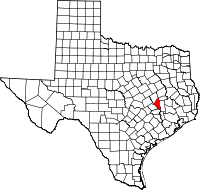
Location in the state of Texas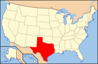
Texas's location in the U.S.Founded 1841 Seat Bryan Area
- Total
- Land
- Water
590 sq mi (1,528 km²)
586 sq mi (1,518 km²)
5 sq mi (13 km²), 0.76%Population
- (2010)
- Density
194,851
332.5/sq mi (128/km²)Website www.co.brazos.tx.us Brazos County is a county located in the U.S. state of Texas in the Central Texas region. In 2010, its population was 194,851. The county seat is Bryan[1] and it is part of the Bryan-College Station metropolitan area. Brazos is named for the Brazos River, along with Brazoria County.
Contents
Geography
According to the U.S. Census Bureau, the county has a total area of 590 square miles (1,528.1 km2), of which 586 square miles (1,517.7 km2) is land and 5 square miles (12.9 km2) (0.76%) is water.
Major highways
Main article: List of highways in Brazos County, Texas U.S. Highway 190
 State Highway 6
 State Highway 21
Adjacent counties
- Burleson County (southwest)
- Grimes County (east)
- Madison County (northeast)
- Robertson County (northwest)
- Washington County (south)
Demographics
Historical populations Census Pop. %± 1900 18,859 — 1910 18,919 0.3% 1920 21,975 16.2% 1930 21,835 −0.6% 1940 26,997 23.6% 1950 38,390 42.2% 1960 44,895 16.9% 1970 57,978 29.1% 1980 94,492 63.0% 1990 121,862 29.0% 2000 152,415 25.1% 2010 194,851 27.8% As of the census[2] of 2000, there were 152,415 people, 55,202 households, and 30,416 families residing in the county. The population density was 260 people per square mile (100/km²). There were 59,023 housing units at an average density of 101 per square mile (39/km²). The racial makeup of the county was 74.45% White, 10.72% Black or African American, 0.36% Native American, 4.01% Asian, 0.07% Pacific Islander, 8.42% from other races, and 1.97% from two or more races. 17.88% of the population were Hispanic or Latino of any race. 15.3% were of German, 8.4% English, 7.3% Irish and 7.2% American ancestry according to Census 2000.
There were 55,202 households out of which 27.90% had children under the age of 18 living with them, 41.30% were married couples living together, 10.00% had a female householder with no husband present, and 44.90% were non-families. 25.50% of all households were made up of individuals and 5.00% had someone living alone who was 65 years of age or older. The average household size was 2.52 and the average family size was 3.16.
In the county, the population was spread out with 21.50% under the age of 18, 32.00% from 18 to 24, 26.00% from 25 to 44, 13.80% from 45 to 64, and 6.70% who were 65 years of age or older. The median age was 24 years. For every 100 females there were 102.10 males. For every 100 females age 18 and over, there were 100.30 males.
The median income for a household in the county was $29,104, and the median income for a family was $46,530. Males had a median income of $32,864 versus $24,179 for females. The per capita income for the county was $16,212. About 14.00% of families and 26.90% of the population were below the poverty line, including 21.60% of those under age 18 and 10.30% of those age 65 or over.
Cities and towns
See also
References
- ^ "Find a County". National Association of Counties. http://www.naco.org/Counties/Pages/FindACounty.aspx. Retrieved 2011-06-07.
- ^ "American FactFinder". United States Census Bureau. http://factfinder.census.gov. Retrieved 2008-01-31.
-Wellborn
External links
- Brazos County AgriLife Extension office
- Brazos County Attorney's Office
- Brazos County government’s website
- Brazos County in Handbook of Texas Online
- Historic Brazos County materials, hosted by the Portal to Texas History.
Municipalities and communities of Brazos County, Texas Cities Bryan | College Station | Kurten | Millican | Wixon Valley

Unincorporated
communityWellborn
Ghost towns Boonville | Zack
Brazos County highways U.S. Highways US 190
State Highways State Highway Business Routes Bus. SH 6-R • Bus. SH 21-H
Farm to Market Roads Categories:- Texas counties
- Brazos County, Texas
- 1841 establishments in the United States
- Populated places established in 1841


Wikimedia Foundation. 2010.