- Northumberland County, Virginia
-
Northumberland County, Virginia 
Seal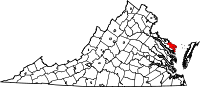
Location in the state of Virginia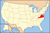
Virginia's location in the U.S.Founded 1648 Seat Heathsville Area
- Total
- Land
- Water
286 sq mi (741 km²)
192 sq mi (497 km²)
93 sq mi (241 km²), 32.68%Population
- Density
12,330
65/sq mi (25/km²)Website www.co.northumberland.va.us Northumberland County is a county located on the Northern Neck in the Commonwealth of Virginia, a state in the United States. In 2010, its population was 12,330[1]. Its county seat is Heathsville[2]. The county is located on the Northern Neck peninsula and is part of the Northern Neck George Washington Birthplace AVA winemaking appellation.
Contents
History
The county was created by the Virginia General Assembly in 1648 during a period of rapid population growth and geographic expansion. Settlement began in this area of the Northern Neck around 1635. Originally known as the Indian district Chickacoan, the first appearance of the name Northumberland in the colonial records was in 1644. The following year, John Mottrom served as the first burgess for the territory in the House of Burgesses, which met at the capital of the Virginia Colony at Jamestown.
The size of the county was drastically reduced in 1651 and 1653 as Lancaster County and Westmoreland County, respectively, were carved out of it.
Of the 172 counties that have ever existed in Virginia's history, Northumberland ended up being an "ancestor" of 116 of these –– more than the current 95 counties (several having been lost to other states).[3]
Geography
According to the U.S. Census Bureau, the county has a total area of 286 square miles (740 km²), of which 192 square miles (498 km²) is land and 93 square miles (242 km²) (32.68%) is water. The county is located between the Rappahannock River and Potomac River.
Adjacent Counties
- Lancaster County - south
- Richmond County -southwest
- Westmoreland County - northwest
Demographics
Historical populations Census Pop. %± 1790 9,163 — 1800 7,803 −14.8% 1810 8,308 6.5% 1820 8,016 −3.5% 1830 7,953 −0.8% 1840 7,924 −0.4% 1850 7,346 −7.3% 1860 7,531 2.5% 1870 6,863 −8.9% 1880 7,929 15.5% 1890 7,885 −0.6% 1900 9,486 20.3% 1910 10,777 13.6% 1920 11,518 6.9% 1930 11,081 −3.8% 1940 10,463 −5.6% 1950 10,012 −4.3% 1960 10,185 1.7% 1970 9,239 −9.3% 1980 9,828 6.4% 1990 10,524 7.1% 2000 12,259 16.5% 2010 12,330 0.6%
As of the census[4] of 2000, there were 12,259 people, 5,470 households, and 3,785 families residing in the county. The population density was 64 people per square mile (25/km²). There were 8,057 housing units at an average density of 42 per square mile (16/km²). The racial makeup of the county was 72.18% White, 26.58% Black or African American, 0.15% Native American, 0.20% Asian, 0.33% from other races, and 0.56% from two or more races. 0.93% of the population were Hispanic or Latino of any race.There were 5,470 households out of which 20.11% had children under the age of 18 living with them, 57.30% were married couples living together, 8.70% had a female householder with no husband present, and 30.80% were non-families. 27.70% of all households were made up of individuals and 15.20% had someone living alone who was 65 years of age or older. The average household size was 2.24 and the average family size was 2.70.
In the county, the population was spread out with 18.60% under the age of 18, 4.80% from 18 to 24, 20.20% from 25 to 44, 30.10% from 45 to 64, and 26.20% who were 65 years of age or older. The median age was 50 years. For every 100 females there were 91.20 males. For every 100 females age 18 and over, there were 88.40 males.
The median income for a household in the county was $38,129, and the median income for a family was $49,047. Males had a median income of $30,151 versus $24,116 for females. The per capita income for the county was $22,917. 12.30% of the population and 8.10% of families were below the poverty line. Out of the total people living in poverty, 17.00% are under the age of 18 and 10.70% are 65 or older.
Government, Law Enforcement, and Emergency Services
The county is governed by a Board of Supervisors, who are elected every four years from each of the five districts.
There is no police department in the county. Instead, law enforcement is the responsibility of the county Sheriff, who is a constitutional officer elected every four years. The Northumberland County Sheriff's Office is located in Heathsville.
Northumberland County has two courthouses; an antebellum building constructed before the Civil War and a new building constructed in the late 1990s behind the older structure. The county courts (Circuit Court, General District Court, and Juvenile and Domestic Relations District Court) and the Clerk of the Circuit Court, a constitutional officer, are located in the new building. The Commissioner of Revenue and the Treasurer, both constitutional officers, have offices in the older building.
Northumberland County is one of the few counties left in Virginia that has all volunteer emergency services. The county is served by two fire departments, Callao Volunteer Fire Department in Callao and Fairfields Volunteer Fire Department in Reedville. There are 3 rescue squads that serve the county, Callao Volunteer Rescue Squad in Callao, Mid-County Volunteer Rescue Squad in Heathsville and, Northumberland County Rescue Squad in Reedville. The county also has a water rescue service, Smith Point Sea Rescue.
Reedville, menhaden fishing industry
Reedville is a small village in eastern Northumberland County on the western shore of the Chesapeake Bay. Reedville is home to the Atlantic menhaden fishing industry. It is named for Captain Elijah W. Reed (1827-1888), who is credited with bringing the menhaden fishing industry and the tremendous wealth that resulted from it to Reedville –– and Northumberland County in general.
Years ago, dozens of fish-processing factories, most recently Omega Protein Corporation (successor to Zapata Haynie, Reedville Oil and Guano Company and Haynie Products Company) and Standard Products Company, dotted the Northumberland coastline near Reedville and adjacent fishing communities.
Today, Omega Protein remains the largest industrial organization in the area. Omega, with a fleet of large oceangoing fish-harvesting vessels, supported by a number of spotter aircraft, is a major industry in the area and on the eastern seaboard. Menhaden, once caught, are cooked in large mass and processed for further use in various applications including as a protein additive for poultry feed.
Located at the eastern terminus of U.S. Route 360, Reedville is a popular place to begin fishing charters and trips to Tangier Island in the Bay. Reedville also is a tourist destination itself, steeped in the history of the menhaden fishing industry. The Millionaire's Row of Victorian Era mansions and several watercraft of the Fishermen's Museum are listed on the National Register of Historic Places.
Communities
Town
- Kilmarnock in Lancaster County extends into southeastern Northumberland County.
Unincorporated communities
- Burgess
- Callao
- Fairport
- Fleeton
- Heathsville
- Lake
- Lottsburg
- Reedville
- Wicomico Church
See also
References
- ^ [1]. Weldon Cooper Center 2010 Census Count Retrieved September 9, 2011
- ^ "Find a County". National Association of Counties. http://www.naco.org/Counties/Pages/FindACounty.aspx. Retrieved 2011-06-07.
- ^ A Hornbook of Virginia History, p. 9.
- ^ "American FactFinder". United States Census Bureau. http://factfinder.census.gov. Retrieved 2008-01-31.
External links

Westmoreland County Potomac River 
Chesapeake Bay  Northumberland County, Virginia

Richmond County Lancaster County Municipalities and communities of Northumberland County, Virginia Town 
CDP Unincorporated
communitiesAvalon | Beverlyville | Blackberry | Blackwells | Blundon Corner | Browns Corner | Browns Store | Bryant Corner | Bundick | Burgess | Burtons Corner‡ | Byrdton | Callao | Chesapeake Beach | Chestnut Grove‡ | Claraville | Coan | Cowart | Crabbe Mill | Ditchley | Dodlyt | Downings Corner | Edwardsville | Fairport | Fleeton | Folly | Georgetown | Gibeon | Gillick Corner | Gonyon | Hamlins Corner | Hardings | Hardins Corner | Harryhogan | Harveys | Highland Landing | Horse Head | Howland | Hyacinth | Jetts Store | Kayan‡ | Lake | Lankford Corner‡ | Lara‡ | Lee Dale Shores | Lewisetta | Lilian | Lodge | Lottsburg | Luttrellville‡ | Luttrels Corner | Lynhams | Middletons Corner | Mila | Miskimon | Moon Corner‡ | Morrisons Corner | Mount Olive | Nokomis | Oak Grove | Ophelia | Rainswood | Reedville | Regina‡ | Remo | Reynolds Corner | Sandy Point | Sissons Corner | Slash | Stately Oak | Sunnybank | Surprise Hill | Tibitha | Tipers | Village‡ | Vir-Mar Beach | Waddeys | Walkers Corner | Walmsley | Wicomico Church | Williams Corner
Footnotes ‡This populated place also has portions in an adjacent county or counties
Categories:- Virginia counties
- Northumberland County, Virginia
- 1648 establishments in the Thirteen Colonies
- Potomac River counties
- Northern Neck
- Populated places established in 1648


Wikimedia Foundation. 2010.