- Derby Canal
-
Derby Canal The Shacklecross Lock (Borrowash Bottom Lock) undergoing restoration in 2006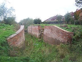
Original owner Derby Canal Co Principal engineer Benjamin Outram Date of act 1793 Date of first use 1796 Maximum boat length 72 ft 0 in (21.95 m) Maximum boat beam 14 ft 0 in (4.27 m) Start point Derby End point Swarkestone Connects to Trent and Mersey Canal, Erewash Canal Locks 17 Status Under restoration The Derby Canal ran 14 miles (23 km) from the Trent and Mersey Canal at Swarkestone to Derby and Little Eaton, and to the Erewash Canal at Sandiacre, Derbyshire, England. The canal gained its Act of Parliament in 1793 and was fully completed in 1796. The canal's main cargo was coal.
Contents
Origin
Although the River Derwent had been used for transport from the Trent since ancient times, it was winding and shallow in many places, silting frequently. In 1790, George Sorocold had done much to improve it, but it was still unusable for long periods of flood or dry weather. Indeed the Trent itself was little better.
In 1770, James Brindley had brought the Trent and Mersey Canal to the Trent near Shardlow. He had planned to link it to Derby, but was prevented by vested interests and the matter was not raised again until 1791. In 1792, Benjamin Outram was asked to prepare plans for a broad canal from Swarkestone to Smithy Houses, near Denby, with a branch at Derby to the Erewash Canal at Sandiacre, which he estimated would cost £60,000 (£6 million as of 2011),[1]
The costs of the length from Derby to Denby would account for a third of this, and the plan included an aqueduct across the River Derwent at Derby. Initially Outram suggested a narrow canal as an alternative. William Jessop was asked to give his opinion and he suggested a tramway from Little Eaton to Denby. This, the Derby Canal Railway, but known locally, as the Little Eaton Gangway, was therefore one of the first to be publicly subscribed, and would save the construction of six locks.
Outram also proposed to save some £4000 by dispensing with the aqueduct and, instead, building a weir to raise the river level to form a basin adjacent to the Morledge, with locks connecting it to each branch of the canal. A small aqueduct would still be needed to cross the mill race on the west side of the Holmes.
Construction
 Swarkstone Junction and Toll House in 2007
Derby Canal Legend

Erewash Canal 
Sandiacre Bottom Lock Sandiacre Top Lock 
M1 motorway embankment 
Borrowash Bottom Lock 
Station Road bridge Borrowash Top Lock 
Little Eaton Wharf 
Duffield Bridge feeder Bottle Brook feeder 
Little Eaton Branch locks(4) 
River Derwent 
St Mary's Bridge 


Phoenix Lock 
Syphon to Day's Lock 

Weir 
White Bear Lock 

Derby 
Pegg's Flood Lock 
Long Bridge Weir 


Aqueduct over Mill Fleam Gandy's Wharf River Derwent Day's Lock Syphon from White Bear Lock 
A50 road culvert Shelton Lock Fullen's Lock 
Swarkestone Bridge 


Trent and Mersey Canal River Trent locks (3) River Trent The Bill was passed by Parliament in 1793 by a narrow majority in the face of strong opposition from the Trent & Mersey and the Erewash Canal owners who had a scheme of their own.
Work commenced with the Little Eaton branch and the gangway, followed by the Sandiacre line. This began with a small basin under what is now St. Alkmund's Way, proceeding eastwards following a line south of the Nottingham Road. A short branch from the basin led via Phoenix lock to the river above a weir at St. Mary's Bridge, which gave access to the Darley Abbey mills.
The Sandiacre line followed the course of the old Nottingham Road with two locks near Borrowash, then level through Draycott and Breaston, and descending through two locks to Sandiacre Junction with the Erewash Canal, a distance of 9 miles (14 km). The Little Eaton line branched northwards at the boundary of the racecourse, passing to the east of Chester Green, parallel to and east of the present day railway. The canal from Derby to Little Eaton was opened on 11 May 1795, the first load of coal from Denby being distributed to the poor of Derby. The Sandiacre line was opened on 30 May 1795. [2]
Work then began on the crossing of the Derwent, followed by the line out to Swarkestone. From the small weir mentioned above a canal led through what is now Darwin Place to the Derwent Basin above the weir in the river which still exists behind the Council House, downstream of the Exeter Bridge. A timber causeway was built on trestles for use as the towpath. The weir also contained a culvert which transferred water between two branches, a distance of about .25 miles (400 m).
From the basin the canal fell into a lock before crossing the mill race (which still runs beside Bass's Recreation Ground) by way of the cast-iron aqueduct arriving at Gandy's Wharf roughly where the Cockpit island is now.
It followed the line of the mill race before passing behind what became the Locomotive Works (now Pride Park), before turning sharply southwards towards Chellaston descending through Shelton and Fullen's locks. It joined the Trent and Mersey Canal at Swarkestone Junction, a distance from Derby of 5.5 miles (8.9 km). A short extension led on to the River Trent just upstream from Swarkestone Bridge. From Derby to Swarkestone was opened on 30 June 1796. [3]
History
The Holmes Aqueduct proved to be extremely troublesome. Aqueducts up to that time had been made of stone, but several short arches would have been necessary, causing obstruction to the flow of the stream. The 44-foot-long (13 m) single-span cast iron structure that Outram devised, and completed in 1796, was the first of its kind, it was completed earlier in the year 1796 than the structure by Thomas Telford at Longdon upon Tern on the Shrewsbury Canal.[4]
In 1802 there was a partial failure, probably due to the sides bowing and transferring too much weight to the base where they joined to the deck. After remedial work it failed again in 1812 and was reinforced with timber baulks.Although plans were prepared for replacement in stone, it survived until 1930, when it collapsed again to be shored up once more.
In 1817 the link to the Trent and Mersey canal was closed due to its lack of financial success. The reason for this failure was that the Trent and Mersey canal had been charging tolls at extortionate rates on boats using the link.
 View of Derby from Nottinghan Road c 1850 by Henry Lark Pratt has Derby Canel in the foreground
In 1838 the canal was diverted away from the River Derwent at Borrowash [5] to allow construction of the Midland Counties Railway line between Derby and Long Eaton. This diversion included building a new Borrowash Top Lock.
By the mid 19th century the canal was in trouble. Competition from the railways had resulted in several neighbouring canals being sold off which had in turn reduced the level of through traffic. However the canal company did continue. In 1935 the Little Eaton Branch was closed and commercial traffic on the remainder of the canal ceased in 1945.[6] In 1964 the canal company gained permission to close the rest of the canal. Over the next three decades, areas of the canal were built on while others were allowed to decay.
The canal today
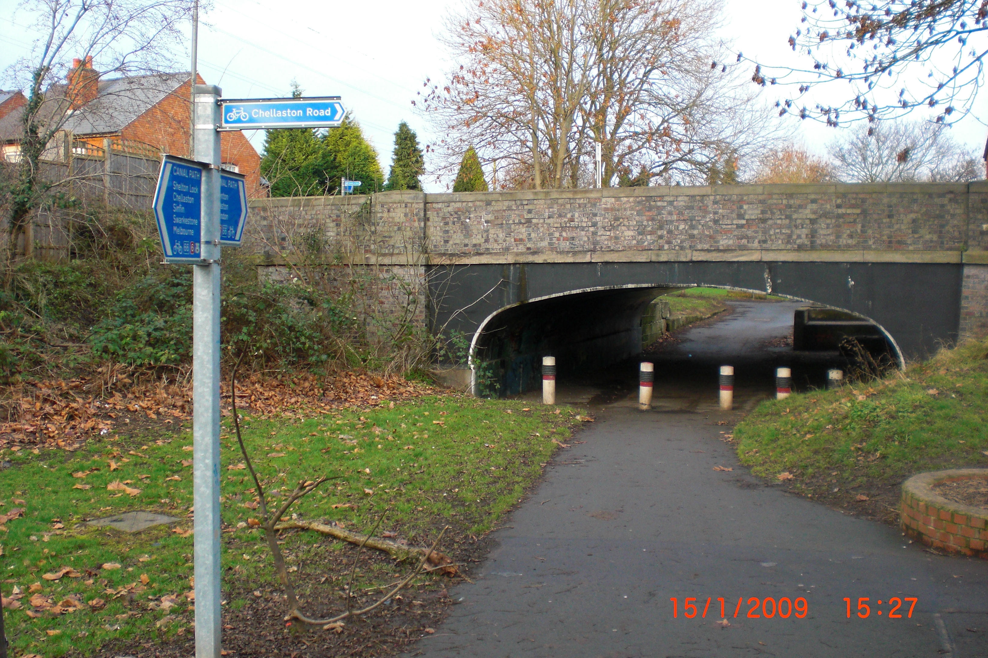
 The former canal at Shelton Lock, now a footpath
From Swarkestone the line of the canal can be followed into Derby as far as Wilmorton although the only recognisable canal features are the chambers of Fullen's and Shelton Locks and the bridges under Chellaston Road (pictured) and London Road. Route 6 of the National Cycle Network (NCN 6) follows this part of the canal.
Although traces of the canal through Derby city centre remained until well into the twentieth century (the ice factory on what was the Cockpit island drew its water from the canal), it has all been covered by development, mainly the inner ring road and Pride Parkway. New building at Pride Park has obliterated all traces of the canal in that area.
The weir built across the river to form the Derwent Basin still exists behind the Council House, downstream of the Exeter Bridge, and the timber causeway on trestles, which was used as the towpath, remained until 1959.[7] The Holmes Aqueduct was demolished in 1971.
The remains of the towpath are visible at a bridge under the railway immediately north of Derby railway station. An unused span of the railway bridge over Old Nottingham Road once crossed the canal. Steel girders set into the kerb edge of Old Nottingham Road near its junction with Stores Road are the remains of a bridge over the Little Eaton line. The Little Eaton line and the gangway have also disappeared, apart from the Wharf Building at Little Eaton, in the present day trading estate, and a couple of bridges.
The A52 Brian Clough Way was built upon the canal between the Pentagon and Spondon. From Spondon the line can be traced to Sandiacre. NCN 6 uses the canal route between Borrowash and Breaston.
In 1994 the Derby and Sandiacre Canal Society was set up. Restoration began in earnest the following year and is now well underway.
See also
- Canals of Great Britain
- History of the British canal system
- Chesterfield Canal
- Chesterfield Canal Trust
- Derby and Sandiacre Canal
- Derby and Sandiacre Canal Trust
- List of waterway societies in the United Kingdom
References
- ^ UK CPI inflation numbers based on data available from Lawrence H. Officer (2010) "What Were the UK Earnings and Prices Then?" MeasuringWorth.
- ^ Smith, Michael E., The Derby Canal, p.35, Moorleys Bookshop, Ilkeston, 1980
- ^ Smith, Michael E., The Derby Canal, p.35
- ^ Whitehead, P.,. "Longdon-on-Tern Aqueduct". http://www.pittdixon.go-plus.net/telford-aqueducts/telford-aqueducts.htm.
- ^ Barnes, E.G., The Rise of the Midland Railway 1844-1874, p.26, George Allen & Unwin, 1966
- ^ Smith, Michael E., The Derby Canal, p.61
- ^ Smith, Michael E., The Derby Canal, p.61
- Schofield, R.B., (2000) Benjamin Outram 1764-1805 : an engineering biography, Cardiff : Merton Priory, ISBN 1-898937-42-7
Further reading
- Derbyshire Archaeological Society [1852] (1980) Map of the borough of Derby with portions of Darley, Litchurch and Little Chester, Facsimile edition, Derby : The Society, ISBN 0-9501786-7-5
- De Salis, H.R. (1969) Bradshaw's Canals and Navigable Rivers, David & Charles, ISBN 0-7153-4689-X
- Hadfield, C. (1970) The Canals of the East Midlands, David & Charles, ISBN 0-7153-4871-X
- Ripley, D., (1993) The Little Eaton Gangway and Derby Canal, Locomotion papers LP71, 2nd ed., Oxford : Oakwood Press, ISBN 0-85361-431-8
- Russell, R. (1971) Lost Canals of England and Wales, David & Charles, ISBN 0-7153-5417-5
- Smith, M.E., (1980) The Derby Canal, Ilkeston : Moorley's Bible and Bookshop, ISBN 0-86071-089-0
External links
- The Derby and Sandiacre Canal Society website
- The Derby Canal Route map This map shows the entire original route of the Derby Canal using Satellite mapping with markers along the way indicating points of interest such as bridges and locks. Each marker has links to old and new photographs, Google Streetviews, 360 degree VR photography.
Categories:- Canals in England
- Transport in Derby
- Canals in Derbyshire


Wikimedia Foundation. 2010.