- Cowlitz County, Washington
-
Cowlitz County, Washington 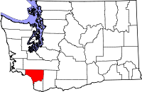
Location in the state of Washington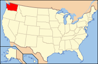
Washington's location in the U.S.Founded April 21, 1854 Seat Kelso Largest city Longview Area
- Total
- Land
- Water
1,166 sq mi (3,020 km²)
1,139 sq mi (2,950 km²)
28 sq mi (73 km²), 2.37%Population
- (2010)
- Density
102,410
90/sq mi (34.7/km²)Website www.co.cowlitz.wa.us Cowlitz County is a county located in the U.S. state of Washington. As of the 2010 census its population was 102,410.[1] It forms the Longview, Washington, Metropolitan Statistical Area which encompasses all of Cowlitz County. The county seat is at Kelso, and its largest city is Longview. Its name derives from the anglicized version of the Cowlitz Indian term, Cow-e-liske, meaning either “river of shifting sands” or “capturing the medicine spirit.” It was formed on April 21, 1854.[2]
Contents
History
Prior to the Europeans' arrival to the area, it was inhabited by numerous Native American tribes, with the Cowlitz tribe being the largest. They were drawn to the region by the abundance of salmon. The Cowlitz are considered to be the first regional inhabitants to engage in commerce as they traded extensively with other tribes in Western and Eastern Washington. The Cowlitz Indian population declined significantly from the 1829-1830 smallpox outbreak.
European explorers discovered and began navigating the Columbia River in 1792 as British Lieutenant W.R. Broughton sailed up the river to and past present day Cowlitz County. Then on November 5, 1805, Lewis and Clark camped at that mouth of the Kalama River, under orders from President Thomas Jefferson. Over the following days, they would reached the present sites of Kelso and Longview.
By the 1820s, the Hudson’s Bay Company had established a lucrative fur trade in the region. Furs were shipped down the Cowlitz River to the Columbia where they were loaded and shipped around the world. Trade declined significantly in the late 1830s as over-hunting and fashions had changed.
During the next several decades, white settlement of the region was in full swing. Most of the settlers homesteaded around the number of tributaries that fed the Columbia River. It was during this era that the first settlements were established. The first was Monticello, near present-day Longview. In 1841 several families with the HBC directedSinclair expedition from Red River Colony settled there.
This was the location of the Monticello Convention where a group of prominent settlers from the Cowlitz and Puget Sound regions met to draft a petition to the District of Columbia calling for a separate territory, to be carved out the Oregon Territory, north of the Columbia River. This convention took place on November 25, 1852 and three months later the United States Congress formed Columbia Territory, which was later known as Washington Territory. Being one of the first counties organized, it was created on April 24, 1854, by the newly formed Washington Territorial Government and signed into law by Governor Isaac Stevens.
Nearly every town that sprang up in the late 19th century began around a logging or lumber-milling operation. In the latter half of the 1920s, the Weyerhaeuser Company and Long-Bell Lumber Company established processing facilities. At the time, these two facilities were the first and second largest in the world. The county is still heavily dependent on the timber industry.[3]
Four towns have claimed the Cowlitz County seat.[4]
- Monticello (1854–1865)
- Freeport (1865–1872)
- Kalama (1872–1922)
- Kelso (1922–Present)
Geography
According to the U.S. Census Bureau, has a total area of 1,166 square miles (3,019.9 km2), of which 1,139 square miles (2,950.0 km2) is land and 28 square miles (72.5 km2) (2.37%) is water.
Cowlitz County is part of the Puget Sound – Willamette Depression, a geologic formation extending south from the Puget Sound to the Willamette Valley in Oregon. Nestled up against the Cascade Mountains, many of the county’s major rivers originate in this range. These rivers include the Cowlitz, Coweeman, Kalama, Lewis and Toutle.[3]
Cowlitz County is the 28th largest out of 39 counties in Washington State.[5]
Geographic features
Major highways
Adjacent counties
- Lewis County, Washington - north
- Skamania County, Washington - east
- Clark County, Washington - south
- Columbia County, Oregon - southwest
- Wahkiakum County, Washington - west
National protected areas
- Gifford Pinchot National Forest (part)
- Mount St. Helens Volcanic National Monument (part)
County Parks
- Catlin Cemetery
- Cougar Wayside
- County Line Park
- Finn Hall Wayside
- Harry Gardner Park
- Hog Island Access
- Riverside Park
- SRS Viewpoint
- Willow Grove Park
- Woodbrook Park[6]
Demographics
Historical populations Census Pop. %± 1860 406 — 1870 730 79.8% 1880 2,062 182.5% 1890 5,917 187.0% 1900 7,877 33.1% 1910 12,561 59.5% 1920 11,791 −6.1% 1930 31,906 170.6% 1940 40,155 25.9% 1950 53,369 32.9% 1960 57,801 8.3% 1970 68,616 18.7% 1980 79,548 15.9% 1990 82,119 3.2% 2000 92,948 13.2% 2010 102,410 10.2% source:[7] As of the census[8] of 2000, there were 92,948 people, 35,850 households, and 25,059 families residing in the county. The population density was 82 people per square mile (32/km²). There were 38,624 housing units at an average density of 34 per square mile (13/km²). The racial makeup of the county was 91.80% White, 0.52% Black or African American, 1.52% Native American, 1.30% Asian, 0.13% Pacific Islander, 2.11% from other races, and 2.62% from two or more races. 4.55% of the population were Hispanic or Latino of any race. 18.6% were of German, 11.2% United States or American, 10.4% English, 8.6% Irish and 7.0% Norwegian ancestry according to Census 2000. 94.6% spoke English, and 3.5% Spanish as their first language.
There were 35,850 households out of which 32.80% had children under the age of 18 living with them, 54.60% were married couples living together, 10.70% had a female householder with no husband present, and 30.10% were non-families. 24.30% of all households were made up of individuals and 9.70% had someone living alone who was 65 years of age or older. The average household size was 2.55 and the average family size was 3.01.
In the county, the population was spread out with 26.80% under the age of 18, 8.30% from 18 to 24, 27.50% from 25 to 44, 24.10% from 45 to 64, and 13.30% who were 65 years of age or older. The median age was 37 years. For every 100 females there were 98.20 males. For every 100 females age 18 and over, there were 95.80 males.
The median income for a household in the county was $39,797, and the median income for a family was $46,532. Males had a median income of $40,378 versus $25,710 for females. The per capita income for the county was $18,583. About 10.30% of families and 14.00% of the population were below the poverty line, including 19.50% of those under age 18 and 6.60% of those age 65 or over.
Cities
Census-designated places
Other communities
See also
References
- ^ "U.S. Census Bureau Delivers Washington's 2010 Census Population Totals, Including First Look at Race and Hispanic Origin Data for Legislative Redistricting" (.xls). U.S. Census Bureau. 2011-02-23. http://www.census.gov/newsroom/releases/archives/2010_census/cb11-cn45.html. Retrieved 2011-03-26.
- ^ "Milestones for Washington State History — Part 2: 1851 to 1900". HistoryLink.org. 2003-03-06. http://www.historylink.org/essays/output.cfm?file_id=5380.
- ^ a b "Cowlitz and Wahkiakum County Profile" (CSV). Employment Security Department. October 1998. http://govdocs.evergreen.edu/wastate/wslmia/countyprofiles/cowlitz-wahkiakum/1998oct.pdf. Retrieved September 14, 2009.
- ^ "Cowlitz County" (CSV). http://www.rootsweb.ancestry.com/~wasgs/cowlitz.pdf. Retrieved September 14, 2009.
- ^ "Region 4" (CSV). Washington State Hazard Mitigation Plan. April 2004. http://www.emd.wa.gov/plans/documents/reg-4-profile.pdf. Retrieved September 14, 2009.
- ^ "Cowlitz County Parks and Recreation Division". http://www.co.cowlitz.wa.us/.+2009-09-10. http://www.co.cowlitz.wa.us/Maintenance/parks/index.htm.
- ^ "Population of Counties 1890-2000" (CSV). Office of Financial Management, Washington State. 2010-04-01. http://www.ofm.wa.gov/databook/local/lt08co.asp. Retrieved 2011-01-16.
- ^ "American FactFinder". United States Census Bureau. http://factfinder.census.gov. Retrieved 2008-01-31.

Lewis County Wahkiakum County 
Skamania County  Cowlitz County, Washington

Columbia County, Oregon Clark County Municipalities and communities of Cowlitz County, Washington Cities Castle Rock | Kalama | Kelso | Longview | Woodland‡

CDPs Unincorporated
communitiesFootnotes ‡This populated place also has portions in an adjacent county or counties
Categories:- Washington (state) counties
- Cowlitz County, Washington
- 1854 establishments in the United States


Wikimedia Foundation. 2010.