- Grays Harbor County, Washington
-
Grays Harbor County, Washington 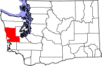
Location in the state of Washington
Washington's location in the U.S.Founded April 14, 1854 Seat Montesano Area
- Total
- Land
- Water
2,224 sq mi (5,760 km²)
1,917 sq mi (4,965 km²)
308 sq mi (798 km²), 13.83%Population
- (2010)
- Density
72,797
38/sq mi (14.6/km²)Website www.co.grays-harbor.wa.us Grays Harbor County is a county in the state of Washington, in the United States of America. As of 2010, the population was 72,797. The county seat is at Montesano, and its largest city is Aberdeen. The county is named after a large estuarine bay near its southwestern corner. On May 7, 1792, Boston fur trader Robert Gray crossed the bar into the bay he called Bullfinch Harbor, but which later cartographers would label Chehalis Bay, and then Grays Harbor.[1]
Grays Harbor County was formed out of Thurston County on April 14, 1854. Originally named Chehalis County, it took its present name in 1915.[1][2]
Contents
Geography
According to the U.S. Census Bureau, the county has a total area of 2,224 square miles (5,760.1 km2), of which 1,917 square miles (4,965.0 km2) is land and 308 square miles (797.7 km2) (13.83%) is water.
Geographic features
- Aberdeen Lake
- Chehalis River
- Duck Lake
- Failor Lake
- Grays Harbor
- Humptulips River
- Hoquiam River
- Lake Quinault
- Olympic Mountains
- Olympic Peninsula
- Pacific Ocean
- Quinault River
- Quinault Rain Forest
- Satsop River
- Wishkah River
- Wynoochee Lake
- Wynoochee River
Adjacent and/or overlapping
- Chehalis Indian Reservation
- Colonel Bob Wilderness
- Olympic National Park
- Olympic National Forest
- Quinault Indian Reservation
State parks
- Griffiths-Priday State Park
- Lake Sylvia State Park
- Ocean City State Park
- Pacific Beach State Park
- Twin Harbors State Park
- Westhaven State Park
- Westport Light State Park
Major highways
Adjacent counties
- Jefferson County, Washington - north
- Mason County, Washington - northeast
- Thurston County, Washington - east/southeast
- Lewis County, Washington - south/southeast
- Pacific County, Washington - south
National protected areas
- Copalis National Wildlife Refuge
- Grays Harbor National Wildlife Refuge
- Olympic National Forest (part)
- Olympic National Park (part)
Demographics
Historical populations Census Pop. %± 1860 285 — 1870 401 40.7% 1880 921 129.7% 1890 9,249 904.2% 1900 15,124 63.5% 1910 35,590 135.3% 1920 44,745 25.7% 1930 59,982 34.1% 1940 53,166 −11.4% 1950 53,644 0.9% 1960 54,465 1.5% 1970 59,553 9.3% 1980 66,314 11.4% 1990 64,175 −3.2% 2000 67,194 4.7% 2010 72,797 8.3% As of the census[3] of 2000, there were 67,194 people, 26,808 households, and 17,907 families residing in the county. The population density was 35 people per square mile (14/km²). There were 32,489 housing units at an average density of 17 per square mile (7/km²). The racial makeup of the county was 88.30% White, 0.34% Black or African American, 4.66% Native American, 1.22% Asian, 0.11% Pacific Islander, 2.27% from other races, and 3.10% from two or more races. 4.85% of the population were Hispanic or Latino of any race. 16.3% were of German, 11.9% United States or American, 9.9% English, 9.2% Irish, and 6.1% Norwegian ancestry according to Census 2000. 94.1% spoke English and 3.9% Spanish as their first language.
There were 26,808 households out of which 30.50% had children under the age of 18 living with them, 50.70% were married couples living together, 11.10% had a female householder with no husband present, and 33.20% were non-families. 26.70% of all households were made up of individuals and 11.60% had someone living alone who was 65 years of age or older. The average household size was 2.48 and the average family size was 2.98.
In the county, the population was spread out with 25.70% under the age of 18, 7.90% from 18 to 24, 26.00% from 25 to 44, 25.00% from 45 to 64, and 15.40% who were 65 years of age or older. The median age was 39 years. For every 100 females there were 98.80 males. For every 100 females age 18 and over, there were 96.20 males.
The median income for a household in the county was $34,160, and the median income for a family was $39,709. Males had a median income of $35,947 versus $24,262 for females. The per capita income for the county was $16,799. 16.10% of the population and 11.90% of families were below the poverty line. 21.60% of those under the age of 18 and 9. 40% of those 65 and older were living below the poverty line.
Politics
Grays Harbor County is one of the most consistently Democratic in the nation. The last Republican Presidential candidate to carry the county was Herbert Hoover in 1928[4] and the last Republican gubernatorial candidate to carry the county was Daniel J. Evans in 1964.[5]
In the United States House of Representatives Grays Harbor is part of Washington's 6th congressional district, which has a Cook Partisan Voting Index of D+5 and is represented by Norman D. Dicks. In the Washington State Legislature it lies in the 19th, 24th, and 35th districts. In the Washington State Senate it is represented by Brian Hatfield, James Hargrove, and Tim Sheldon. In the Washington House of Representatives it is represented by Brian Blake, Fred Finn, Kathy Haig, Lynn Kessler, Dean Takko, and Kevin Van De Wege. All of these politicians are of the Democratic Party.[6]
Principal Economic Activities
- Wood and Paper Products
- Seafood Processing
- Food Processing
- Manufacturing
Notable Harborites
- Robert Eugene Bush – Medal of Honor recipient
- Reuben H. Fleet – Aviation Pioneer
- Kurt Cobain – Musician
- Krist Novoselic – Musician
- John Elway – NFL player
- Mark Bruener– NFL player
- Gail Brown – Actress
- Buzz Osborne – Musician
- Dale Crover – Musician
- Bryan Danielson - Professional wrestler
- Chris Grant - Hydroplane racer
- Robert Motherwell – Artist
- Douglas Osheroff – Nobel-winning physicist
- Elton Bennett – Artist
- Peter Norton – Software developer (Norton Utilities)
- Patrick Simmons – Musician
- Colin Cowherd - ESPN Radio host (The Herd with Colin Cowherd)
- Robert Arthur - actor
Census-recognized communities
Other communities
- Alder Grove
- Aloha
- Amanda Park
- Bay City
- Bench Drive
- Carlisle
- Cedarville
- Chenois Creek
- Copalis Crossing
- Deckerville
- Garden City
- Gray Gables
- Grays Harbor City
- Grisdale
- Heather
- Hillgrove
- Melbourne
- New London
- Newton
- Nisson
- Ocosta
- Pacific Beach
- Preachers Slough
- Quinault
- Saginaw
- South Aberdeen
- South Elma
- South Montesano
- Whites
- Wishkah
- Woodlawn
See also
References
- ^ "Milestones for Washington State History — Part 2: 1851 to 1900". HistoryLink.org. March 6, 2003. http://www.historylink.org/essays/output.cfm?file_id=5380.
- ^ "Historical Highlights of Montesano". 2002. http://www.montesano.us/montesano_welcomes_you_westbound.htm.
- ^ "American FactFinder". United States Census Bureau. http://factfinder.census.gov. Retrieved 2008-01-31.
- ^ Geographie Electorale
- ^ David Leip's Election Atlas
- ^ Washington State Legislature district map
External links
- Official website
- Harborpedia
- Maritime Heritage Network, an online directory of maritime history resources in the Pacific Northwest, including the Grays Harbor cities of Aberdeen and Hoquiam.

Jefferson County Mason County Pacific Ocean 
Thurston County  Grays Harbor County, Washington

Pacific County Lewis County Municipalities and communities of Grays Harbor County, Washington Cities Aberdeen | Cosmopolis | Elma | Hoquiam | McCleary | Montesano | Oakville | Ocean Shores | Westport

CDPs Aberdeen Gardens | Brady | Central Park | Chehalis Village | Cohassett Beach | Copalis Beach | Grayland | Humptulips | Junction City | Malone-Porter | Markham | Moclips | Neilton | Ocean City | Oyehut-Hogans Corner | Satsop | Taholah
Unincorporated
communitiesAmanda Park | Copalis Crossing | Pacific Beach | Quinault
Indian reservations Chehalis Indian Reservation‡ | Quinault Indian Reservation‡
Footnotes ‡This populated place also has portions in an adjacent county or counties
Categories:- Washington (state) counties
- Grays Harbor County, Washington
- 1854 establishments in the United States


Wikimedia Foundation. 2010.