Mingajik — Original name in latin Mingajik Name in other language Mengajik, Mengajk, Mengeh Jek, Mingajek, Mingajik, Mungajik, mngjk State code AF Continent/City Asia/Kabul longitude 37.0279 latitude 66.12817 altitude 280 Population 0 Date 2012 02 28 … Cities with a population over 1000 database
Mingajik — Admin ASC 2 Code Orig. name Mingajik Country and Admin Code AF.31.7053814 AF … World countries Adminstrative division ASC I-II
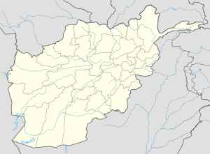
Mingajik District — Mangajik District is situated in the central part of Jowzjan Province, Afghanistan. It borders Khwaja du koh and Khamyab districts to the west, Qarqin District to the north, Mardyan District to the east and Aqcha District to the south. The… … Wikipedia
Mardyan District — is situated in the central eastern part of the Jowzjan Province, Afghanistan. It borders Mingajik District to the west, Qarqin District to north, Balkh Province and Fayzabad District to the east and Aqcha District to the south. The population is… … Wikipedia
Jowzjan Province — Geobox|Province country = Afghanistan country name = Jowzjan native name = جوزجان map caption = Map of Afghanistan with Jowzjan highlighted capital = Sheberghan capital lat d = 36.75 capital long d = 66.00 population as of = 2002 population = 441 … Wikipedia
Nangarhar Province — Coordinates: 34°15′N 70°30′E / 34.25°N 70.50°E / 34.25; 70.50 … Wikipedia
Nimruz Province — Coordinates: 31°00′N 62°30′E / 31.0°N 62.5°E / 31.0; 62.5 … Wikipedia
Nuristan Province — This page is about the province in Afghanistan. Nuristan is also a proposed name of Khyber Pakhtunkhwa Province of Pakistan. Coordinates: 35°15′N 70°45′E / 35.25°N 70.75°E … Wikipedia
Orūzgān Province — Coordinates: 32°48′N 66°00′E / 32.8°N 66.0°E / 32.8; 66.0 … Wikipedia
Sar-e Pol Province — Coordinates: 35°36′N 66°18′E / 35.6°N 66.3°E / 35.6; 66.3 … Wikipedia
 Mingajik
 Afghanistan