- Crook County, Wyoming
-
Crook County, Wyoming 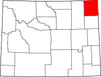
Location in the state of Wyoming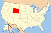
Wyoming's location in the U.S.Founded 1875 Seat Sundance Largest city Sundance Area
- Total
- Land
- Water
2,871 sq mi (7,436 km²)
2,860 sq mi (7,407 km²)
12 sq mi (31 km²), 0.42%Population
- (2010)
- Density
7,083
3/sq mi (1/km²) Buffalo on the range in Crook County, Wyoming
Crook County is a county located in the U.S. state of Wyoming. As of 2010, the population was 7,083, up from 5,887 in 2000. Its county seat is Sundance[1].
Contents
History
Crook County was created by on the legislature of the Wyoming Territory on December 8, 1868, from portions of Albany and Laramie Counties.[2]
Crook County was named for Brigadier General George Crook, a commander during the Indian Wars.[3] In 1890, Crook County lost territory when Weston County was created. Campbell County was formed with land ceded by Crook County in 1911.
Geography
According to the U.S. Census Bureau, the county has a total area of 2,871 square miles (7,435.9 km2), of which 2,859 square miles (7,404.8 km2) is land and 12 square miles (31.1 km2) (0.42%) is water. The lowest point in the state of Wyoming is located on the Belle Fourche River in Crook County, where it flows out of Wyoming and into South Dakota.
Devils Tower National Monument is located in Crook County.
Major highways
 Interstate 90
 U.S. Highway 14
 U.S. Highway 16
 U.S. Highway 212
 Wyoming Highway 24
 Wyoming Highway 51
 Wyoming Highway 111
 Wyoming Highway 112
 Wyoming Highway 113
 Wyoming Highway 116
 Wyoming Highway 585
Adjacent counties
- Campbell County, Wyoming - west
- Weston County, Wyoming - south
- Lawrence County, South Dakota - east
- Butte County, South Dakota - east
- Carter County, Montana - north
- Powder River County, Montana - northwest
National protected areas
- Black Hills National Forest (part)
- Devils Tower National Monument
- Thunder Basin National Grassland (part)
Demographics
Historical populations Census Pop. %± 1880 239 — 1890 2,338 878.2% 1900 3,137 34.2% 1910 6,492 106.9% 1920 5,524 −14.9% 1930 5,333 −3.5% 1940 5,463 2.4% 1950 4,738 −13.3% 1960 4,691 −1.0% 1970 4,535 −3.3% 1980 5,308 17.0% 1990 5,294 −0.3% 2000 5,887 11.2% 2010 7,083 20.3% As of the census[4] of 2000, there were 5,887 people, 2,308 households, and 1,645 families residing in the county. The population density was 2 people per square mile (1/km²). There were 2,935 housing units at an average density of 1 per square mile (0/km²). The racial makeup of the county was 97.86% White, 0.05% Black or African American, 1.02% Native American, 0.07% Asian, 0.25% from other races, and 0.75% from two or more races. 0.92% of the population were Hispanic or Latino of any race. 34.1% were of German, 14.6% English, 7.8% Irish and 6.8% American ancestry according to Census 2000.
There were 2,308 households out of which 32.30% had children under the age of 18 living with them, 62.30% were married couples living together, 5.40% had a female householder with no husband present, and 28.70% were non-families. 24.90% of all households were made up of individuals and 10.30% had someone living alone who was 65 years of age or older. The average household size was 2.51 and the average family size was 3.01.
In the county the population was spread out with 26.90% under the age of 18, 6.60% from 18 to 24, 24.60% from 25 to 44, 27.20% from 45 to 64, and 14.70% who were 65 years of age or older. The median age was 40 years. For every 100 females there were 102.40 males. For every 100 females age 18 and over, there were 101.80 males.
The median income for a household in the county was $35,601, and the median income for a family was $43,105. Males had a median income of $34,483 versus $18,967 for females, indicating a relatively high level of income inequality based on gender. The per capita income for the county was $17,379. About 7.8% of families and 9.10% of the population were below the poverty line, including 9.90% of those under age 18 and 11.80% of those age 65 or over.
Communities
Towns
Other communities
Politics
Crook County is historically Republican in Presidential elections. The last Democratic candidate to carry the county was Franklin D. Roosevelt in 1932.[5] In the last five Presidential elections the Democratic candidate has consistently received less than 24% of the county's vote.[6]
In the Wyoming Senate the county is represented by Republican Ogden Driskill since 2011.[7] In the Wyoming House of Representatives it has been represented by Republican Mark Semlek since 2003.[8]
See also
References
- ^ "Find a County". National Association of Counties. http://www.naco.org/Counties/Pages/FindACounty.aspx. Retrieved 2011-06-07.
- ^ Long, John H. (2006). "Wyoming: Individual County Chronologies". Wyoming Atlas of Historical County Boundaries. The Newberry Library. http://historical-county.newberry.org/website/Wyoming/documents/WY_Individual_County_Chronologies.htm#Individual_County_Chronologies. Retrieved 2011-09-06.
- ^ Urbanek, Mae (1988). Wyoming Place Names. Missoula, MT: Mountain Press Publishing Company. ISBN 0-87842-204-8.
- ^ "American FactFinder". United States Census Bureau. http://factfinder.census.gov. Retrieved 2008-01-31.
- ^ Geographie Electorale
- ^ The New York Times electoral map (Zoom in on Wyoming)
- ^ Wyoming State Legislature Profile for Charles Townsend
- ^ Wyoming State Legislature Profile for Mark Semlek

Powder River County, Montana Carter County, Montana Campbell County 
Lawrence County, South Dakota and Butte County, South Dakota  Crook County, Wyoming

Weston County Municipalities and communities of Crook County, Wyoming Towns Hulett | Moorcroft | Pine Haven | Sundance

Unincorporated
communities State of Wyoming
Topics - Governors
- Delegations
- Geography
- Government
- History
- People
- Visitor Attractions
- State Symbols
- Radio Stations
Society - Crime
- Demographics
- Economy
- Education
- Politics
Regions Cities Counties Categories:- Wyoming counties
- Crook County, Wyoming
- 1875 establishments
- Black Hills


Wikimedia Foundation. 2010.