Maungatua

Maungatua
Maungatua, Otago
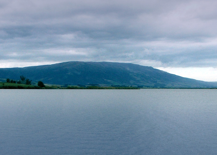
From the shore of Lake Waihola, 15 kilometres to the south

Often incorrectly called The Maungatuas or The Maungatua Range, Maungatua is a prominent ridge which dominates the skyline of the Taieri Plains in Otago, New Zealand. Rising 900 metres above the floodplain of the Taieri River, directly to the west of Dunedin's airport at Momona, it can be clearly seen from much of Dunedin's urban area, 35 kilometres to the east, and from as far south as the outskirts of Balclutha, 65 kilometres to the southwest. Lake Mahinerangi is located on the western side of Maungatua.

The name Maungatua comes from the Maori words Maunga-atua, meaning "Hill of the spirits".[1]

Ecology of Maungatua

On the summit of Maungatua there are swamps that contain species of insect eating plants called sundews. At the base of Maungatua glowworms may be found living in manuka trees.

References

Coordinates: 45°53′S 170°07′E / 45.883°S 170.117°E / -45.883; 170.117


Wikimedia Foundation. 2010.

Игры ⚽ Поможем решить контрольную работу

Look at other dictionaries:

  • Mosgiel — …   Wikipedia

  • Taieri Plains — The Taieri Plains are an area of fertile agricultural land to the southwest of Dunedin, in Otago, New Zealand. The plains cover an area of some 300 square kilometres, with a maximum extent of 30 kilometres.The floodplains of the Taieri and… …   Wikipedia

  • South Otago — lies in the south east of the South Island of New Zealand. As the name suggests, it forms the southernmost part of the geographical region of Otago. The exact definition of the area designated as South Otago is imprecise, as the area is not… …   Wikipedia

  • Lake Mahinerangi — Infobox lake lake name = Lake Mahinerangi image lake = Lakemahinerangi.jpg caption lake = Lake Mahinerangi image bathymetry = caption bathymetry = location = Clutha District, Otago Region, South Island coords = coord|45|52|S|169|57|E|region:NZ… …   Wikipedia

  • Strath-Taieri — The Strath Taieri is a large glacial valley and river plateau, surrounded by rugged hill ranges located to the north and west of Otago Harbour. Since 1989 it has been part of the city of Dunedin. Middlemarch is located at its southern end. The… …   Wikipedia

  • List of mountains of New Zealand by height — The following is a list of the highest mountains in New Zealand, and also of some other notable mountains and hills, ordered by height.The 30 highest mountainsThe 30 highest mountains [This list excludes mountains in the Ross Dependency, an area… …   Wikipedia

  • Outram, New Zealand — This article is about a town in New Zealand. For other uses of Outram, see Outram (disambiguation). Outram Hotel, in the main street of Outram …   Wikipedia

  • Horomona Pohio — Horomona Pohio, (1815 1880) was a Ngai Tahu leader, missionary, assessor and land protester. Early life Horomona Pohio claimed descent from the major lines of Ngai Tahu, Ngati Mamoe and Waitaha. His hapu were Ngai Taoka, Ngati Huirapa, Ngai Te… …   Wikipedia

  • Charles Kettle — Charles Kettle. Charles Henry Kettle (6 April 1821 – 5 June 1862) surveyed the city of Dunedin in New Zealand, imposing a bold design on a challenging landscape. He was aiming to create a Romantic effect and incidentally produced the world s… …   Wikipedia

  • Henry Monson (gaoler) — Henry Monson (August 25, 1793 ndash; December 9, 1866) was a founding settler in Dunedin, New Zealand. His journal, recording his career as Dunedin s first full time gaoler, forms a valuable historical document on social conditions in New Zealand …   Wikipedia

Share the article and excerpts

Direct link
Do a right-click on the link above
and select “Copy Link”