- NR postcode area
-
Norwich postcode area 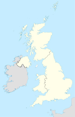
 NR
NRPostcode area NR Postcode area name Norwich Post towns 16 Postcode districts 35 Postcode sectors 105 Postcodes (live) 22,605 Postcodes (total) 25,793 Statistics as at October 2006 [1] The NR postcode area, also known as the Norwich postcode area,[2] is a group of postcode districts covering much of Norfolk and parts of the adjacent county of Suffolk in the East Anglian area of England.
Contents
Coverage
The approximate coverage of the postcode districts:
Postcode district Post town Coverage Local authority area NR1 NORWICH Thorpe Hamlet, (parts of) City Centre, areas close to Thorpe Road Mail Centre NR2 NORWICH Eaton NR3 NORWICH NR4 NORWICH Villages W and SW of Norwich: Cringleford, Colney, Keswick NR5 NORWICH W and NW suburbs of Norwich: Bowthorpe, Costessey NR6 NORWICH N and NW suburbs of Norwich: Old Catton, Hellesdon NR7 NORWICH E and SE suburbs of Norwich: Sprowston, Thorpe St. Andrew, Heartsease NR8 NORWICH Suburbs and villages NW of Norwich: Drayton, Taverham, Ringland NR9 NORWICH Villages W and NW of Norwich: Bawburgh, Hethersett, Honingham, Lenwade, Little Melton, Lyng, Marlingford and Colton, Weston Longville NR10 NORWICH Villages and towns N and NW of Norwich: Pettywell, Reepham, Hevingham, Stratton Strawless NR11 NORWICH Alby with Thwaite, Aldborough, Aylmerton, Aylsham, Banningham, Blickling, East Beckham, Little Barningham, Hanworth, North Barningham, Roughton, Felbrigg, Gimingham, Ingworth, Matlask, Mundesley, Southrepps, Wickmere NR12 NORWICH Bacton, Brumstead, Coltishall, East Ruston, Hickling, Ingham, Lessingham, Sloley, Stalham, Tunstead, Wroxham NR13 NORWICH Towns and villages E of Norwich: Acle, Brundall, Reedham, Rackheath, Salhouse NR14 NORWICH Suburbs and villages SE of Norwich: Loddon, Poringland, Trowse NR15 NORWICH Long Stratton NR16 NORWICH Larling NR17 ATTLEBOROUGH Little & Great Ellingham NR18 WYMONDHAM NR19 DEREHAM NR20 DEREHAM Villages N and E of Dereham: Bawdeswell, Bylaugh, Elsing, Foxley, Foulsham, Gressenhall, Guestwick, Hockering, Mattishall, Whissonsett, Nethergate, North Elmham, Swanton Morley, Themelthorpe NR21 FAKENHAM Barsham, Binham, Fakenham, Fulmodeston, South Raynham, East Raynham, West Raynham, Hempton, Helhoughton, Hindringham, Gunthorpe, Tatterford, Toftrees NR22 WALSINGHAM NR23 WELLS-NEXT-THE-SEA Quarles NR24 MELTON CONSTABLE Stody, Briningham, Brinton, Sharrington, Plumstead, Swanton Novers NR25 HOLT Kelling, Baconsthorpe, Blakeney, Bodham, Cley next the Sea, Edgfield, Hempstead, High Kelling, HunworthLangham, Letheringsett, Glandford, Weybourne, West Beckham, Salthouse NR26 SHERINGHAM Beeston Regis, West Runton, Upper Sheringham NR27 CROMER Cromer, East Runton, Frogshall, Trimingham, Northrepps, Overstrand NR28 NORTH WALSHAM Antingham, Crostwight, Honing, Knapton, Paston, Ridlington NR29 GREAT YARMOUTH NR30 GREAT YARMOUTH Caister-on-Sea NR31 GREAT YARMOUTH Gorleston, Bradwell NR32 LOWESTOFT North Lowestoft NR33 LOWESTOFT South Lowestoft NR34 BECCLES Beccles, Worlingham Waveney NR35 BUNGAY Bungay, Topcroft, Flixton Waveney Adjacent areas
Adjacent postcode areas 
PE  NR
NR 

IP Clockwise from the east, the adjacent postcode areas are: , IP (Ipswich), PE (Peterborough).
See also
References
- ^ "National Statistics Postcode Directory" (PDF). Office for National Statistics Postcode Directory (November 2006). Office for National Statistics. November 2006. http://www.statistics.gov.uk/geography/downloads/NSPDVersionNotes.pdf. Retrieved 2009-05-29.
- ^ Royal Mail, Address Management Guide, (2004)
Postcode areas in the United Kingdom, Channel Islands and Isle of Man AB AL B BA BB BD BH BL BN BR BS BT BX CA CB CF CH CM CO CR CT CV CW DA DD DE DG DH DL DN DT DY E EC EH EN EX FK FY G GIR GL GU GY HA HD HG HP HR HS HU HX IG IM IP IV JE KA KT KW KY L LA LD LE LL LN LS LU M ME MK ML N NE NG NN NP NR NW OL OX PA PE PH PL PO PR RG RH RM S SA SE SG SK SL SM SN SO SP SR SS ST SW SY TA TD TF TN TQ TR TS TW UB W WA WC WD WF WN WR WS WV YO ZE
Related lists: Postal counties · Post towns · Postcode districts · London postal district Categories:- Norwich
- Postcode areas covering the East of England

Wikimedia Foundation. 2010.