- Thaya
-
For the town of the same name, see Thaya, Austria.
Thaya (Dyje) 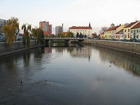
Thaya in BřeclavOrigin near Panenská Rozsíčka Mouth Morava River Basin countries Czech Republic, Austria Length 235.4 km Source elevation 410 m Mouth elevation 148 m Avg. discharge 43.9 m³/s Basin area 13,419 km² The Thaya (Czech: Dyje [ˈdɪjɛ]) is a river in Central Europe, tributary to the Morava River. It is about 235 km long and meanders from west to east in the border area between Lower Austria (Austria) and South Moravia (Czech Republic), but does not exactly follow the border in most parts. Its source is in two smaller rivers, namely the German Thaya (Deutsche Thaya) and the Moravian Thaya (Czech: Moravská Dyje, German: Mährische Thaya), the confluence of which is located at Raabs. Its name means "the inert".
In its upper reaches, the Thaya flows through deep gorges, along which it passes many castles and chateaus. In Moravia, it has been dammed in several locations.
The name of the river bears also a small village Dyje in Znojmo District in the Czech Republic.
Important cities and towns along the Thaya:
- Raabs an der Thaya
- Drosendorf-Zissersdorf
- Vranov nad Dyji
- Hardegg
- Znojmo
- Laa an der Thaya
- Lednice
- Břeclav
Dams: All dams are situated at Czech Republic. They are used for irrigation, hydroenergetics and flood protection.
Dam Name Dimension Level Altitude Qav Q100 Qmax. Power Station Type Qpp Vranov 348,45 9.74m3s-1 260m3s-1 364m3s-1 18.9 MW Conventional 45m3s-1 Znojmo 225,6 10.25m3s-1 280m3s-1 379m3s-1 1.4 WM run-of-the-river 12m3s-1 Nove Mlyny I (upper reservoir) 171,4 13.3m3s-1 290m3s-1 see lower reservoir N/A N/A N/A Nove Mlyny II (middle reservoir) 170,35 40.9m3s-1 see lower reservoir see lower reservoir N/A N/A N/A Nove Mlyny III (LOWER RESERVOIR) 170,35 40.9m3s-1 820m3s-1 657m3s-1 2.4 MW run-of-the-river 48m3s-1 Coordinates: 48°37′N 16°56′E / 48.617°N 16.933°E
Categories:- Rivers of the South Moravian Region
- Břeclav District
- Znojmo District
- Rivers of Austria
- International rivers of Europe
- South Moravian Region geography stubs
- Austria geography stubs

Wikimedia Foundation. 2010.