- Nordfriesland
-
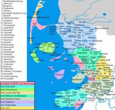
Nordfriesland — District — 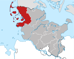
Country  Germany
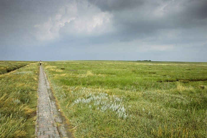
State Schleswig-Holstein Capital Husum Area - Total 2,047 km2 (790.4 sq mi) Population (31 December 2010)[1] - Total 165,480 - Density 80.8/km2 (209.4/sq mi) Time zone CET (UTC+1) - Summer (DST) CEST (UTC+2) Vehicle registration NF Website nordfriesland.de 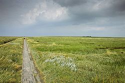 Marshland in Eiderstedt, typical of the North Frisian coast
Nordfriesland, English "Northern Friesland" or "North Frisia", is a district in Schleswig-Holstein, Germany. It includes almost all of traditional North Frisia along with adjacent areas to the east and south and is bounded by (from the east and clockwise) the districts of Schleswig-Flensburg and Dithmarschen, the North Sea and the Danish county of South Jutland. The district is called Kreis Nordfriesland in German, Kreis Noordfreesland in Low German, Kris Nordfraschlönj in Mooring North Frisian, Kreis Nuurdfresklun in Fering North Frisian and Nordfrislands amt in Danish.
Nordfriesland is the most visited rural district in Germany.
Contents
History
There has always been a strong influence of the sea in the region. In medieval times storm tides made life in what is now Nordfriesland quite dangerous. Only in modern times the loss of land and lives could be stopped by building solid dikes. Many villages that once existed, are now at the bottom of the sea. The best-known example is the small seaport of Rungholt, which was destroyed by a storm surge in 1362. The island of Strand vanished in the Burchardi flood, another disastrous storm in 1634: subsequent to this storm surge, there were many small islets instead of Strand.
From approximately 1200 until 1864, the area that is now Nordfriesland was a part of the Duchy of Schleswig, which itself was not directly a part of the Danish Kingdom, but a fiefdom of the Danish crown and linked to the kings of Denmark by personal union as a separate entity. Nordfriesland is still a multilingual district: there are people speaking standard German, Low German, North Frisian and Danish including South Jutlandic. The North Frisian language exists in nine slightly different dialects, yet it is mainly used by older persons in mainland Nordfriesland. A relatively lively community of Frisian speakers exists though on the islands of Föhr and Amrum. After becoming German, three districts were established in the region: Südtondern in the north, Husum in the centre, and Eiderstedt in the south. In 1970 these three districts were merged to form the Nordfriesland district.
Geography
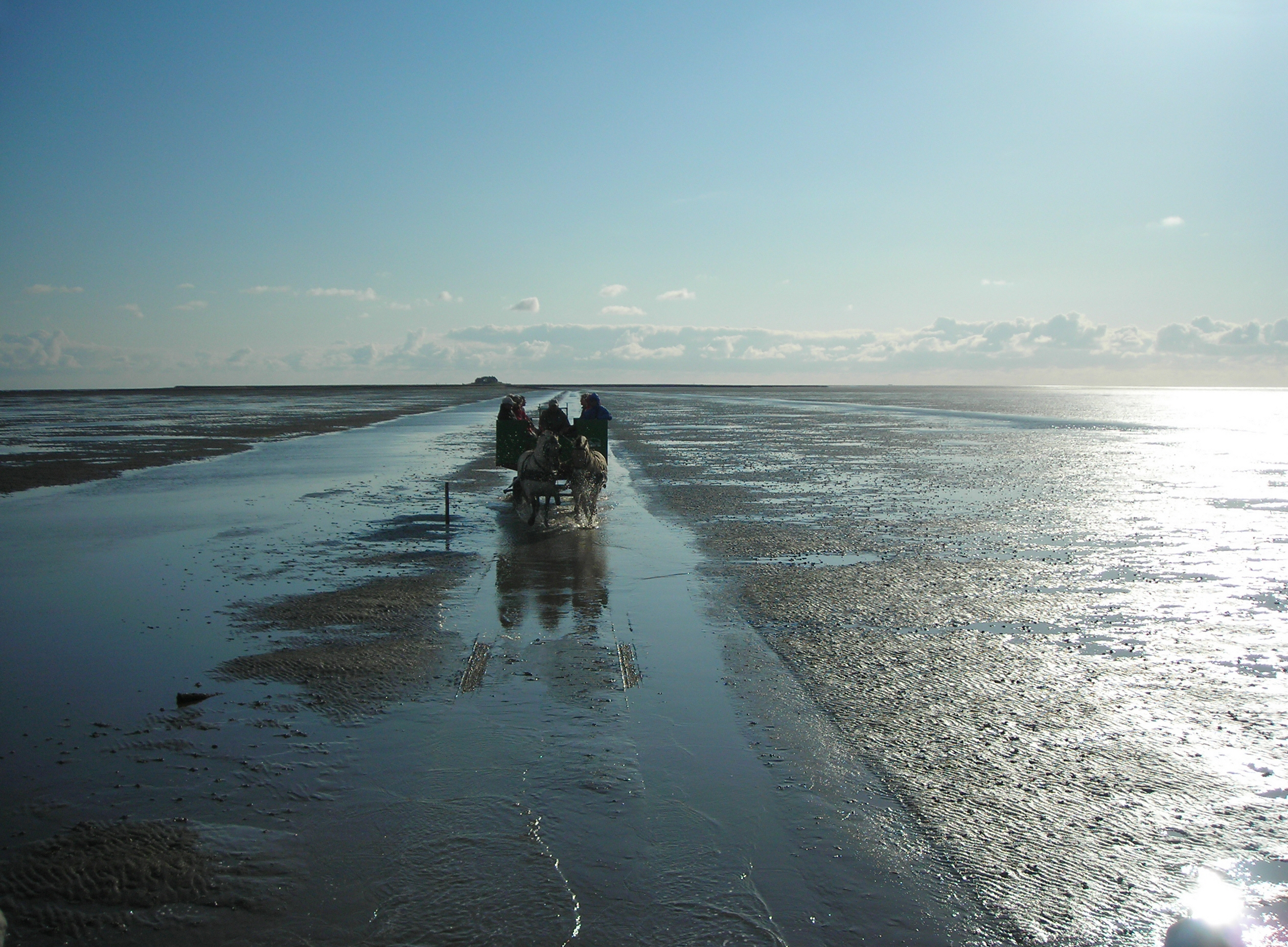
The entire coast is part of the Schleswig-Holstein Wadden Sea National Park. Nordfriesland includes the coastal section between Dithmarschen and Denmark. In the south there is the Eiderstedt peninsula, where the River Eider meets the sea.
The North Frisian Islands are part of the district and located inside the national park as well. There are five large islands (Sylt, Föhr, Amrum, Pellworm and Nordstrand) and ten small islets known as Halligen.
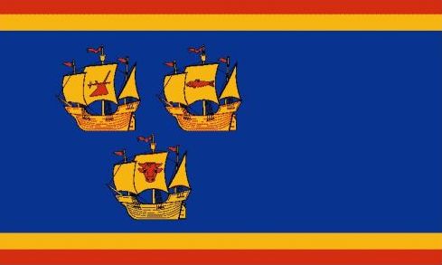
Coat of arms
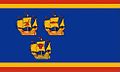 The official flag of the district Nordfriesland
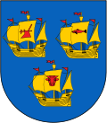
The coat of arms displays three golden ships on a blue background. These arms have been used by the Eiderstedt peninsula since the 17th century. When the district was established in 1970, the arms of Eiderstedt were applied to the entire district. Differing from the old arms, though, there are three images visible on the ships' sails: a plow, a herring and a bull's head.
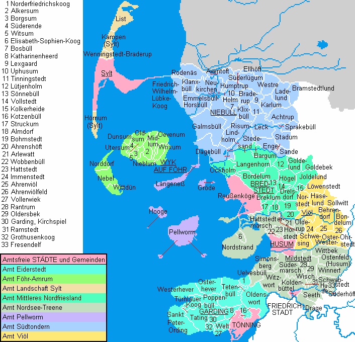
Towns and municipalities
Independent towns and municipalities - Friedrichstadt
- Husum
- Tönning
- Reußenköge
Ämter - 1. Eiderstedt
- Garding1, 2
- Garding, Kirchspiel
- Grothusenkoog
- Katharinenheerd
- Kotzenbüll
- Norderfriedrichskoog
- Oldenswort
- Osterhever
- Poppenbüll
- Sankt Peter-Ording
- Tating
- Tetenbüll
- Tümlauer-Koog
- Vollerwiek
- Welt
- Westerhever
- 2. Föhr-Amrum
- 6. Pellworm
- 7. Südtondern
- Achtrup
- Aventoft
- Bosbüll
- Braderup
- Bramstedtlund
- Dagebüll
- Ellhöft
- Emmelsbüll-Horsbüll
- Enge-Sande
- Friedrich-Wilhelm-Lübke-Koog
- Galmsbüll
- Holm
- Humptrup
- Karlum
- Klanxbüll
- Klixbüll
- Ladelund
- Leck
- Lexgaard
- Neukirchen
- Niebüll1, 2
- Risum-Lindholm
- Rodenäs
- Sprakebüll
- Stadum
- Stedesand
- Süderlügum
- Tinningstedt
- Uphusum
- Westre
- 8. Viöl
1seat of the Amt; 2town References
- ^ "Statistikamt Nord: Bevölkerung in Schleswig-Holstein am 31. Dezember 2010 nach Kreisen, Ämtern, amtsfreien Gemeinden und Städten" (in German). Statistisches Amt für Hamburg und Schleswig-Holstein. 31 December 2010. http://www.statistik-nord.de/uploads/tx_standocuments/A_I_2_vj104_S.pdf.
External links
Urban districts Rural districts Dithmarschen · Herzogtum Lauenburg · Nordfriesland · Ostholstein · Pinneberg · Plön · Rendsburg-Eckernförde · Schleswig-Flensburg · Segeberg · Steinburg · StormarnCategories:- Districts of Schleswig-Holstein
- Frisia
- Nordfriesland district


Wikimedia Foundation. 2010.