- Maxton, Kent
-
Coordinates: 51°07′13″N 1°17′20″E / 51.1204°N 1.2889°E
Maxton 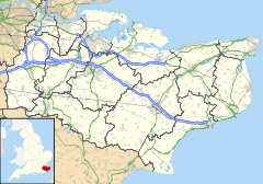
 Maxton
Maxton shown within KentOS grid reference TR302408 District Dover Shire county Kent Region South East Country England Sovereign state United Kingdom Post town Dover Postcode district CT17 Dialling code 01304 Police Kent Fire Kent Ambulance South East Coast EU Parliament South East England UK Parliament Dover List of places: UK • England • Kent Maxton, Kent was once a rural parish to the west of Dover, in England. Maxton also served as the terminus of the tramway system serving the town until its closure in 1938.
Maxton is now a suburb of Dover.
External links
 Media related to Maxton, Kent at Wikimedia Commons
Settlements in the Dover district of Kent 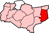
Towns Villages and hamlets Alkham · Ash · Ashley · Aycliff · Aylesham · Barfrestone · Barnsole · Betteshanger · Buckland · Buttsole · Capel-le-Ferne · Chillenden · Church Whitfield · Coldred · Coombe · Denton · Drellingore · East Langdon · Eastry · East Studdal · Elmstone · Elvington · Ewell Minnis · Eythorne · Farthingloe · Finglesham · Frogham · Goodnestone · Great Mongeham · Little Mongeham · Guston · Hacklinge · Ham · Hoaden · Hougham · Kearsney · Kingsdown · Knowlton · Langdon · Lydden · Marley · Marshborough · Martin · Martin Mill · Maxton · Nonington · Northbourne · Preston-next-Wingham · Richborough · Ringwould · Ripple · River · Shepherdswell · Sholden · Sibertswold · Snowdown · St Margaret-at-Cliffe · Staple · Stourmouth · Sutton · Swingate · Temple Ewell · Tilmanstone · Waldershare · Ware · West Langdon · West Studdal · Westcliffe · Westmarsh · Whitfield · Wingham · Woodnesborough · Wootton · WorthCivil parishes Categories:- Villages in Kent
- Dover, Kent
- Kent geography stubs


Wikimedia Foundation. 2010.