- Chart Sutton
-
Coordinates: 51°13′25″N 0°34′15″E / 51.223550°N 0.570900°E
Chart Sutton 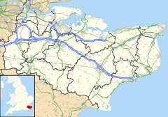
 Chart Sutton
Chart Sutton shown within KentDistrict Maidstone Shire county Kent Region South East Country England Sovereign state United Kingdom Police Kent Fire Kent Ambulance South East Coast EU Parliament South East England UK Parliament Faversham and Mid Kent List of places: UK • England • Kent Chart Sutton is a small village on the edge of the Weald of Kent, approximately 5 miles (8 km) to the south of Maidstone. The village is small, with around 800 inhabitants, but the village does offer a village hall and a park. The Corner shop, which housed the Post Office, and the village's public house: The Buffalo's Head, have both recently closed down.
St Michael's Church, parts of which date back to the 14th century, lies outside of the village centre, in between Chart Sutton and Sutton Valence. The church shares its vicar with Sutton Valence and East Sutton; the three villages are collectively known as the "Three Suttons" and have close connections with each other.
Mike Fitzgerald, the councillor for the village and for Boughton Monchelsea served as Mayor of Maidstone 2006-2007.
External links
 Media related to Chart Sutton at Wikimedia Commons
Park Wood Otham Langley Boughton Monchelsea 
Sutton Valence  Chart Sutton

Cross-at-Hand Staplehurst Sutton Valence Towns and villages in the Maidstone borough of Kent, England 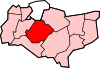 Allington · Barming · Bearsted · Bedmonton · Benover · Bexon · Bicknor · Boughton Green · Boughton Malherbe · Boughton Monchelsea · Boxley · Bredhurst · Broomfield · Caring · Chainhurst · Chart Sutton · Chegworth · Collier Street · Coxheath · Detling · Downswood · East Barming · East Farleigh · East Sutton · Fairbourne Heath · Frinsted · Grove Green · Harrietsham · Hawkenbury · Headcorn · Hollingbourne · Horden · Hucking · Hunton · Kingswood · Kit's Coty · Laddingford · Langley · Leeds · Lenham · Linton · Loose · Lordswood · Maidstone · Marden · Marley · Milebush · Nettlestead · Nettlestead Green · Otham · Otterden · Park Wood · Platt's Heath · Penenden Heath · Pollhill · Ringlestone (hamlet) · Ringlestone (suburb) · Sandling · Sandway · Shepway · Sutton Valence · Staplehurst · Stockbury · Teston · Thurnham · Tovil · Ulcombe · Walderslade · Weavering · West Farleigh · Wichling · Wormshill · Yalding
List of places in Kent Categories:- Maidstone (borough)
- Villages in Kent


Wikimedia Foundation. 2010.