- City Park, Saskatoon
-
City of Saskatoon Neighbourhoods City Park Core Neighbourhoods Suburban Development Area  Civic Heritage Home: Alexander House, 1020 Spadina Crescent
 Homes along 10th Avenue North near Duke Street
Population: 4,305 Average Family Income: $55,552 Average Household Size: 1.6 Homeownership: 32.0% Average Home Selling Price: $126,539 Municipal Ward: 1 Gross Area 140.60 Hectares 347.40 Acres Statistics c2005 - [1][2] [3]  Home along Queen Street near 7th Avenue
 Home along Queen Street near 7th Avenue
City Park is a community in Saskatoon, Saskatchewan, Canada. It has a mixture of early 1900 character homes, wartime houses circa 1946, and recent developments. This neighbourhood is centrally located in the City of Saskatoon just to the north of the Central Business District. Saskatoon City Hospital, the Mendel Art Gallery, numerous parks, and the Meewasin observation point of the weir are just a few of the many points of interest in this river side neighbourhood.
Contents
Location
Within the Core Neighbourhoods Suburban Development Area (West Side), the neighbourhood of City Park is bounded to the south by 25th Street and the Central Business District. Buildings on both sides of First Avenue are included, and everything the east to the South Saskatchewan River. 33rd Street is the northern boundary.
History
The greenspace named City Park is now named Kinsmen Park. This area was first purchased by the municipality in 1903. This area was first used as a horse racing track. In 1886, residents assembled together at Broadway Area "Louise Grounds" for an agricultural fair. Following this year, this event was held at City Park until 1910 when the agriculture exhibition moved to Prairieland Park. Kinsmen Park now hosts a children's park a play pool adjoins the Kinsmen Park Rides complete with miniature Ferris wheel, carousel, and train rides. [4][5] [6] [7]
A unique new heritage site for Saskatoon is located in City Park subdivision. The Alexander Residence which is located at 1020 Spadina Crescent East, this unique 1912 character house was home to Dr. Harold Alexander, head of the Surgery Department at St. Paul’s Hospital. [8]
The river weir built in the depression years of the dirty thirties. Prairie Farm Rehabilitation Administration (PFRA), completed this cement structure to control South Saskatchewan River water levels on March 15, 1940. [9] The Meewasin Valley Authority completed the Meewasin Riverworks observation area in the year. The sandbar combined with the excellent feeding grounds of the weir makes an excellent undisturbed nesting ground for migrating bird species of which pelicans herald the arrival of spring. City Park is connected to the east side near University of Saskatchewan campus via a walking path on the CPR Bridge.
A unique flavour to the community is Warburton Street. This street has been shown on maps running between 3rd and 10th Avenues since Saskatoon's early years, but until only about two decades ago, it never existed. Although the portion between 7th and 10th Avenues now exists, the remainder -- despite still appearing on maps between 3rd and 7th Avenues is considered a paper street (E.T. Russell, in his Streets and Roads of Saskatoon, described the roadway as "trackage".) [10] An attempt at imaging the section between 3rd and 7th was made by Google Street View, the result being several images that appear to have been taken in the middle of a field.
Post office
The first post office of City Park named Saskatoon Sub 3 was located at a store located at the corner of 27th St. and Avenue D. (A later address was given as 402 27th St. West) Joseph I. Mercer was appointed post master July 14, 1915.[11]
Layout
City Park, being one of the first areas of the City of Saskatoon to develop is laid out in a grid road fashion. Streets run east and west, Avenues travel north and south. First Avenue through 9th Avenue meet up to King Crescent and Spadina Crescent. Spadina Crescent provides a scenic route along the riverbank of the South Saskatchewan River. Spadina Crescent crosses the Spadina Crescent Bridge. The streets stop being named numerically at 26th Street through the City Park neighbourhood, and introduce Queen, King, Princess, Duke, Duchess, Lauriston and Warburton Streets.
Arts
 Mendel Art Gallery and Civic Conservatory
 Saskatchewan's Vice-Regal Couple visit the Mendel at a community event for the Monarchist League of Canada, 2006
- Mendel Art Gallery and Civic Conservatory founded by Frederick (Fred) Salomon Mendel and opened on October 16, 1964. The gallery hosts many permanent exhibitions, as well as galleries of art displays that tour Canada. The Civic Conservatory is an amazing indoor plantscape which changes with tender care from the Saskatoon Horticultural Society. Here you will see tropical banana trees nestled beside a fountain, and changing plants of all types of weather zones. [12]
- Mendel Site Park
Famous people
- Robert Hinitt a teacher of French at City Park Collegiate was awarded the Saskatchewan Order of Merit in the year 2000. [13]
Education
 City Park Collegiate
 Wilson School (First Nations University)
- City Park Collegiate Secondary Public School [14] - opened in 1928.[15]
- Wilson School Elementary Public School opened 1928 at 710 Duke St. [16]
- First Nations University of Canada [17]
- King Edward brick School opened July 1904. The frame Pioneer school closed at its location, but was soon moved to supplement classes at King Edward School. In 1912, the King Edward School building housed the City of Saskatoon City Hall Chambers in the heart of the Central Business District Third Avenue and 23rd Street. The first King Edward School building was used as City Hall until 1956 when it was destroyed and replaced with modern civic buildings. It wasn't long before another King Edward school was re-built to serve the educational needs of the public school children still residing in this area. It was located in City Park now Kinsmen Park a part of the City Park subdivision. The second King Edward School was on 25th Street until it was demolished in 1980[18]
Hotels and motels
Shopping
There is a wonderful gift shop of artist creations at the Mendel Art Gallery as well as art books and posters.
There is a small hospital gift shop at the Saskatoon City Hospital.
See also
Area parks
 Wilson Park and upgrades
- Wilson Park 6.44 acres (26,100 m2)
- City Park
- Kinsmen Park 28.95 acres (117,200 m2) - first named City Park[21]
- Meewasin Park 9.27 acres (37,500 m2)
- Meewasin Riverworks observation area
- Weir
- Mendel Site Park 8.32 acres (33,700 m2)
Health
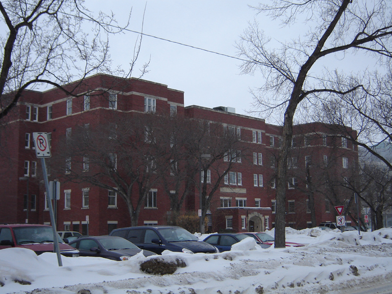
 Saskatoon City Hospital Nurses Residence
 Saskatoon City Hospital
 Saskatoon City Hospital
- Saskatoon City Hospital first opened in 1907 on 6th Avenue North. A larger hospital was soon built at Queen Street and 7th Avenue. This building was added to several times over the years, until a new hospital was erected and opened in 1993.
Transportation
- City Transit
- Bicycle Trails [24]
- groomed cross-country ski trails
- Riverside Meewasin Walking Trail system
Life
City Park Community Association provides recreation and leisure activities through the facilities available at City Park Collegiate. The outdoor rink at the Saskatchewan Indian Federated College is another facility available for community hockey and public skating activities. [25]
Location
Coordinates: 52°08′08″N 106°39′12″W / 52.135556°N 106.653333°W
North: North Park West: Central Industrial | Caswell Hill City Park East: South Saskatchewan River | U of S Management Area South: Central Business District ; CBD References
- ^ Neighbourhood Profiles
- ^ City of Saskatoon · Departments · Community Services · Community ...
- ^ About Saskatoon - sellingsaskatoon.com URL accessed February 17, 2007
- ^ City of Saskatoon · Departments · Community Services · Leisure ... URL accessed February 14, 2007]
- ^ Saskatoon Gen Web Project - Narratives of Saskatoon 1882-1912 URL accessed February 14, 2007]
- ^ Prairieland Park URL accessed February 14, 2007]
- ^ City of Saskatoon Archives - A Sporting Proposition - Virtual ... URL accessed February 14, 2007]
- ^ [1] URL accessed February 14, 2007]
- ^ Weir URL accessed February 14, 2007]
- ^ Warburton Street - the street that doesn't exist URL accessed February 14, 2007]
- ^ Search - Post Offices and Postmasters - ArchiviaNet - Library and Archives Canada URL accessed April 1, 2007
- ^ Mendel Art Gallery URL accessed February 14, 2007
- ^ Government Relations | Office of Protocol and Honours 2000 Recipient – Saskatchewan Order of Merit URL accessed February 14, 2007
- ^ City Park Collegiate | Saskatoon Public Schools URL accessed February 14, 2007]
- ^ On the Trail - April 2003
- ^ First Nations University of Canada URL accessed February 14, 2007
- ^ Campuses of the First Nations University of Canada URL accessed February 14, 2007
- ^ A View From Above A Key to Landmarks URL accessed February 14, 2007
- ^ Auntie Aggie's Visitor Lodge URL accessed February 14, 2007
- ^ [The Inn The Inn Saskatoon, Saskatchewan (Hotels and Motels)]URL accessed February 14, 2007
- ^ July, 2002 - City Park - Saskatoon's "First Gymnaseum" - 1911 URL accessed February 14, 2007
- ^ Saskatoon City Hospital URL accessed February 14, 2007y
- ^ City of Saskatoon Archives - History of Saskatoon URL accessed February 14, 2007y
- ^ Bicycle Trails submitted by Borealis at Bikely.com URL accessed by February 14, 2007
- ^ City of Saskatoon · Departments · Community Services · Community ... URL accessed February 14, 2007
- ^ Selling an Idea or a Product URL accessed January 27, 2007
External links
- Local Area Planning
- City of Saskatoon Archives - A View From Above - HST-019-05 ...
- Narratives of Saskatoon Picture of Saskatoon in 1890
- City of Saskatoon City of Saskatoon · Departments · Community Services · City Planning · ZAM Maps
- Populace Spring 2006
Categories:- Neighbourhoods in Saskatoon
- Mendel Art Gallery and Civic Conservatory founded by Frederick (Fred) Salomon Mendel and opened on October 16, 1964. The gallery hosts many permanent exhibitions, as well as galleries of art displays that tour Canada. The Civic Conservatory is an amazing indoor plantscape which changes with tender care from the Saskatoon Horticultural Society. Here you will see tropical banana trees nestled beside a fountain, and changing plants of all types of weather zones. [12]


Wikimedia Foundation. 2010.