- Oregon Route 429
-
Oregon Route 429
Route information Maintained by ODOT Length: 2.39 mi (3.85 km) Existed: 2002 – present Major junctions South end: Lava Odell Road in Crescent Lake North end:  OR 58 in Crescent Lake Junction
Highway system Oregon highways
Routes • Highways←  OR 422
OR 451  →
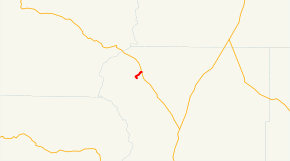
→Oregon Route 429 (OR 429) is an Oregon state highway running from OR 58 at Crescent Lake Junction to Lava Odell Road in Crescent Lake. OR 429 is known as the Crescent Lake Highway No. 429 (see Oregon highways and routes). It is 2.39 miles (3.85 km) long and runs northeast to southwest, entirely within Klamath County.
OR 429 was established in 2002 as part of Oregon's project to assign route numbers to highways that previously were not assigned, and, as of May 2007, was unsigned.
Contents
Route description
OR 429 begins at an intersection with OR 58 at Crescent Lake Junction and heads southwest to Crescent Lake, where it ends at an intersection with Lava Odell Road.
History
OR 429 was assigned to the Crescent Lake Highway in 2002.
Major intersections
Milepost City Intersection 0.00 Crescent Lake Junction OR 58 2.39 Crescent Lake End route References
- Oregon Department of Transportation, Descriptions of US and Oregon Routes, http://www.oregon.gov/ODOT/HWY/TRAFFIC/TEOS_Publications/PDF/Descriptions_of_US_and_Oregon_Routes.pdf, page 31.
- Oregon Department of Transportation, Crescent Lake Highway No. 429, ftp://ftp.odot.state.or.us/tdb/trandata/maps/slchart_pdfs_1980_to_2002/Hwy429_2000.pdf
Categories:- State routes in Oregon
- Transportation in Klamath County, Oregon


Wikimedia Foundation. 2010.