- Marin County, California
-
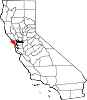
County of Marin — County — Marin County Civic Center Location in the state of California
 California's location in the United States
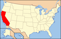
Country United States State California Region/Metro area San Francisco Bay Area Incorporated February 18, 1850 County seat San Rafael Largest city San Rafael Government – Board of Supervisors SupervisorsArea – Total 828.20 sq mi (2,145 km2) – Land 519.80 sq mi (1,346.3 km2) – Water 308.39 sq mi (798.7 km2) Population (2010) – Total 252,409 – Density 304.8/sq mi (117.7/km2) Time zone Pacific Standard Time (UTC-8) – Summer (DST) Pacific Daylight Time (UTC-7) Website www.co.marin.ca.us Marin County (
 /məˈrɪn/) is a county located in the North San Francisco Bay Area of the U.S. state of California, across the Golden Gate Bridge from San Francisco. As of 2010, the population was 252,409. The county seat is San Rafael and the largest employer is the county government. Marin County is well known for its natural beauty, liberal politics, affluence and a strong New Age reputation. In May 2009, the county had the fifth highest income per capita in the United States at $91,483.[1] The county is governed by local cities and the Marin County Board of Supervisors.
San Quentin Prison is located in the county, as is Skywalker Ranch. Autodesk, the publisher of AutoCAD, is also located there, as well as numerous other high-tech companies. The headquarters of film and media company Lucasfilm Ltd., previously based in San Rafael, have moved to the Presidio of San Francisco.
The Marin County Civic Center was designed by Frank Lloyd Wright and draws thousands of visitors a year to guided tours of its arch and atrium design.
America's oldest cross country running event, the Dipsea Race, takes place annually in Marin County, attracting thousands of athletes. Mountain biking is said to have been invented on the slopes of Mount Tamalpais in Marin.
Marin County's natural sites include Muir Woods redwood forest, the Marin Headlands, Stinson Beach, Point Reyes National Seashore, and Mount Tamalpais.
Contents
History
Marin County is one of the original 27 counties of California, created February 18, 1850, following adoption of the Constitution of 1849 and just months before the state was admitted to the Union.[2]
The origin of the county's name is not clear. One version is the county was named after Chief Marin, of the Coast Miwok, Licatiut tribe of Native Americans who inhabited that section and waged fierce battle against the early Spanish military explorers. The other version is that the bay between San Pedro Point and San Quentin Point was named Bahía de Nuestra Señora del Rosario la Marinera in 1775, and it is quite possible that Marin is simply an abbreviation of this name.[3]
The Coast Miwok Indians were hunters and gatherers whose ancestors had occupied the area for thousands of years. About 600 village sites have been identified in the county. The Coast Miwok numbered in the thousands. Today there are few left, and even fewer with any knowledge of their Coast Miwok lineage. Efforts are being made so that they are not forgotten.[4]
The English explorer and privateer, Sir Francis Drake and the crew of the Golden Hind was thought to have landed on the Marin coast in 1579 claiming the land as Nova Albion. A bronze plaque inscribed with Drake's claim to the new lands, fitting the description in Drake's own account, was discovered in 1933. This so-called Drake's Plate of Brass was revealed as a hoax in 2003.[5]
In 1595 Sebastian Cermeno lost his ship, the San Agustin, while exploring the Marin Coast. The Spanish explorer Vizcaíno landed about twenty years after Drake in what is now called Drake's Bay. However the first Spanish settlement in Marin was not established until 1817 when Mission San Rafael Arcángel was founded partly in response to the Russian-built Fort Ross to the north in what is now Sonoma County.[citation needed]
Mission San Rafael Arcángel was founded in what is now downtown San Rafael as the 20th Spanish mission in the colonial Mexican province of Alta California by four priests, Father Narciso Duran from Mission San Jose, Father Abella from Mission San Francisco de Asís, Father Gil y Taboada and Father Mariano Payeras, the President of the Missions, on December 14, 1817, four years before Mexico gained independence from Spain.[citation needed]
Geography
According to the 2000 census, the county has a total area of 828.20 square miles (2,145.0 km2), of which 519.80 square miles (1,346.3 km2) (or 62.76%) is land and 308.39 square miles (798.7 km2) (or 37.24%) is water.[6] According to the records at the County Assessor-Recorder's Office, as of June 2006, Marin had 91,065 acres (369 km2) of taxable land, consisting of 79,086 parcels with a total tax basis of $39.8 billion. These parcels are divided into the following classifications:
Parcel Type Tax ID Quantity Value Vacant 10 6,900 $508.17 million Single Family Residential 11 61,264 $30,137.02 million Mobile Home 12 210 $7.62 million House Boat 13 379 $61.83 million Multi Family Residential 14 1,316 $3,973.51 million Industrial Unimproved 40 113 $12.24 million Industrial Improved 41 562 $482.83 million Commercial Unimproved 50 431 $97.89 million Commercial Improved 51 7,911 $4,519.64 million  The view of the Golden Gate Bridge from the Marin Headlands.
Geographically, the county forms a large, southward-facing peninsula, with the Pacific Ocean to the west, San Pablo Bay and San Francisco Bay to the east, and – across the Golden Gate – the city of San Francisco to the south. Marin County's northern border is with Sonoma County.
Most of the county's population resides on the eastern side, with a string of communities running along San Francisco Bay, from Sausalito to Tiburon to Corte Madera to San Rafael. The interior contains large areas of agricultural and open space; West Marin, through which State Route 1 runs alongside the California coast, contains many small unincorporated communities whose economies depend on agriculture and tourism.
Notable features of the shoreline along the San Francisco Bay include the Sausalito shoreline, Richardson Bay, the Tiburon Peninsula including Ring Mountain and Triangle Marsh at Corte Madera. Further north lies San Quentin State Prison along the San Rafael shoreline.
Adjacent counties
- Sonoma County, California - north, northeast
- Contra Costa County, California - east
- Alameda County, California - southeast
- San Francisco County, California - south
National protected areas
- Golden Gate National Recreation Area (part)
- Marin Islands National Wildlife Refuge
- Muir Woods National Monument
- Point Reyes National Seashore
- San Pablo Bay National Wildlife Refuge (part)
- Gulf of the Farallones National Marine Sanctuary (part)
Transportation infrastructure
 Bicentennial Campground within the Golden Gate National Recreation Area surrounding the San Francisco Bay area.
Major highways
 Interstate 580
 U.S. Route 101 (Redwood Highway)
 State Route 1
 State Route 37
 State Route 131 (Tiburon Boulevard)
Scenic roads
- Conzelman Road, Marin Headlands
- Dillon Beach Road
- Bear Valley Road: connects Olema to Inverness Park
- Limantour Road: travels across central Point Reyes
- Crown Road
- Tomales Petaluma Road
- Chileno Valley Road: Connects Marshall Petaluma Road to Tomales Petaluma Road
- Marshall Petaluma Road
- Hicks Valley Road: Connects Marshall Petaluma Road to Point Reyes Petaluma Road
- Point Reyes Petaluma Road
- Novato Boulevard: Novato to Point Reyes Petaluma Road
- Sir Francis Drake Blvd: Point Reyes Lighthouse to San Quentin
- Panoramic Highway
- Bolinas Fairfax Road: Connects Sir Francis Drake Blvd to State Route 1 (also a scenic road) at Bolinas
- Bolinas Ridge Road: Connects Bolinas Fairfax Road to Panoramic Highway and Muir Woods Road
- Lucas Valley Road and Nicasio Valley Road: Connect 101 with Point Reyes Petaluma Road
- Point/North San Pedro Road: Connects Santa Venetia and Peacock Gap neighborhoods via China Camp State Park
- Bridgeway Blvd, Sausalito
- Ridgecrest Blvd: transverses the top of Mount Tamalpais
- Pierce Point Road: travels across Northern Point Reyes
- Paradise Drive: Tiburon to Corte Madera
- Camino Alto/Magnolia Avenue: connects Larkspur to Mill Valley
Public transportation
Golden Gate Transit provides service primarily along the U.S. 101 corridor, serving cities in Marin County, as well as San Francisco and Sonoma County. Service is also provided to Contra Costa County via the Richmond-San Rafael Bridge. Ferries to San Francisco operate from Larkspur and Sausalito. Ferry service from Tiburon is provided by Blue and Gold Fleet and by the Angel Island Ferry.
Local bus routes within Marin County are operated by Golden Gate Transit under contract to the Marin County Transit District. MCTD also operates the West Marin Stage, serving communities in the western, rural areas of Marin County. The Marin Airporter offers scheduled bus service to and from Marin County and the San Francisco Airport. The lines run 7 days a week, 365 days a year.
Greyhound Lines buses service San Rafael.
Airports
Marin County Airport or Gnoss Field (ICAO: KDVO) is a general aviation airport operated by the County Department of Public Works. The nearest airports with commercial flights are San Francisco International Airport and Oakland International Airport as well as Charles M. Schulz - Sonoma County Airport north of Marin County.
Education
Main article: Education in Marin CountyMarin County Free Library is the county library system. It is headquartered in San Rafael.[7] In addition the Belvedere-Tiburon Library is located in Tiburon.
Ecology
Marin county is considered in the California Floristic Province, a zone of extremely high biodiversity and endemicism. There are numerous ecosystems present, including Coastal Strand, oak woodland, mixed evergreen forest, Coast Redwood Forests chaparral and riparian zones. There are also a considerable number of protected plant and animal species present: fauna include the California Red-legged Frog (Rana aurora draytonii) and California freshwater shrimp, while flora include Marin Dwarf Flax, Hesperolinon congestum; Tiburon Jewelflower, Streptanthus niger; and Tiburon Indian paintbrush, Castilleja neglecta.All of the county's beaches were listed as the cleanest in the state in 2010.[8]
A number of watersheds exist in Marin County including Walker Creek, Lagunitas Creek, Miller Creek, and Novato Creek.
The Lagunitas Creek Watershed is home to the largest-remaining wild run of coho salmon (Oncorhynchus kisutch) in Central California. These coho are part of the "Central California Coast Evolutionarily Significant Unit," or CCC ESU, and are listed as "endangered" at both the state and federal level.
Significant efforts to protect and restore these fish have been underway in the Watershed since the 1980s. Fifty-percent of historical salmon habitat is now behind dams. Strong efforts are also being made to protect and restore undammed, headwater reaches of this Watershed in the San Geronimo Valley, where upwards of 40% of the Lagunitas salmon spawn each year and where as much as 1/3 of the juvenile salmon (or fry) spend their entire freshwater lives. The Salmon Protection and Watershed Network ([1]) leads winter tours for the public to learn about and view these spawning salmon, and also leads year-round opportunities for the public to get involved in stream restoration, monitoring spawning and smolt outmigration, juvenile fish rescue and relocation in the summer, and advocacy and policy development.
Around 490 different species of birds have been observed in Marin County. ([2])
Demographics
Historical populations Census Pop. %± 1850 323 — 1860 3,334 932.2% 1870 6,903 107.0% 1880 11,324 64.0% 1890 13,072 15.4% 1900 15,702 20.1% 1910 25,114 59.9% 1920 27,342 8.9% 1930 41,648 52.3% 1940 52,907 27.0% 1950 85,619 61.8% 1960 146,820 71.5% 1970 206,038 40.3% 1980 222,568 8.0% 1990 230,096 3.4% 2000 247,289 7.5% 2010 252,409 2.1% 2010
The 2010 United States Census reported that Marin County had a population of 252,409. The racial makeup of Marin County was 201,963 (80.0%) White, 6,987 (2.8%) African American, 1,523 (0.6%) Native American, 13,761 (5.5%) Asian, 509 (0.2%) Pacific Islander, 16,973 (6.7%) from other races, and 10,693 (4.2%) from two or more races. Hispanic or Latino of any race were 39,069 persons (15.5%).[9]
Population reported at 2010 United States Census The County Total
PopulationWhite African
AmericanNative
AmericanAsian Pacific
Islanderother
racestwo or
more racesHispanic
or Latino
(of any race)Marin County 252,409 201,963 6,987 1,523 13,761 509 16,973 10,693 39,069 Incorporated
cities and townsTotal
PopulationWhite African
AmericanNative
AmericanAsian Pacific
Islanderother
racestwo or
more racesHispanic
or Latino
(of any race)Belvedere 2,068 1,940 3 0 58 7 18 42 72 Corte Madera 9,253 7,808 87 15 625 29 262 427 772 Fairfax 7,441 6,617 110 36 204 4 174 296 504 Larkspur 11,926 10,311 186 26 563 13 343 484 918 Mill Valley 13,903 12,341 118 23 755 14 152 500 622 Novato 51,904 39,443 1,419 286 3,428 117 4,693 2,518 11,046 Ross 2,415 2,265 6 2 45 3 19 75 94 San Anselmo 12,336 11,134 106 40 437 26 164 429 717 San Rafael 57,713 40,734 1,154 709 3,513 126 8,513 2,964 17,302 Sausalito 7,061 6,400 65 16 342 10 53 175 287 Tiburon 8,962 7,899 83 16 505 8 80 371 410 Census-designated
placeTotal
PopulationWhite African
AmericanNative
AmericanAsian Pacific
Islanderother
racestwo or
more racesHispanic
or Latino
(of any race)Alto 711 619 8 2 30 1 16 35 51 Black Point-Green Point 1,306 1,185 7 6 45 0 28 35 112 Bolinas 1,620 1,406 27 10 17 14 64 82 260 Dillon Beach 283 266 0 3 4 0 0 10 9 Inverness 1,304 1,212 15 8 16 2 19 32 79 Kentfield 6,485 5,908 35 10 224 7 95 206 299 Lagunitas-Forest Knolls 1,819 1,658 26 11 11 1 43 69 133 Lucas Valley-Marinwood 6,094 5,225 68 18 424 5 117 237 444 Marin City 2,666 1,037 1,017 15 287 21 120 169 365 Muir Beach 310 283 5 1 12 0 1 8 7 Nicasio 96 94 2 0 0 0 0 0 7 Point Reyes Station 848 725 7 3 10 0 73 30 155 San Geronimo 446 421 3 2 3 0 3 14 21 Santa Venetia 4,292 3,335 88 27 306 16 350 170 815 Sleepy Hollow 2,384 2,160 14 9 113 6 11 71 69 Stinson Beach 632 582 3 8 14 1 9 15 33 Strawberry 5,393 4,325 115 18 589 16 99 231 352 Tamalpais-Homestead Valley 10,735 9,449 91 24 592 28 121 430 499 Tomales 204 193 0 3 4 0 0 4 9 Woodacre 1,348 1,231 3 4 27 4 10 69 77 Unincorporated
communitiesTotal
PopulationWhite African
AmericanNative
AmericanAsian Pacific
Islanderother
racestwo or
more racesHispanic
or Latino
(of any race)All others not CDPs (combined) 18,451 13,757 2,116 172 558 30 1,323 495 2,529 2000
As of the census[10] of 2000, there were 247,289 people, 100,650 households, and 60,691 families residing in the county. The population density was 476 people per square mile (184/km²). There were 104,990 housing units at an average density of 202 per square mile (78/km²). The racial makeup of the county was 84.03% White, 2.89% Black or African American, 0.43% Native American, 4.53% Asian, 0.16% Pacific Islander, 4.50% from other races, and 3.47% from two or more races. 11.06% of the population were Hispanic or Latino of any race.
In 2000, there were 100,650 households out of which 27.5% had children under the age of 18 living with them, 48.4% were married couples living together, 8.5% had a female householder with no husband present, and 39.7% were non-families. 29.8% of all households were made up of individuals and 9.6% had someone living alone who was 65 years of age or older. The average household size was 2.34 and the average family size was 2.90.
In the county the population was spread out with 20.3% under the age of 18, 5.5% from 18 to 24, 31.0% from 25 to 44, 29.7% from 45 to 64, and 13.5% who were 65 years of age or older. The median age was 41 years. For every 100 females there were 98.2 males. For every 100 females age 18 and over, there were 96.4 males.
Race and ethnicity
According to the 2010 United States Census, the racial composition of Marin County was as follows:
- White: 72.8% (non-Hispanic)
- Black: 2.6% (non-Hispanic)
- Native American: 0.2%
- Asian: 5.4%
- Pacific Islander: 0.2%
- Some other race: 0.4%
- Two or more races: 2.9%
- Hispanic or Latino (of any race): 15.5%
Place of birth
According to the 2006-2008 American Community Survey, 81.3% of Marin County's residents were native to the United States. Approximately 80.0% of the county's residents were born in one of the fifty states, while 1.3% were born in Puerto Rico, a U.S. territory, or born abroad to American parents.
Foreign-born individuals made up the remaining 18.7% of the population. Latin America was the most common birthplace of foreign-born residents; those born in Latin America made up the plurality (42.2%) of Marin County's foreign population. Individuals born in Europe were the second largest foreign-born group; they made up 25.3% of Marin County's foreign population. Immigrants from Asia comprised 23.7% of the county's foreign population. Those born in other parts of North America and Africa made up 3.9% and 3.8% of the foreign-born populace respectively. Lastly, residents born in Oceania made up a mere 1.2% of Marin County's foreign population.
Source:[11]
Language
According to the 2006-2008 American Community Survey, English was the most commonly spoken language at home by residents over five years of age; those who spoke only English at home made up 77.1% of Marin County's residents. Speakers of non-English languages comprised the remaining 22.9% of the population. Speakers of Spanish made up 11.7% of the county's residents, while speakers of other Indo-European languages made up 7.1% of the populace. Speakers of Asian languages and indigenous languages of the Pacific islands made up 3.4% of the population. The remaining 0.7% spoke other languages.
Source:[11]
Ancestry
According to the 2006-2008 American Community Survey, there were sixteen ancestries in Marin County that made up over 1.0% of its population. The sixteen ancestries are listed below.
- German: 15.8%
- Irish: 14.8%
- English: 13.6%
- Italian: 8.7%
- French: 4.0%
- Scottish: 3.9%
- Russian: 3.6%
- Swedish: 2.6%
- Polish: 2.4%
- Scots Irish: 2.3%
- American: 2.2%
- Norwegian: 1.9%
- Dutch: 1.5%
- Portuguese: 1.1%
- Swiss: 1.1%
- Danish: 1.1%
Source:[11]
Income
The median income for a household in the county was $71,306, and the median income for a family was $88,934. These figures had risen to $83,732 and $104,750 respectively as of 2007.[12] In May 2010, the county had the lowest unemployment rate in California.[13] According to the U.S. Bureau of Labor Statistics, in July 2010, however, Marin's unemployment rate rose to 8.3%.[14]
Government and infrastructure
San Quentin State Prison of the California Department of Corrections and Rehabilitation is located in the county. San Quentin houses the male death row and the execution chamber of California.[15]
Politics
Marin County vote
by party in presidential electionsYear GOP DEM Others 2008 20.2% 28,384 78.0% 109,320 1.8% 2,493 2004 25.4% 34,378 73.2% 99,070 1.4% 1,877 2000 28.3% 34,872 64.2% 79,135 7.4% 9,148 1996 28.2% 32,714 58.0% 67,406 13.8% 16,020 1992 23.3% 30,479 58.3% 76,158 18.4% 24,070 1988 39.7% 46,855 58.9% 69,394 1.4% 1,671 1984 49.0% 56,887 49.6% 57,533 1.4% 1,630 1980 45.8% 49,678 36.2% 39,231 18.1% 19,598 1976 52.5% 53,425 42.9% 43,590 4.6% 4,700 1972 52.1% 54,123 45.6% 47,414 2.3% 2,346 1968 50.1% 41,422 43.8% 36,278 6.1% 5,055 1964 38.1% 28,682 61.6% 46,462 0.3% 220 1960 57.3% 37,620 42.5% 27,888 0.2% 157 1956 65.9% 33,792 33.8% 17,301 0.3% 151 1952 67.1% 31,178 31.9% 14,824 1.0% 475 1948 57.1% 18,747 38.2% 12,540 4.8% 1,568 1944 47.7% 13,304 52.0% 14,516 0.3% 76 1940 48.5% 10,974 50.2% 11,365 1.3% 301 1936 33.4% 6,211 65.4% 12,152 1.1% 209 1932 38.1% 6,480 57.5% 9,764 4.4% 752 1928 57.4% 7,862 41.5% 5,686 1.0% 140 1924 53.5% 5,780 6.1% 656 40.4% 4,364 1920 68.8% 5,375 21.6% 1,688 9.6% 750 Marin is part of California's 6th congressional district, held by ninth-term Democrat Lynn Woolsey.
In the state legislature, Marin is in the 6th Assembly district, held by second-term Democrat Jared Huffman, and the 3rd Senate district, held by first-term Democrat Mark Leno.
Marin County tended to vote Republican for most of the 20th century (from 1948 to 1980, the only Democrat to win there was Lyndon Johnson in 1964). However, the county has become a stronghold of the Democratic Party in recent decades. Out of California counties, only San Francisco County and Alameda County voted more Democratic in the 2008 Presidential election, all three counties voted more heavily for Democratic Presidential candidate Barack Obama than Cook County, Ill., Obama's home county.
On Nov. 4, 2008, the citizens of Marin county voted strongly against Proposition 8, a constitutional amendment which eliminated the right of same-sex couples to marry, by a 75.1 percent to 24.9 percent margin. The official tally was 103,341 against and 34,324 in favor.[16] Only San Francisco County voted against the measure by a wider margin (75.2% against).[17]
According to the California Secretary of State, as of January 5, 2010, Marin County has 148,723 registered voters, out of 181,918 eligible (81.75%). Of those, 81,589 (54.86%) are registered Democrats, 29,088 (19.56%) are registered Republicans, 6,141 (4.13%) are registered with other political parties, and 31,905 (21.45%) have declined to state a political party.[18] Democrats hold wide voter-registration majorities in all political subdivisions in Marin County, except for the town of Belvedere, in which Democrats only hold a 54-vote (3.52%) registration advantage. Democrats' largest registration advantage in Marin is in the town of Fairfax, wherein there are only 420 Republicans (8.0%) out of 5,248 total voters compared to 3,386 Democrats (64.52%) and 1,057 voters who have declined to state a political party (20.14%) voters.
"Marin County hot-tubber"
In 2002, former U.S. President George H.W. Bush denounced convicted American Taliban associate John Walker Lindh as "some misguided Marin County hot-tubber," as a reference to the county's liberal, "hippie" political culture. Outraged by the label, some local residents wrote scathing letters to the Marin Independent Journal, complaining of Bush's remarks. In response, Bush wrote a letter to readers in the same newspaper, admitting regret and promising to not use the phrases Marin County and hot tub "in the same sentence again."[19]
Economy
As of 2011, the largest private-sector employers in Marin County were:[20]
- Kaiser Permanente (1,803 full-time employees in Marin County)
- Marin General Hospital (1,100)
- Fireman's Fund Insurance Company (950)
- Autodesk (878)
- BioMarin Pharmaceutical (871)
- Safeway Inc. (841)
- Comcast (620)
- Macy's (380)
- Bradley Real Estate (376)
- MHN (350)
- Dominican University of California (346)
- Wells Fargo (332)
- Kentfield Rehabilitation and Specialty Hospital (315)
- Community Action Marin (268)
- Costco (260)
- Brayton Purcell (256)
- CVS/pharmacy (232)
- Novato Community Hospital (227)
- Lucasfilm (220)
- Mollie Stone's Markets (190)
- Guide Dogs for the Blind (189)
- W. Bradley Electric (185)
- Bank of Marin (178)
- Cagwin & Dorward (175)
- Ghilotti Bros. (145)
- West Bay Builders (133)
- Villa Marin (130)
Media
Marin county has several media outlets that serve the local community.
- Marin Magazine, a monthly lifestyle magazine with headquarters in Sausalito.
- Marin Independent Journal, a daily newspaper with headquarters in Novato.
- Pacific Sun, a free weekly distributed throughout the county.
- Novato Advance, a weekly newspaper that serves Marin's second-largest city.
- The Point Reyes Light, a weekly newspaper.
- West Marin Citizen, a weekly newspaper.
- KWMR radio, West Marin Radio,
- Channel 26, Public-access television cable TV in Marin.
- Marin Local Music [3], Music listings for Marin's Restaurants & Venues who host live music.
- San Francisco Examiner, Rick Marianetti, Marin County Culture & Events.
Notable current and former residents
Main article: List of people from Marin County, CaliforniaCities, towns and unincorporated districts
- Belvedere
- Bolinas
- Corte Madera
- Dillon Beach
- Dogtown
- Fairfax
- Inverness
- Inverness Park
- Kentfield
- Lagunitas-Forest Knolls
- Larkspur
- Marshall
- Mill Valley
- Muir Beach
- Nicasio
- Novato
- Bel Marin Keys
- Black Point-Green Point
- Hamilton
- Ignacio
- Olema
- Point Reyes Station
- Ross
- San Anselmo
- San Geronimo
- San Rafael
- Sausalito
- Stinson Beach
- Tiburon
- Tomales
- Woodacre
Books and films
Marin County has been used as the venue for numerous films and books; in some cases these works have also incorporated scenes set in neighboring San Francisco or Sonoma County. The following are representative works produced in whole or in part in Marin County:
- Marin County lifestyles of the 1970s were spoofed in the 1977 novel The Serial: A Year in the Life of Marin County by Cyra McFadden, and in the subsequent film Serial which was based on the novel.
- The book The Body Snatchers was set in Mill Valley.
- Key scenes in the 1973 movie American Graffiti were filmed in Marin at Tamalpais High School and on 4th Street in downtown San Rafael.
- Scenes from The Godfather and The Godfather: Part II were filmed in Marin.
- Marin County's reputation as a counterculture enclave, especially the town of Bolinas and its isolationist reputation, made it a location of many key events in the 1981 novel Ecotopia Emerging by Ernest Callenbach.
- Many scenes of the 1971 film Dirty Harry and its sequels were filmed in Marin.
- The 2006 film The Beckoning was filmed in Marin, and tells of Sir Francis Drake's landing.
- The 1995 film Village of the Damned was filmed entirely in Marin.
- The 1996 film Jack was filmed almost entirely in Ross.
- The 2001 film Bandits was filmed in Marin.
- The 1997 film Gattaca was filmed at the Marin County Civic Center.
- Scenes from the 1971 film THX 1138 were filmed at the Marin County Civic Center.
- In the 1981 film Raiders of the Lost Ark, the college scenes were filmed at Dominican University of California; additionally, Indiana Jones' home exteriors was filmed in San Rafael.
- In the book Youth in Revolt: The Journals of Nick Twisp, the Twisp family resides in Oakland and Nick's father is in jail in Marin County.
- The book A Time For Dancing was set in Mill Valley, and the characters attended Tamalpais High School
- Scenes from the 1992 film Basic Instinct were filmed in Marin, particularly the car chase scene when Nick Curran (Michael Douglas), follows Catherine Trammell (Sharon Stone) from Mill Valley to Muir Beach on Highway 1.
- In the 1978 movie Foul Play Chevy Chase's character, Tony Carlson, lives on a houseboat in Sausalito.
- Short scenes in the 1995 movie Nine Months were set in Tiburon with a view of San Francisco.
- Short scenes from the 2007 film Zodiac were filmed in and around Marin County. Note: the stabbing scene at the lake was not filmed in Novato but at Lake Berryessa.
- The staging of George Grisby's shooting in The Lady From Shanghai was shot on the dock outside what is now the Gaylord Indian Restaurant in Sausalito.
- In the television series M*A*S*H, the fictional character Capt. B.J. Hunnicut (played by actor Mike Farrell) was from Mill Valley in Marin County.
- Much of the film Radio Flyer was filmed in Novato (other portions were filmed in Sonora, CA).
- The independent film The Moneytree was set in Marin County.
- Segments from the 2009 film Funny People were filmed in Marin County.
- Several scenes from the 1996 film Mother were shot in Kentfield, Larkspur, Sausalito, and other areas of Marin.
- Some scenes from the 1983 film Star Wars Episode VI: Return of the Jedi were filmed in Marin County.[21]
- In the film Terminator Salvation, Skynet's California headquarters is presumably located in Marin County.
- In 1986's Star Trek IV: The Voyage Home, Spock and Captain Kirk find their humpbacked whales in the "Cetacean Institute" supposedly situated in Sausalito. Star Trek: The Next Generation places Starfleet Academy in what is now Fort Baker, immediately south of Sausalito.
- Both in the novel and 1998 film, the main character Stella in How Stella Got Her Groove Back was from Marin County.
- Mount Tamalpais in the Marin Hills serves as the home of the Greek Titans in the Rick Riordan series Percy Jackson & the Olympians.
- The Ted Knight Show, a retooled continuation of Too Close for Comfort in which the characters Henry and Muriel Rush and Monroe Ficus move to Marin County from San Francisco.
- Touching Home directed in 2008 by Marin County twin brothers, Noah and Logan Miller.
- Parts of Kim Stanley Robinson's 2002 novel The Years of Rice and Salt take place in an alternate Marin County colonized by Ming-dynasty China.
- Parts of the recent film, Rise of the Planet of the Apes take place in Marin County and Muir Woods.
See also
- Hiking trails in Marin County
- List of California counties
- List of school districts in Marin County, California
- List of people from Marin County, California
- Golden Gate Transit
- Gnoss Field
- Marin Municipal Water District
- Mount Tamalpais State Park
- Moon Over Marin, a Dead Kennedys song about pollution in Marin County
- National Register of Historic Places listings in Marin County, California
Notes
- ^ "N.J. has four of nation's 20 highest-income counties". Associated Press. May 20, 2009. http://www.nj.com/news/index.ssf/2009/05/nj_has_four_of_nations_20_high.html. Retrieved 8 August 2010.
- ^ California's Legislature, "APPENDIX M, Origin and Meaning of the Names of the Counties of California With County Seats and Dates Counties Were Created," p. 302. Spring 2006, Accessed March 26, 2007
- ^ Gudde, Erwin G. (1949). California Place Names: A Geographical Dictionary, p. 204. Berkeley and Los Angeles: University of California Press; Paperback edition (2004). ISBN 0520243173.
- ^ Thomas, Robert C., Drake at Olompali
- ^ Chen, Allan, Drake's Plate: the end of the mystery?," Science Beat, Berkeley Lab, April 4, 2003
- ^ "Census 2000 U.S. Gazetteer Files: Counties". United States Census. http://www.census.gov/tiger/tms/gazetteer/county2k.txt. Retrieved 2011-02-13.
- ^ "Contact Us." Marin County Free Library. Retrieved on May 4, 2009.
- ^ Bay Area beaches grade well for safe swimming, May 27, 2010 by Carolyn Jones, San Francisco Chronicle
- ^ "2010 Census P.L. 94-171 Summary File Data". United States Census Bureau. http://www2.census.gov/census_2010/01-Redistricting_File--PL_94-171/California/.
- ^ "American FactFinder". United States Census Bureau. http://factfinder.census.gov. Retrieved 2008-01-31.
- ^ a b c American FactFinder
- ^ United States Census Bureau. 2005-2007 American Community Survey 3-Year Estimates. Data Profile Highlights
- ^ Bernstein-Wax, Jessica (June 18, 3020). "Marin regains title of lowest jobless rate in state". Marin Independent Journal. http://www.marinij.com/ci_15326659. Retrieved 19 June 2010.
- ^ 2010 Marin County Unemployment Rate. U.S. Bureau of Labor Statistics.
- ^ "San Quentin State Prison." California Department of Corrections and Rehabilitation. Retrieved on September 12, 2010.
- ^ County of Marin. Registrar of Voters. November 4, 2008 General Election Results
- ^ San Francisco Department of Elections. Election Summary: November 4, 2008.
- ^ CA Secretary of State – Report of Registration – January 5, 2010
- ^ Campbell, Duncan (July 16, 2002). "From hot tub to hot water". The Guardian (London). http://www.guardian.co.uk/world/2002/jul/16/worlddispatch.usa. Retrieved May 12, 2010.
- ^ "Private-sector employers - Marin County". North Bay Business Journal. 2011. http://lists.northbaybusinessjournal.com/index.htm?djoPage=view_html&djoPid=4493.
- ^ "Filming locations for Star Wars: Episode VI - Return of the Jedi" IMDb.
External links
- County of Marin official website
- Marin County – Untold Stories
- Marin County Free Library
- Information and resources for families in Marin
- Marin Fraternal Organizations
- Marin County community profiles at the Marin Independent Journal
- Marin County Arts
- Marin County Fire Department
- Marin County Sheriff's Search & Rescue

Sonoma County Sonoma County Pacific Ocean 
San Francisco Bay  Marin County, California

San Francisco County Contra Costa County/Alameda County Municipalities and communities of Marin County, California Cities and towns Belvedere | Corte Madera | Fairfax | Larkspur | Mill Valley | Novato | Ross | San Anselmo | San Rafael | Sausalito | Tiburon
CDPs Alto | Black Point-Green Point | Bolinas | Dillon Beach | Inverness | Kentfield | Lagunitas-Forest Knolls | Lucas Valley-Marinwood | Marin City | Muir Beach | Nicasio | Point Reyes Station | San Geronimo | Santa Venetia | Sleepy Hollow | Stinson Beach | Strawberry | Tamalpais-Homestead Valley | Tomales | Woodacre
Unincorporated
communitiesAlmonte | Bel Marin Keys | Belvedere Island | Bivalve | Black Point | Blakes Landing | Burdell | California Park | Cerro | Chapman | Cypress Grove | Dewitt | Dogtown | El Campo | Fallon | Five Brooks | Forest Knolls | Gallinas | Greenbrae | Hamlet | Harbor Point | Homestead Valley | Ignacio | Inverness Park | Jewell | Kent Woodlands | Lagunitas | Lairds Landing | Las Gallinas | Los Ranchitos | Lucas Valley | Manzanita | Marconi | Marinwood | Marshall | McDonald | McNears Beach | Meadowsweet | Millerton | Murray Park | Nicks Cove | Ocean Roar | Old Town | Olema | Paradise Cay | Reed | Reynolds | Sacramento Landing | Saint Vincent | San Antonio | San Quentin | Seahaven | Shafter | Strawberry Manor | Tamalpais Valley | Tamalpais Valley Junction | Tocaloma | Vincent Landing | Waldo
Ghost towns  State of California
Topics - Climate
- Delegations
- Deserts
- Districts
- Ecology
- Elections
- Environment
- Geography
- Government
- History
- Protected areas
- Sports
- Symbols
- Transportation
- Visitor attractions
- Index of California-related articles
Society Regions - Antelope Valley
- Big Sur
- Cascade Range
- Central California
- Central Coast
- Central Valley
- Channel Islands
- Coachella Valley
- Conejo Valley
- Cucamonga Valley
- Death Valley
- East Bay (SF)
- East County (SD)
- Eastern California
- Emerald Triangle
- Gold Country
- Great Basin
- Greater Los Angeles
- Greater Sacramento
- Inland Empire
- Lake Tahoe
- Los Angeles Basin
- Lost Coast
- Metropolitan Fresno
- Mojave
- Mountain Empire
- North Bay (SF)
- North Coast
- North County (SD)
- Northern California
- Owens Valley
- Oxnard Plain
- San Francisco Peninsula
- Pomona Valley
- Sacramento Valley
- San Bernardino Valley
- San Diego–Tijuana
- San Fernando Valley
- San Francisco Bay Area
- San Gabriel Valley
- San Joaquin Valley
- Santa Clara Valley
- Santa Clara River Valley
- Santa Clarita Valley
- Shasta Cascade
- Sierra Nevada
- Silicon Valley
- South Bay (LA)
- South Bay (SF)
- South Bay (SD)
- South Coast
- Southern California
- Southern Border Region
- Tri-Valley
- Upstate California
- Victor Valley
- Wine Country
- Yosemite
Metro areas - Bakersfield
- Chico
- El Centro
- Fresno
- Hanford–Corcoran
- Los Angeles–Long Beach–Glendale
- Madera
- Modesto
- Merced
- Napa
- Oakland–Fremont–Hayward
- Oxnard–Thousand Oaks–Ventura
- Redding
- Riverside–San Bernardino–Ontario
- Sacramento–Arden Arcade–Roseville
- Salinas
- San Diego–Carlsbad–San Marcos
- San Francisco–San Mateo–Redwood City
- San Jose–Sunnyvale–Santa Clara
- San Luis Obispo–Paso Robles
- Santa Ana–Anaheim–Irvine
- Santa Barbara–Santa Maria–Goleta
- Santa Cruz–Watsonville
- Santa Rosa–Petaluma
- Stockton
- Vallejo–Fairfield
- Visalia–Porterville
- Yuba City
Micro areas Counties - Alameda
- Alpine
- Amador
- Butte
- Calaveras
- Colusa
- Contra Costa
- Del Norte
- El Dorado
- Fresno
- Glenn
- Humboldt
- Imperial
- Inyo
- Kern
- Kings
- Lake
- Lassen
- Los Angeles
- Madera
- Marin
- Mariposa
- Mendocino
- Merced
- Modoc
- Mono
- Monterey
- Napa
- Nevada
- Orange
- Placer
- Plumas
- Riverside
- Sacramento
- San Benito
- San Bernardino
- San Diego
- San Francisco
- San Joaquin
- San Luis Obispo
- San Mateo
- Santa Barbara
- Santa Clara
- Santa Cruz
- Shasta
- Sierra
- Siskiyou
- Solano
- Sonoma
- Stanislaus
- Sutter
- Tehama
- Trinity
- Tulare
- Tuolumne
- Ventura
- Yolo
- Yuba
Categories:- California counties
- Counties in the San Francisco Bay Area
- Marin County, California


Wikimedia Foundation. 2010.