- Laurel Fork (Cheat River)
Geobox|River
name = Laurel Fork
image_size =
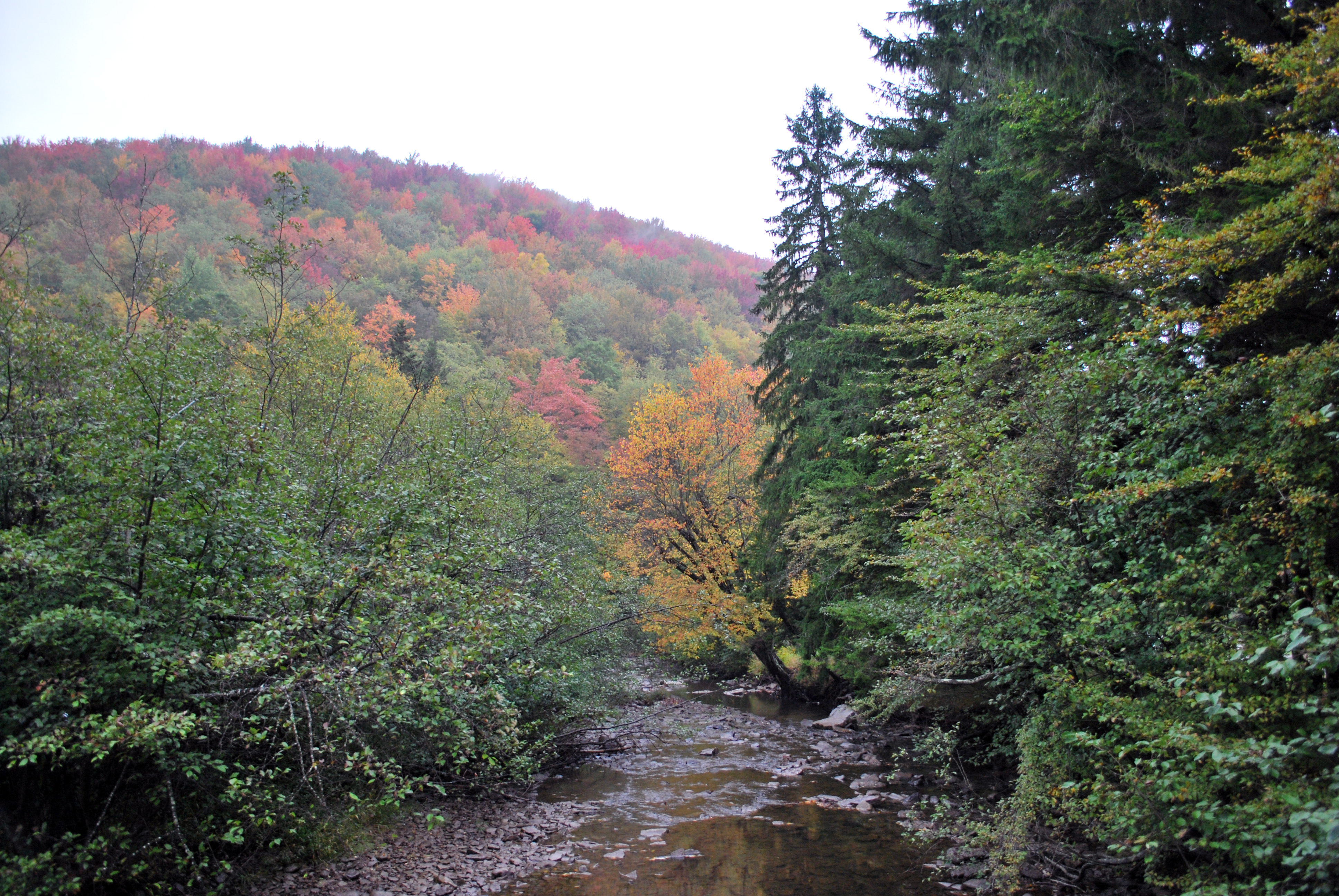
image_caption = Laurel Fork at Laurel Fork Recreation Area
image_first =
country = United States
country_
state_
state = West Virginia
region_type = County
region = Randolph
length =
length_imperial = 35
length_note = approximatelycite book |last= Davidson |first= Paul |coauthors= Ward Eister, Dirk Davidson, Charlie Walbridge |title= Wildwater West Virginia |edition= 4th ed. |publisher= Menasha Ridge Press |location= Birmingham, Ala. |year= 1995 |isbn= 0-89732-156-1 |pages=p.82-84]DeLorme (1997). "West Virginia Atlas & Gazetteer". Yarmouth, Maine: DeLorme. pp. 37-38, 47. ISBN 0-89933-246-3.]
watershed =
watershed_imperial = 60
watershed_note =cite web |url= http://www.dep.state.wv.us/watershed/ |pages = [http://www.dep.state.wv.us/watershed/w5020004.html Cheat River] | title= Watershed Atlas Project | author= West Virginia Department of Environmental Protection | accessdate=2007-02-02]
discharge_location =
discharge_average =
discharge_average_imperial =
discharge_max =
discharge_max_imperial =
discharge_min =
discharge_min_imperial =
discharge1_location =
discharge1_average =
discharge1_average_imperial =
source_name =
source_location =
source_location_note =
source_region =
source_country =
source_country1 =
source_lat_d = 38
source_lat_m = 39
source_lat_s = 55
source_lat_NS = N
source_long_d = 79
source_long_m = 40
source_long_s = 52
source_long_EW = W
source_coordinates_note =cite web |url=Gnis3|1551712 |title=Geographic Names Information System entry for Laurel Fork (Feature ID #1551712)|accessdate=2007-02-02]
source_elevation =
source_elevation_imperial =
source_elevation_note =
source_length =
source_length_imperial =
source1_name =
source_meet =
mouth_name = Dry Fork
mouth_location = Randolph County, northwest of Harman
mouth_location_note =
mouth_country =
mouth_region =
mouth_country1 =
mouth_elevation =
mouth_elevation_imperial = 2047
mouth_elevation_note =
mouth_lat_d = 38
mouth_lat_m = 58
mouth_lat_s = 57
mouth_lat_NS = N
mouth_long_d = 79
mouth_long_m = 32
mouth_long_s = 43
mouth_long_EW = W
mouth_coordinates_note =
tributary_left =
tributary_left1 =
tributary_right =
tributary_right1 =
map_size =
map_caption =
map_first =Laurel Fork is a
river , approximately 35 miles (56 km) long, in easternWest Virginia , USA. It is atributary of the Dry Fork; via the Dry Fork, the Black Fork, and the Cheat, Monongahela and Ohio Rivers, it is part of the watershed of theMississippi River , draining an area of 60 square miles (155 km²) in theAllegheny Mountains . With the Dry Fork, theGlady Fork , theShavers Fork and the Blackwater River, it is considered to be one of the five principal headwaters tributaries of the Cheat River. [Julian, Norman. 2006. "Cheat River." "The West Virginia Encyclopedia". Ken Sullivan, editor. Charleston, WV: West Virginia Humanities Council. ISBN 0-9778498-0-5.]Geography
The Laurel Fork flows for its entire length in eastern Randolph County. It rises on a divide on the Randolph-Pocahontas county border separating the watershed of the Cheat River from that of the Greenbrier, and flows north-northeastwardly in a
meander ing course between Middle Mountain and Rich Mountain, through theMonongahela National Forest , to its mouth at the Dry Fork just south of the Tucker County border, approximately four miles (6 km) northwest of Harman. The lowermost seven miles (11 km) of the river are characterized by continuous Class 3 rapids.Two adjacent wilderness areas of the Monongahela National Forest (separated only by a road), the north and south units of the
Laurel Fork Wilderness , are located along the river. These areas of the watershed were logged of all virgin timber by 1921, by a company known as the Laurel River Lumber Company, which also constructed a railroad along the river. [cite web|url=http://www.fs.fed.us/r9/mnf/sp/laurel_forks_wildernesses.htm |title=Laurel Fork North and South Wildernesses |author=Monongahela National Forest |authorlink=Monongahela National Forest |accessdate=2007-02-02] According to the West Virginia Department of Environmental Protection, nearly 87% of the Laurel Fork watershed isforest ed, primarilydeciduous .ee also
*
List of West Virginia rivers References


Wikimedia Foundation. 2010.