- List of county routes in Monmouth County, New Jersey
-
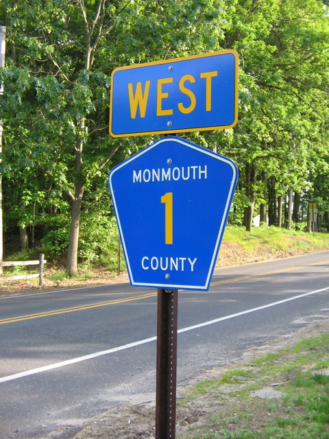
 Normal Monmouth County Road signage. This is depicting County Route 1 going westbound
The following is a list of county routes in Monmouth County in the U.S. state of New Jersey. For more information on the county route system in New Jersey as a whole, including its history, see County routes in New Jersey. In the 1937 renumbering of Monmouth County roads, numbers 1 through 5 were reserved for the longer, "cross-county" routes; those numbered 6 and above were to be more local in nature. County Route 1 was designated to run from the Mercer County line via Freehold and Eatontown to the Long Branch city limits. With the establishment of the 500 Series of county routes, CR 1 was superseded by CR 524 from the Mercer County line to Smithburg, and CR 537 from Smithburg to the Long Branch boundary. The present CR 1 was formed when part of County Route 3 was separated from the balance of CR 3 with the 1952 establishment of CR 527 as part of the 500 Series routes. Since the CR 1 designation was available, that portion of CR 3 between CR 527 and CR 571 was re-designated as County Route 1.[1]
Contents
500-series county routes
In addition to those listed below, the following 500-series county routes serve Monmouth County:
- CR 516, CR 516 Spur, CR 520, CR 522, CR 524, CR 524 Alt, CR 524 Spur, CR 526, CR 526 Spur, CR 527, CR 527 Alt, CR 537, CR 539, CR 547, CR 549, CR 571
County routes in Monmouth County
Italicized routes are decommissioned
Route Length[2] South/West end North/East end Road name(s) Existence 
County Route 1 6.54 miles (10.53 km) CR 571 in Elys Corner CR 527/Alt CR 527 in Carrs Corner Perrineville Road, Sweetman's Lane 
County Route 2 2.07 miles (3.33 km) Oxford Way in Neptune City Ocean Avenue (CR 18) in Bradley Beach Oxford Avenue, 6th Avenue, Brinley Avenue 
County Route 3 13.21 miles (21.26 km) Millhurst Road (CR 527) in Manalapan Township NJ 35 in Keyport Main Street, Tennent Road, Morganville Road, Lloyd Road 
County Route 3A 1.20 miles (1.93 km) Baird Road in Millstone Township NJ 33 in Millstone Township Conover Road 
County Route 4 (section 1) 3.08 miles (4.96 km) NJ 79 in Marlboro Township CR 4 (section 2) in Colts Neck Township Vanderburg Road, Crine Road County Route 4 (section 2) 9.26 miles (14.90 km) end of county maintenance in Colts Neck Township First Street (CR 6) in Keyport Conover Road, South Street, South Holmdel Road, Holmdel Road, Keyport-Holmdel Road, Main Street, Broad Street 
County Route 4A 2.10 miles (3.38 km) CR 520 in Marlboro Township NJ 79 in Marlboro Township Conover Road 
County Route 5 1.36 miles (0.97 km) W. Sylvania Avenue (NJ 35) in Neptune City Neptune Township/Wall Township border Steiner Avenue, Atkins Avenue 
County Route 6 (section 1) 1.18 miles (1.90 km) NJ 35 in Aberdeen Township CR 4 in Keyport Amboy Avenue, West Front Street, Front Street County Route 6 (section 2) 0.36 miles (0.58 km) CR 516 in Keyport CR 6 (section 1) in Keyport Broadway County Route 6 (section 3) 0.91 miles (1.46 km) CR 6 (section 4) in Keyport NJ 36 in Union Beach Stone Road County Route 6 (section 4) 1.11 miles (1.79 km) CR 4 in Keyport CR 39 in Union Beach First Street, Broadway 
County Route 6A (section 1) 1.43 miles (2.30 km) Middlesex County border in Aberdeen Township NJ 35 in Aberdeen Township Cliffwood Avenue County Route 6A (section 2) 1.61 miles (2.59 km) CR 6A (section 1) in Matawan Main Street (CR 516 Spur) in Matawan Cross Road, Ravine Drive 
County Route 7 (section 1) 2.81 miles (4.52 km) NJ 35 in Holmdel Township NJ 36 in Hazlet Township Palmer Avenue, Main Street, Church Street, Munroe Avenue County Route 7 (section 2) 0.61 miles (0.98 km) CR 7(section 1) in Keansburg Atlantic Avenue in Keansburg Port Monmouth Road 
County Route 8 4.22 miles (6.79 km) NJ 36 in Atlantic Highlands NJ 36 in Highlands 1st Avenue, Ocean Boulevard, Linden Avenue, Bay Avenue 
County Route 8A 3.55 miles (5.71 km) Rumson Road (CR 520) in Rumson NJ 36 in Atlantic Highlands Bingham Avenue, Oceanic Bridge Road, Locust Point Road, Locust Avenue, Valley Drive East 
County Route 8B 1.02 miles (1.64 km) Valley Drive (CR 8A) in Middletown Township NJ 36 in Middletown Township Navesink Avenue 
County Route 9 5.27 miles (8.48 km) Monmouth Beach - Long Branch border Sea Bright - Middletown Township border at Sandy Hook Ocean Avenue 
County Route 10 5.21 miles (8.38 km) Hubbard Avenue (CR 12) in Middletown Township Ridge Road (CR 34) in Rumson West Front Street, East Front Street, River Road, West River Road, East River Road 
County Route 11 (section 1) 0.47 miles (1.34 km) CR 520 in Red Bank Harding Road (CR 34) in Red Bank Broad Street County Route 11 (section 2) 2.82 miles (4.54 km) Port-Au-Peck Avenue in Oceanport Madison Avenue in Little Silver Oceanport Avenue, Branch Avenue County Route 11 (section 3) 1.09 miles (1.75 km) Broadway (CR 537) in West Long Branch Port-Au-Peck Avenue in Oceanport Oceanport Avenue 
County Route 12 4.19 miles (6.74 km) Red Hill Road (CR 52) in Middletown Township W. Front Street (CR 10) in Middletown Township Dwight Road, Nut Swamp Road, Hubbard Avenue 
County Route 12A 4.40 miles (7.08 km) Hubbard Road (CR 12) in Middletown Township Locust Point Road (CR 8A) in Middletown Township Navesink River Road 
County Route 13 3.06 miles (4.92 km) NJ 35 in Tinton Falls NJ 35 in Red Bank Shrewsbury Avenue, Rector Place 
County Route 13A 3.76 miles (6.05 km) Tinton Avenue (CR 537) in Tinton Falls Branch Avenue (CR 11) in Little Silver Sycamore Avenue 
County Route 13B (section 1) 1.09 miles (1.75 km) Branch Avenue (CR 11) in Little Silver Rumson Road (CR 520) in Little Silver Willow Drive, Prospect Avenue County Route 13B (section 2) 0.28 miles (0.45 km) Prospect Avenue (CR 13B section 1) in Little Silver Rumson Road (CR 520) in Little Silver Church Street 
County Route 14 3.2 miles (5.15 km) Green Grove Road in Ocean Twp. CR 15 in Ocean Twp. West Park Avenue 
County Route 15 5.19 miles (8.35 km) Deal Lake Drive (NJ 71) in Asbury Park Broadway (CR 537) in West Long Branch Main Street, Grassmere Avenue, Westra Street, Monmouth Road, Locust Avenue 
County Route 16 6.22 miles (10.01 km) Naval Weapons Station Earle in Colts Neck Township Main Street (NJ 71) in Asbury Park Asbury Avenue 
County Route 17 (section 1) 1.73 miles (2.78 km)[3] NJ 33 in Neptune Township NJ 33 in Neptune Township Old Corles Avenue 1937-present[1] County Route 17 (section 2) 3.51 miles (5.65 km)[4] CR 17 (section 1) in Neptune Township Neptune Township/Asbury Park border West Bangs Avenue 1937-present[1] County Route 17 (section 3) 1.39 miles (2.24 km)[5] Brighton Avenue in Neptune City NJ 35 in Neptune City West Sylvania Avenue 1937-present[1] County Route 17 (section 4) 0.38 miles (0.61 km)[6] South Riverside Drive in Neptune Township CR 17 (section 3) in Neptune City East End Avenue 1937-present[1] County Route 17 (section 5) 0.40 miles (0.64 km)[7] CR 17 (section 3) in Neptune City CR 2 in Neptune Township Neptune Avenue 1937-present[1] County Route 17 (section 6) 0.64 miles (1.03 km)[8] NJ 71 in Avon-by-the-Sea Ocean Avenue (CR 18) in Avon-by-the-Sea Sylvania Avenue 1937-present[1] 
County Route 18 (section 1) 8.65 miles (13.92 km) Main Street (CR 524) in Howell Township CR 18 (section 3) in Belmar Belmar Boulevard, 16th Avenue 1903-present[1] County Route 18 (section 2) 0.45 miles (0.72 km) NJ 34 in Wall Township CR 18 (section 1) in Wall Township Megill Road 1903-present[1] County Route 18 (section 3) 5.63 miles (9.06 km) CR 49 in Spring Lake Main Street (NJ 71) in Bradley Beach Brown Avenue, Ocean Avenue, Lake Terrace Drive 1903-present[1] 
County Route 20 3.08 miles (4.96 km) Holly Hill Drive in Wall Township 7th Avenue (NJ 71) in Sea Girt Old Bridge Road, South Street, Broad Street, North Broad Street, 8th Avenue 
County Route 21 8.08 miles (13.00 km) Squankum-Yellowbrook Road (Alt CR 524) in Howell Township Atlantic Avenue (CR 524) in Wall Township Southard Avenue, Manassa Road, Old Tavern Road, Allenwood Road, Squankum Road, Allenwood-Lakewood Road 
County Route 22 1.18 miles (1.90 km) Main Street (CR 527) in Englishtown Conmack Lane in Manapalan Township Gordon's Corner Road 
County Route 23 3.97 miles (6.39 km) The Ocean County border in Freehold Township Elton-Adelphia Road (CR 524) in Freehold Township Jackson Mills Road 
County Route 24 0.62 miles (1.00 km) Swan Lake Park Road in Freehold Township W. Main Street (CR 537) in Freehold Borough Manalapan Avenue 
County Route 25 (section 1) 0.99 miles (1.59 km) NJ 71 in West Long Branch Ocean Avenue (CR 57) in Long Branch Cedar Avenue County Route 25 (section 2) 1.26 miles (2.03 km) CR 25 (section 1) in Long Branch Broadway (CR 537) in Long Branch Norwood Avenue 
County Route 27 (section 1) 4.67 miles (7.52 km) CR 537 in Upper Freehold Township Meirs Road in Upper Freehold Township Holmes Mill Road, Burlington Path Road County Route 27 (section 2) 1.53 miles (2.46 km) CR 27 (section 1) in Upper Freehold Township CR 539 in Upper Freehold Township Arneytown-Hornerstown Road County Route 27 (section 3) 0.41 miles (0.66 km) CR 27 (section 2) in Upper Freehold Township CR 537 in Upper Freehold Township Main Street 
County Route 28 0.79 miles (1.27 km) The Mercer County border in Upper Freehold Township Allentown-Yardville Road (CR 524) in Allentown Old York Road 
County Route 29 2.69 miles (4.33 km) Monmouth Boulevard (CR 33) in Oceanport Ocean Avenue in Long Branch Shrewsbury Avenue, Branchport Avenue, Atlantic Avenue 
County Route 29A 0.60 miles (0.97 km) Port-au-Peck Avenue in Oceanport Monmouth Avenue (CR 33) in Oceanport Myrtle Avenue 
County Route 30 (section 1) 1.25 miles (2.01 km) Atlantic Avenue (CR 524) in Wall Township NJ 34 in Wall Township West 18th Avenue County Route 30 (section 2) 4.60 miles (7.40 km) Allenwood Road Wall Township 8th Avenue (NJ 71) in Belmar 18th Avenue, Main Street 
County Route 31 0.88 miles (1.42 km) Wickapecko Drive in Interlaken Railroad crossing in Allenhurst Corlies Avenue 
County Route 32 3.01 miles (4.84 km) NJ 35/36 in Eatontown Norwood Avenue (CR 25) in Long Branch Wall Street 
County Route 33 3.34 miles (5.38 km) Rumson Road (CR 520) in Little Silver Atlantic Avenue (CR 29) in Long Branch Port-Au-Peck Avenue, Monmouth Boulevard, Seven Bridges Road 
County Route 34 4.54 miles (7.31 km) Broad Street (CR 11) in Red Bank Rumson Road (CR 520) in Rumson Harding Road, Ridge Road, Avenue of Two Rivers 
County Route 35 1.80 miles (2.90 km) W. Main Street (CR 524) in Farmingdale NJ 33 in Howell Township North Main Street, Colts Neck Road 
County Route 36 0.82 miles (1.32 km) NJ 36 in Middletown Township Weehawken Avenue in Middletown Township Thompson Avenue, Ocean Avenue 
County Route 37 1.10 miles (1.77 km) CR 25 in Long Branch Ocean Avenue in Long Branch Brighton Avenue 
County Route 38 3.54 miles (5.70 km) Green Grove Road in Tinton Falls Tinton Avenue (CR 537) in Tinton Falls Wayside Road 1992-present[1] 
County Route 39 2.20 miles (3.54 km) Stone Road (CR 6) in Union Beach NJ 36 in Union Beach Florence Avenue, Front Street, Union Avenue 
County Route 40 0.70 miles (1.13 km) NJ 35 in Ocean Township Wickapecko Drive in Ocean Township Sunset Avenue 
County Route 40A[orphan 1] 2.11 miles (3.40 km)[9] NJ 35 in Avon-by-the-Sea Munroe Avenue in Asbury Park Memorial Drive 
County Route 42 1.05 miles (1.69 km) NJ 35 in Keyport Green Grove Avenue in Keyport Maple Place 
County Route 43 (section 1) 1.66 miles (2.67 km)[10] CR 526 in Upper Freehold Township CR 524 in Upper Freehold Township Imlaystown - Hightstown Road County Route 43 (section 2) 0.14 miles (0.23 km)[11] CR 539 in Upper Freehold Township end of county maintenance in Upper Freehold Township Davis Station Road 
County Route 44 1.35 miles (2.17 km) Branchport Avenue in Long Branch Ocean Avenue in Long Branch Joline Avenue 
County Route 45 0.13 miles (0.21 km) Gravelly Brook in Aberdeen Township Henry Hudson Trail in Aberdeen Township Church Street 
County Route 46 4.98 miles (8.01 km) Broadway (NJ 79) in Freehold Borough Crine Road (CR 4) in Colts Neck Township Dutch Lane Road 
County Route 47 1.01 miles (1.63 km) Allaire Road (CR 524) in Wall Township NJ 71 in Spring Lake Heights Warren Avenue 
County Route 48 1.67 miles (2.69 km) NJ 70 in Brielle Higgins Avenue in Brielle Riverview Drive 
County Route 49 1.54 miles (2.48 km) 6th Avenue (CR 20) in Manasquan Brown Avenue (CR 18) in Spring Lake Sea Girt Avenue, Washington Boulevard, The Crescent, 1st Avenue 
County Route 50 8.19 miles (13.18 km) Colts Neck Road (CR 537) in Colts Neck Township Cherry Tree Farm Road (CR 516) in Middletown Township Swimming River Road, Middletown-Lincroft Road, Church Street, King's Highway, New Monmouth Road 
County Route 51 4.45 miles (7.16 km) Wykoff Road (CR 547) in Tinton Falls Newman Springs Road (CR 520) in Tinton Falls Hope Road, Hance Avenue 
County Route 52 5.25 miles (8.45 km) Newman Springs Road (CR 520) in Middletown Township NJ 35 in Holmdel Township Crawfords Corner-Everett Road, Red Hill Road, Van Shoick Road, South Laurel Avenue 
County Route 53 1.03 miles (1.66 km) Turkey Swamp Park entrance in Freehold Township Jackson Mills Road (CR 23) in Freehold Township Georgia Road 
County Route 54 3.82 miles (6.15 km) NJ 34 in Colts Neck Township Newman Springs Road (CR 520) in Middletown Township Phalanx Road 
County Route 55 3.5 miles (5.6 km) Willowbrook Road in Freehold Township Broadway (NJ 79) in Freehold Township Halls Mill Road, Kozloski Road 
County Route 56 0.96 miles (1.54 km) Church Street (CR 7) in Keansburg Beachway Avenue in Keansburg Carr Avenue 
County Route 57 2.21 miles (3.56 km) Cedar Avenue (CR 25) in Long Branch Joline Avenue (NJ 36) in Long Branch Ocean Avenue, Ocean Boulevard See also
 U.S. Roads portal
 New Jersey portal
Footnotes
- ^ Route 40A is considered an orphan route after County Route 40 was decommissioned in 2004.
References
- ^ a b c d e f g h i j k County Roads Straight Line Diagrams, Prepared by the Monmouth County Planning Board, April 10, 2006.
- ^ http://www.state.nj.us/transportation/refdata/sldiag/Monmouth.pdf
- ^ County Route 17 (section 1) straight line diagram from New Jersey Department of Transportation
- ^ County Route 17 (section 2) straight line diagram from New Jersey Department of Transportation
- ^ County Route 17 (section 3) straight line diagram from New Jersey Department of Transportation
- ^ County Route 17 (section 4) straight line diagram from New Jersey Department of Transportation
- ^ County Route 17 (section 5) straight line diagram from New Jersey Department of Transportation
- ^ County Route 17 (section 6) straight line diagram from New Jersey Department of Transportation
- ^ County Route 40A straight line diagram from New Jersey Department of Transportation
- ^ County Route 43 (section 2) straight line diagram from New Jersey Department of Transportation
- ^ County Route 43 (section 1) straight line diagram from New Jersey Department of Transportation
- The Monmouth County Scenic Roadway Plan, Monmouth County Planning Board, September 17, 2001
Categories:- County routes in New Jersey
- Lists of roads in the United States
- New Jersey-related lists

Wikimedia Foundation. 2010.