- U.S. Route 15 in Maryland
-
This article is about the section of U.S. Route 15 in Maryland. For the entire length of the highway, see U.S. Route 15.
U.S. Route 15

Map of west central Maryland showing major roads with US 15 in redRoute information Maintained by MDSHA Length: 37.85 mi[2] (60.91 km) Existed: 1927[1] – present Major junctions South end:  US 15 in Point of Rocks
 MD 28 in Point of Rocks
 MD 464 in Point of Rocks
 US 340 near Jefferson
 I-70 in Frederick
 US 40 in Frederick
 MD 26 in Frederick
 MD 77 in Thurmont
 MD 550 in Thurmont
 MD 76 near Emmitsburg
 MD 140 in Emmitsburg
North end: US 15 near EmmitsburgLocation Counties: Frederick Highway system United States Numbered Highways
List • Bannered • Divided • ReplacedMaryland highway system
Interstate • US • State • Minor • Former • Turnpikes←  MD 14
MD 14MD 16  →
→U.S. Route 15 (US 15) is a part of the U.S. Highway System that runs from Walterboro, South Carolina to Painted Post, New York. In Maryland, the highway runs 37.85 miles (60.91 km) from the Virginia state line at the Potomac River in Point of Rocks north to the Pennsylvania state line near Emmitsburg. US 15 is the primary north–south highway of Frederick County. The highway connects the county seat of Frederick with Point of Rocks and Leesburg to the south and with Thurmont, Emmitsburg, and Gettysburg to the north. US 15 is a four-lane divided highway throughout the state except for the portion between the Point of Rocks Bridge and the highway's junction with US 340 near Jefferson. The U.S. Highway is a freeway along its concurrency with US 340 and through Frederick, where the highway meets US 40 and Interstate 70 (I-70).
US 15 is the descendent of a pair of turnpikes that connected Frederick with Emmitsburg to the north and Buckeystown to the south. These turnpikes were reconstructed as state roads in the 1910s north of Frederick and in the early 1920s from Frederick south to Tuscarora. When US 15 was assigned in 1927, the Tuscarora – Point of Rocks highway had yet to be improved; this section was paved in the early 1930s. The modern Point of Rocks Bridge was built in the late 1930s after its predecessor was destroyed in a flood. The Frederick Freeway was constructed in the 1950s. US 15 was relocated to part of the freeway; the old route of the U.S. Highway through downtown Frederick became part of Maryland Route 355 (MD 355). US 15's present highway between Point of Rocks and Jefferson was constructed in the late 1960s; the old road south of Frederick was replaced with MD 28 and MD 85. North of Frederick, the U.S. Highway bypassed Thurmont and Emmitsburg in the late 1950s and mid-1960s, respectively. US 15 was upgraded to a divided highway north of Frederick in the early 1980s.
Contents
Route description
US 15 has several official designations throughout its course in Maryland. The U.S. Highway is known as Catoctin Mountain Highway from the Virginia state line at Point of Rocks north to US 340 near Jefferson and from MD 26 in Frederick north to the Pennsylvania state line near Emmitsburg. US 15 is also part of Jefferson National Pike along its freeway concurrency with US 340 and the Frederick Freeway between US 340 and MD 26.[2] In July 2004, the Maryland General Assembly designated the highway the 115th Infantry Regiment Memorial Highway; a marker honoring the 115th Infantry Regiment was completed in the median of US 15 in Emmitsburg in July 2006.[3] All of US 15 except the portion between Catoctin Furnace and Thurmont is part of the Catoctin Mountain Scenic Byway, which was designated a National Scenic Byway in September 2005.[4][5] The entire length of the highway in Maryland is part of the National Highway System.[6]
Point of Rocks to Frederick
US 15 enters Maryland at Point of Rocks, named for the pair of mountain peaks between which the Potomac River cuts through Catoctin Mountain, Pine Rock in Maryland and Furnace Mountain in Loudoun County, Virginia. The highway crosses the river on the Point of Rocks Bridge, a two-lane, eight-span camelback truss bridge that also passes over the Chesapeake and Ohio Canal and CSX's Metropolitan Subdivision on the Maryland side of the river. Just north of the bridge, US 15 meets the western terminus of MD 28 (Clay Street), which serves as the main street of the community of Point of Rocks. The U.S. Highway heads north as a two-lane controlled-access road that passes through a mix of farmland and forest on the eastern flank of Catoctin Mountain. North of its roundabout at MD 464 (Point of Rocks Road), US 15 has only two intersections, with Basford Road and Mountville Road, before passing under Elmer Derr Road and reaching a partial interchange with US 340 (Jefferson National Pike) east of Jefferson. There is no direct access from northbound US 15 to westbound US 340 or from eastbound US 340 to southbound US 15.[2][7]
 Riverside view from the Maryland side of the Point of Rocks Bridge, which carries US 15 across the Potomac River at Point of Rocks
US 15 and US 340 run concurrently northeast toward Frederick as a four-lane freeway. The two highways have a diamond interchange with Mt. Zion Road and cross over Ballenger Creek. On the southwest side of Frederick, the freeway has a partial interchange with I-70 (Eisenhower Memorial Highway), a folded diamond interchange with MD 180 (Jefferson Pike), and a partial cloverleaf interchange with the Frederick Freeway, which carries US 40 through the interchange. US 340's eastern terminus is within the third interchange, where US 15 exits north onto the Frederick Freeway and Jefferson Street continues east toward downtown Frederick.[2][7]
US 15 continues north concurrent with US 40 along the six-lane Frederick Freeway. US 40 exits the freeway at a partial cloverleaf interchange with Patrick Street, which heads east toward downtown Frederick and west through the heavily commercialized Golden Mile. US 15 crosses Carroll Creek and continues north with four lanes through folded diamond interchanges with Rosemont Avenue, 7th Street, and Motter Avenue. All three streets provide access to Fort Detrick, home of the United States Army Medical Research Institute of Infectious Diseases. In addition, Rosemont Avenue leads to Hood College and Motter Avenue connects the freeway with Frederick Community College. The Frederick Freeway ends at US 15's partial interchange with MD 26 (Liberty Road).[2][7]
Frederick to Emmitsburg
US 15 continues north as a four-lane controlled-access expressway that has directional crossover intersections with Hayward Road and Monocacy Boulevard before leaving the city of Frederick by crossing Tuscarora Creek. The highway parallels the Monocacy River and has a junction with Biggs Ford Road on its way north to the hamlet of Hansonville, where the U.S. Highway intersects Old Frederick Road. US 15 crosses Fishing Creek to the west of Lewistown and is closely paralleled on the west by Auburn Road as the highway gradually approaches the eastern flank of Catoctin Mountain. At the northern end of Auburn Road, MD 806 (Catoctin Furnace Road) begins to parallel the northbound side of the U.S. Highway, which follows the eastern boundary of Cunningham Falls State Park just west of the village of Catoctin Furnace. Access to the main section of the state park is provided by Catoctin Hollow Road, which intersects the southbound lanes of US 15 and follows Little Hunting Creek up the mountain. The park's Manor Area is accessible from US 15 a short distance north of Catoctin Hollow Road.[2][7]
North of its intersection with Blue Mountain Road and Pryor Road, US 15 leaves the park boundary and enters the town of Thurmont. The U.S. Highway has a diamond interchange with unnamed and unsigned MD 15C that leads to the northern end of MD 806 and to Frederick Road, which serves a commercial area south of downtown Thurmont. US 15 continues north to a folded diamond interchange with MD 77 (Main Street) where the highway also crosses Hunting Creek; MD 77 follows the creek up the mountain as Foxville Road toward Catoctin Mountain Park. The highway intersects Sandy Spring Lane (unsigned MD 15D) and crosses over the Maryland Midland Railroad. US 15 leaves the town of Thurmont and meets MD 550 (Church Street) at a diamond interchange before crossing Owens Creek, which MD 550 follows up the mountain as Sabillasville Road. The U.S. Highway heads northeast through farmland and meets the northern end of MD 76 (Motters Station Road) before bisecting the campus of Mount St. Mary's University. The main part of the campus and National Shrine Grotto of Our Lady of Lourdes are located to the west of the highway; the athletic complex, which includes Knott Arena, is to the east.[2][7]
North of Mount St. Mary's University, US 15 meets the southern end of unsigned US 15 Business (Seton Avenue) at a directional crossover intersection that also serves Old Frederick Road; U-turn ramps on either side of the intersection provide the missing movements. The U.S. Highway crosses Toms Creek and Flat Run along the eastern side of the town of Emmitsburg before its interchange with MD 140 (Main Street). MD 140 is accessed via a pair of right-in/right-out interchanges with Emmit Gardens Drive, which is unsigned MD 904H on the northbound side of US 15 and MD 904F on the southbound side. North of MD 140, the southbound direction of US 15 has a welcome center, the Mason and Dixon Discovery Center.[8] US 15's last intersection in Maryland is with the northern end of US 15 Business (Seton Avenue) and Welty Road, which leads to Old Gettysburg Road. North of the intersection, US 15 becomes a freeway that continues across the Pennsylvania state line as the U.S. highway's bypass of Gettysburg.[2][7]
History
When the U.S. Highway System was laid out in 1926, US 15 did not enter Maryland. US 240 followed US 15's current corridor from Frederick north to near Harrisburg. No U.S. Highway connected Frederick and Leesburg via Point of Rocks.[9] By the end of 1927, US 240 was reduced to a Washington–Frederick highway and US 15 connected Point of Rocks and Emmitsburg via Frederick as it does today.[1]
Original construction and early improvements
US 15 was established partially along what had been a pair of turnpikes. The Frederick and Emmitsburg Turnpike connected Emmitsburg with Worman's Mill, which was located at the northern end of Market Street at MD 26 on the north side of Frederick. The Frederick and Buckeystown Turnpike ran from its co-terminus with the Frederick and Monocacy Turnpike at Evergreen Point at what is today the junction of MD 85 and MD 355, south to 1 mile (1.6 km) south of Buckeystown.[10] When the Maryland State Roads Commission (MDSRC) designated highways to be improved as part of a state road system in 1909, the Frederick–Emmitsburg highway was included in the new system. MDSRC originally planned to build the state road north from the city of Frederick along the Frederick and Opossumtown Turnpike, then turn east along Hayward Road to meet the Frederick and Emmitsburg Turnpike at Harmony Grove.[11]
MDSRC purchased the Frederick and Emmitsburg Turnpike from its operating company in 1911.[12] The first section of the turnpike to be rebuilt as a modern road was between Tuscarora Creek north of Frederick and just north of Sundays Lane near Hansonville in 1911.[13] The old turnpike was resurfaced as a 14-foot-wide (4.3 m) macadam road from Lewistown to Thurmont in 1914 and from Harmony Grove to Lewistown in 1915. The Gettysburg Road from Emmitsburg to the Pennsylvania state line was also paved in 1915.[14] The gaps between Thurmont and Emmitsburg and between the city of Frederick and Harmony Grove were resurfaced between 1915 and 1919; the Frederick – Harmony Grove road followed the turnpike right-of-way north from Worman's Mill rather than the 1910 planned route via Opossumtown Pike.[15][16]
The right-of-way of the Frederick and Buckeystown Turnpike was resurfaced with macadam by 1921.[16] The remainder of Buckeystown Pike was paved as a 15-foot-wide (4.6 m) concrete road from south of Buckeystown to around Lily Pons Road in 1918 and 1919 and south of Lily Pons Road to just north of the modern MD 28 junction in Tuscarora by 1921.[15][16] The concrete highway was extended south through the MD 28 junction to modern MD 28's junction with Nolands Ferry Road by 1923. That same year, Emmitsburg Pike was paved through Thurmont.[17] In 1926, MDSRC assumed maintenance of and resurfaced Market Street with asphalt from the city of Frederick between the south city limit at New Design Road (now Stadium Drive) to the north city limit at 9th Street. The commission also replaced Buckeystown Pike's covered bridge at Ballenger Creek with the modern concrete arch bridge that year.[18] US 15 was widened to a width of 20 feet (6.1 m) from Frederick to the Pennsylvania state line around 1930.[19] The highway from Tuscarora to Point of Rocks was constructed as a concrete road in three stages starting in 1929, when the paved highway was extended west from Nolands Ferry Road to west of New Design Road.[19][20] The second section of the new highway was started in 1930.[19] The third segment was finished in 1933, which completed the paving of US 15 in Maryland.[21][22] Around 1938, the U.S. Highway was resurfaced with asphalt from Emmitsburg to the Pennsylvania state line and from the south end of Frederick to Evergreen Point; in addition, a grade separation was constructed with the Western Maryland Railway in Thurmont.[23]
Point of Rocks Bridge
Several ferries crossed the Potomac River at Point of Rocks before the first bridge was constructed there in 1852. This wooden bridge was constructed to carry a double-track narrow gauge railroad from a junction with the Baltimore and Ohio Railroad to a blast furnace to process the area's iron ore.[24] This bridge, which also carried wagons and horses, was destroyed on June 9, 1861 by Confederate forces under General Turner Ashby, the same day the bridge at Brunswick was destroyed.[24][25] The second bridge at Point of Rocks was an iron bridge constructed in 1889.[26] US 15 originally followed Commerce Street and Canal Road, which is now used to access the Chesapeake and Ohio Canal National Historical Park, through an at-grade crossing of the B&O Railroad to the Maryland end of the bridge, which crossed the river immediately to the east of the modern bridge.[27] The 1889 iron bridge was swept away in the March 1936 flood that also destroyed the Potomac River crossings at Harpers Ferry, Shepherdstown, and Hancock.[28]
In November 1936, MDSRC put together a plan to replace the Potomac River bridges at Hancock, Shepherdstown, and Point of Rocks.[29] The Point of Rocks Bridge became the first of the three crossings to be started when construction began March 25, 1937; the bridge's concrete piers were completed and the piers of the old bridge were removed from the river by September of that year.[30] The new bridge and its approaches, which crossed over the B&O Railroad on the Maryland side, opened December 26, 1937.[31] The camelback truss bridge spans 1,689 feet (515 m) and has a 24-foot-wide (7.3 m) roadway and a pair of 3-foot-wide (0.91 m) sidewalks. US 15 followed a temporary approach to the new bridge along Commerce Street that remained vulnerable to major floods.[23] The U.S. Highway was moved to higher ground on Clay Street when the highway was reconstructed and widened from Point of Rocks to Tuscarora in 1949.[32]
Relocation through Frederick
The first relocation of US 15 north of Frederick occurred at Tuscarora Creek between 1950 and 1952.[33] Construction on Washington National Pike, which is now I-270, began in 1950.[32] The highway's cloverleaf interchange with US 15, which would serve as the freeway's northern terminus for several years, was built in 1952 and 1953. The adjacent portion of US 15 from Evergreen Point south to Lime Kiln was relocated, reconstructed, and widened in 1951 and 1952.[33][34] In 1954, US 240 was moved to Washington National Pike; the old alignment became US 240 Alternate and then MD 355 in 1956.[35][36] The section of freeway from US 15 to the Frederick Freeway was built between 1954 and 1956 concurrent with the first section of the Frederick Freeway.[34][37] The original interchange between the Frederick Freeway and Washington National Pike included two ramps between the north–south and east–west portions of the Frederick Freeway.[37]
The first section of the Frederick Freeway opened from US 40 (now MD 144) east of Frederick to a temporary half-cloverleaf interchange with Patrick Street in 1956; this section featured a cloverleaf interchange with US 340.[36] The remainder of the Frederick Freeway from Patrick Street to MD 26 was placed under construction in 1956.[37][38] The highway was constructed as a two-lane freeway from just south of its interchange with Rosemont Avenue to its northern end near Hayward Road, where the freeway tied into existing US 15 at Harmony Grove. The freeway north of Patrick Street featured interchanges with Rosemont Avenue, Motter Avenue, and a westward extension of MD 26. When the Frederick Freeway opened in 1959, US 15 was moved to Washington National Pike north of Buckeystown Pike and north through Frederick along the Frederick Freeway.[39] Market Street north of Evergreen Point through downtown Frederick to US 15 north of the city became a northward extension of MD 355; the section of Buckeystown Pike from the freeway to Evergreen Point became a section of MD 806.[39][40]
In 1960, US 15 from the MD 26 interchange to Harmony Grove was expanded to a divided highway.[41] The Frederick Freeway gained exit numbers in 1965, the same year the highway's interchange with 7th Street was added.[42] The exit numbers ranged from 1 at the freeway's interchange with MD 144 east of Frederick to 9 at the highway's interchange with MD 26; the 7th Street interchange became exit 7A.[43] The two-lane section of the freeway was expanded to its present four-lane configuration in 1969, the same year the US 340 freeway was completed between Jefferson and Frederick.[44] US 15's present alignment from Point of Rocks to US 340 was also under construction by 1969.[44] When the new highway opened in 1970, US 15 was moved to the new highway and joined US 340 in a concurrency along Jefferson National Pike from Jefferson to the Frederick Freeway. The old section of US 15 from Point of Rocks to Tuscarora became a westward extension of MD 28.[45] Buckeystown Pike from MD 28 to Washington National Pike was designated MD 85, which was extended north to MD 355 the following year.[45][46] The U.S. Highway's interchange with Mt. Zion Road opened in 1972.[47]
Bypasses and expansion north of Frederick
US 15 was widened from downtown Thurmont north to Owens Creek starting in 1953. That same year, the highway was relocated as the first carriageway of an ultimate divided highway from Owens Creek to just south of the intersection of US 15 with St. Anthony and Orndorff roads south of Mount St. Mary's University.[34] In 1956, construction began on the Thurmont Bypass, which was constructed as the first carriageway of an ultimate divided highway from south of Catoctin Furnace to just south of Owens Creek.[37] The bypass, which included an interchange with MD 77, was completed in 1958.[37][48] The MD 77 interchange originally consisted of one two-way ramp in the northeast quadrant of the junction.[49] The old alignment of US 15 through Catoctin Furnace and Thurmont was designated MD 806 by 1960.[41] US 15's interchange with MD 550 was built in 1972.[47]
Several other sections of US 15 were bypassed in the 1960s. The highway bypassed Lewistown in 1962, leaving behind its old alignment of Hessong Bridge Road and Angleberger Road, which became a section of MD 806.[50] Construction on the U.S. Highway's bypass of Emmitsburg began in 1963.[51] The following year, the portion of US 15 from the northern end of the bypass to the Pennsylvania state line opened contemporaneously with US 15's bypass of Gettysburg.[40] The Emmitsburg bypass was completed in 1965; the old road through the town was designated US 15 Business by 1967.[52] MD 140's overpass of US 15 was constructed in 1971; the old alignment of MD 140 was used for interchange ramps between the two highways.[53]
US 15 was expanded to a divided highway north of Frederick between 1972 and 1985.[54] The U.S. Highway was expanded to four lanes from MD 355 at Harmony Grove to Angleberger Road in Lewistown in 1973.[55] Four-laning of US 15 continued in 1981 when the highway was expanded from the intersection with St. Anthony and Orndorff roads south of Mount St. Mary's University to just south of the Pennsylvania state line near Emmitsburg.[56] This section of divided highway was extended south through the MD 550 interchange in 1983.[57] As part of this project, the oblique intersection with MD 806 on the north side of Thurmont was removed. MD 806 was moved onto Albert Staub Road, which was extended north over a new crossing of Owens Creek to its present terminus at Roddy Creek Road, where local traffic could access US 15 at a perpendicular intersection.[49][58][59] The two-lane highway between Lewistown and MD 550 was expanded to a four-lane divided highway in 1985.[60] The MD 77 interchange was completed with the construction of the southbound US 15 ramps in the southwest quadrant of the junction.[61] A third interchange was added on the south side of Thurmont as a connector between US 15 and MD 806 in 1985 as well.[62] US 15's expansion to a four-lane divided highway north of Frederick was completed in 1989 when the piece of highway at the Pennsylvania state line was expanded to four lanes contemporaneous with the four-laning of the Gettysburg bypass.[63]
Recent and future projects
US 15 in Frederick is a subject of the I-270/US 15 Multi-Modal Corridor Study, which encompasses the corridor of the two highways from I-270's interchange with Shady Grove Road in Montgomery County to north of US 15's intersection with Biggs Ford Road north of Frederick. The study was started by the Maryland State Highway Administration (MDSHA) and Maryland Transportation Authority in the mid-1990s to examine upgrades to the highway and transit infrastructure within the corridor.[64] As part of another long-term project initiated by the I-70 Corridor Planning Study, Jefferson National Pike's interchange with I-70, which was constructed with two ramps in 1969, received two ramps from eastbound I-70 in 1997; that same year, access from northbound US 15 and US 340 to westbound I-70 was added at the Frederick Freeway interchange.[44][65][66] Exit numbers on US 15's portions of Jefferson National Pike and the Frederick Freeway were changed to their present numbers in 2002.[67] The interchange between Jefferson National Pike and the Frederick Freeway was transformed from a cloverleaf to a partial cloverleaf interchange in 2004.[68] Access between US 15 and the northern end of MD 355, then named Wormans Mill Road, was removed in 2006, the same year a ramp was added from westbound MD 26 to northbound US 15.[69] The roundabout at the US 15–MD 464 intersection in Point of Rocks was built in 2009.[2]
There are two upcoming construction projects involving US 15 in Frederick. MDSHA plans to replace Motter Avenue's bridge over US 15 because the concrete deck of the present bridge is deteriorating and the four-lane width of the bridge is insufficient for the traffic it carries. The new bridge will have four through traffic lanes and a continuous left turn lane. The replacement bridge will also be long enough to accommodate future widening of US 15. Engineering and right-of-way acquisition are underway; construction is expected to begin in spring 2012 and last three years. The new bridge will be built in two sections: one half of the bridge will be constructed immediately to the north of the present bridge, traffic will be moved to the half-bridge and the old bridge removed, and the other half of the new bridge will be constructed in place of the removed bridge.[70]
In 2011, MDSHA completed a study to examine constructing an interchange at Monocacy Boulevard on the north side of Frederick to replace the present directional crossover intersection. Design work is underway on a diamond interchange with the municipal highway, which serves as a circumferential arterial in the northeastern part of the city. Monocacy Boulevard will be extended west to north–south Thomas Johnson Drive and meet the eastern end of Christophers Crossing, which is a circumferential boulevard throughout northwestern Frederick. As part of this project, US 15's intersection with Hayward Road will be removed, resulting in the northern end of US 15's freeway section being extended from MD 26 to Tuscarora Creek.[71]
Junction list
The entire route is in Frederick County.
Location Mile
[2]Exit Destinations Notes Point of Rocks 0.00 US 15 south (James Monroe Highway) – LeesburgSouthern terminus of US 15 in Maryland; Virginia state line at Potomac River 0.37 MD 28 east (Clay Street) – Tuscarora1.40 MD 464 (Point of Rocks Road) – BrunswickRoundabout Jefferson 7.22 US 340 west (Jefferson National Pike) – Charles TownPartial interchange; no direct access from northbound US 15 to westbound US 340 or from eastbound US 340 to southbound US 15; south end of concurrency with US 340 8.84 Mt. Zion Road Diamond interchange Frederick 11.30 10  I-70 east (Eisenhower Memorial Highway) to I-270 south – Baltimore, Washington
I-70 Exit 52; no exit southbound 11.54 11 
 MD 180 (Jefferson Pike) to MD 351 (Ballenger Creek Pike)
11.93 12 I-70 west (Eisenhower Memorial Highway) / US 40 east (Frederick Freeway) / Jefferson Street east – HagerstownPartial cloverleaf interchange; split into exits 12A (I-70) and 12B (US 15 / US 40) northbound; no exit number southbound; northern terminus of US 340; south end of concurrency with US 40 12.63 13 US 40 west (Patrick Street) / Patrick Street eastNorth end of concurrency with US 40 13.40 14 Rosemont Avenue 13.91 15 7th Street 14.60 16 Motter Avenue 15.14 17  MD 26 (Liberty Road) to MD 194 – Libertytown, Walkersville
No access from southbound US 15 to eastbound MD 26 18.02 Biggs Ford Road east – Walkersville Directional crossover intersection; unsigned US 15A Catoctin Furnace 24.64  MD 806 north (Catoctin Furnace Road) / Auburn Road south
26.96 Blue Mountain Road east / Pryor Road west Blue Mountain Road is unsigned US 15G Thurmont 27.83 To MD 806 (Catoctin Furnace Road) / Frederick Road – ThurmontDiamond interchange; crossroad is unnamed and unsigned MD 15C 28.60 MD 77 (Main Street) – Thurmont, FoxvilleFolded diamond interchange 29.42 MD 550 (Church Street) – Thurmont, SabillasvilleEmmitsburg 33.53 MD 76 south (Motters Station Road) / St. Anthony Road north – Rocky Ridge35.02 US 15 Bus. north (Seton Avenue) / Old Frederick Road south Directional crossover intersection; US 15 Business is unsigned 36.60 MD 140 (Main Street) – Emmitsburg, TaneytownAccess to MD 140 provided via right-in/right-out interchanges with Emmit Gardens Drive, which is unsigned MD 904H (northbound) and MD 904F (southbound) 37.38 US 15 Bus. south (Seton Avenue) / Welty Road east No direct access from northbound US 15 Business to northbound US 15 37.85 US 15 north – GettysburgNorthern terminus of US 15 in Maryland; Pennsylvania state line 1.000 mi = 1.609 km; 1.000 km = 0.621 mi Related routes
Emmitsburg business route
Main article: U.S. Route 15 Business (Emmitsburg, Maryland)U.S. Route 15 Business (US 15 Business) is an unsigned business route of US 15 in Maryland. The highway runs 2.34 miles (3.77 km) between intersections with US 15 within Emmitsburg.[2] US 15 Business serves the St. Joseph's College and Mother Seton Shrine campuses, which are home to several emergency management institutions and a shrine dedicated to Elizabeth Ann Seton, the first person born in the United States to be canonized by the Roman Catholic Church. US 15 Business was assigned in the mid-1960s after US 15 bypassed Emmitsburg.
Auxiliary routes
US 15 has five unsigned auxiliary routes. Two of them have a Maryland state route number designation.
- US 15A is the designation for the 0.04-mile (0.064 km) section of Biggs Ford Road immediately east of its intersection with US 15 north of Frederick.[2][72]
- US 15B is the designation for the 0.19-mile (0.31 km) section of Jefferson Street from the center of US 15's bridge over the Frederick Freeway to just west of Jefferson Street's intersection with Pearl Street in the city of Frederick. The western terminus of US 15B is also the eastern terminus of US 340.[2][73]
- MD 15C is the designation for the unnamed 0.12-mile (0.19 km) roadway within US 15's diamond interchange on the southern edge of Thurmont. The roadway continues as Tippin Drive to the west of the interchange and Thurmont Boulevard to the east. Thurmont Boulevard ends at Frederick Road, which becomes MD 806 just to the south at the town limit of Thurmont.[2][74]
- MD 15D is the designation for the 0.04-mile (0.064 km) section of Sandy Spring Lane immediately north of its intersection with US 15 in Thurmont.[2][75]
- US 15G is the designation for the 0.14-mile (0.23 km) section of Blue Mountain Road between US 15 and MD 806 south of Thurmont.[2][76]
References
- ^ a b Maryland Geological Survey. Map of Maryland: Showing State Road System and State Aid Roads (Map) (1927 ed.). Section A13–14, B13, C13, D12–13.
- ^ a b c d e f g h i j k l m n o p "Highway Location Reference: Frederick County" (PDF). Maryland State Highway Administration. 2009. pp. 12–13, 95–110. http://www.marylandroads.com/Location/2009_FREDERICK.pdf. Retrieved 2011-04-04.
- ^ Gallucci, Gina (2006-07-16). "Highway dedicated to 115th". The Frederick News–Post (Frederick, MD: Randall Family, LLC). http://www.fredericknewspost.com/sections/archives/display_detail.htm?StoryID=121690. Retrieved 2011-04-09.
- ^ "Maryland Byways" (PDF). Maryland State Highway Administration. http://www.marylandroads.com/oed/MarylandScenicByways.pdf. Retrieved 2011-04-09.
- ^ Guynn, Susan (2005-11-20). "The road much-traveled has gone by many names, and recently, the federal Department of Transportation added another moniker to U.S. 15, designating it a National Scenic Byway". The Frederick News–Post (Frederick, MD: Randall Family, LLC). http://www.fredericknewspost.com/sections/archives/display_detail.htm?StoryID=53585. Retrieved 2011-04-09.
- ^ Federal Highway Administration (August 2003) (PDF). National Highway System: Maryland (Map). http://www.fhwa.dot.gov/planning/nhs/maps/md/md_Maryland.pdf. Retrieved 2011-04-07.
- ^ a b c d e f Google, Inc. Google Maps – U.S. Route 15 in Maryland (Map). Cartography by Google, Inc. http://maps.google.com/maps?f=d&source=s_d&saddr=US-15+N&daddr=US-15+N&hl=en&geocode=FRI_VwId1Ltg-w%3BFaATXgId5mRk-w&mra=ls&sll=39.715902,-77.304311&sspn=0.014888,0.038581&ie=UTF8&t=h&z=10. Retrieved 2011-04-04.
- ^ Wilson, Ike (2006-05-17). "Mason and Dixon Center Opens". The Frederick News–Post (Frederick, MD: Randall Family, LLC). http://www.fredericknewspost.com/sections/archives/display_detail.htm?StoryID=57834. Retrieved 2011-04-09.
- ^ Bureau of Public Roads (1926). United States System of Highways (Map). http://en.wikipedia.org/wiki/File:1926us.jpg. Retrieved 2011-04-11.
- ^ Clark, William Bullock (1899). Report on the Highways of Maryland. Baltimore: Maryland Geological Survey. p. 232. http://books.google.com/books?id=b9l9AAAAIAAJ&printsec=frontcover#v=onepage&q&f=false. Retrieved 2011-04-11.
- ^ Maryland Geological Survey. Map of Maryland (Map) (1910 ed.). Section A13–14, B13, C13.
- ^ Report of the State Roads Commission of Maryland (1908–1911 ed.). Baltimore: Maryland State Roads Commission. 1912-05. p. 34. http://www.archive.org/details/annualreportsofs1908mary. Retrieved 2011-04-11.
- ^ Maryland Geological Survey. Map of Maryland: Showing State Road System and State Aid Roads Completed or Under Construction December 31, 1911 (Map) (1911 ed.). Section B13, C13.
- ^ Report of the State Roads Commission of Maryland (1912–1915 ed.). Baltimore: Maryland State Roads Commission. 1915-05. pp. 50, 110. http://www.archive.org/details/annualreportsofs1912mary. Retrieved 2011-04-11.
- ^ a b Report of the State Roads Commission of Maryland (1916–1919 ed.). Baltimore: Maryland State Roads Commission. 1920-01. p. 22. http://www.archive.org/details/annualreportsofs1916mary. Retrieved 2011-04-11.
- ^ a b c Maryland Geological Survey. Map of Maryland: Showing State Road System and State Aid Roads (Map) (1921 ed.). Section C13, D13.
- ^ Maryland Geological Survey. Map of Maryland: Showing State Road System and State Aid Roads (Map) (1923 ed.). Section C13, D13.
- ^ Report of the State Roads Commission of Maryland (1924–1926 ed.). Baltimore: Maryland State Roads Commission. 1927-01. p. 48. http://www.archive.org/details/annualreportsofs1924mary. Retrieved 2011-04-11.
- ^ a b c Report of the State Roads Commission of Maryland (1927–1930 ed.). Baltimore: Maryland State Roads Commission. 1930-10-01. pp. 83, 210. http://www.archive.org/details/reportofstateroa1927mary. Retrieved 2011-04-11.
- ^ Maryland Geological Survey. Map of Maryland Showing State Road System: State Aid Roads and Improved County Road Connections (Map) (1930 ed.). Section D13.
- ^ Report of the State Roads Commission of Maryland (1931–1934 ed.). Baltimore: Maryland State Roads Commission. 1934-12-28. p. 334. http://www.archive.org/details/reportofstateroa1931mary. Retrieved 2011-04-11.
- ^ Maryland Geological Survey. Map of Maryland Showing State Road System: State Aid Roads and Improved County Road Connections (Map) (1933 ed.). Section D12–D13.
- ^ a b Report of the State Roads Commission of Maryland (1937–1938 ed.). Baltimore: Maryland State Roads Commission. 1939-03-04. pp. 77, 87, 123–124. http://www.archive.org/details/reportofstateroa1937mary. Retrieved 2011-04-11.
- ^ a b Scheel, Eugene (2005-10-02). "When Iron Was Hot in Loudoun". The Washington Post (Washington, DC: The Washington Post Company): p. T04.
- ^ Barger, Raymond Granville; Cooper, H. Austin (January/February 1991). "A Chronological History of Berlin-Brunswick, Maryland 1934-1990" (PDF). Brunswick Citizen (Brunswick, MD: Citizen Communications): p. 4. http://www.brunswickmd.gov/files/Forms/BrunswickHistory.pdf. Retrieved 2011-04-11.
- ^ "In and Around Baltimore". The Baltimore Sun (Baltimore: Tribune Company): p. 1. 1889-05-11.
- ^ United States Geological Survey. Antietam, MD quadrangle (Map). 1:48,000. 15 Minute Series (Topographic) (1910 ed.). http://historical.mytopo.com/quad.cfm?quadname=Antietam&state=MD&series=15. Retrieved 2011-04-11.
- ^ "Point of Rocks Bridge Washed from Moorings". The Baltimore Sun (Baltimore: Tribune Company): p. 8. 1936-03-20.
- ^ "Agree Upon Rebuilding 3 Potomac River Spans". The Baltimore Sun (Baltimore: Tribune Company): p. 4. 1936-11-19.
- ^ "Progress Being Made on Maryland Bridge". Farmers Advocate (Charles Town, WV: Jefferson Publishing Company): p. 1. 1937-07-09. http://news.google.com/newspapers?id=ILQkAAAAIBAJ&sjid=7Q0GAAAAIBAJ&pg=3538,1380991&dq=point-of-rocks-bridge+potomac&hl=en. Retrieved 2011-04-11.
- ^ "Two National Pike Contracts Placed". The Baltimore Sun (Baltimore: Tribune Company): p. 9. 1937-12-29.
- ^ a b Report of the State Roads Commission of Maryland (1949–1950 ed.). Baltimore: Maryland State Roads Commission. 1950-12-20. pp. 173, 177. http://www.archive.org/details/reportofstateroa1949mary. Retrieved 2011-04-11.
- ^ a b Report of the State Roads Commission of Maryland (1951–1952 ed.). Baltimore: Maryland State Roads Commission. 1952-12-15. pp. 191, 195. http://www.archive.org/details/reportofstateroa1951mary. Retrieved 2011-04-11.
- ^ a b c Report of the State Roads Commission of Maryland (1953–1954 ed.). Baltimore: Maryland State Roads Commission. 1954-11-12. pp. 216, 219, 222. http://www.archive.org/details/reportofstateroa1953mary. Retrieved 2011-04-11.
- ^ Maryland State Roads Commission. Maryland: Official Highway Map (Map) (1954 ed.).
- ^ a b Maryland State Roads Commission. Maryland: Official Highway Map (Map) (1956 ed.).
- ^ a b c d e Report of the State Roads Commission of Maryland (1955–1956 ed.). Baltimore: Maryland State Roads Commission. 1956-11-02. pp. 202–203, 205. http://www.archive.org/details/reportofstateroa1955mary. Retrieved 2011-04-11.
- ^ Report of the State Roads Commission of Maryland (1957–1958 ed.). Baltimore: Maryland State Roads Commission. 1958-12-15. p. 91. http://www.archive.org/details/reportofstateroa1957mary. Retrieved 2011-04-11.
- ^ a b Maryland State Roads Commission. Maryland: Official Highway Map (Map) (1959 ed.). Section Frederick inset.
- ^ a b Maryland State Roads Commission. Maryland: Official Highway Map (Map) (1964 ed.).
- ^ a b Maryland State Roads Commission. Maryland: Official Highway Map (Map) (1960 ed.).
- ^ Maryland State Roads Commission. Maryland: Official Highway Map (Map) (1965 ed.). Section Frederick inset.
- ^ Maryland State Roads Commission. Maryland: Official Highway Map (Map) (1966 ed.). Section Frederick inset.
- ^ a b c Maryland State Roads Commission. Maryland: Official Highway Map (Map) (1969 ed.). Section C13, D12–D13, Frederick inset.
- ^ a b Maryland State Roads Commission. Maryland: Official Highway Map (Map) (1970 ed.). Section C13, D12–D13.
- ^ Maryland State Roads Commission. Maryland: Official Highway Map (Map) (1971 ed.). Section Frederick inset.
- ^ a b Maryland State Highway Administration. Maryland: Official Highway Map (Map) (1972 ed.). Section C13, A13.
- ^ Maryland State Roads Commission. Maryland: Official Highway Map (Map) (1958 ed.).
- ^ a b United States Geological Survey (1981-07-01). Thurmont, Maryland, United States (Map). Topo Map. http://msrmaps.com/image.aspx?T=2&S=12&Z=18&X=366&Y=5487&W=2. Retrieved 2011-04-12.
- ^ Maryland State Roads Commission. Maryland: Official Highway Map (Map) (1962 ed.).
- ^ Maryland State Roads Commission. Maryland: Official Highway Map (Map) (1963 ed.).
- ^ Maryland State Roads Commission. Maryland: Official Highway Map (Map) (1967 ed.).
- ^ "NBI Structure Number: 100000100153010". National Bridge Inventory. Federal Highway Administration. http://nationalbridges.com. Retrieved 2011-04-12.
- ^ "NBI Structure Number: 100000100159010". National Bridge Inventory. Federal Highway Administration. http://nationalbridges.com. Retrieved 2011-04-12.
- ^ Maryland State Highway Administration. Maryland: Official Highway Map (Map) (1973 ed.). Section B13, C13.
- ^ Maryland State Highway Administration. Maryland: Official Highway Map (Map) (1981-82 ed.). Section A13–A14.
- ^ Maryland State Highway Administration. Maryland: Official Highway Map (Map) (1983-84 ed.). Section A13, B13.
- ^ "NBI Structure Number: 100000100173010". National Bridge Inventory. Federal Highway Administration. http://nationalbridges.com. Retrieved 2011-04-12.
- ^ United States Geological Survey (1988-04-05). 2 km NE of Thurmont, Maryland, United States (Map). Topo Map. http://msrmaps.com/image.aspx?T=1&S=11&Z=18&X=734&Y=10976&W=2&qs=. Retrieved 2011-04-12.
- ^ Maryland State Highway Administration. Maryland: Official Highway Map (Map) (1985-86 ed.). Section A13, B13.
- ^ "NBI Structure Number: 100000100180010". National Bridge Inventory. Federal Highway Administration. http://nationalbridges.com. Retrieved 2011-04-12.
- ^ "NBI Structure Number: 100000100181011". National Bridge Inventory. Federal Highway Administration. http://nationalbridges.com. Retrieved 2011-04-12.
- ^ Maryland State Highway Administration. Maryland: Official Highway Map (Map) (1989 ed.). Section A14.
- ^ "Project Information: IS 0270 Shady Grove Road (MO CO) To North of Biggs Ford Road (FR CO)". Maryland State Highway Administration. http://apps.roads.maryland.gov/WebProjectLifeCycle/ProjectInformation.asp?projectno=FR1921110. Retrieved 2011-04-12.
- ^ "Purpose and Need: I-70" (DOC). Maryland State Highway Administration. 1984. http://apps.roads.maryland.gov/WebProjectLifeCycle/FR427_51/htdocs/Documents/Purpose_and_Need/Purpose%20and%20Need.doc. Retrieved 2011-05-13.
- ^ Maryland State Highway Administration. Maryland: Official Highway Map (Map) (1997 ed.). Section Back side C13.
- ^ "Highway Location Reference: Frederick County" (PDF). Maryland State Highway Administration. 2002. pp. 2–5. http://www.marylandroads.com/Location/2002_FREDERICK.pdf. Retrieved 2011-04-11.
- ^ "Highway Location Reference: Frederick County" (PDF). Maryland State Highway Administration. 2004. pp. 88–89. http://www.marylandroads.com/Location/2004_FREDERICK.pdf. Retrieved 2011-04-11.
- ^ "Highway Location Reference: Frederick County" (PDF). Maryland State Highway Administration. 2006. pp. 94–95. http://www.marylandroads.com/Location/2006_FREDERICK.pdf. Retrieved 2011-04-11.
- ^ "Project Information: Frederick Freeway Bridge 10098 On Motter Avenue over US 15". Maryland State Highway Administration. http://apps.roads.maryland.gov/WebProjectLifeCycle/ProjectInformation.asp?projectno=FR4182110. Retrieved 2011-04-12.
- ^ "Project Information: US 0015 Catoctin Mountain Highway Monocacy Boulevard Interchange". Maryland State Highway Administration. http://apps.roads.maryland.gov/WebProjectLifeCycle/ProjectInformation.asp?projectno=FR5712110. Retrieved 2011-04-12.
- ^ Google, Inc. Google Maps – U.S. Route 15A (Map). Cartography by Google, Inc. http://maps.google.com/maps?f=d&source=s_d&saddr=Biggs+Ford+Rd&daddr=Biggs+Ford+Rd&hl=en&geocode=FQRyWgIdagVj-w%3BFchxWgIdzAdj-w&mra=ls&sll=39.481471,-77.394229&sspn=0.003735,0.009645&ie=UTF8&ll=39.48198,-77.396064&spn=0.001867,0.004823&t=h&z=18. Retrieved 2011-04-07.
- ^ Google, Inc. Google Maps – U.S. Route 15B (Map). Cartography by Google, Inc. http://maps.google.com/maps?f=d&source=s_d&saddr=US-15+N%2FUS-340+E&daddr=S+Jefferson+St&hl=en&geocode=FW1JWQId-3di-w%3BFbBOWQIdxINi-w&mra=ls&sll=39.405718,-77.430139&sspn=0.003739,0.009645&ie=UTF8&ll=39.406638,-77.431276&spn=0.003739,0.009645&t=h&z=17. Retrieved 2011-04-07.
- ^ Google, Inc. Google Maps – Maryland Route 15C (Map). Cartography by Google, Inc. http://maps.google.com/maps?f=d&source=s_d&saddr=Tippin+Dr&daddr=Thurmont+Blvd&hl=en&geocode=FUF6XAIdUKZi-w%3BFSJ3XAIdm61i-w&mra=ls&sll=39.614408,-77.419968&sspn=0.001864,0.004823&ie=UTF8&ll=39.614693,-77.419893&spn=0.001864,0.004823&t=h&z=18. Retrieved 2011-04-07.
- ^ Google, Inc. Google Maps – Maryland Route 15D (Map). Cartography by Google, Inc. http://maps.google.com/maps?f=d&source=s_d&saddr=Sandy+Spring+Ln+Exd&daddr=Sandy+Spring+Ln+Exd&hl=en&geocode=FXC6XAIdvbli-w%3BFVy7XAIdILdi-w&mra=ls&sll=39.631639,-77.416443&sspn=0.001863,0.004823&ie=UTF8&ll=39.631506,-77.417328&spn=0.007453,0.01929&t=h&z=16. Retrieved 2011-04-07.
- ^ Google, Inc. Google Maps – U.S. Route 15G (Map). Cartography by Google, Inc. http://maps.google.com/maps?f=d&source=s_d&saddr=US-15+N%2FCatoctin+Mountain+Hwy&daddr=Unknown+road&hl=en&geocode=FQhOXAId9o1i-w%3BFXBKXAIdjpZi-w&mra=ls&sll=39.603593,-77.426223&sspn=0.001864,0.004823&ie=UTF8&ll=39.603473,-77.426147&spn=0.003728,0.009645&t=h&z=17. Retrieved 2011-04-07.
External links
U.S. Route 15Previous state:
VirginiaMaryland Next state:
PennsylvaniaRoads in Frederick County, Maryland State highways 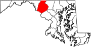
U.S. Highways Interstate Highways Categories:- Roads in Frederick County, Maryland
- U.S. Highways in Maryland


Wikimedia Foundation. 2010.