- Middlesex County, Massachusetts
-
Middlesex County, Massachusetts 
Seal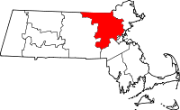
Location in the state of Massachusetts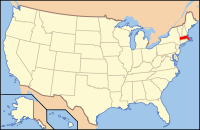
Massachusetts's location in the U.S.Founded 1643 Seat Lowell, Cambridge Largest city Lowell Area
- Total
- Land
- Water
847.54 sq mi (2,195 km²)
823.46 sq mi (2,133 km²)
24.08 sq mi (62 km²), 2.84%Population
- (2010)
- Density
1,503,085
1,826/sq mi (705/km²)Time zone Eastern: UTC-5/-4 Middlesex County, in the U.S. state of Massachusetts, is the twenty-third most populous county in the United States and the most populous county in New England. As of 2010[update], the population was 1,503,085.[1] The center of population of Massachusetts is in Natick, Middlesex County.[2]
For administrative purposes the county held two regions, Middlesex-North with county seat in Lowell, and Middlesex-South with county seat in Cambridge.[3] The county government was abolished in 1997, but the county boundaries continue to describe a state district for court jurisdictions and for other administrative purposes, such as an indicator for elections.
As of 2006[update], Middlesex County was tenth in the United States on the list of most millionaires per county.[4]
Contents
History
The county was created by the Massachusetts General Court on May 10, 1643, when it was ordered "that the whole plantation within this jurisdiction be divided into four sheires". Middlesex initially contained Charlestown, Cambridge, Watertown, Sudbury, Concord, Woburn, Medford, and Reading.[5]
Law and government
On July 11, 1997, the Massachusetts State Legislature abolished Middlesex County as a governmental entity due primarily to the county's insolvency. Middlesex County continues to exist as a geographic boundary.[6]
Immediately prior to its abolition, the government of Middlesex County consisted of three County Commissioners elected at-large to staggered four-year terms, a County Treasurer elected to a six-year term, a County Sheriff elected to a six-year term and two Registers of Deeds, one for the Northern District at Lowell and the other for the Southern District at Cambridge, both elected to six-year terms.[7] Middlesex County owned and operated the Superior Courthouses in Cambridge and Lowell and the Middlesex County Hospital in Waltham. Besides the employees of the Sheriff's Department and the two Registries of Deeds, the county had a Maintenance Department, a Security Department, small administrative staffs in the Treasurer's and Commissioners' Offices, and the employees at the hospital. Budgets proposed by the County Commissioners were approved by a County Advisory Board that consisted of a single representative of each of the 54 cities and towns in the county. The votes of the individual members of the Advisory Board were weighted based on the overall valuation of property in their respective communities. The county derived its revenue primarily from document filing fees at the Registries of Deeds and from a Deeds Excise Tax, a transfer tax assessed on the sales price of real estate that was also collected by the Registries of Deeds.[8]
The legislation abolishing Middlesex County retained the Sheriff and Registers of Deeds as independently elected officials and transferred for administrative purposes the Sheriff's Department to the state Department of Public Safety and the two Registry of Deeds offices to the Massachusetts Secretary of State's Office.[9] Additionally, all county maintenance and security employees were absorbed into the corresponding staffs of the Massachusetts Trial Court. The legislation also transferred ownership of the two Superior Courthouses to the Commonwealth of Massachusetts. The hospital was closed. Finally, the office of County Commissioner was immediately abolished and the office of County Treasurer was abolished as of December 31, 2002.[10]
Besides the Sheriff and the two Registers of Deeds, the Middlesex District Attorney, the Middlesex Register of Probate and the Middlesex Clerk of Courts (which were already part of state government before the abolition of Middlesex County government) are all elected countywide to six-year terms. In Middlesex County (as in the entire Commonwealth of Massachusetts) governmental functions such as property tax assessment and collection, public education, road repair and maintenance and elections are all conducted at the city and town level and not by county government.
Records of land ownership in Middlesex County are maintained at the two Registries of Deeds. The first Middlesex County Registry of Deeds was created in 1649 in Cambridge. In 1855, the Massachusetts State Legislature created a Registry of Deeds for the Northern District of Middlesex County in Lowell. The Northern District consists the city of Lowell and the towns of Billerica, Carlisle, Chelmsford, Dracut, Dunstable, Tewksbury, Tyngsborough, Westford and Wilmington. The remaining 44 cities and towns of Middlesex County are in the Southern District which remained in Cambridge.[11]
Even after the abolition of county government in Middlesex, communities are now granted the right to form their own regional compacts for sharing services.
County government: Middlesex County Clerk of Courts: Michael A. Sullivan District Attorney: Gerard T. Leone, Jr. Register of Deeds: Richard P. Howe, Jr. (North at Lowell)
Eugene C. Brune (South at Cambridge)Register of Probate: Tara E. DeCristofaro County Sheriff: Peter J. Koutoujian [2] State government State Representative(s): 37 Representatives: [3] State Senator(s): 16 Senators: [4] Governor's Councilor(s): Federal government U.S. Representative(s): John Olver (D-1st District)
James P. McGovern (D-3rd District)
Barney Frank (D-4th District)
Niki Tsongas (D-5th District)
John F. Tierney (D-6th District)
Edward J. Markey (D-7th District)
Michael Capuano (D-8th District)U.S. Senators: John Kerry (D), Scott Brown (R) Geography
According to the 2000 census, the county has a total area of 847.54 square miles (2,195.1 km2), of which 823.46 square miles (2,132.8 km2) (or 97.16%) is land and 24.08 square miles (62.4 km2) (or 2.84%) is water.[12]
The MetroWest region comprises much of the southern portion of the county.
Adjacent counties
- Hillsborough County, New Hampshire (north)
- Essex County (northeast)
- Suffolk County (southeast)
- Norfolk County (south)
- Worcester County (west)

Hillsborough County, New Hampshire Essex County Worcester County 
 Middlesex County, Massachusetts

Norfolk County Suffolk County National protected areas
- Assabet River National Wildlife Refuge
- Great Meadows National Wildlife Refuge
- Longfellow National Historic Site
- Lowell National Historical Park
- Minute Man National Historical Park
- Oxbow National Wildlife Refuge (part)
Demographics
Historical populations Census Pop. %± 1790 42,769 — 1800 46,928 9.7% 1810 52,789 12.5% 1820 61,472 16.4% 1830 77,961 26.8% 1840 106,611 36.7% 1850 161,383 51.4% 1860 216,354 34.1% 1870 274,353 26.8% 1880 317,830 15.8% 1890 431,167 35.7% 1900 565,696 31.2% 1910 669,915 18.4% 1920 778,352 16.2% 1930 934,924 20.1% 1940 971,390 3.9% 1950 1,064,569 9.6% 1960 1,238,742 16.4% 1970 1,397,268 12.8% 1980 1,367,034 −2.2% 1990 1,398,468 2.3% 2000 1,465,396 4.8% 2010 1,503,085 2.6% [13][14][15] As of the census[16] of 2000, there were 1,465,396 people,[1] 561,220 households, and 361,076 families residing in the county.[17] The population density was 1,780/sq mi (687/km²). There were 576,681 housing units at an average density of 700 per square mile (270/km²). The racial makeup of the county was 85.88% White, 3.36% Black or African American, 0.15% Native American, 6.26% Asian, 0.04% Pacific Islander, 2.07% from other races, and 2.24% from two or more races. 4.55% of the population were Hispanic or Latino of any race. 20.0% were of Irish, 15.7% Italian and 8.0% English ancestry according to Census 2000. 79.6% spoke English, 4.3% Spanish, 2.7% Portuguese, 1.6% Italian, 1.6% Chinese or Mandarin and 1.5% French as their first language. Middlesex County has the largest Irish-American population of any U.S. county with a plurality of Irish ancestry.[18]
There were 561,220 households out of which 30.20% had children under the age of 18 living with them, 51.30% were married couples living together, 9.90% had a female householder with no husband present, and 35.70% were non-families. 27.10% of all households were made up of individuals and 9.50% had someone living alone who was 65 years of age or older. The average household size was 2.52 and the average family size was 3.11.
In the county the population was spread out with 22.50% under the age of 18, 9.00% from 18 to 24, 33.40% from 25 to 44, 22.40% from 45 to 64, and 12.80% who were 65 years of age or older. The median age was 36 years. For every 100 females there were 93.70 males. For every 100 females age 18 and over, there were 90.70 males.
The median income for a household in the county was $60,821, and the median income for a family was $74,194 (these figures had risen to $77,004 and $96,325 respectively as of a 2009 estimate[19]). Males had a median income of $49,460 versus $36,288 for females. The per capita income for the county was $31,199. About 4.30% of families and 6.50% of the population were below the poverty line, including 7.20% of those under age 18 and 7.10% of those age 65 or over.
As of 2006[update], Middlesex County was tenth in the United States on the list of most millionaires per county.[4]
Politics
Presidential Election Results 1960-2008 Year Democratic Republican 2008 64.2% 462,226 34.1% 245,215 2004 63.99% 440,862 34.52% 237,815 2000 61.49% 404,043 30.27% 198,914 1996 63.41% 398,190 27.06% 169,926 1992 49.89% 343,994 28.10% 193,703 1988 54.57% 361,563 43.82% 193,703 1984 50.26% 325,065 49.42% 319,604 1980 42.46% 270,751 40.30% 256,999 1976 55.94% 359,919 40.42% 260,044 1972 55.91% 345,343 43.56% 269,064 1968 64.11% 370,310 32.60% 188,304 1964 76.25% 439,790 23.36% 134,729 1960 59.01% 356,130 40.78% 246,126 Voter Registration and Party Enrollment as of October 13, 2010[20] Party Number of Voters Percentage Democratic 351,993 37.45% Republican 98,461 10.48% Unaffiliated 484,279 51.53% Minor Parties 5,156 0.55% Total 939,889 100% Cities and towns
Most municipalities in Middlesex County have a town form of government; the remainder are cities, and are so designated on this list. Villages listed below are census or postal divisions, but have no separate corporate or statutory existence from the cities and towns in which they are located.
- Acton
- Arlington
- Ashby
- Ashland
- Ayer
- Bedford
- Belmont
- Billerica*
- North Billerica, a village of Billerica
- Pinehurst, a village of Billerica
- Boxborough
- Burlington
- Cambridge, a city and county seat
- Carlisle*
- Chelmsford*
- North Chelmsford, a village of Chelmsford
- Concord
- West Concord, a village of Concord
- Dracut*
- Dunstable*
- Everett, a city
- Framingham
- Nobscot, a village of Framingham
- Saxonville, a village of Framingham
- South Framingham, a region of Framingham south of state rte. 9
- Groton
- Holliston
- Hopkinton
- Hudson
- Lexington
- East Lexington, a village of Lexington
- Lincoln
- Littleton
- Littleton Common, a village of Littleton
- Lowell, a city and county seat*
- Malden, a city
- Marlborough, a city
- Maynard
- Medford, a city
- Melrose, a city
- Melrose Highlands, a region of Melrose
- Natick
- Newton, a city
- Auburndale, a village of Newton
- Chestnut Hill, a village of Boston, Brookline and Newton
- Newton Centre, a village of Newton
- Newton Highlands, a village of Newton
- Newton Lower Falls, a village of Newton
- Newton Upper Falls, a village of Newton
- Newtonville, a village of Newton
- Nonantum, a village of Newton
- Thompsonville, a village of Newton
- Waban, a village of Newton
- North Reading
- Pepperell
- East Pepperell, a village of Pepperell
- Reading
- Sherborn
- Shirley
- Somerville, a city
- Stoneham
- Stow
- Sudbury
- Tewksbury*
- Townsend
- Tyngsborough*
- Wakefield
- Waltham, a city
- Watertown, officially called a town but legally a city
- Wayland
- Cochituate, a village of Wayland.
- Westford*
- Forge Village, a village of Westford.
- Graniteville, a village of Westford.
- Nabnasset, a village of Westford.
- Weston
- Wilmington*
- Winchester
- Woburn, a city
- * denotes a municipality of Middlesex-North.[21]
See also
- Middlesex, historic county of England
- National Register of Historic Places listings in Middlesex County, Massachusetts
- Middlesex Fells
- Middlesex Community College (Massachusetts)
- Middlesex Turnpike (Massachusetts)
Notes
- ^ a b Corrected Census 2000 Counts
- ^ Middlesex County, Massachusetts detailed profile - houses, real estate, cost of living, wages, work, agriculture, ancestries, and more
- ^ "Find a County". National Association of Counties. http://www.naco.org/Counties/Pages/FindACounty.aspx. Retrieved 2011-06-07.
- ^ a b Sahadi, Jeanne (March 28, 2006). "Top 10 millionaire counties". CNN. http://money.cnn.com/2006/03/28/news/economy/millionaires/.
- ^ Davis, William T. Bench and Bar of the Commonwealth of Massachusetts, p. 44. The Boston History Company, 1895.
- ^ Massachusetts General Laws (MGL) c.34B, s.1
- ^ MGL c.34, s.4
- ^ Middlesex County Directory: 1993-1995, (Cambridge: Middlesex County Commissioners Office, 1995)
- ^ MGL c.34B, s.10
- ^ MGL c.34B, s.2
- ^ MGL c.36, s.1
- ^ "Census 2000 U.S. Gazetteer Files: Counties". United States Census. http://www.census.gov/tiger/tms/gazetteer/county2k.txt. Retrieved 2011-02-13.
- ^ http://www.census.gov/population/www/censusdata/cencounts/files/ma190090.txt
- ^ http://factfinder2.census.gov/faces/tableservices/jsf/pages/productview.xhtml?pid=DEC_10_PL_QTPL&prodType=table
- ^ http://mapserver.lib.virginia.edu/
- ^ "American FactFinder". United States Census Bureau. http://factfinder.census.gov. Retrieved 2008-01-31.
- ^ DP-1. Profile of General Demographic Characteristics: 2000
- ^ [1][dead link]
- ^ S1901. Income in the Past 12 Months (In 2009 Inflation-Adjusted Dollars)
- ^ "Registration and Party Enrollment Statistics as of October 13, 2010" (PDF). Massachusetts Elections Division. http://www.sec.state.ma.us/ele/ele10/enrollment_count_regdt_10132010.pdf. Retrieved 2010-03-14.
- ^ Middlesex-North Registry of Deeds
- History of Middlesex County, Massachusetts, Volume 1 (A-H), Volume 2 (L-W) by Samuel Adams Drake, published 1879 and 1880. 572 and 505 pages.
- Ancient Middlesex with Brief Biographical Sketches. By Levi Swanton Gould, published 1905, 366 pages.
External links
- Middlesex County Sheriff's Department
- Walling & Gray. 1871 Map of Middlesex County Plate 44-45 from the 1871 Atlas of Massachusetts.
- National Register of Historic Places listing for Middlesex Co., Massachusetts
- Middlesex County entry from Hayward's New England Gazetteer of 1839
- Map of cities and towns of Massachusetts
- Massachusetts County Map
- History of Middlesex County by Samual Adams Drake, 1880. Contains histories of each town in the county.
- History of Middlesex County, Massachusetts With Biographical Sketches of Many of Its Pioneers and Prominent Men, edited by Duane Hamilton Hurd. J. W. Lewis & Co., Philadelphia. 1890.
- Middlesex North District Registry of Deeds
- Middlesex South District Registry of Deeds
- League of Women Voters, Massachusetts: County Government
Municipalities and communities of Middlesex County, Massachusetts Cities 
Towns Acton | Arlington | Ashby | Ashland | Ayer | Bedford | Belmont | Billerica | Boxborough | Burlington | Carlisle | Chelmsford | Concord | Dracut | Dunstable | Framingham | Groton | Holliston | Hopkinton | Hudson | Lexington | Lincoln | Littleton | Maynard | Natick | North Reading | Pepperell | Reading | Sherborn | Shirley | Stoneham | Stow | Sudbury | Tewksbury | Townsend | Tyngsborough | Wakefield | Wayland | Westford | Weston | Wilmington | Winchester
CDPs Ayer | Cochituate | Fort Devens | East Pepperell | Groton | Hopkinton | Hudson | Littleton Common | Pepperell | Pinehurst | Shirley | Townsend | West Concord
Other
villagesAuburndale | Chestnut Hill | Gleasondale | Nabnasset | Newton Centre | Newton Highlands | Newton Lower Falls | Newton Upper Falls | Newtonville | Nonantum | North Billerica | North Chelmsford | Waban | West Newton
Categories:- Massachusetts counties
- Middlesex County, Massachusetts


Wikimedia Foundation. 2010.