- Noheji, Aomori
-
Noheji
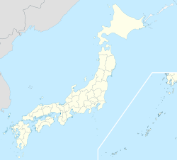
野辺地— Town — Location of Noheji in Aomori
 Noheji
Coordinates: 40°52′N 141°08′E / 40.867°N 141.133°ECoordinates: 40°52′N 141°08′E / 40.867°N 141.133°E Country Japan Region Tōhoku Prefecture Aomori District Kamikita Area – Total 81.61 km2 (31.5 sq mi) Population (September 2009) – Total 14,271 – Density 175/km2 (453.2/sq mi) Time zone Japan Standard Time (UTC+9) City Symbols - Tree Sakura - Flower Rosa rugosa - Bird Common gull Phone number 0175-64-2111 Address
Noheiji 123-1, Kitakami-gun, Aomori-ken 039-3131Website Noheji Town HP  Noheji Town Hall
Noheji (野辺地町 Noheji-machi) is a town located in the Kamikita District of northeastern Aomori Prefecture in the Tōhoku region of Japan. As of 2009, the town had an estimated population of 14,721 and a density of 175 persons per km². Its total area was 81.61 km².
Contents
Geography
Noheji occupies the southeastern coastline of Mutsu Bay at the base of the Shimokita Peninsula. The village has a cold maritime climate characterized by cool short summers and long cold winters with heavy snowfall.
Neighbouring municipalities
History
The area around Noheji was inhabited by the Emishi people until the historical period, and the name “Noheji” is derived from “Nosobechi”, or “place where a pure river flows through a field” in the Ainu language. During the Edo period, the area was controlled by the Nambu clan of Morioka Domain and prospered due to its fishing industry and location on the road connecting Morioka Domain with the Hirosaki Domain. During the Boshin War of the Meiji Restoration, the Battle of Noheji occurred between the Tokugawa loyalist forces of Morioka Domain and pro-imperial forces of Hirosaki Domain on November 11, 1868. During the cadastral reform of 1889, Noheiji Village was proclaimed. It was elevated to town status on August 28, 1898.
Economy
The economy of Noheji is heavily dependent on commercial fishing, especially for scallops, and on agriculture with the raising of Japanese mountain yams predominating. The town also serves as a commercial and transportation center for the surrounding rural areas.
Transportation
Railway
- Aoimori Railway Company
- East Japan Railway Company
- Ōminato Line
- Noheji Station, Kita-Noheji Station, Arito Station
- Ōminato Line
Highway
- Route 4 (Japan)
- Route 279 (Japan)
Tourist attractions
- Makado Onsen, a hot spring and ski resort
Noted people from Noheji
- Tsuyoshi Ichinohe – skier
- Takaya Eguchi - modern dancer
External links
- (Japanese) Noheji official website
 Aomori Prefecture
Cities 
Districts See also: Towns and villages by districtCategories:- Towns in Aomori Prefecture
- Populated coastal places in Japan


Wikimedia Foundation. 2010.