- Walton County, Florida
-
Walton County, Florida 
Seal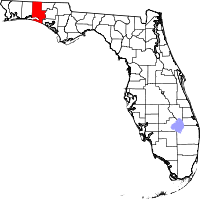
Location in the state of Florida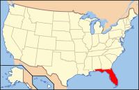
Florida's location in the U.S.Founded 29 December 1824 Seat DeFuniak Springs Area
- Total
- Land
- Water
1,238.03 sq mi (3,206 km²)
1,057.56 sq mi (2,739 km²)
180.47 sq mi (467 km²), 14.58%Population
- (2010)
- Density
55,043
52/sq mi (20.09/km²)Website www.co.walton.fl.us Walton County is a county located in the state of Florida. As of 2000, the population was 40,601. The U.S. Census Bureau 2005 estimate for the county is 50,324.[1] Its county seat is DeFuniak Springs, Florida.[2] The county is home to the highest natural point in Florida: Britton Hill, at 345 feet (105 m).
Contents
History
Walton County was created in 1824. It was named for George Walton, Secretary of the Florida territory from 1821 to 1826.
In 1951, Mossy Head became the interchange point for a base railroad constructed between the Louisville and Nashville Railroad and Eglin Air Force Base, located partially in Walton County. The line operated until the early 1980s, and a short section on the north end of the alignment still exists for rail shipments.
Geography
According to the 2000 census, the county has a total area of 1,238.03 square miles (3,206.5 km2), of which 1,057.56 square miles (2,739.1 km2) (or 85.42%) is land and 180.47 square miles (467.4 km2) (or 14.58%) is water.[3]
Adjacent counties
- Covington County, Alabama - northwest
- Geneva County, Alabama - northeast
- Holmes County, Florida - east
- Washington County, Florida - east
- Bay County, Florida - southeast
- Okaloosa County, Florida - west
National protected area
Demographics
Historical populations Census Pop. %± 1840 1,461 — 1850 1,817 24.4% 1860 3,037 67.1% 1870 3,041 0.1% 1880 4,201 38.1% 1890 4,816 14.6% 1900 9,346 94.1% 1910 16,460 76.1% 1920 12,119 −26.4% 1930 14,576 20.3% 1940 14,246 −2.3% 1950 14,725 3.4% 1960 15,576 5.8% 1970 16,087 3.3% 1980 21,300 32.4% 1990 27,760 30.3% 2000 40,601 46.3% 2010 55,043 35.6% [4][5][6] As of the census[7] of 2000, there were 40,601 people, 16,548 households, and 11,120 families residing in the county. The population density was 38 people per square mile (15/km²). There were 29,083 housing units at an average density of 28 per square mile (11/km²). The racial makeup of the county was 88.41% White, 6.98% Black or African American, 1.28% Native American, 0.45% Asian, 0.04% Pacific Islander, 0.75% from other races, and 2.09% from two or more races. 2.17% of the population were Hispanic or Latino of any race.
There were 16,548 households out of which 26.40% had children under the age of 18 living with them, 53.00% were married couples living together, 10.10% had a female householder with no husband present, and 32.80% were non-families. 27.10% of all households were made up of individuals and 10.10% had someone living alone who was 65 years of age or older. The average household size was 2.35 and the average family size was 2.83.
In the county the population was spread out with 21.70% under the age of 18, 7.10% from 18 to 24, 28.50% from 25 to 44, 26.90% from 45 to 64, and 15.80% who were 65 years of age or older. The median age was 40 years. For every 100 females there were 105.20 males. For every 100 females age 18 and over, there were 105.00 males.
The median income for a household in the county was $32,407, and the median income for a family was $37,663. Males had a median income of $26,799 versus $21,208 for females. The per capita income for the county was $18,198. About 11.60% of families and 14.40% of the population were below the poverty line, including 21.00% of those under age 18 and 10.90% of those age 65 or over.
Places
 Walton County Courthouse, 2008
Incorporated
- City of DeFuniak Springs
- City of Freeport
- Town of Paxton
Unincorporated
- Argyle
- Eucheanna (Euchee Valley)
- Glendale
- Grayton Beach
- Miramar Beach
- Mossy Head
- Seaside
- Santa Rosa Beach
See also
- Beaches of South Walton, Florida
- National Register of Historic Places listings in Walton County, Florida
-

The hilly terrain of Walton County differs from most of the rest of Florida.
-

Walton County contains Florida's highest point.
-

South Walton contains many neighborhoods nestled in sugary-white sand dunes.
-

The coast of Walton County is fringed by emerald Gulf waters.
References
- ^ www.census.gov Population estimates
- ^ "Find a County". National Association of Counties. http://www.naco.org/Counties/Pages/FindACounty.aspx. Retrieved 2011-06-07.
- ^ "Census 2000 U.S. Gazetteer Files: Counties". United States Census. http://www.census.gov/tiger/tms/gazetteer/county2k.txt. Retrieved 2011-02-13.
- ^ http://www.census.gov/population/www/censusdata/cencounts/files/fl190090.txt
- ^ http://factfinder2.census.gov/faces/tableservices/jsf/pages/productview.xhtml?pid=DEC_10_PL_QTPL&prodType=table
- ^ http://mapserver.lib.virginia.edu/
- ^ "American FactFinder". United States Census Bureau. http://factfinder.census.gov. Retrieved 2008-01-31.
External links
Government links/Constitutional offices
- Walton County Board of County Commissioners
- Walton County Supervisor of Elections
- Walton County Property Appraiser
- Walton County Sheriff's Office
- Walton County Tax Collector
Special districts
- Walton County School District
- Northwest Florida Water Management District
- South Walton Fire District
Judicial branch
- Walton County Clerk of Courts
- Public Defender, 1st Judicial Circuit of Florida serving Escambia, Santa Rosa, Okaloosa, and Walton counties
- Office of the State Attorney, 1st Judicial Circuit of Florida
- Circuit and County Court for the 1st Judicial Circuit of Florida
Media links

Covington County, Alabama Geneva County, Alabama Okaloosa County 
Holmes County and Washington County  Walton County, Florida

Gulf of Mexico Bay County Municipalities and communities of Walton County, Florida Cities 
Town CDP Unincorporated
communitiesGrayton Beach | Lakewood | Rosemary Beach | Sandestin | Seaside
Categories:- Florida counties
- Walton County, Florida
- 1824 establishments in the United States
- Populated places established in 1824


Wikimedia Foundation. 2010.