- Volusia County, Florida
-
"Volusia" redirects here. For the unincorporated community, see Volusia, Florida.
Volusia County, Florida 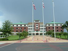 Volusia County Courthouse
Seal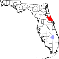
Location in the state of Florida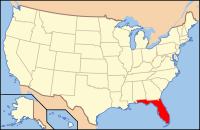
Florida's location in the U.S.Founded December 29, 1854 Seat DeLand Area
- Total
- Land
- Water
1,432.44 sq mi (3,710 km²)
1,103.25 sq mi (2,857 km²)
329.19 sq mi (853 km²), 22.98%Population
- (2010)
- Density
494,593
448/sq mi (173.11/km²)Website www.volusia.org Volusia County is a county located in the state of Florida. The U.S. Census Bureau 2010 official county's population was 494,593 [1]. Its county seat is DeLand[1], and its most populous city is currently Deltona.
Volusia County is coextensive with the Deltona-Daytona Beach-Ormond Beach-New Smyrna Beach, Florida Metropolitan Statistical Area, a metropolitan statistical area designated by the Office of Management and Budget for statistical purposes and used by the United States Census Bureau and other agencies. It is the 103rd-largest in population in the United States as of the 2010 Census estimate.
Volusia County is traversed from north to south by the important highways Interstate 95 and U.S. Route 1. It also sits at the northeastern end of the Interstate 4, where it merges with Interstate 95.
Contents
History
 Timucua owl totem found near Hontoon Island in the St. Johns River, Volusia County
Volusia County was named after the then-largest-community, Volusia, when the Florida legislature divided Orange County on December 29, 1854. At the time, Volusia County had as few as 600 residents.[2]
The origins of the word "Volusia" are unclear, though there are several theories:
- The name came from from a word meaning "Land of the Euchee," from the Euchee indians who migrated into the area after the Timucua indian cultures faded away in the early 1700's.[2]The Euchees (or Uchees) lived in the area of Spring Gardens, about ten miles south of Volusia.[3]
- The name was taken from the a British man named Voluz who owned a plantation located on the St. Johns River in the late 1700s.[4]
- The name originated from the last name Veluche belonging to the French or Belgian owner of the trading post in Volusia. According to some, this was during the British regime, and according to others, it was around 1818. Over time, the name Veluche became anglicized to Volusia.[5]
- The town was established by and named for Jere Volusia.[6]
- The settlement was named by the Spanish after the celebrated Roman jurist Volusio, who wrote 30 books and tutored Marcus Aurelius, the Roman emperor and philosopher.[4]
The land area of present day Volusia County was inhabited by the indigenous Timucua, and Mayaca people . Neither group exists today as distinct racial entities, having been decimated by war and disease after contact with European settlers. Evidence of their habitation can still be seen in various areas of Volusia County such as the large shell middens at Tomoka State Park.
During the British occupation of Florida, a failed colony was started in southeast Volusia County by Andrew Turnbull, known as New Smyrna. This colony was connected to St. Augustine, the capital of East Florida, via the Kings Road. After the failure of the colony the settlers, many of Minorcan heritage made the 70-mile (110 km) journey to live in St. Augustine.
The Seminole indians, descendants of the Creek tribe of Alabama and Georgia who resisted forced relocation to Indian Territory also camped in various parts of Volusia County. During the Second Seminole War (1836–1842) a large sugar plantation in what is today the city of Daytona Beach was burned by the Seminole.
On the east shore of the St. Johns River in Volusia, in present day Debary, General Winfield Scott established a fort/depot in 1836 named Fort Florida.
Geography
 Avenue of Moss-Covered Oaks, Near Ormond, Florida -- an 1893 duotone print
According to the 2000 census, the county has a total area of 1,432.44 square miles (3,710.0 km2), of which 1,103.25 square miles (2,857.4 km2) (or 77.02%) is land and 329.19 square miles (852.6 km2) (or 22.98%) is water.[7]
Volusia County is bordered on the west by the St. Johns River and Lake Monroe, and by the Atlantic Ocean to the east. Roughly the size of Rhode Island, Volusia is situated 50 miles (80 km) northeast of Orlando, 60 miles (97 km) north of the Kennedy Space Center, and 89 miles (143 km) south of Jacksonville.
Volusia County is the sole county in the Deltona-Daytona Beach-Ormond Beach Metropolitan Statistical Area.
Regions
The Volusia County Government divides the county into three regions. This parallels the three calling regions used by BellSouth, the regional phone company:
East Volusia - also known as the Greater Daytona Beach Area, or the Halifax Area (named for the Halifax River which runs through the area), this region includes the cities of Daytona Beach, Daytona Beach Shores, Holly Hill, Ormond Beach, Ponce Inlet, Port Orange, and South Daytona; and the surrounding unincorporated areas close to these cities.
Southeast Volusia - also known as the Greater New Smyrna Beach Area, this region includes the cities of New Smyrna Beach, Edgewater, and Oak Hill; also the unincorporated areas close to these cities.
West Volusia - also called Saint John's River Country (named for the Saint John's River which lies nearby), this region includes the cities of Barberville, Debary, DeLand, De Leon Springs, Deltona, Glenwood, Lake Helen, Orange City, Pierson, and Seville; as well as the surrounding unincorporated areas close to these cities. Deltona is the largest city in Volusia County.
Adjacent counties
- Flagler County, Florida - north
- Brevard County, Florida - south
- Orange County, Florida - south
- Seminole County, Florida - southwest
- Lake County, Florida - west
- Marion County, Florida - northwest
- Putnam County, Florida - northwest
Parks and gardens
- Blue Spring State Park
- Bulow Creek State Park
- Canaveral National Seashore
- De Leon Springs State Park
- Dunlawton Plantation and Sugar Mill
- Hontoon Island State Park
- Lake George State Forest
- Lake Woodruff National Wildlife Refuge
- North Peninsula State Park
- Ormond Beach Memorial Art Museum and Gardens
- Tiger Bay State Forest
- Tomoka State Park
Rivers and Waterways
- Atlantic Ocean
- Halifax River
- Intracoastal Waterway
- Lake George
- Lake Monroe
- Mosquito Lagoon
- Ponce de León Inlet
- St. Johns River
- Tomoka River
Major attractions
- Daytona International Speedway in Daytona Beach
- Jackie Robinson Ballpark in Daytona Beach
- New Smyrna Speedway in New Smyrna Beach
- Ponce de Leon Inlet Lighthouse and Museum in Ponce Inlet
- The Ocean Center (convention center) in Daytona Beach
- Volusia County Fair and Expo Center in DeLand
- Volusia Speedway Park in Barberville
Law and government
Under Volusia County's council-manager form of government, voters elect a county council which consists of seven members who serve four-year terms. Five are elected by district, the county chair and at-large representative are elected county-wide.
The county council establish ordinances and policies for the county. It also reviews and approves the county budget annually. The commission appoints a county manager, who carries out the will of the commission and handles day-to-day business.
Elected officials
- County Chair: Frank Bruno Jr.
- Commissioner-At-Large: Joyce Cusack
- District 1 Commissioner - Andy Kelly
- District 2 Commissioner - Joshua J. Wagner
- District 3 Commissioner - Joie Alexander
- District 4 Commissioner - Carl G. Persis
- District 5 Commissioner and Vice Chair - Pat Northey
- County Manager (appointed) - James Dinneen
The following are considered state officials but are elected and paid by the county:
- Sheriff - Ben F. Johnson
- Clerk of the Courts - Diane M. Matousek
- Property Appraiser - Morgan B. Gilreath Jr.
- Supervisor of Elections - Ann McFall
- State Attorney - R.J. Larizza
- Public Defender - James S. Purdy
County offices
- Thomas C. Kelly Administration Center, 123 W. Indiana Ave., DeLand 32720
- Daytona Beach Administration Building, 250 N. Beach St., Daytona Beach 32114
- New Smyrna Beach Administration Office, 111 Canal St., New Smyrna Beach 32168
- Orange City Administration Office, 2744 Enterprise Rd., Orange City 32763
Justice
The county has centralized most county courts in DeLand which try a variety of cases including felonies, misdemeanors, traffic, and domestic. An elected prosecutor tries cases for the public. Defendants can be represented through the auspices of the office of the elected public defender.
The County elects a sheriff, immediately responsible to the courts but also to the state for the enforcement of state laws. Volusia county sheriff's deputies provide law enforcement to the unincorporated areas of Volusia County, as well as assisting in the various municipal police departments such as the Daytona Beach Police Department
Many volunteers work alongside the paid professionals. Included are Citizen Observer Program (C.O.P.). C.O.P. volunteers work under the direction of the county sheriff and play a part in the county's policing operations.
The Volusia County Branch Jail is a modern facility, located on Highway US-92 (International Speedway Boulevard), approximately halfway between DeLand and Daytona Beach. The county jail retains prisoners who have been sentenced to a year or less. Longer sentences must be served in state prisons.
Libraries
The county centrally controls 16 libraries with Deland and Daytona (City Island) being the two largest libraries. Collections included 869,491 books, 83,943 videos, 58,784 audio materials, 2,051 magazines and newspapers, over 100,000 government documents and 51 licensed databases. Personal computers for public use are hooked up on broadband in all libraries. An estimated 230,000 Volusia County residents have library cards. One library card is valid at all locations, and materials are loaned between locations through a daily courier service and outside the libraries via Inter-Library Loan. Library cards are free for all Volusia County residents.
Economy
The overall Gross Metro Product (GMP) for Volusia County economy increased from $12.98-billion in 2005 to $13.69-billion in 2006; a $709.9-million increase. The GMP is an annual measurement of the total economic output and sales of goods and services provided within the Metropolitan Statistical Area (MSA) that comprises all of Volusia County and its 16 cities. A GMP of $13.69-billion represents a significant circulation of new capital resources in an economy populated by just over 500,000 residents.
Local consumer confidence and a continued immigration of an estimated 28,800 new residents, new capital investments for new construction exceeding $1.11-billion and the steady growth of professional and health care services continued to drive much of the County’s economic viability.
Volusia County’s manufacturing sector maintained a steady and stable position within the local economy contrary to the declining trends being experienced elsewhere within the State of Florida. The overall number of manufacturers present within the county increased to over 430 in 2006 and accounted for a large portion of the county’s GMP. Manufacturing maintains one of the highest of all average wage levels within the county and generates a higher rate of circulation of economic impact than any other business sector that comprises the local economy.
Volusia County’s manufacturing sector generated an average annual wage of $37,632 in 2006, well above the county’s average annual wage of $32,200 for all workers. [2]
Demographics
Historical populations Census Pop. %± 1860 1,158 — 1870 1,723 48.8% 1880 3,294 91.2% 1890 8,467 157.0% 1900 10,003 18.1% 1910 16,510 65.1% 1920 23,374 41.6% 1930 42,757 82.9% 1940 53,710 25.6% 1950 74,229 38.2% 1960 125,319 68.8% 1970 169,487 35.2% 1980 258,762 52.7% 1990 370,712 43.3% 2000 443,343 19.6% 2010 494,593 11.6% [8][9][10] As of the census[11] of 2000, there were 443,343 people, 184,723 households, and 120,069 families residing in the county. The population density was 402 people per square mile (155/km²). There were 211,938 housing units at an average density of 192 per square mile (74/km²). The racial makeup of the county was 86.11% White, 9.29% Black or African American, 0.31% Native American, 1.00% Asian, 0.04% Pacific Islander, 1.82% from other races, and 1.43% from two or more races. 6.57% of the population were Hispanic or Latino of any race. 13.7% were of German, 11.5% Irish, 11.2% English, 10.7% American and 8.7% Italian ancestry according to Census 2000.
There were 184,723 households out of which 24.10% had children under the age of 18 living with them, 50.40% were married couples living together, 10.90% had a female householder with no husband present, and 35.00% were non-families. 27.90% of all households were made up of individuals and 13.60% had someone living alone who was 65 years of age or older. The average household size was 2.32 and the average family size was 2.82.
In the county the population was spread out with 20.30% under the age of 18, 8.20% from 18 to 24, 25.30% from 25 to 44, 24.20% from 45 to 64, and 22.10% who were 65 years of age or older. The median age was 42 years. For every 100 females there were 94.50 males. For every 100 females age 18 and over, there were 91.80 males.
The median income for a household in the county was $35,219, and the median income for a family was $41,767. Males had a median income of $30,573 versus $22,471 for females. The per capita income for the county was $19,664. About 7.90% of families and 11.60% of the population were below the poverty line, including 16.30% of those under age 18 and 7.10% of those age 65 or over.
Places
Incorporated
As of August 2007, Volusia County has 16 incorporated cities and towns.
- City of Daytona Beach
- City of Daytona Beach Shores
- City of DeBary
- City of DeLand
- City of Deltona
- City of Edgewater
- City of Holly Hill
- City of Lake Helen
- City of New Smyrna Beach
- City of Oak Hill
- City of Orange City
- City of Ormond Beach
- Town of Pierson
- Town of Ponce Inlet
- City of Port Orange
- City of South Daytona
Unincorporated
- Alamana
- Ariel
- Bakerstown
- Barberville
- Benson Junction
- Beresford
- Bethune Beach
- Blake
- Blue Springs Landing
- Bluffton
- Boden
- Cassadaga
- Connersville
- Conrad
- Cow Creek
- Creighton
- Cypress Lake Estates
- Daisy lake
- Daytona Highridge Estates
- Daytona Park Estates
- Deadman Landing
- Deland Highlands
- DeLand Southwest
- DeLeon Springs
- DeLeon Springs Heights
- Edgewater Junction
- Eldora
- Eldridge
- Ellinor Village
- Emporia
- Enterprise
- Farmton
- Fatio
- Fort Florida
- Glencoe
- Glenwood
- Halifax Estates
- Harbor Oaks
- Hucomer
- Isleboro
- Kalamazoo
- Lake Ashby Shores
- Lemon Bluff
- Maytown
- Mission City
- Mound Grove
- National Gardens
- North DeLand
- Orange City Hills
- Ormond-By-The-Sea
- Ortona
- Osteen
- Packwood Place
- Pennichaw
- Riverside
- Samsula
- Seabreeze
- Senyah
- Seville
- Stone Island
- Sugar Mill Estates
- Tallahassee Yuchi
- Tomoka Estates
- Valdez
- Volusia
- West DeLand
- Wilbur By-The-Sea
Transportation
Major roads
 The Volusia County Parking Garage in Daytona Beach provides a place for visitors to park and walk around.
 Interstate 95
 Interstate 4
 U.S. 1
 US 17
US 17 US 92
US 92 SR A1A
 SR 40
SR 40 SR 44
SR 44 SR 5A
SR 5A SR 421
 SR 11
SR 11 SR 483
Public transportation
Volusia County Public Transit System (VOTRAN) is the name of the local Volusia County bus service. It is an inexpensive way to get around and is handicap accessible. The buses offer service throughout the county, Monday through Saturday, from 7 a.m. to 7 p.m. Some limited bus routes are offered in East Volusia in the evenings and on Sundays. Buses travel to most sites and places of interest. The cost is $1.25 per trip, $3.00 for a one-day bus pass, or $40 for a 31-day pass (valid for all VOTRAN routes). There is also a VOTRAN transfer station (Intermodal Transit Facility - ITF) located inside the Volusia County Parking Garage in Daytona Beach.
Service between Volusia County and Orlando is provided by LYNX from Orange City, serving Heathrow and Downtown Orlando via Interstate 4.[12] The LYNX route operates Monday through Friday with three trips in each direction. The regular fare is $3.50 per trip or $80 for a monthly pass.
Service to Orlando is planned to be expanded in the form of SunRail, a commuter rail running from Volusia to Osceola county with the initial phase starting in 2013. In the initial phase, service will only extend to Debary. It is planned to extend this to also include the DeLand Amtrak station in 2015.[13][14]
Education
Public primary and secondary education is handled by Volusia County Schools. Some of the larger private schools include Father Lopez Catholic High School.
Middle schools
- Campbell Middle School
- Creekside Middle School
- David C. Hinson Middle School
- Deland Middle School
- Deltona Middle School
- Galaxy Middle School
- Heritage Middle School
- Holly Hill School
- New Smyrna Beach Middle School
- Ormond Beach Middle School
- River Springs Middle School
- Silver Sands Middle School
- Southwestern Middle School
- T. Dewitt Taylor Middle High School
High schools
- Atlantic High School
- DeLand High School
- Deltona High School
- Mainland High School
- New Smyrna Beach High School
- Pine Ridge High School
- Seabreeze High School
- Spruce Creek High School
- T. Dewitt Taylor Middle High School
- University High School
Colleges and universities
 The life-sized Wright Flyer statue is located at the Embry-Riddle Aeronautical University Daytona Beach campus.
- Bethune-Cookman University
- Daytona State College
- Embry-Riddle Aeronautical University
- Keiser University
- Palmer College of Chiropractic
- Stetson University
- University of Central Florida (Daytona Beach branch campus)
Vocational
- Advanced Technology College (Daytona Beach)
- International Academy Beauty School (South Daytona)
- Florida Technical College (DeLand)
- Palmer College of Chiropractic (Port Orange)
- Phoenix East Aviation (Daytona Beach)
- The Airline Academy (Daytona Beach)
- WyoTech (formerly AMI) (Daytona Beach)
Newspapers
- The Daytona Beach News-Journal - Online edition of daily newspaper covering the Greater Daytona Beach Area.
- The DeLand-Deltona Beacon [3] - Weekly news publication covering DeLand and West Volusia.
- Orlando Sentinel - Newspaper and news site based in Orlando with a bureau covering Volusia County.
- The Avion Newspaper - Student college publication of Embry-Riddle Aeronautical University in Daytona Beach.
Telecommunications
Television
The channel 2 television station in the area is allocated to Daytona Beach - Orlando, and its transmission tower is located midway between those two. Otherwise, Volusia County is served by the major TV broadcasting stations in Orlando and Orange County, Florida.
Radio stations
AM
- WNDB, 1150 AM, Daytona Beach, News/Talk/Sports
- WSBB, 1230 AM, New Smyrna Beach, Standards
- WYND, 1310 AM, DeLand, Religious
- WROD, 1340 AM, Daytona Beach, Standards
- WELE, 1380 AM, Ormond Beach, News/Talk
- WMFJ, 1450 AM, Daytona Beach, Religious
- WTJV, 1490 AM, DeLand, Spanish Language
- WPUL, 1590 AM, South Daytona, Talk
FM
- WEAZ, 88.3 FM, Holly Hill, Contemporary Christian
- WKTO, 88.9 FM, Edgewater, Religious
- WJLU, 89.7 FM, New Smyrna Beach, Religious
- WAPN, 91.5 FM, Holly Hill, Contemporary Christian
- WKRO-FM, 93.1 FM, Edgewater, Country
- WCFB, 94.5 FM, Daytona Beach, Urban Adult Contemporary
- WLGM-LP, 95.3 FM, Edgewater
- WHOG-FM, 95.7 FM, Ormond-by-the-Sea, Classic Rock
- WJLU, 97.3 FM, Deland, Religious
- WJHM, 101.9 FM, Daytona Beach, Mainstream Urban
- WVYB, 103.3 FM, Holly Hill, Top 40
- WOCL, 105.9 FM, Deland, Oldies
See also
References
- ^ "Find a County". National Association of Counties. http://www.naco.org/Counties/Pages/FindACounty.aspx. Retrieved 2011-06-07.
- ^ a b Scofield, Tom. "What's in a name? Origins of Volusia". Volusia County. http://www.volusia.org/about/name.htm. Retrieved 17 August 2011.
- ^ Simmons, William Hayne (1822). Notices of East Florida. Gainesville, FL: University of Florida Press (1973 reprint). pp. 27, 28, 59. ISBN 0813004004. http://ufdc.ufl.edu/UF00103078/00001/1j. Retrieved 18 August 2011.
- ^ a b Poertner, Bo (10 May 1997). "While Visiting France, Volusia Man Finds Possible Link To County's Name". Orlando Sentinel. http://articles.orlandosentinel.com/1997-05-10/news/9705091605_1_volusia-gaby-johns-river. Retrieved 18 August 2011.
- ^ Gold, Pleasant Daniel (1927). History of Volusia County Florida. Daytona Beach, FL: Higginson Book Company (reprint). pp. 78–84. ISBN 0832870617.
- ^ The Journal of American History 11 (1): 68. January-March 1917.
- ^ "Census 2000 U.S. Gazetteer Files: Counties". United States Census. http://www.census.gov/tiger/tms/gazetteer/county2k.txt. Retrieved 2011-02-13.
- ^ http://www.census.gov/population/www/censusdata/cencounts/files/fl190090.txt
- ^ http://factfinder2.census.gov/faces/tableservices/jsf/pages/productview.xhtml?pid=DEC_10_PL_QTPL&prodType=table
- ^ http://mapserver.lib.virginia.edu/
- ^ "American FactFinder". United States Census Bureau. http://factfinder.census.gov. Retrieved 2008-01-31.
- ^ "LYNX - Route 200 Schedule Times". Central Florida Regional Transportation Authority. http://www.golynx.com/index.cfm?fuse=cstm&app=route&view=sched&cid=200. Retrieved 2009-04-11.
- ^ http://www.sunrail.com/
- ^ http://www.sunrail.com/Documents/699.pdf
External links
Volusia Government Sites
- Volusia County Government
- Volusia Counthy Economic Development
- Volusia County Eco-tourism (ECHO)
- Volusia County Library
- Volusia County Law Library
- Daytona Beach International Airport (Maintained by Volusia County)
- Volusia County Court Clerk
- Volusia County Metropolitan Planning Organization
- Volusia County Transit (Votran)
- Volusia County Sheriff's Office
- Volusia County Supervisor of Elections
- Volusia County Property Appraiser
- Volusia County History
- Municipal Code of Ordinances
- Volusia County Public Schools
Other sites
- The Volusia Community
- Virtual Volusia
- Ocean View Cam
- Connell Collection Approximately 550 photographs of Volusia County and the surrounding area taken between 1900 and 1915. From the State Library & Archives of Florida
- Search Volusia County Property Records

Marion County and Putnam County Flagler County Lake County 
Atlantic Ocean  Volusia County, Florida

Seminole County Brevard County and Orange County Municipalities and communities of Volusia County, Florida Cities Daytona Beach | Daytona Beach Shores | DeBary | DeLand | Deltona | Edgewater | Flagler Beach‡ | Holly Hill | Lake Helen | New Smyrna Beach | Oak Hill | Orange City | Ormond Beach | Port Orange | South Daytona

Towns CDPs Unincorporated
communitiesAlamana | Allandale | Barberville | Bethune Beach | Boden | Cassadaga | Cow Creek | Creighton | Eldora | Emporia | Enterprise | Farmton | Fort Florida | Lemon Bluff | Maytown | Osteen | Pennichaw | Senyah | Seville | Volusia | Wilbur-By-The-Sea
Footnotes ‡This populated place also has portions in an adjacent county or counties
Categories:- Florida counties
- Charter counties in Florida
- Volusia County, Florida
- 1854 establishments in the United States


Wikimedia Foundation. 2010.