- New Brunswick Route 2
-
Route 2
Trans-Canada Highway Route information Maintained by New Brunswick Department of Transportation Length: 519.364 km[2] (322.718 mi) Existed: 1927[1] – present Major junctions West end:  Route 185
  towards Rivière-du-Loup, QC
 Route 17 in Saint-Leonard
 Route 95 near Woodstock
 Route 7 near Fredericton
 Route 15 near Moncton
East end:  Hwy 104 (TCH) towards Amherst, NS
Highway system Provincial highways in New Brunswick
Former routes←  Route 1
Route 3  →
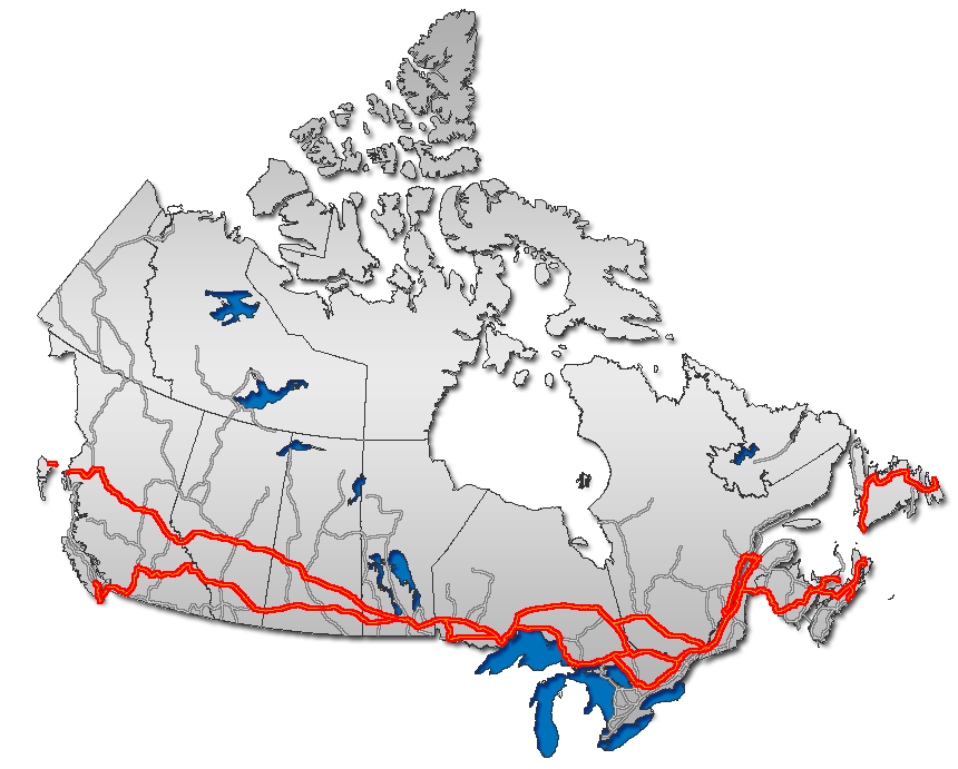
→Route 2 is a major provincial highway in the Canadian province of New Brunswick, carrying the main route of the Trans-Canada Highway in the province. It is a 4-lane freeway for all but three kilometres in the north, where the road connects with Quebec Route 185. The highway connects with Route 185 at the border with Quebec and with Highway 104 at the border with Nova Scotia, as well as traffic from Interstate 95 via the Route 95 connector. Route 2 directly serves the cities of Edmundston, Fredericton and Moncton.
A 20-year project to replace the original 1960s-era 2-lane Trans-Canada Highway with a 4-lane freeway was completed on November 1, 2007. The final upgrade to Route 2 and its short connector Route 95 has extended the continuous freeway network of North America east to New Glasgow, Nova Scotia. Once Autoroute 85 in Quebec is completed, Route 2 will also connect with the freeway networks of central Canada without passing through the United States.
Contents
Route description
 Route 2 outside Moncton, New Brunswick. Note the wide median.
The highway's western terminus is at the interprovincial boundary with Quebec 15 km north of Edmundston. It follows the lower section of the Madawaska River valley and enters the Saint John River valley where it passes north of Edmundston, running several kilometres inland from the east bank of the Saint John River, continuing past Saint-Léonard.
At Grand Falls, the highway crosses to the west bank of the river and passes by Perth-Andover, Florenceville, and Hartland. At Woodstock the Saint John River turns east and the highway continues to parallel the river on a ridge several kilometres inland along the western bank. It passes south of Fredericton and Oromocto before crossing the northeastern edge of CFB Gagetown.
The Saint John River turns south near Jemseg where the highway crosses the river on the Saint John River High Level Crossing and continues east over the Jemseg River using the Jemseg River Bridge.
The highway leaves the river valleys as it continues east across the rolling hills south of Grand Lake and passes by Havelock, River Glade and Salisbury.
The highway passes north and east of Moncton and Dieppe before turning south and passing by Memramcook, Sackville, and Aulac before reaching the eastern terminus at the inter-provincial boundary with Nova Scotia.
History
 The 1901 Hartland Covered Bridge, used by Route 2 until the Hugh John Flemming Bridge opened in 1960
Route 2 was one of the initial routes defined in 1927,[1] running from Quebec to Nova Scotia via Edmundston, Grand Falls, Woodstock, Fredericton, Saint John and Moncton. After a short crossing of the New Brunswick Panhandle alongside the Madawaska River to Edmundston, Route 2 closely followed the Saint John River all the way to Saint John, crossing three times - from the east to the west at Grand Falls, back to the east at Perth-Andover, and back to the west at Hartland (on the Hartland Covered Bridge). The road on the east side of the river between Edmundston and Grand Falls had just been opened in about 1926; previously travelers had to pass through Maine (US 1, SR 165, and Boundary Road) on the west side. A Route 2A cut the distance between Fredericton and Saint John via a poorer-quality but more direct road, intersecting Route 2 at Oromocto and Westfield. Beyond Saint John, Route 2 went northeast via Sussex to Moncton, and then turned southeast to cross the Nova Scotia border near Sackville.[3][4][5] The original path of Route 2 between Quebec and Sussex is now approximately the River Valley Scenic Drive.[6]
 Hugh John Flemming Bridge
When the route of the Trans-Canada Highway was defined in about 1950, it did not follow Route 2 via Saint John between Fredericton and Sussex, but took the more direct Route 9.[9] Through the late 1950s and 1960s, a number of bypasses and realignments, mostly two-lane, were built to improve Route 2 with federal Trans-Canada Highway funds. The first, built in the 1950s, was around Moncton, between southwest of Salisbury and Sackville.[citation needed] The old road through Moncton became Route 2A, then Route 6 in 1965, and is now Route 106.[10]
Next was the bypass around Woodstock. The road from Route 42 (now Route 560) at Jacksonville northeast to Route 2 (now Route 103) at Somerville was Route 2B by the late 1950s;[11] with the 1960 completion[citation needed] of the Hugh John Flemming Bridge, just upstream from the Hartland Covered Bridge, and the extension of Route 2B south from Jacksonville to Route 2 (now Route 165) south of Woodstock, Route 2B became a realignment of Route 2, with old Route 2 through Woodstock becoming Route 2A (renumbered Route 103 in 1965).[10]
The initial bypass of Fredericton was also built in about 1960, including the 1959[citation needed] Princess Margaret Bridge across the Saint John River, which replaced the Carleton Street Bridge for traffic to Routes 8, 9, and 10. Traffic remaining on Route 2 to Saint John exited the bypass at what is now exit 7 for Route 7.
Route 2 was moved to be identical with the Trans-Canada Highway, absorbing Route 9, in the 1965 renumbering of several New Brunswick highways. The old alignment via Saint John, where it did not become Route 7 (which replaced Route 2A) or an extension of Route 1, was renumbered as the new Route 102 between Oromocto and Westfield.[10]
The majority of road development in New Brunswick follows settlement patterns which pre-dated motor transport, thus most communities developed along navigable waterways or were served by railways. The development of controlled access expressways only began in the 1960s and only around the largest communities. The majority of early provincial highway improvements merely consisted of upgrading local roads.
Route 2 initially followed local roads from the N.B.-Quebec interprovincial boundary to Edmundston and down the Saint John River Valley to Grand Falls. There, it crossed to the west bank of the Saint John River, and continued south to Florenceville where it crossed to the east bank to continue to Hartland, then recrossed the river to the west bank which it followed to Fredericton in a southeast direction.
At Fredericton a controlled-access 4-lane section was built around the city, and the highway crossed the Saint John River on the Princess Margaret Bridge to the east bank just south of the central business district. Following the river's east bank just metres above its water level (frequently flooded in spring freshets), the route continued south to Jemseg where the highway turned east along the southeast shore of Grand Lake to Youngs Cove Road where the highway turned south to Coles Island and on to Sussex.
At Sussex the highway turned east again and passed by Petitcodiac and then by Salisbury. East of Salisbury, Route 2 followed local roads over a series of low hills north of Moncton, cresting at Lutes Mountain, before descending and following a controlled access section bypassing the city and Dieppe, skirting the edge of the Memramcook River valley and on to Sackville, then Aulac, and finally the N.B.-N.S. inter-provincial boundary.
Four-lane construction
From the early upgrades of these local roads in the 1960s under Trans-Canada Highway funding (which became designated Route 2) until the mid-1980s, very little was done to improve New Brunswick highways (aside from some re-alignment of Route 2 west of Fredericton with the flooding created by the Mactaquac Dam construction in 1968), leading to significant deterioration of the Trans-Canada Highway in New Brunswick. By the mid-1980s Route 2 was a significant traffic hazard and a major embarrassment to the province.
The provincial government changed in 1987 with the election of Premier Frank McKenna who was focused on improving the province's business climate. One of the government's major tasks was to revamp provincial transportation infrastructure and McKenna entered into aggressive negotiations with the federal government of prime minister Brian Mulroney to secure federal funding of new highway projects. McKenna viewed Route 2 (the Trans-Canada Highway) and Route 1 in New Brunswick as being partially a federal responsibility since they funnelled the majority of Atlantic Canada's highway traffic to the U.S. and central Canada. The signing of the Canada-U.S. Free Trade Agreement in 1989, coupled with federal approval for numerous railway line abandonments in the Maritimes during the 1980s, led to predictions of further highway traffic growth on New Brunswick highways in the 1990s.
Under the remainder of the McKenna administration's years of power (until 1997), Route 2 saw significant upgrading to become a 4-lane expressway on heavily-travelled portions of the highway between the N.B.-N.S. inter-provincial boundary and Penobsquis (east of Sussex). Other isolated sections were also upgraded south of Grand Lake and between Edmundston and St. Leonard, as well as at Woodstock where an interchange connected to Interstate 95.
Major re-alignments
 Route 2 eastbound, west of Edmundston
Despite the upgrades, the uncontrolled-access sections of Route 2 were still a significant traffic hazard. Intensive lobbying from other provincial governments in the Atlantic provinces, as well as various trucking companies and business and transportation interests, asked that Route 2 be further upgraded. Unfortunately provincial finances could not handle the relatively large price tag required, even with the federal funding at the time.
Fredericton - Moncton
As a result, the final years of the McKenna administration saw a significant re-alignment of Route 2 proposed, running from Long Creek west of Fredericton, by-passing Fredericton and Oromocto to the west, and continuing southeast to Jemseg where it would cross the Saint John River and connect with an existing 4-lane section south of Grand Lake. From there the highway would again depart from its original alignment (which headed south to Sussex) and instead head due east to meet the existing Route 2 alignment at River Glade, just east of Petitcodiac.
225 km (140 mi) of new 4-lane controlled-access expressway would be privately financed and built, with the builder charging tolls for a 25-year period before the provincial government would gain control of the highway. In the late 1990s, an agreement was signed with a private consortium called Maritime Road Development Corporation (led by former provincial Liberal leader and former federal Minister of Transport Douglas Young) to build the new Route 2 alignment at an estimated cost of $1 billion (CAD).
The toll issue was not without controversy as it, along with several other issues, led to the downfall of McKenna's successor, Camille Thériault in 1999 to PC leader Bernard Lord. The highway was built, but tolls were removed from most portions of the highway before they opened. This portion of the privately built re-alignment of the Trans-Canada Highway has a hidden toll calculated by sensors in the pavement. The toll is instead charged to the provincial government, thus motorists do not directly pay for their highway usage. Along with a payment worth millions of dollars to get out of the original contract, the provincial government now makes all provincial taxpayers cover the cost of the highway when the original plan had been for a user-pay system under a toll structure.
The new alignment of the Trans-Canada Highway opened in fall 2001 and at this time the portion of the old Route 2 alignment which ran between River Glade and Sussex was re-designated as part of Route 1, extending the eastern terminus of that highway approximately 40 km. The re-alignment also had the effect of shortening the total length of Route 2 in the province by approximately 40 km (25 mi).
The re-alignment and construction of Route 2 between Long Creek and River Glade "catapulted" New Brunswick highways forward by decades virtually overnight. The road was designed with 500 ft medians, extensive wildlife fencing and underpasses, rumble strips along emergency breakdown lanes, paved emergency U-turn areas, sensors beneath the asphalt for monitoring truck weights as well as local weather and road surface conditions, extensive guard rails and reflectors, as well as two major bridges: the Saint John River High Level Crossing and the nearby Jemseg River Bridge.
Suddenly it was now possible to travel from Fredericton into Nova Scotia (and on to Halifax or New Glasgow) completely on a 4-lane controlled access highway.
The Fredericton-Moncton section was officially opened to traffic at 10am on October 24, 2001, five weeks ahead of schedule.
Fredericton-Grand Falls
The high quality of construction of the new Route 2 alignment and improvement in the provincial highway system was not unnoticed by the new government of premier Bernard Lord. Throughout 2000–2003, several small 4-lane controlled access sections on Route 2 between Fredericton and Edmundston were opened, most requiring construction of a new alignment.
During this same period, negotiations were undertaken with the federal government to secure funding to complete the last, and one of the most costly parts of the new construction — a 98 km (61 mi) gap between Woodstock and Grand Falls over the Appalachian Mountains, and a 30 km (19 mi) gap between Long Creek and Pokiok, west of Fredericton.
In August, 2003 a joint announcement was made by Premier Lord and Prime Minister Jean Chrétien for a $400 million (CAD) agreement to complete upgrades to the last remaining non-controlled access section of Route 2.
The Pokiok-Long Creek section had been independently contracted by the provincial government and opened in November 2006.[12] However, the provincial government sought to construct the remaining 98 km gap as part of a complete "design-build-finance-operate-maintain-rehabilitate" plan which would see large private sector consortia bid for the right to design and construct the 98 km of new highway for Route 2, as well as to operate the entire 275 km section of Route 2 between Long Creek (where it abuts the 230 km hidden-toll highway section built and operated by Maritime Road Development Corporation) and the Quebec-New Brunswick border as well as all of Route 95.
The winning consortium was Brun-Way Group, a joint venture by Atcon Construction and SNC-Lavalin. Brun-Way Group has two subsidiaries, Brun-Way Construction Inc., which is receiving the ~$540 million to complete the 98 km of new construction as well as selected upgrades to other sections of Route 2 between Long Creek and the Quebec border, and Brun-Way Highway Operations Inc., which will receive an annual payment from the government of New Brunswick until 2033 to operate and maintain this section of the highway. This agreement will place fully 85% of the maintenance of Route 2 and 100% of Route 95 in the hands of the consortia Brun-Way and MRDC.
The construction of the last segment of four-lane Route 2 was completed by Brun-Way on November 1, 2007. This construction saw a completely new alignment built north of Woodstock, staying several kilometres inland from the Saint John River's west bank, and paralleling the Canada-U.S. border north to Grand Falls, where it crosses to the east bank of the river and connects with existing four-lane upgrades to Route 2 through to the Quebec boundary. In addition to upgrades to Route 2, Brun-Way is also contracted to perform similar upgrades to Route 95, a short connecting route between the Trans-Canada Highway at Woodstock and the Canada-U.S. border at Houlton where it meets Interstate 95.
Upon the opening of this section to traffic on November 1, 2007, the entire length of Route 2 and Route 95 are four-lane controlled-access freeways with a posted speed limit of 110 km/h (70 mph) and a design speed of up to 120 km/h (75 mph).
Exit list
County Location Exit Destinations Notes Madawaska Edmundston 8  Route 144 (Principale Street) – Saint-Jacques
13 Route 144 (Principale Street, Canada Road) – Saint-JacquesSigned as exits 13A (west) and 13B (east); former exit 15[13] 16 Carrier Street, Victoria Street 18 

 To Route 120 / Route 161 / US 1 / Hébert Boulevard – Edmundston, Lac-Baker
21 To Route 144 / Iroquois Road – Saint-Basile26 To Route 144 (Principale Street) – Saint-Basile32 To Route 144 – Rivière-Verte46 To Route 144 / Martin Road – Sainte-Anne51 To Route 144 – Siegas, Notre-Dame-des-Lourdes56 To Route 144 / Grand-Riviere Road – Saint-LeonardSaint-Léonard 58 Route 17 to US 1 – Saint-Léonard, Saint-Quentin, Campbellton, Saint Leonard Airport69 Bourgoin Road Grand Falls 75 
 Route 108 east / Route 255 north – Grand Falls, Plaster Rock, Saint-André
Victoria 77 Route 108 (Madawaska Street)Westbound exit and eastbound entrance; former exit 75[14] 79  To Route 218 (Everard-Daigle Boulevard)
Former exit 78[14] 83  Route 130 (Portage Road)
88 Route 130 - Limestone, New Denmark99 Route 130 – Four Falls107 Route 130 – Aroostook, Four FallsPerth-Andover 115 

 Route 109 / Route 190 to Route 105 – Perth-Andover, Fort Fairfield
Former exit 112[14] Carleton 153  Route 110 – Florenceville, Centreville
172 Route 130 – Hartland184  Route 560 / Lockhart Mill Road – Jacksonville, Upper Woodstock
Woodstock 185  Route 550 – Woodstock, Bloomfield
Former exit 188[13] 187 _ Route 95 to  I-95 - Houlton
Former exit 191A[13] 188 
 Route 103 / Route 555 – Woodstock
Former exit 191B[13] 191 Beardsley Road Former exit 194[13] 194 Hodgdon Road - Woodstock First Nation 200 Dugan Road York 212 
 Route 122 / Route 165 – Meductic, Canterbury
223 Charlie Lake Road - Temple Westbound exit and eastbound entrance 231  Route 102 to Route 105 – Nackawic, Millville
253 
 Route 635 south to Route 636 south – Lake George, Kings Landing
258 Route 3 / Route 102 – Saint Stephen, Saint Andrews, Fredericton, Mactaquac271  To Route 640 / Mazerolle Settlement Road – Hanwell
Fredericton 280  Route 8 – Fredericton, Miramichi
Eastbound exit and westbound entrance 281 Route 640 (Hanwell Road)285  Route 101 – Fredericton, New Maryland, Fredericton Junction
Signed as exits 285A (south) and 285B (north) Sunbury 294 Route 7 to Route 8 – Fredericton, Miramichi, MactaquacWest end of Route 7 overlap; westboound exit and eastbound entrance 297 Nevers Road - Rusagonis, Lincoln Former exit 11[13] Oromocto 301 To Route 102 – Fredericton AirportEastbound exit and westbound entrance; former exit 15[13] 303 To Route 102 – Oromocto, CFB Gagetown, Geary, Fredericton Airport306 Route 7 – Saint JohnEast end of Route 7 overlap; no westbound exit Queens 330 Route 102 – Village of Gagetown333 Route 105 – Sheffield, FrederictonNo westbound entrance 339  Route 105 / Route 695 – Cambridge-Narrows, Jemseg, Gagetown Ferry
Former exit 343[13] 347  Route 105 to Route 10 / Route 695 – Mill Cove, Chipman, Cambridge-Narrows
365  Route 10 to Route 112 – Fundy National Park, Sussex, Chipman
Westmorland 414  Route 885 – Petitcodiac, Havelock
423 Route 1 – Petitcodiac, Sussex, Saint JohnSalisbury 433  Route 112 to Route 106 – Salisbury
Former exit 470[13] Moncton 446  Route 128 – Moncton, Fundy, Riverview
Former exit 482[13] 450  Route 126 – Moncton, Magnetic Hill, Miramichi
Former exit 488[13] 452 Gorge Road Former exit 490[13] 454 Mapleton Road - Mapleton Former exit 492[13] 459  Route 115 (Elmwood Drive) – Saint-Antoine, Notre-Dame
Signed as exits 459A (south) and 459B (north); former exit 496[13] 462 Caledonia Former exit 500[13] 465  Route 134 – Moncton, Lakeville
Former exit 502[13] Dieppe 467  Route 11 / Route 15 – Dieppe, Moncton Airport, Moncton, Fundy, Shediac, Miramichi
Signed as exits 467A (south/west) and 467B (north/east); former exit 504[13] 474  Route 132 – Dieppe, Moncton Airport, Scoudouc
Signed as exits 474A (south) and 474B (north); former exit 511[13] 480 Old Shediac Road - Calhoun Former exit 517[13] 482 

 To Route 104 / Route 925 / Route 933 – Memramcook Centre, Dorchester
Former exit 519[13] 488 Route 933 (Pont Rouge Road) to Route 104 / Route 925Westbound exit and eastbound entrance; former exit 524[13] 488 Memramcook Estate Road Eastbound exit and westbound entrance; former exit 524[13] 500 Walker Road Former exit 538[13] Sackville 504  Route 940 (Main Street)
Former exit 541[13] 506  Route 106 (Bridge Street) to Route 544 (old) – Dorchester
Former exit 544[13] 513  Route 16 (TCH) – Aulac, Fort Beauséjour, Port Elgin, Prince Edward Island
Signed as exits 513A (Aulac) and 513B (Route 16); former exit 550[13] 1.000 mi = 1.609 km; 1.000 km = 0.621 mi See also
References
- ^ a b Commerce Reports: A Weekly Survey of Foreign Trade, Thirtieth Year (1927), Volume 1: Nos. 1-13, p. 177
- ^ Controlled Access Highways regulations enabled by the Highway Act
- ^ Rand McNally Auto Road Atlas, 1926, Maine
- ^ Automobile Blue Books, New Brunswick, 1926 and 1927
- ^ Automobile Legal Association, Automobile Green Book, New Brunswick, 1929-30
- ^ New Brunswick Department of Tourism and Parks, map of the River Valley Scenic Drive, accessed August 2007
- ^ Rand McNally Road Atlas: United States, Canada, Mexico, 1946
- ^ The Atlas of Canada, 3rd Edition, 1957: Major Roads, 1955
- ^ James Montagnes, New York Times, Canada's Highways; Motorists Now Use Cross-Country Roads Being Integrated Into National Route, May 4, 1952, p. XX33
- ^ a b c Rand McNally Road Atlas: United States, Canada, Mexico, 1964 and 1965
- ^ United States Geological Survey 1:250000 topographic maps, Campbellton (1960), Woodstock (1959), and Fredericton (1957), accessed via TerraServer-USA
- ^ [1]
- ^ a b c d e f g h i j k l m n o p q r s t u v w x y z New Brunswick Department of Transportation, Highway Advertisements Information Kit, April 2001: Appendix "G" lists the changes made in fall 2001
- ^ a b c New Brunswick Department of Transportation, Changes to exit numbers this fall, October 20, 2003
Preceded by
QuebecHighway 2
New BrunswickSucceeded by
 Nova Scotia
Preceded by
 QC Route 185
Trans-Canada Highway
NB Route 2Succeeded by
NS Highway 104Succeeded by
NB Route 16Expressways and freeways in New Brunswick  Portions of the Trans-Canada Highway
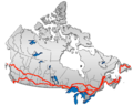 British Columbia: Highway 1 • Highway 5 • Highway 16 | Alberta: Highway 1 • Highway 16
Saskatchewan: Highway 1 • Highway 16 | Manitoba: Highway 1 • Highway 16 • Highway 100
Ontario: Highway 17 • Highway 69 • Highway 400 • Highway 12 • Highway 7 • Highway 71 • Highway 11 • Highway 66 • Highway 417
Quebec: Autoroute 40 • Autoroute 25 • Autoroute 20 • Autoroute 85 • Route 185 • Route 117 • Autoroute 15
New Brunswick: Route 2 • Route 16 | Confederation Bridge | Prince Edward Island: Route 1 | Nova Scotia: Highway 104 • Highway 105 • Highway 106
Newfoundland: Route 1Categories:- New Brunswick provincial highways
- Trans-Canada Highway
- Saint John River (Bay of Fundy)
- Roads in Madawaska County, New Brunswick
- Roads in Victoria County, New Brunswick
- Roads in Carleton County, New Brunswick
- Roads in York County, New Brunswick
- Roads in Sunbury County, New Brunswick
- Roads in Queens County, New Brunswick
- Roads in Kings County, New Brunswick
- Roads in Westmorland County, New Brunswick


Wikimedia Foundation. 2010.